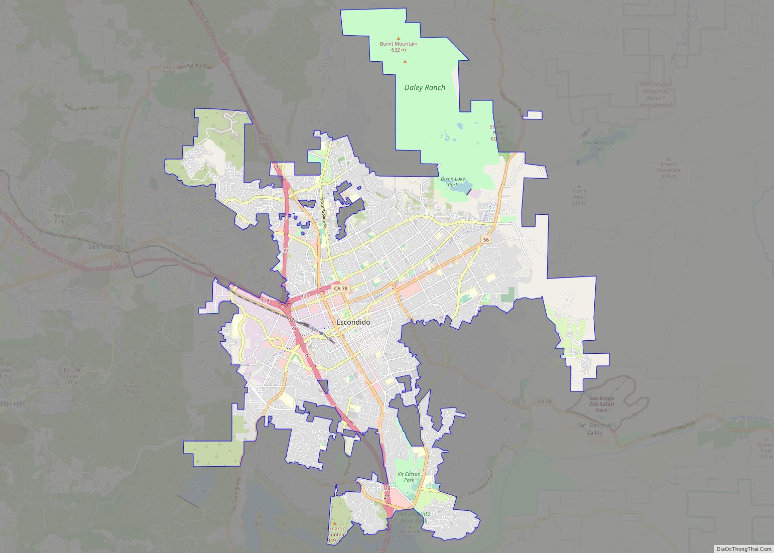
Map of Roseville city

Map of Roseville city, California

Roseville is the most populous city in Placer County, California, located within the Sacramento metropolitan area. As of 2019, the US Census Bureau estimated the city’s population to be 141,500. Interstate 80 runs through Roseville and State Route 65 runs through part of the northern edge of the city. Roseville city overview: Name: Roseville city … Read more

Map of Pomona city

Map of Pomona city, California

Pomona is a city in eastern Los Angeles County, California. Pomona is located in the Pomona Valley, between the Inland Empire and the San Gabriel Valley. At the 2020 census, the city’s population was 151,713. The main campus of California State Polytechnic University, Pomona, also known as Cal Poly Pomona, lies partially within Pomona’s city … Read more

Map of Torrance city

Map of Torrance city

Torrance is a city in the Los Angeles metropolitan area located in Los Angeles County, California, United States. The city is part of what is known as the South Bay region of the metropolitan area. Torrance has 1.5 miles (2.4 km) of beachfront on the Pacific Ocean and a moderate year-round climate with an average rainfall … Read more

Map of Visalia city

Map of Visalia city

Visalia (/vaɪˈseɪljə, vɪ-/ vy-SAYL-yə, vih-) is a city in the agricultural San Joaquin Valley of California. The population was 141,384 as per the 2020 census. Visalia is the fifth-largest city in the San Joaquin Valley, the 42nd most populous in California, and 192nd in the United States. As the county seat of Tulare County, Visalia … Read more

Map of Fullerton city

Map of Fullerton city, California

Fullerton (/ˈfʊlərtən/ FUUL-ər-tən) is a city located in northern Orange County, California, United States. As of the 2020 census, the city had a total population of 143,617. Fullerton was founded in 1887. It secured the land on behalf of the Atchison, Topeka and Santa Fe Railway. Historically it was a center of agriculture, notably groves … Read more

Map of Pasadena city

Map of Pasadena city, California

Pasadena (/ˌpæsəˈdiːnə/ PAS-ə-DEE-nə) is a city in Los Angeles County, California, United States, 11 miles (18 km) northeast of downtown Los Angeles. It is the most populous city and the primary cultural center of the San Gabriel Valley. Old Pasadena is the city’s original commercial district. Its population was 138,699 at the 2020 census, making it … Read more

Map of Victorville city

Map of Victorville city

Victorville is a city in Victor Valley in San Bernardino County, California. Its population as of the 2020 census was 134,810. Victorville is the principal city of a Victor Valley–based urban area defined by the United States Census Bureau: the Victorville–Hesperia–Apple Valley urban area had a population of 355,816 as of the 2020 census, making … Read more

Map of Simi Valley city

Map of Simi Valley city

Simi Valley (/ˈsiːmiː/ (listen); Chumash: Shimiyi) is a city in the valley of the same name in the southeast region of Ventura County, California, United States. Simi Valley is 40 miles (65 km) from Downtown Los Angeles, making it part of the Greater Los Angeles Area. The city sits next to Thousand Oaks, Moorpark, and Chatsworth. … Read more

Map of Thousand Oaks city

Map of Thousand Oaks city

Thousand Oaks is a city in the northwestern part of Greater Los Angeles, approximately 15 miles (24 km) from the city of Los Angeles and 40 miles (64 km) from Downtown. The second-largest city in Ventura County, California, it is named after the many oak trees present in the area. The city forms the central populated core … Read more

Map of Concord city, California

Map of Concord city, California

Concord (/ˈkɒŋkərd/ KON-kerd) is the largest city in Contra Costa County, California. According to an estimate completed by the United States Census Bureau, the city had a population of 129,295 in 2019, making it the eighth largest city in the San Francisco Bay Area. Founded in 1869 as Todos Santos by Don Salvio Pacheco II, … Read more