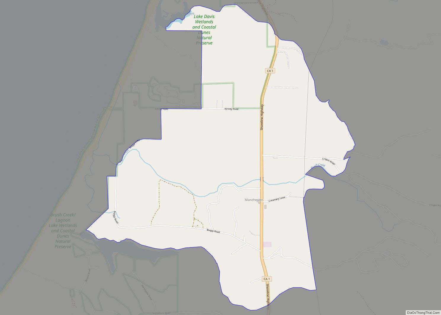
Map of Manteca city

Map of Manteca city

Manteca is a city in San Joaquin County, California. The city had a population of 83,498 as of the 2020 Census. Manteca city overview: Name: Manteca city LSAD Code: 25 LSAD Description: city (suffix) State: California County: San Joaquin County Incorporated: May 28, 1918 Elevation: 36 ft (11 m) Total Area: 21.41 sq mi (55.46 km²) Land Area: 21.39 sq mi (55.40 km²) … Read more

Map of March ARB CDP

Map of March ARB CDP

March ARB CDP overview: Name: March ARB CDP LSAD Code: 57 LSAD Description: CDP (suffix) State: California County: Riverside County FIPS code: 0645680 Online Interactive Map March ARB online map. Source: Basemap layers from Google Map, Open Street Map (OSM), Arcgisonline, Wmflabs. Boundary Data from Database of Global Administrative Areas. March ARB location map. Where … Read more

Map of Manton CDP

Map of Manton CDP, California

Manton is a census-designated place (CDP) partially in Tehama County, California, United States. It is also in Shasta County. The population in the Tehama County portion was 347 at the 2010 census, down from 372 at the 2000 census. Manton CDP overview: Name: Manton CDP LSAD Code: 57 LSAD Description: CDP (suffix) State: California County: … Read more

Map of Marina del Rey CDP

Map of Marina del Rey CDP

Marina del Rey (Spanish for “Marina of the King”) is an unincorporated seaside community in Los Angeles County, California, with an eponymous harbor that is a major boating and water recreation destination of the greater Los Angeles area. The port is North America’s largest man-made small-craft harbor and is home to approximately 5,000 boats. The … Read more

Map of Marin City CDP

Map of Marin City CDP

Marin City is an unincorporated community and census-designated place (CDP) in Marin County, California, United States. As of the 2020 census, it had a population of 2,993, up from 2,666 in 2010. It is located 1.5 miles (2.4 kilometers) northwest of downtown Sausalito, 8 miles (13 km) south-southeast of San Rafael, and about 5 miles (8 km) … Read more

Map of Maricopa city, California

Map of Maricopa city, California

Maricopa is a city in Kern County, California. Maricopa is located 6.5 miles (10 km) south-southeast of Taft, at an elevation of 883 feet (269 m). The population was 1,154 at the 2010 census, up from 1,111 at the 2000 census. The Carrizo Plain is located to the northwest, and the enormous Midway-Sunset Oil Field, the third … Read more

Map of Markleeville CDP

Map of Markleeville CDP

Markleeville (formerly, Markleville) is a census-designated place (CDP) and the county seat of Alpine County, California, United States. The population was 191 at the 2020 census, down from 210 at the 2010 census. Markleeville CDP overview: Name: Markleeville CDP LSAD Code: 57 LSAD Description: CDP (suffix) State: California County: Alpine County Elevation: 5,531 ft (1,686 m) Total … Read more

Map of Mariposa CDP

Map of Mariposa CDP

Mariposa (/ˌmærɪˈpoʊzə, -sə/ (listen); Spanish for “Butterfly”) is an unincorporated community and census-designated place (CDP) in and the county seat of Mariposa County, California, United States. The population was 1,526 at the 2020 census. The community is named after the flocks of monarch butterflies seen overwintering there by early explorers. Mariposa CDP overview: Name: Mariposa … Read more

Map of Marina city

Map of Marina city

Marina is a city in Monterey County, California, United States. As of the 2020 census, the population was 22,359, up from 19,718 in 2010. The city is located along the central coast of California, 8 miles (13 km) west of Salinas and 8 miles (13 km) northeast of Monterey. It is on California State Route 1 between … Read more

Map of Marysville city

Map of Marysville city, California

Marysville is a city and the county seat of Yuba County, California, located in the Gold Country region of Northern California. As of the 2010 United States Census, the population was 12,072, reflecting a decrease of 196 from the 12,268 counted in the 2000 Census. It is part of the Yuba-Sutter area of Greater Sacramento. … Read more

Map of Martinez city

Map of Martinez city, California

Martinez (Spanish: Martínez) is a city and the county seat of Contra Costa County, California, United States, in the East Bay region of the San Francisco Bay Area. Located on the southern shore of the Carquinez Strait, the city’s population was 38,290 at the 2020 census. The city is named after Californio ranchero Ygnacio Martínez, … Read more

Map of Martell CDP

Map of Martell CDP

Martell (formerly Oneida) is a census-designated place in Amador County, California, United States. It is located 1.5 miles (2.4 km) northwest of Jackson, at an elevation of 1486 feet (453 m). The population was 282 at the 2010 census. Martell is located west of Jackson and east of Ione, by which it is connected by the … Read more