Marysville is a city and the county seat of Yuba County, California, located in the Gold Country region of Northern California. As of the 2010 United States Census, the population was 12,072, reflecting a decrease of 196 from the 12,268 counted in the 2000 Census. It is part of the Yuba-Sutter area of Greater Sacramento.
| Name: | Marysville city |
|---|---|
| LSAD Code: | 25 |
| LSAD Description: | city (suffix) |
| State: | California |
| County: | Yuba County |
| Incorporated: | February 5, 1851 |
| Elevation: | 62 ft (19 m) |
| Total Area: | 3.58 sq mi (9.28 km²) |
| Land Area: | 3.46 sq mi (8.97 km²) |
| Water Area: | 0.12 sq mi (0.31 km²) 3.36% |
| Total Population: | 12,072 |
| Population Density: | 3,601.62/sq mi (1,390.67/km²) |
| ZIP code: | 95901 |
| Area code: | 530 |
| FIPS code: | 0646170 |
| Website: | www.marysville.ca.us |
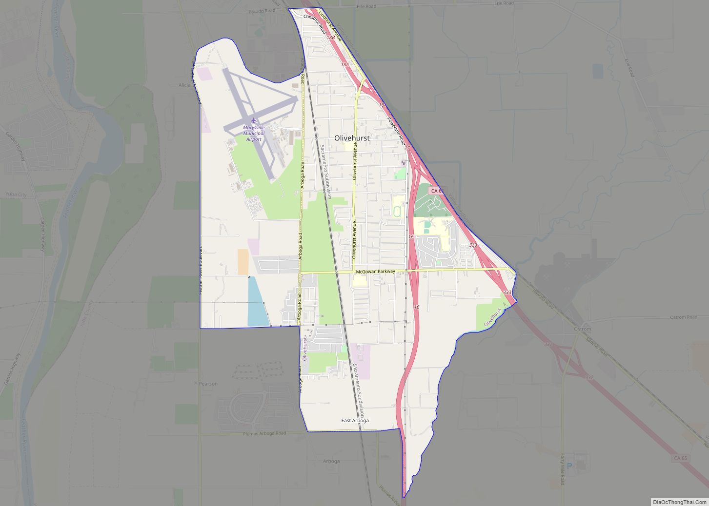
Online Interactive Map
Click on ![]() to view map in "full screen" mode.
to view map in "full screen" mode.
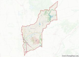
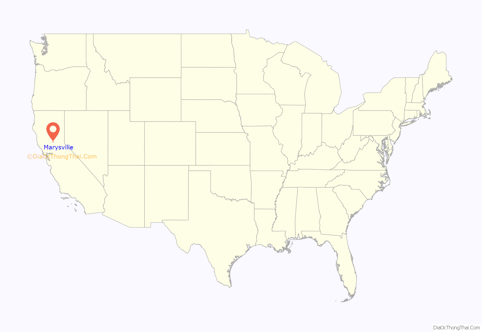
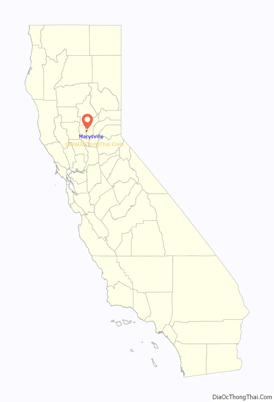
Marysville location map. Where is Marysville city?
History
Marysville is located on the ancestral land of the Maidu, who occupied the area for 10,000 years prior to the arrival of Jedediah Smith and trappers from the Hudson Bay Company in 1828, who were the first non-natives to explore the area. Spanish and Mexican explorers never reached that far north on the Feather River. In 1842, John Sutter leased part of his Rancho New Helvetia land to Theodore Cordua, a native of Mecklenburg in Germany, who raised livestock, and in 1843 built a home and trading post he called New Mecklenburg. The trading post and home was situated at what would later become the southern end of ‘D’ Street, Marysville’s main street. In 1844, the Mexican government granted Cordua his own land grant, Rancho Honcut.
In 1848, Charles Covillaud, a former employee of Cordua, discovered riches in the gold fields and bought half of the Cordua ranch. In January 1849, Michael C. Nye and William Foster, brothers-in-law of Covillaud’s wife, Mary Murphy, a survivor of the Donner Party, bought the other half of the Cordua ranch. They later sold their interest to Covillaud. In October of the same year, Covillaud sold most of the ranch to Jose Ramirez, John Sampson, and Theodore Sicard. During the Gold Rush, the ranch became a stopping point for the riverboats from Sacramento and San Francisco that brought prospectors to the digging grounds. Even today a sign on the roadside as one enters Marysville describes it as the “Gateway to The Gold Fields.”
In 1850, Covillaud, Ramirez, Sampson, and Sicard hired Augustus Le Plongeon, a French surveyor, to create a plan for a town called Jubaville, later called Yubaville. Stephen J. Field, a newly relocated attorney, purchased 65 lots of land and drew up proper deeds for land being sold. Then, after just three days in the mining camp, he accepted the nomination to run for alcalde, a Mexican official, which combined the duties of a mayor and justice of the peace, in a new government that was being formed. On January 18, 1850, Field defeated his rival, who had been in town just six days, and a town council was elected. That night, the townsfolk decided to name the new town Marysville after Charles Covillaud’s wife, Mary Murphy Covillaud, the former wife of William Johnson of Johnson’s Ranch, and one of the surviving members of the Donner Party. After Marysville was incorporated by the new California Legislature, the first mayor was elected in 1851. Field went on to become one of the longest sitting members of the United States Supreme Court.
A post office was established at Marysville in 1851. By 1853, the tent city had been replaced by brick buildings. In addition to the brick merchant buildings, Marysville had developed mills, iron works, factories, machine shops, schools, churches and two daily newspapers. The population was almost 10,000. By 1857, Marysville had become one of the largest cities in California, due to its strategic location. Over $10 million in gold was shipped from the banks in Marysville to the U.S. Mint in San Francisco. The city’s founders imagined Marysville becoming “The New York of the Pacific.”
Debris loosed by hydraulic mining above Marysville raised the riverbeds of both the Feather and the Yuba Rivers and rendered the city vulnerable to flooding during winter storms and spring run-offs. The city built a levee system that is still maintained today. The levee system sealed the city off and has made additional city growth virtually impossible; as such the population has not increased much since their construction and Marysville is known as “California’s Oldest ‘Little’ City.” The hydraulic mining debris choked the Feather River and soon the riverboats could not make the trip to Marysville.
Marysville was home to a significant Chinese American community beginning in the 1850s. While many Chinese were driven forcibly from their homes throughout California between 1870 and 1900, Marysville became a place of refuge for them and was one of the few Chinatowns in the state that did not experience violence. The Chinese Bok Kai Temple claims to be the oldest continually operating Taoist temple in America, and a Chinese New Year festival has been celebrated in Marysville since 1880.
There was also an active Jewish merchant community in Marysville from the Gold Rush era through the early years of the twentieth century. Nathan Schneider established Schneider’s Clothing in 1862, it was advertised as “the Home of Values”, and it existed until the late 1980s. Isaac and Simon Glazier ran the Old Corner Cigar Store from 1851 to 1862, when they moved to San Francisco. J.H. Marcuse founded the Western and Palace Cigar Store. Philip Brown advertised himself as “Marysville’s leading tailor, pants made to order from $4.00 up and P. Brown’s specialty, White Labor Overall.” Union Lumber, established in 1852 by W.K. Hudson and Samuel Harryman, was later purchased by bookkeeper H.J. Cheim, and is still owned by the Cheim family.
In 2010, the Marysville City Council made a decision to sell a portion of Washington Square Park for development of a commercial shopping center, part of an effort to increase tax revenue. This came after the city won a costly legal battle brought on by the Citizens to Preserve Marysville’s Parks, a group of citizens opposed to development in the city’s green spaces. A mitigation measure to offset the loss of city green space is technically within city limits, but falls outside the city’s levee ring.
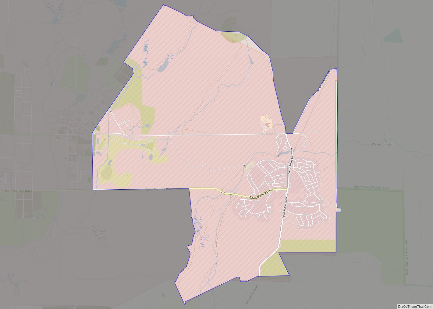
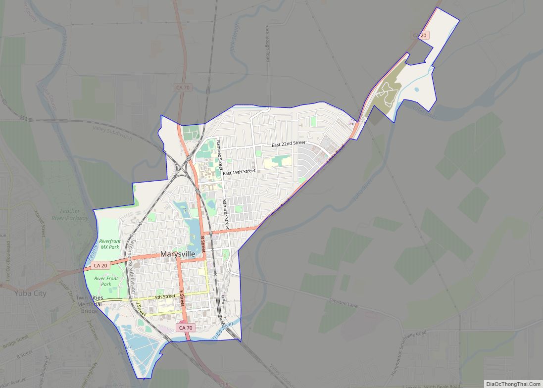
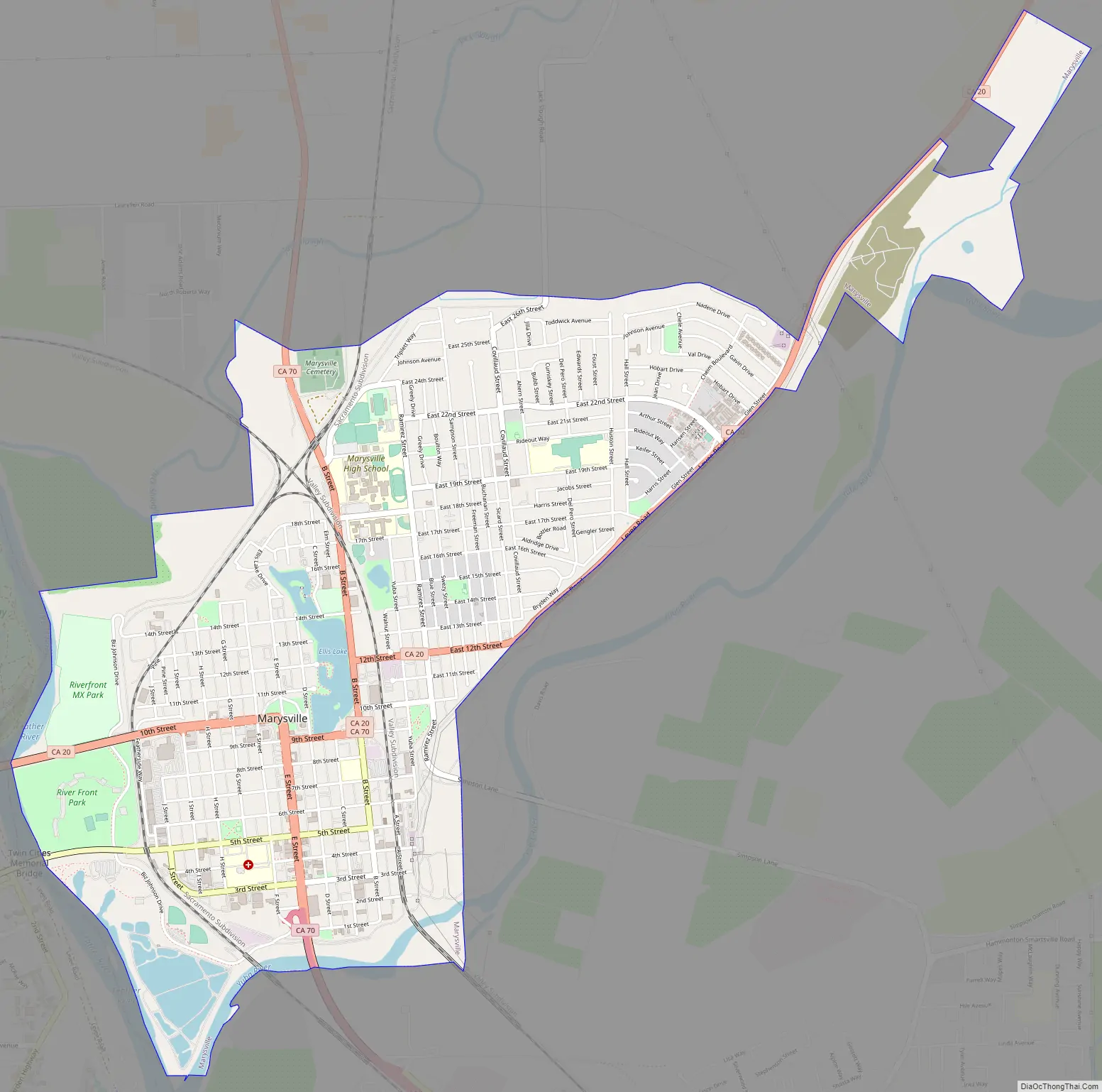
Marysville Road Map
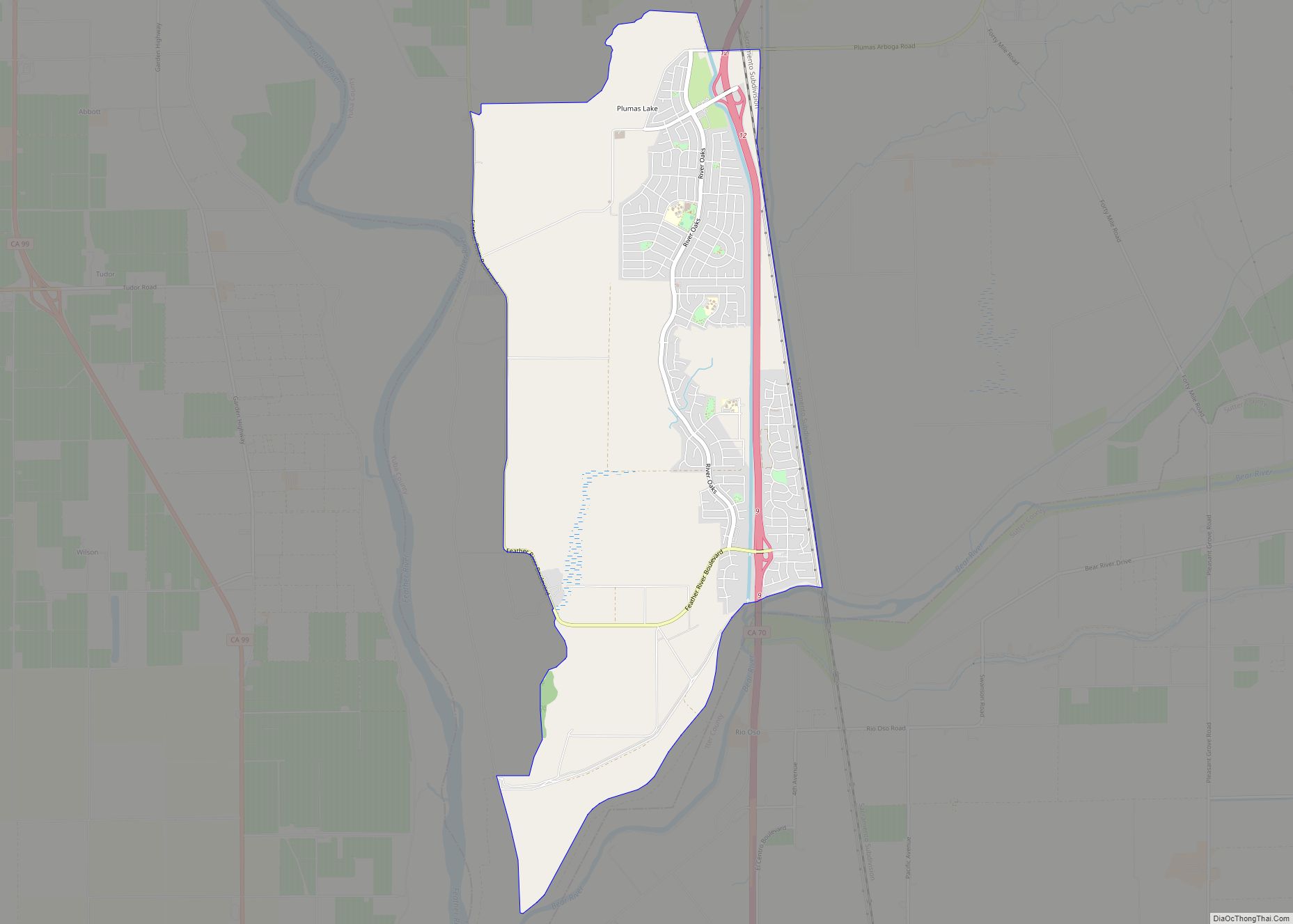
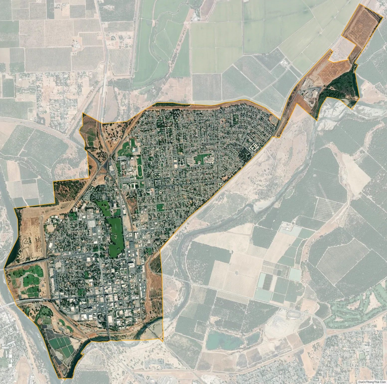
Marysville city Satellite Map
Geography
According to the United States Census Bureau, the city has a total area of 3.6 square miles (9.3 km), of which, 3.5 square miles (9.1 km) of it is land and 0.1 square miles (0.26 km) of it (3.36%) is water.
Flooding has been a major concern for the city for many years.
Marysville is 40 miles north of Sacramento and located in the Sacramento Valley. The city is bordered on the south and east by the Yuba River and the west by the Feather River, with the two rivers converging just southwest of the city. In years of significant snow runoff from the nearby Sierra Nevada range or heavy rain from winter storms, these two rivers pose a serious flooding risk to the city.
Climate
Marysville has a hot-summer Mediterranean climate (Köppen Csa), which has mild, wet winters and hot, dry summers. January is usually the wettest month; July the driest and hottest. The wet season starts from mid-October and ends in mid-April when the region sees frequent rain and is usually under the tule fog. Heavy rain or too much mountain snow from winter storms can cause major flooding in the spring. Snow is rare in the valley, but cold waves from the north bring some light snow and ice. Spring is wet in the beginning but becomes drier and warmer as summer months approach. April is the wettest spring month. May has some rain, but usually from thunderstorms rather than winter storms. Spring orchards and fields become filled with flowers and tree blossoms during this time. June-to-September is the dry and hot season. Rain usually doesn’t fall at all, except from very rare southwest monsoon thunderstorms. July and August are the hottest months when temperatures reach the upper 90s. The delta breeze, which comes from the Bay Area on summer nights, helps cool temperatures and add humidity. At times this delta breeze is strong enough to bring coastal fog inland to the Sacramento Valley. Autumn starts out warm but begins to become cooler, wetter, and foggier. From September to mid October temperatures begin to cool down rapidly bringing rain and fog. Rain and fog become more frequent from mid-October into November.
See also
Map of California State and its subdivision:- Alameda
- Alpine
- Amador
- Butte
- Calaveras
- Colusa
- Contra Costa
- Del Norte
- El Dorado
- Fresno
- Glenn
- Humboldt
- Imperial
- Inyo
- Kern
- Kings
- Lake
- Lassen
- Los Angeles
- Madera
- Marin
- Mariposa
- Mendocino
- Merced
- Modoc
- Mono
- Monterey
- Napa
- Nevada
- Orange
- Placer
- Plumas
- Riverside
- Sacramento
- San Benito
- San Bernardino
- San Diego
- San Francisco
- San Joaquin
- San Luis Obispo
- San Mateo
- Santa Barbara
- Santa Clara
- Santa Cruz
- Shasta
- Sierra
- Siskiyou
- Solano
- Sonoma
- Stanislaus
- Sutter
- Tehama
- Trinity
- Tulare
- Tuolumne
- Ventura
- Yolo
- Yuba
- Alabama
- Alaska
- Arizona
- Arkansas
- California
- Colorado
- Connecticut
- Delaware
- District of Columbia
- Florida
- Georgia
- Hawaii
- Idaho
- Illinois
- Indiana
- Iowa
- Kansas
- Kentucky
- Louisiana
- Maine
- Maryland
- Massachusetts
- Michigan
- Minnesota
- Mississippi
- Missouri
- Montana
- Nebraska
- Nevada
- New Hampshire
- New Jersey
- New Mexico
- New York
- North Carolina
- North Dakota
- Ohio
- Oklahoma
- Oregon
- Pennsylvania
- Rhode Island
- South Carolina
- South Dakota
- Tennessee
- Texas
- Utah
- Vermont
- Virginia
- Washington
- West Virginia
- Wisconsin
- Wyoming