Map of Crowley town

Map of Crowley town, Colorado

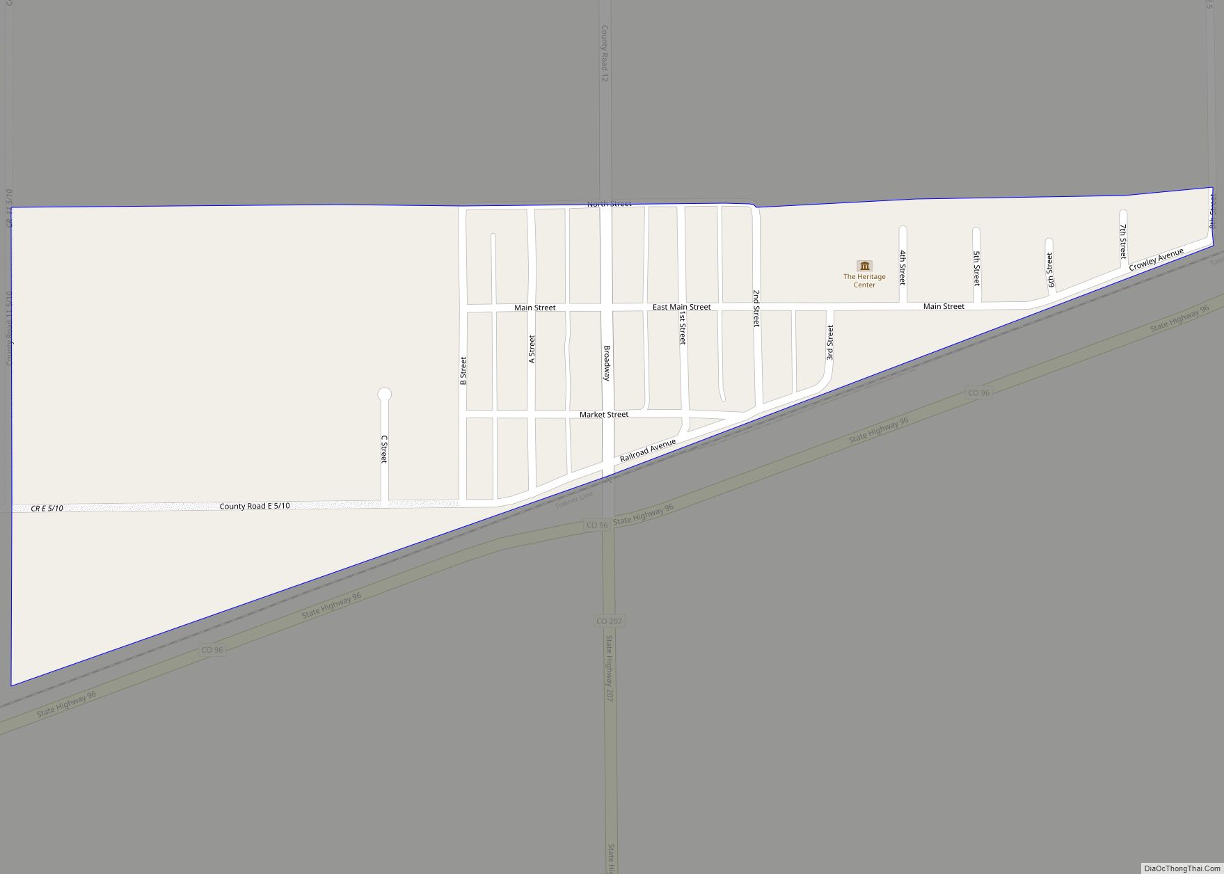
The Town of Crowley is a Statutory Town in Crowley County, Colorado, United States. The town population was 166 at the 2020 United States Census. Crowley town overview: Name: Crowley town LSAD Code: 43 LSAD Description: town (suffix) State: Colorado County: Crowley County Incorporated: October 10, 1921 Elevation: 4,354 ft (1,327 m) Total Area: 0.225 sq mi (0.584 km²) Land … Read more

Map of Crook town

Map of Crook town

The Town of Crook is a Statutory Town in Logan County, Colorado, United States. The town population was 133 at the 2020 United States Census. Crook is a part of the Sterling, CO Micropolitan Statistical Area. Crook town overview: Name: Crook town LSAD Code: 43 LSAD Description: town (suffix) State: Colorado County: Logan County Incorporated: … Read more

Map of Deer Trail town

Map of Deer Trail town

The Town of Deer Trail is a Statutory Town located in eastern Arapahoe County, Colorado, United States. The town population was 1,068 at the 2020 United States Census, a +95.60% increase since the 2010 United States Census. Deer Trail is a part of the Denver–Aurora–Lakewood, CO Metropolitan Statistical Area and the Front Range Urban Corridor. … Read more

Map of De Beque town

Map of De Beque town

The Town of De Beque is a statutory town located in Mesa County, Colorado. The population was 493 at the time of the 2020 census. De Beque is a part of the Grand Junction, CO Metropolitan Statistical Area. The town consists of a small grid, including a historic downtown featuring a town hall, a tavern, … Read more

Map of Dakota Ridge CDP

Map of Dakota Ridge CDP

Dakota Ridge is an unincorporated community and a census-designated place (CDP) located in and governed by Jefferson County, Colorado, United States. The CDP is a part of the Denver–Aurora–Lakewood, CO Metropolitan Statistical Area. The population of the Dakota Ridge CDP was 33,892 at the United States Census 2020. In 1988, voters turned down a proposal … Read more

Map of Derby CDP

Map of Derby CDP, Colorado

Derby is an unincorporated community and a census-designated place (CDP) located in and governed by Adams County, Colorado, United States. The CDP is a part of the Denver–Aurora–Lakewood, CO Metropolitan Statistical Area. The population of the Derby CDP was 8,407 at the United States Census 2020. The Commerce City post office (Zip code 80022) serves … Read more

Map of Delta city, Colorado

Map of Delta city, Colorado

Delta is a home rule municipality that is the county seat and the most populous municipality of Delta County, Colorado, United States. The town population was 9,035 at the 2020 United States Census. The United States Forest Service headquarters of the Grand Mesa, Gunnison, and Uncompahgre National Forests are located in Delta. Delta city overview: … Read more

Map of Del Norte town

Map of Del Norte town

Del Norte is a Statutory Town that is the county seat of Rio Grande County, Colorado, United States. The town’s name is most commonly pronounced /ˈdɛl nɔɹt/. The town population was 1,458 at the 2020 United States Census. Del Norte town overview: Name: Del Norte town LSAD Code: 43 LSAD Description: town (suffix) State: Colorado … Read more

Map of Divide CDP

Map of Divide CDP

Divide is an unincorporated town, a post office, and a census-designated place (CDP) located in and governed by Teller County, Colorado, United States. The CDP is a part of the Colorado Springs, CO Metropolitan Statistical Area. The Divide post office has the ZIP Code 80814. At the United States Census 2020, the population of the … Read more

Map of Dinosaur town

Map of Dinosaur town

Dinosaur is a statutory town in Moffat County, Colorado, United States. As of the 2020 census, the population was 243, down from 339 at the 2010 census. Dinosaur is a part of the Craig, CO Micropolitan Statistical Area. The town of Dinosaur was originally known as “Baxter Springs”, owned by Art and Fanny Baxter. It … Read more

Map of Dillon town

Map of Dillon town, Colorado

The Town of Dillon is a home rule municipality located in Summit County, Colorado, United States. The town population was 1,064 at the 2020 United States Census, a +17.70% increase since the 2010 United States Census. Dillon is a part of the Breckenridge, CO Micropolitan Statistical Area. Dillon town overview: Name: Dillon town LSAD Code: … Read more

Map of Dove Creek town

Map of Dove Creek town

Dove Creek is a statutory town that is the county seat and the most populous municipality of Dolores County, Colorado, United States. The town population was 635 at the 2020 United States Census. The community takes its name from the nearby Dove Creek. Dove Creek is the self-proclaimed Pinto Bean Capital of the World. Dove … Read more