Dakota Ridge is an unincorporated community and a census-designated place (CDP) located in and governed by Jefferson County, Colorado, United States. The CDP is a part of the Denver–Aurora–Lakewood, CO Metropolitan Statistical Area. The population of the Dakota Ridge CDP was 33,892 at the United States Census 2020. In 1988, voters turned down a proposal to incorporate Dakota Ridge. The community lies in ZIP codes 80127 and 80465.
| Name: | Dakota Ridge CDP |
|---|---|
| LSAD Code: | 57 |
| LSAD Description: | CDP (suffix) |
| State: | Colorado |
| County: | Jefferson County |
| Elevation: | 5,771 ft (1,759 m) |
| Total Area: | 9.685 sq mi (25.085 km²) |
| Land Area: | 9.387 sq mi (24.311 km²) |
| Water Area: | 0.299 sq mi (0.774 km²) |
| Total Population: | 33,892 |
| Population Density: | 3,500/sq mi (1,400/km²) |
| ZIP code: | 80127, 80465 |
| FIPS code: | 0819150 |
Online Interactive Map
Click on ![]() to view map in "full screen" mode.
to view map in "full screen" mode.
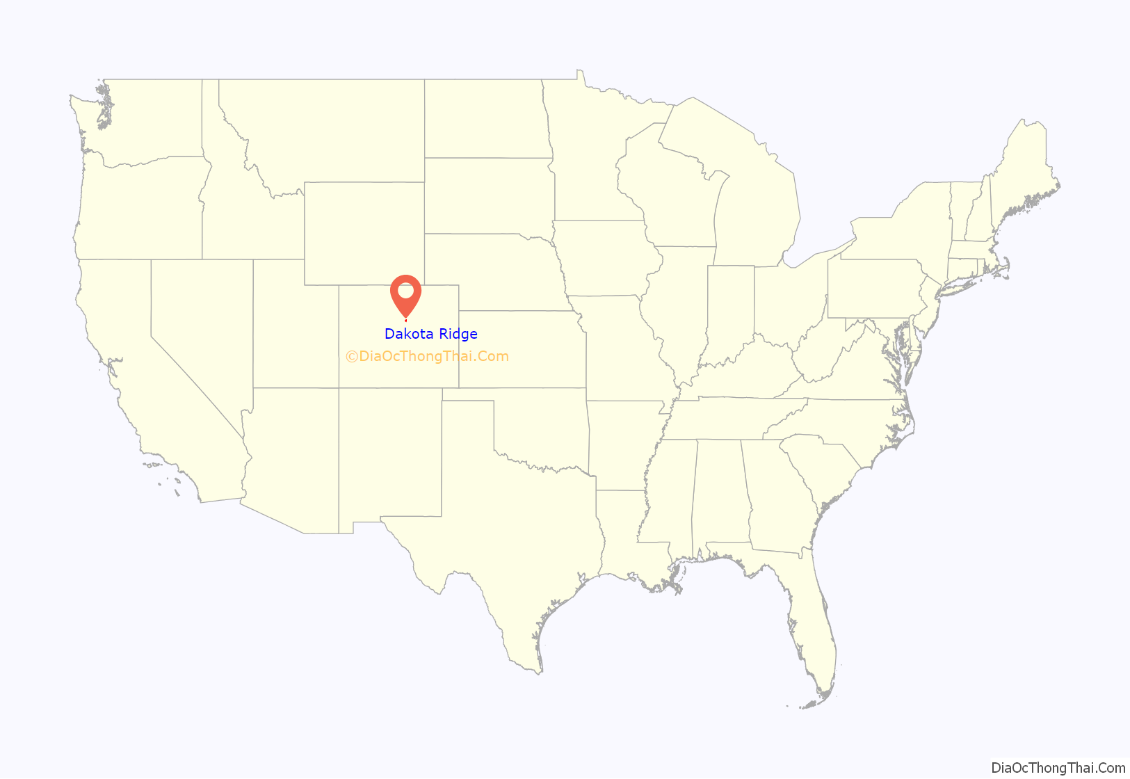
Dakota Ridge location map. Where is Dakota Ridge CDP?
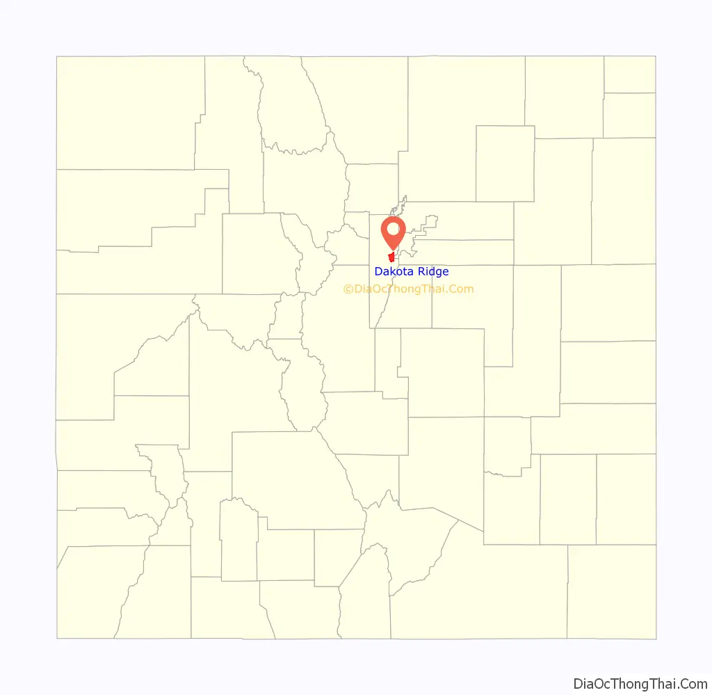
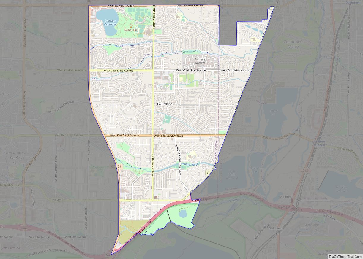
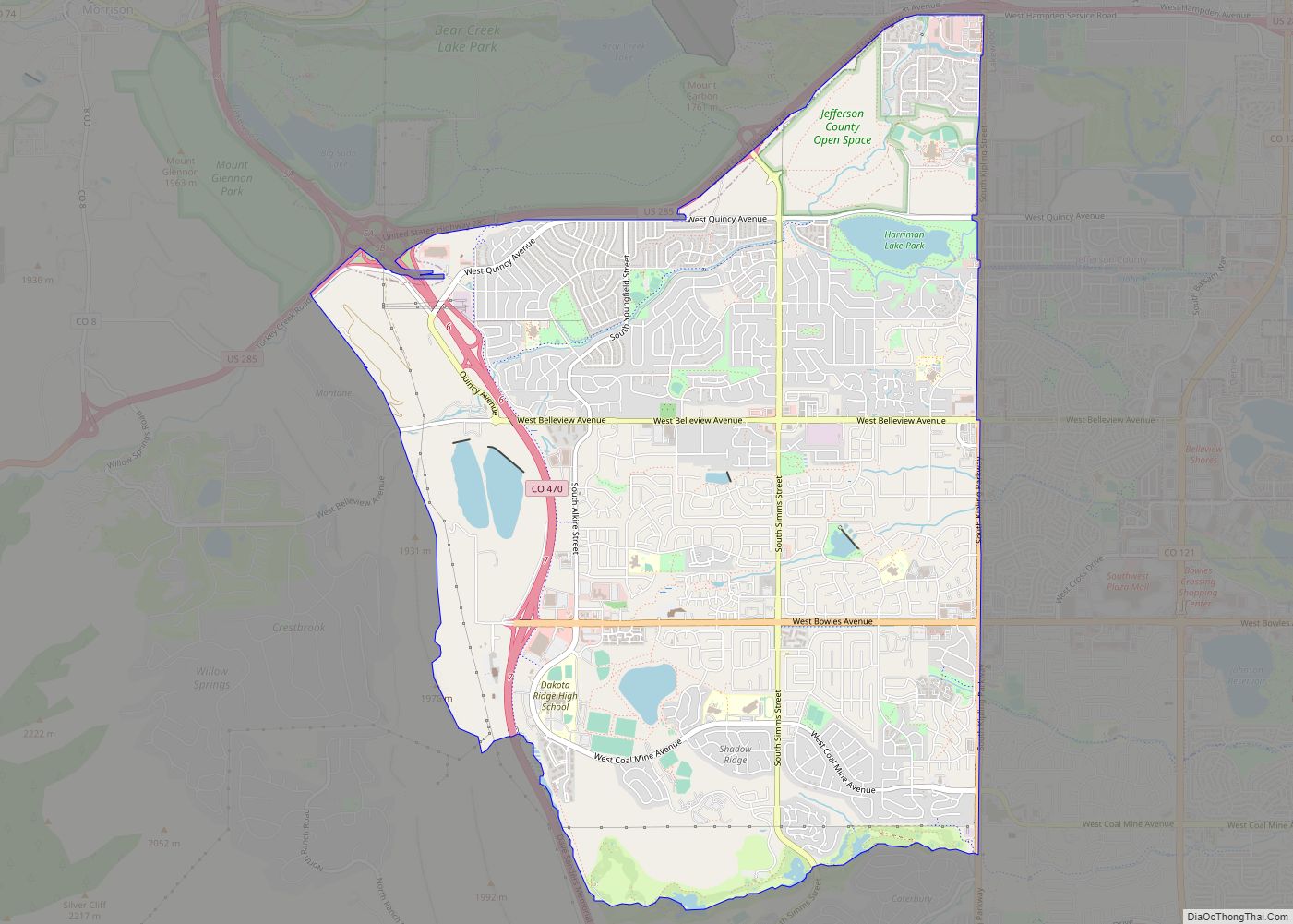
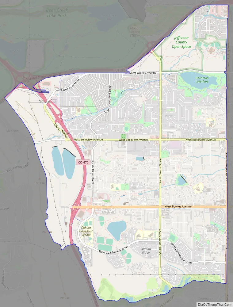
Dakota Ridge Road Map
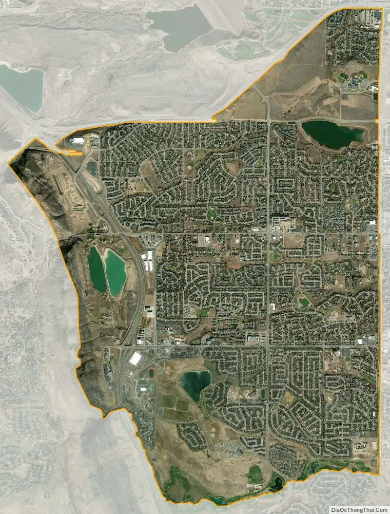
Dakota Ridge city Satellite Map
Geography
Dakota Ridge is bordered to the east by Denver, to the north by Lakewood, and to the south by unincorporated Ken Caryl. It is bordered to the west by the Dakota Hogback, a sharp hogback ridge that to the north near Morrison is also known as Dinosaur Ridge.
Colorado State Highway 470, part of the beltway around the Denver metropolitan area, runs through the western part of the community, leading north to Golden and southeast to Highlands Ranch. Downtown Denver is 17 miles (27 km) to the northeast.
The Dakota Ridge CDP has an area of 6,199 acres (25.085 km), including 191 acres (0.774 km) of water.
See also
Map of Colorado State and its subdivision:- Adams
- Alamosa
- Arapahoe
- Archuleta
- Baca
- Bent
- Boulder
- Broomfield
- Chaffee
- Cheyenne
- Clear Creek
- Conejos
- Costilla
- Crowley
- Custer
- Delta
- Denver
- Dolores
- Douglas
- Eagle
- El Paso
- Elbert
- Fremont
- Garfield
- Gilpin
- Grand
- Gunnison
- Hinsdale
- Huerfano
- Jackson
- Jefferson
- Kiowa
- Kit Carson
- La Plata
- Lake
- Larimer
- Las Animas
- Lincoln
- Logan
- Mesa
- Mineral
- Moffat
- Montezuma
- Montrose
- Morgan
- Otero
- Ouray
- Park
- Phillips
- Pitkin
- Prowers
- Pueblo
- Rio Blanco
- Rio Grande
- Routt
- Saguache
- San Juan
- San Miguel
- Sedgwick
- Summit
- Teller
- Washington
- Weld
- Yuma
- Alabama
- Alaska
- Arizona
- Arkansas
- California
- Colorado
- Connecticut
- Delaware
- District of Columbia
- Florida
- Georgia
- Hawaii
- Idaho
- Illinois
- Indiana
- Iowa
- Kansas
- Kentucky
- Louisiana
- Maine
- Maryland
- Massachusetts
- Michigan
- Minnesota
- Mississippi
- Missouri
- Montana
- Nebraska
- Nevada
- New Hampshire
- New Jersey
- New Mexico
- New York
- North Carolina
- North Dakota
- Ohio
- Oklahoma
- Oregon
- Pennsylvania
- Rhode Island
- South Carolina
- South Dakota
- Tennessee
- Texas
- Utah
- Vermont
- Virginia
- Washington
- West Virginia
- Wisconsin
- Wyoming