Map of La Veta town

Map of La Veta town

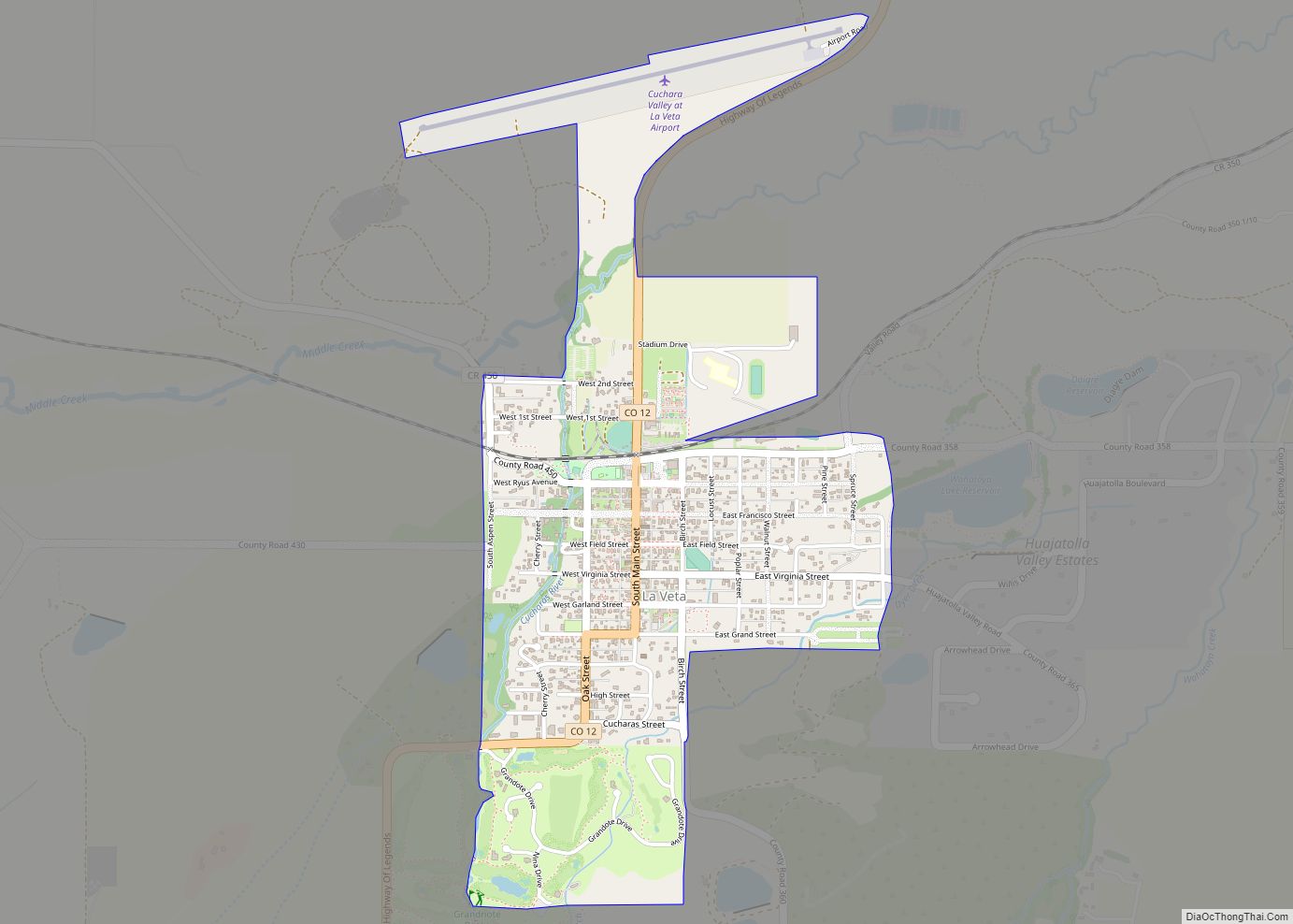
La Veta (/ləˈvitə/ lə-VEE-tə, Spanish for “the vein”) is a statutory town in Huerfano County, Colorado, United States. The town population was 862 as of the 2020 United States Census. La Veta town overview: Name: La Veta town LSAD Code: 43 LSAD Description: town (suffix) State: Colorado County: Huerfano County Elevation: 7,037 ft (2,145 m) Total Area: … Read more

Map of La Salle town

Map of La Salle town, Colorado

La Salle town overview: Name: La Salle town LSAD Code: 43 LSAD Description: town (suffix) State: Colorado County: Weld County FIPS code: 0843605 Online Interactive Map La Salle online map. Source: Basemap layers from Google Map, Open Street Map (OSM), Arcgisonline, Wmflabs. Boundary Data from Database of Global Administrative Areas. La Salle location map. Where … Read more

Map of Laird CDP

Map of Laird CDP

Laird is an unincorporated community and a census-designated place (CDP) located in and governed by Yuma County, Colorado, United States. The population of the Laird CDP was 46 at the United States Census 2020. The Wray post office (Zip Code 80758) serves Laird postal addresses. Laird has the lowest elevation of any community in Colorado … Read more

Map of Lakeside town, Colorado

Map of Lakeside town, Colorado

The Town of Lakeside is a Statutory Town in Jefferson County, Colorado, United States. The town population was 16 at the 2020 United States Census, making Lakeside the least populous municipality in the State of Colorado. Lakeside is immediately west of the City and County of Denver, the most populous municipality in the state. The … Read more

Map of Lake City town, Colorado

Map of Lake City town, Colorado

Lake City is a statutory town that is the county seat, the most populous community, and the only incorporated municipality in Hinsdale County, Colorado, United States. The population was 432 at the 2020 census. It is located in the San Juan Mountains in a valley formed by the convergence of Henson Creek and the headwaters … Read more

Map of Larkspur town, Colorado

Map of Larkspur town, Colorado

Larkspur is a home rule municipality in Douglas County, Colorado, United States. The town population was 206 at the 2020 census. Each year, on weekends in June, July and August, the Colorado Renaissance Festival is held in the hills just west of the town. The town is served by Larkspur Elementary School, a K-6 school … Read more

Map of Laporte CDP

Map of Laporte CDP, Colorado

Laporte (originally spelled La Porte and alternatively spelled LaPorte) is an unincorporated town, a post office, and a census-designated place (CDP) located in and governed by Larimer County, Colorado, United States. The CDP is a part of the Fort Collins, CO Metropolitan Statistical Area. The Laporte post office has the ZIP Code 80535. At the … Read more

Map of Lamar city, Colorado

Map of Lamar city, Colorado

Lamar is the home rule municipality that is the county seat and the most populous municipality of Prowers County, Colorado. The city population was 7,687 at the 2020 United States Census. The city was named after L.Q.C. Lamar, a slaveholder, Confederate soldier and diplomat who wrote the Mississippi Secession Ordinance, and after the Civil War, … Read more

Map of Leadville North CDP

Map of Leadville North CDP

Leadville North is a census-designated place (CDP) in and governed by Lake County, Colorado, United States. The population of the Leadville North CDP was 1,892 at the United States Census 2020. The Leadville post office (Zip Code 80461) serves the area. Leadville North CDP overview: Name: Leadville North CDP LSAD Code: 57 LSAD Description: CDP … Read more

Map of Lazy Acres CDP

Map of Lazy Acres CDP

Lazy Acres is an unincorporated community and a census-designated place (CDP) located in and governed by Boulder County, Colorado, United States. The CDP is a part of the Boulder, CO Metropolitan Statistical Area. The population of the Lazy Acres CDP was 957 at the United States Census 2020. The Boulder post office (Zip Code 80302) … Read more

Map of Las Animas city

Map of Las Animas city

Las Animas is the statutory city that is the county seat, the most populous community, and the only incorporated municipality in Bent County, Colorado, United States. The city population was 2,300 at the 2020 United States Census. Las Animas is located on the Arkansas River, just west of its confluence with the Purgatoire River (or … Read more

Map of Leyner CDP

Map of Leyner CDP

Leyner is an unincorporated community and a census-designated place (CDP) located in and governed by Boulder County, Colorado, United States. The CDP is a part of the Boulder, CO Metropolitan Statistical Area. The population of the Leyner CDP was 40 at the United States Census 2020. The Lafayette post office (Zip Code 80026) serves the … Read more