Lamar is the home rule municipality that is the county seat and the most populous municipality of Prowers County, Colorado. The city population was 7,687 at the 2020 United States Census. The city was named after L.Q.C. Lamar, a slaveholder, Confederate soldier and diplomat who wrote the Mississippi Secession Ordinance, and after the Civil War, went on to serve as Secretary of the Interior and as a Supreme Court Justice.
| Name: | Lamar city |
|---|---|
| LSAD Code: | 25 |
| LSAD Description: | city (suffix) |
| State: | Colorado |
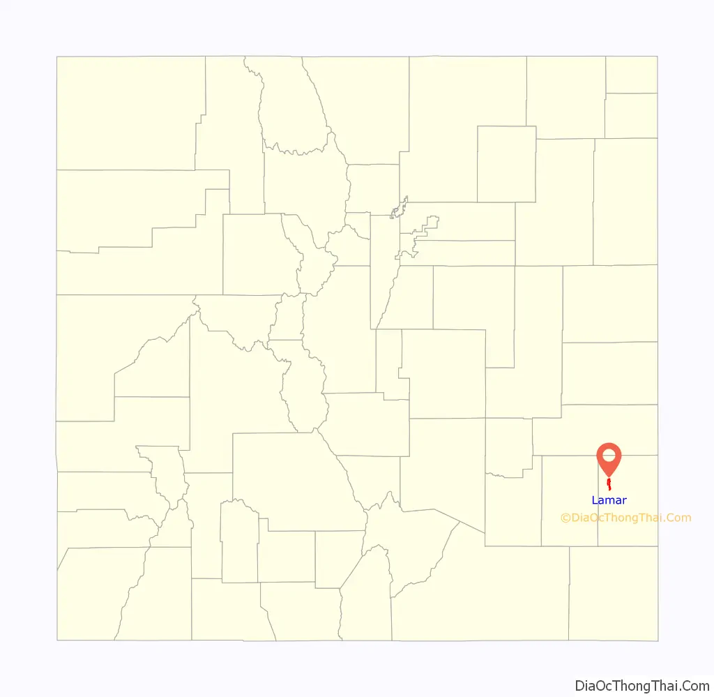
| County: | Prowers County |
| Incorporated: | December 5, 1886 |
| Elevation: | 3,619 ft (1,103 m) |
| Total Area: | 5.29 sq mi (13.70 km²) |
| Land Area: | 5.27 sq mi (13.65 km²) |
| Water Area: | 0.02 sq mi (0.05 km²) |
| Total Population: | 7,687 |
| Population Density: | 1,500/sq mi (560/km²) |
| ZIP code: | 81052 |
| Area code: | 719 |
| FIPS code: | 0843110 |
| GNISfeature ID: | 203835 |
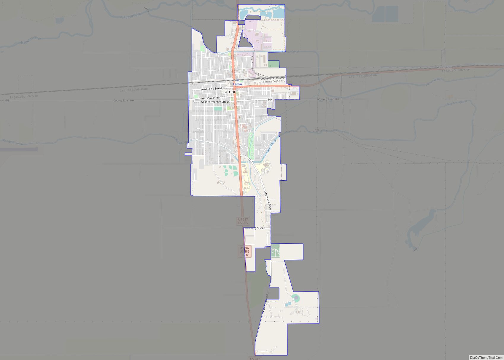
Online Interactive Map
Click on ![]() to view map in "full screen" mode.
to view map in "full screen" mode.
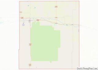
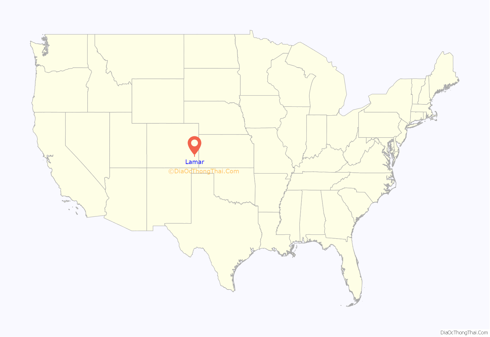
Lamar location map. Where is Lamar city?
History
Lamar was founded on May 24, 1886, by Issac Holmes. It was named after Lucius Lamar. At the time Lamar was the Secretary of the Interior, but previously he had written the Mississippi Ordinance of Secession, served the Confederacy as an officer and a diplomat. The first town elections were held in December, and C. M. Morrison became the town’s first mayor. In 1889 Prowers County was established, and Lamar was elected to house the county’s government. Throughout its history, Lamar has suffered from fires and floods. The town was also greatly affected by the Dust Bowl, and as such participated in projects led by the Civil Works Administration, Federal Emergency Relief Administration, and the Works Progress Administration.
The northern site of the Pierre Auger Observatory of ultra-high energy cosmic rays is planned to be built near Lamar.
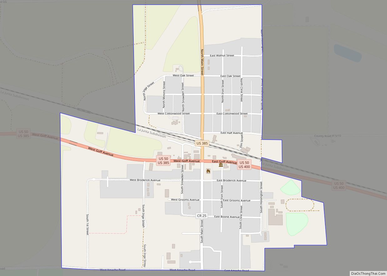
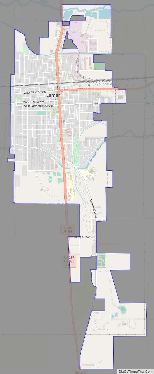
Lamar Road Map
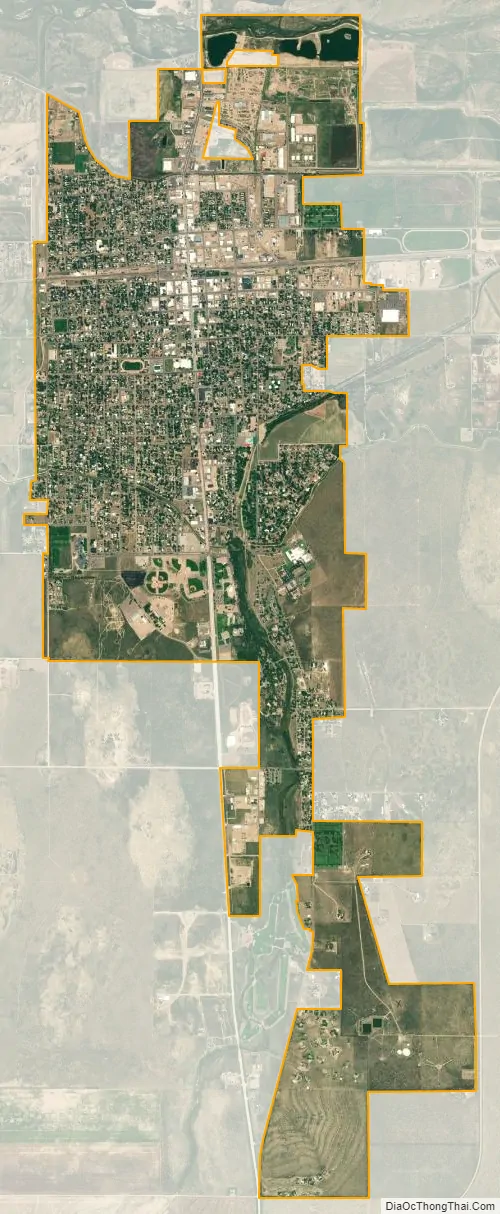
Lamar city Satellite Map
Geography
The city lies in southeastern Colorado in northwestern Prowers County on the south side of the Arkansas River floodplain. Las Animas is about twenty miles to the west.
According to the United States Census Bureau, the city has a total area of 4.2 square miles (11 km), all land.
Transportation
Lamar receives intercity passenger rail service at the Lamar Amtrak Station via Amtrak’s Southwest Chief, which runs between Chicago and Los Angeles. There is also intercity bus service provided by Bustang. Lamar is the last eastbound stop of the Lamar-Pueblo-Colorado Springs Outrider line.
Highways
- US 50 is an east-west highway running from California to Maryland. It is also the main route to Pueblo and Las Animas.
- Prowers County Road 196 (state has abandoned the highway) is an 11.4-mile (18.3 km) stretch that connects around Lamar to Wiley.
- US 287/385 are two concurrent highways that run south through Lamar. They connect Lamar to Springfield. US 287 runs from Texas State Highway 87 in Port Arthur, Texas, to US 89 at Choteau, Montana. US 385 runs from Big Bend National Park in Texas to US 85 in Deadwood, South Dakota.
Climate
According to the Köppen climate classification, Lamar is located in a cold semi-arid climate (Bsk)
See also
Map of Colorado State and its subdivision:- Adams
- Alamosa
- Arapahoe
- Archuleta
- Baca
- Bent
- Boulder
- Broomfield
- Chaffee
- Cheyenne
- Clear Creek
- Conejos
- Costilla
- Crowley
- Custer
- Delta
- Denver
- Dolores
- Douglas
- Eagle
- El Paso
- Elbert
- Fremont
- Garfield
- Gilpin
- Grand
- Gunnison
- Hinsdale
- Huerfano
- Jackson
- Jefferson
- Kiowa
- Kit Carson
- La Plata
- Lake
- Larimer
- Las Animas
- Lincoln
- Logan
- Mesa
- Mineral
- Moffat
- Montezuma
- Montrose
- Morgan
- Otero
- Ouray
- Park
- Phillips
- Pitkin
- Prowers
- Pueblo
- Rio Blanco
- Rio Grande
- Routt
- Saguache
- San Juan
- San Miguel
- Sedgwick
- Summit
- Teller
- Washington
- Weld
- Yuma
- Alabama
- Alaska
- Arizona
- Arkansas
- California
- Colorado
- Connecticut
- Delaware
- District of Columbia
- Florida
- Georgia
- Hawaii
- Idaho
- Illinois
- Indiana
- Iowa
- Kansas
- Kentucky
- Louisiana
- Maine
- Maryland
- Massachusetts
- Michigan
- Minnesota
- Mississippi
- Missouri
- Montana
- Nebraska
- Nevada
- New Hampshire
- New Jersey
- New Mexico
- New York
- North Carolina
- North Dakota
- Ohio
- Oklahoma
- Oregon
- Pennsylvania
- Rhode Island
- South Carolina
- South Dakota
- Tennessee
- Texas
- Utah
- Vermont
- Virginia
- Washington
- West Virginia
- Wisconsin
- Wyoming