Larkspur is a home rule municipality in Douglas County, Colorado, United States. The town population was 206 at the 2020 census. Each year, on weekends in June, July and August, the Colorado Renaissance Festival is held in the hills just west of the town. The town is served by Larkspur Elementary School, a K-6 school in the Douglas County school district.
A post office called Larkspur has been in operation since 1871. The community was named for the abundance of larkspur near the original town site.
Larkspur is also the site of the historic headquarters building of Universal Co-Masonry According to the town’s website, Larkspur’s Vision Statement is “Larkspur, a small friendly town in Colorado. A town that works together by: Fostering a Government of Integrity that Responds to its People, Directing Future Growth within Larkspur´s Small Town Values, Providing Community Facilities and Activities for All Ages, and Preserving the Natural Environment that is Unique to the Larkspur Area.”
| Name: | Larkspur town |
|---|---|
| LSAD Code: | 43 |
| LSAD Description: | town (suffix) |
| State: | Colorado |
| County: | Douglas County |
| Incorporated: | 1979 |
| Elevation: | 6,726 ft (2,050 m) |
| Total Area: | 1.59 sq mi (4.12 km²) |
| Land Area: | 1.59 sq mi (4.12 km²) |
| Water Area: | 0.00 sq mi (0.00 km²) |
| Total Population: | 206 |
| Population Density: | 130/sq mi (50/km²) |
| ZIP code: | 80118 |
| Area code: | Both 303 and 720 |
| FIPS code: | 0843550 |
| GNISfeature ID: | 0193176 |
| Website: | www.townoflarkspur.org |
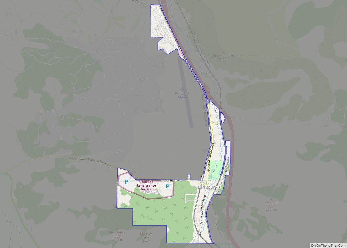
Online Interactive Map
Click on ![]() to view map in "full screen" mode.
to view map in "full screen" mode.
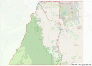
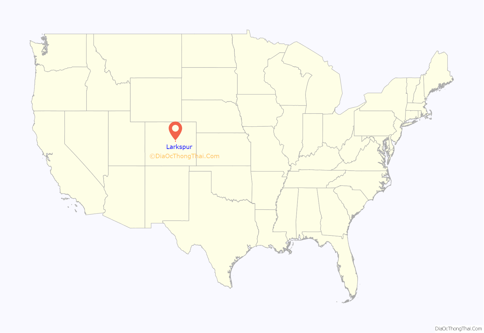
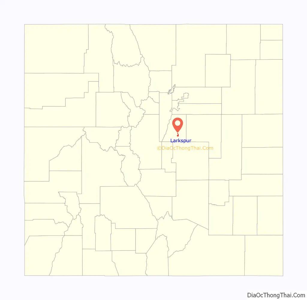
Larkspur location map. Where is Larkspur town?
Larkspur Road Map
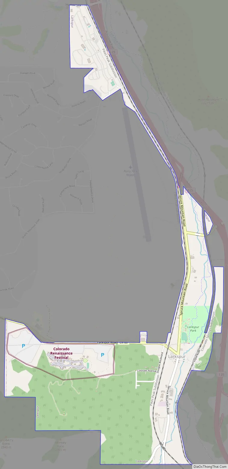
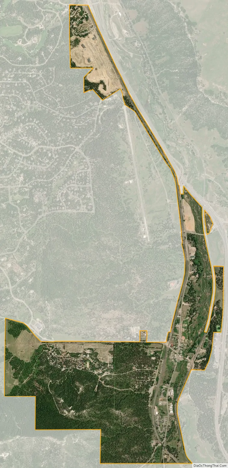
Larkspur city Satellite Map
Geography
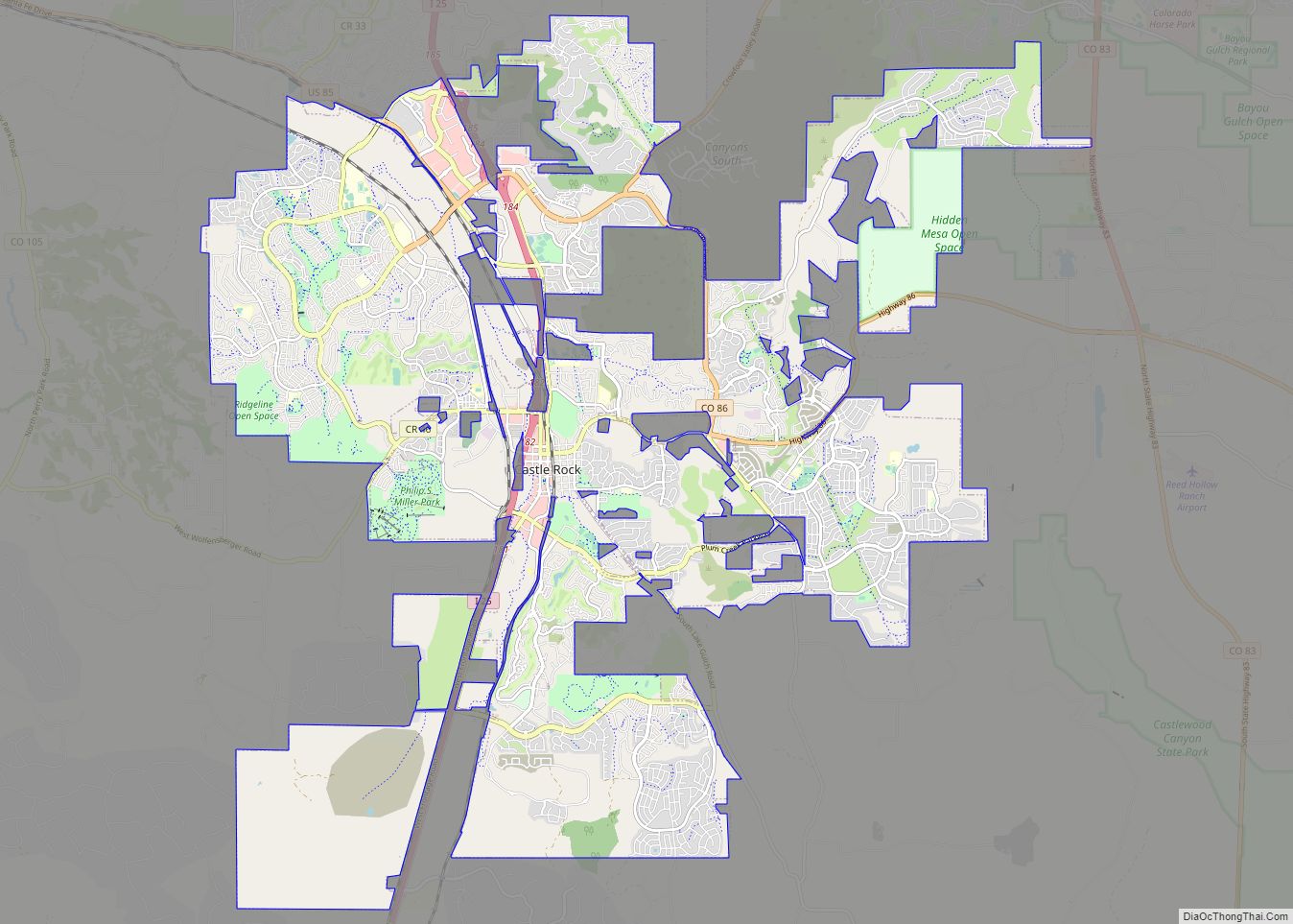
Larkspur is located in southern Douglas County at 39°13′38″N 104°53′03″W / 39.227091°N 104.884233°W / 39.227091; -104.884233, in the valley of East Plum Creek. Interstate 25 passes along the eastern edge of the town, with access from Exits 172, 173, and 174. I-25 leads north 11 miles (18 km) to Castle Rock, the Douglas County seat, and 39 miles (63 km) to Denver, as well as south 32 miles (51 km) to Colorado Springs.
According to the United States Census Bureau, the town has a total area of 1.5 square miles (3.9 km), all land.
See also
Map of Colorado State and its subdivision:- Adams
- Alamosa
- Arapahoe
- Archuleta
- Baca
- Bent
- Boulder
- Broomfield
- Chaffee
- Cheyenne
- Clear Creek
- Conejos
- Costilla
- Crowley
- Custer
- Delta
- Denver
- Dolores
- Douglas
- Eagle
- El Paso
- Elbert
- Fremont
- Garfield
- Gilpin
- Grand
- Gunnison
- Hinsdale
- Huerfano
- Jackson
- Jefferson
- Kiowa
- Kit Carson
- La Plata
- Lake
- Larimer
- Las Animas
- Lincoln
- Logan
- Mesa
- Mineral
- Moffat
- Montezuma
- Montrose
- Morgan
- Otero
- Ouray
- Park
- Phillips
- Pitkin
- Prowers
- Pueblo
- Rio Blanco
- Rio Grande
- Routt
- Saguache
- San Juan
- San Miguel
- Sedgwick
- Summit
- Teller
- Washington
- Weld
- Yuma
- Alabama
- Alaska
- Arizona
- Arkansas
- California
- Colorado
- Connecticut
- Delaware
- District of Columbia
- Florida
- Georgia
- Hawaii
- Idaho
- Illinois
- Indiana
- Iowa
- Kansas
- Kentucky
- Louisiana
- Maine
- Maryland
- Massachusetts
- Michigan
- Minnesota
- Mississippi
- Missouri
- Montana
- Nebraska
- Nevada
- New Hampshire
- New Jersey
- New Mexico
- New York
- North Carolina
- North Dakota
- Ohio
- Oklahoma
- Oregon
- Pennsylvania
- Rhode Island
- South Carolina
- South Dakota
- Tennessee
- Texas
- Utah
- Vermont
- Virginia
- Washington
- West Virginia
- Wisconsin
- Wyoming