Map of Lewis CDP

Map of Lewis CDP, Colorado

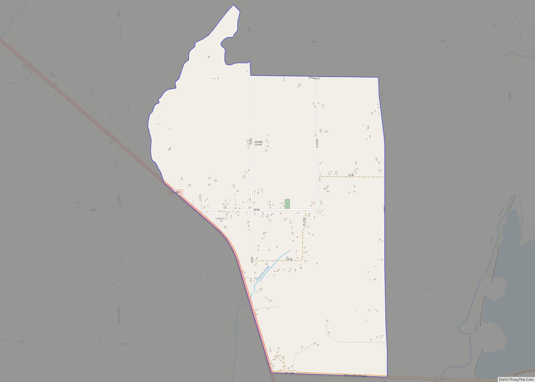
Lewis is an unincorporated town, a post office, and a census-designated place (CDP) located in and governed by Montezuma County, Colorado, United States. The Lewis post office has the ZIP Code 81327. At the 2020 census, the population of the Lewis CDP was 257, down from 302 in 2010. Lewis CDP overview: Name: Lewis CDP … Read more

Map of Leadville city

Map of Leadville city

The City of Leadville is a statutory city that is the county seat, the most populous community, and the only incorporated municipality in Lake County, Colorado, United States. The city population was 2,633 at the 2020 census. It is situated at an elevation of 10,158 feet (3,096 m). Leadville is the highest incorporated city in the … Read more

Map of Littleton city

Map of Littleton city, Colorado

Littleton is a home rule municipality city located in Arapahoe, Douglas, and Jefferson counties, Colorado, United States. Littleton is the county seat of Arapahoe County and is a part of the Denver–Aurora–Lakewood, CO Metropolitan Statistical Area. The city population was 45,652 at the 2020 United States Census, ranking as the 20th most populous municipality in … Read more

Map of Lincoln Park CDP

Map of Lincoln Park CDP, Colorado

Lincoln Park is a census-designated place (CDP) located in and governed by Fremont County, Colorado, United States. The CDP is a part of the Cañon City, CO Micropolitan Statistical Area. The population of the Lincoln Park CDP was 3,934 at the United States Census 2020. The Cañon City post office (Zip Code 81212) serves the … Read more

Map of Limon town

Map of Limon town

Limon is a statutory town that is the most populous municipality in Lincoln County, Colorado, United States. The population was 2,043 at the 2020 United States Census. Limon has been called the “Hub City” of Eastern Colorado because Interstate 70, U.S. Highways 24, 40, and 287, and State Highways 71 and 86 all pass through … Read more

Map of Loghill Village CDP

Map of Loghill Village CDP

Loghill Village is a Census-designated place (CDP) in and governed by Ouray County, Colorado, United States. The CDP is a part of the Montrose, CO Micropolitan Statistical Area. The population of the Loghill Village CDP was 617 at the United States Census 2020. The Ridgway post office (Zip Code 81432) serves Loghill Village postal addresses. … Read more

Map of Log Lane Village town

Map of Log Lane Village town

Log Lane Village is a statutory town in Morgan County, Colorado, United States. The population was 913 at the 2020 census. Log Lane Village was named from the presence of log houses in the town. Log Lane Village town overview: Name: Log Lane Village town LSAD Code: 43 LSAD Description: town (suffix) State: Colorado County: … Read more

Map of Lochbuie town

Map of Lochbuie town

The Town of Lochbuie (/lɒkˈbuːi/ lok-BOO-ee) is a statutory town located in Weld and Adams counties in the U.S. state of Colorado. The town population was 8,088 at the 2020 United States Census. Lochbuie town overview: Name: Lochbuie town LSAD Code: 43 LSAD Description: town (suffix) State: Colorado County: Adams County, Weld County Incorporated: May … Read more

Map of Longmont city

Map of Longmont city

Longmont is a home rule municipality located in Boulder and Weld counties, Colorado, United States. Longmont is located northeast of the county seat of Boulder and 33 miles (53 km) north-northwest of the Colorado State Capitol in Denver. Longmont’s population was 98,885 as of the 2020 U.S. Census. Longmont is named after Longs Peak, a prominent … Read more

Map of Lone Tree city

Map of Lone Tree city, Colorado

The City of Lone Tree is a home rule municipality located in northern Douglas County, Colorado, United States. Lone Tree is a part of the Denver–Aurora–Lakewood, CO Metropolitan Statistical Area. The city population was 14,253 at the 2020 United States Census. Lone Tree city overview: Name: Lone Tree city LSAD Code: 25 LSAD Description: city … Read more

Map of Loma CDP

Map of Loma CDP, Colorado

Loma is an unincorporated town, post office, and census-designated place (CDP) located in and governed by Mesa County, Colorado, United States. It is part of the Grand Junction, CO Metropolitan Statistical Area. The Loma post office has the ZIP Code 81524. At the 2020 census, the population of the Loma CDP was 1,314. Loma CDP … Read more

Map of Louisville city, Colorado

Map of Louisville city, Colorado

The City of Louisville (/ˈluːɪsvɪl/) is a home rule municipality located in southeastern Boulder County, Colorado, United States. The city population was 21,226 at the 2020 United States Census. Louisville began as a mining community in 1877, experienced a period of labor violence early in the 20th century, and transitioned to a suburban residential community … Read more