Map of Loveland city

Map of Loveland city, Colorado

The City of Loveland is the home rule municipality that is the second most populous municipality in Larimer County, Colorado, United States. Loveland is situated 46 miles (74 km) north of the Colorado State Capitol in Denver and is the 14th most populous city in Colorado. As of the 2020 census the population of Loveland was … Read more

Map of Louviers CDP

Map of Louviers CDP

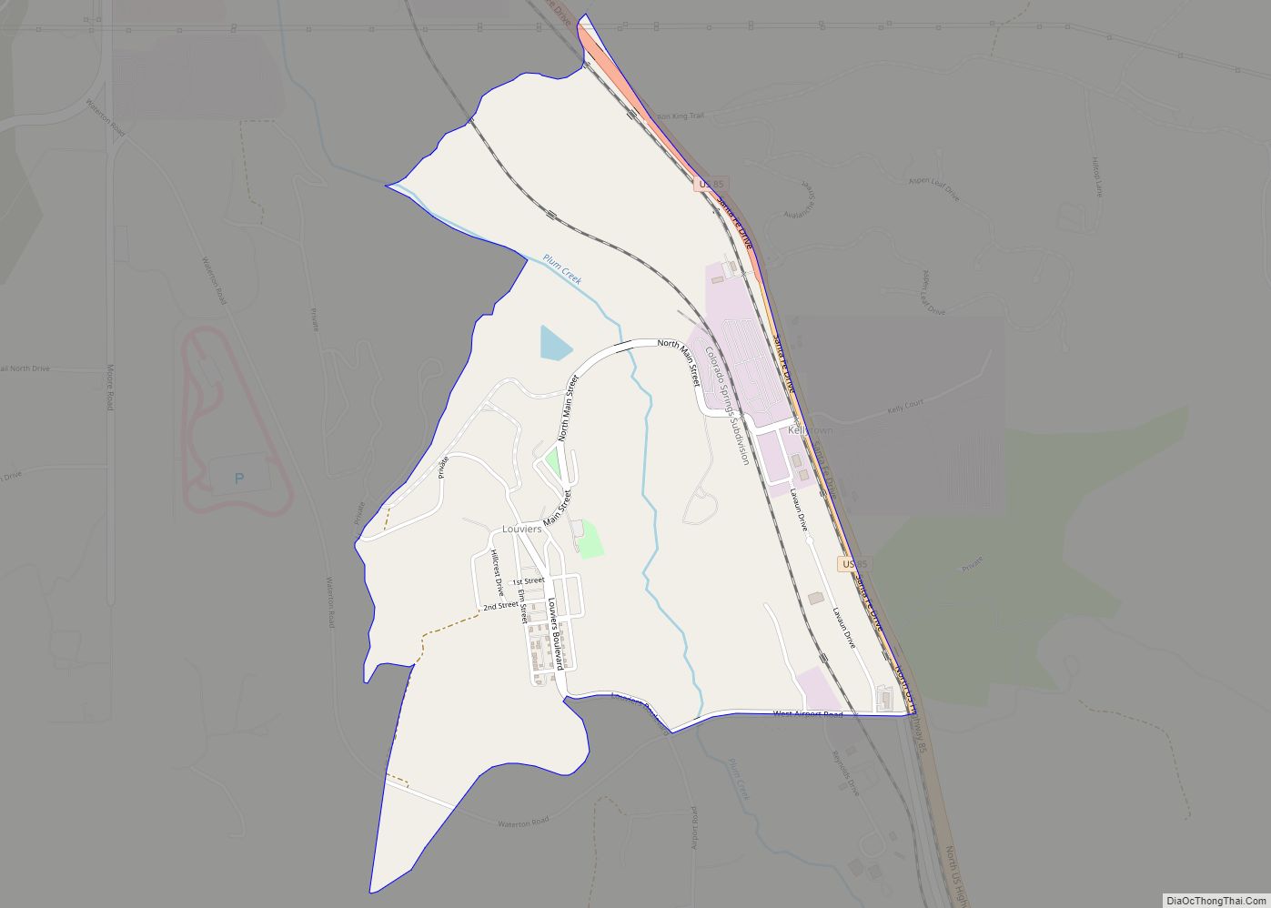
Louviers is an unincorporated town, a post office, and a census-designated place (CDP) located in and governed by Douglas County, Colorado, United States. The CDP is a part of the Denver–Aurora–Lakewood, CO Metropolitan Statistical Area. The Louviers post office has the ZIP Code 80131 (post office boxes). At the United States Census 2020, the population … Read more

Map of Manassa town

Map of Manassa town

The Town of Manassa is the Statutory Town that is the most populous municipality in Conejos County, Colorado, United States. The town population was 947 at the 2020 United States Census. Manassa town overview: Name: Manassa town LSAD Code: 43 LSAD Description: town (suffix) State: Colorado County: Conejos County Founded: 1851 Elevation: 7,690 ft (2,344 m) Total … Read more

Map of Lyons town

Map of Lyons town, Colorado

The Town of Lyons is a Statutory Town in Boulder County, Colorado, United States. The town population was 2033 at the 2010 United States Census, up from 1585 at the 2000 United States Census. Lyons is located at the confluence of North St. Vrain Creek and South St. Vrain Creek, 20 miles (32 km) east of … Read more

Map of Lynn CDP, Colorado

Map of Lynn CDP, Colorado

Lynn is an unincorporated community and a census-designated place (CDP) located in and governed by Las Animas County, Colorado, United States. The population of the Lynn CDP was 11 at the United States Census 2020. The Aguilar post office (Zip Code 81020) serves the area. Lynn CDP overview: Name: Lynn CDP LSAD Code: 57 LSAD … Read more

Map of Manzanola town

Map of Manzanola town

The Town of Manzanola is a Statutory Town in Otero County, Colorado, United States. The town population was 341 at the 2020 United States Census. Manzanola town overview: Name: Manzanola town LSAD Code: 43 LSAD Description: town (suffix) State: Colorado County: Otero County Elevation: 4,255 ft (1,297 m) Total Area: 0.28 sq mi (0.74 km²) Land Area: 0.28 sq mi (0.74 km²) Water … Read more

Map of Manitou Springs city

Map of Manitou Springs city

Manitou Springs is a home rule municipality located at the foot of Pikes Peak in western El Paso County, Colorado, United States. The town was founded for its natural mineral springs. The downtown area continues to be of interest to travelers, particularly in the summer, with many shops and restaurants, as well as a creekside … Read more

Map of Mancos town

Map of Mancos town

Mancos is a statutory town in Montezuma County, Colorado, United States. The population was 1,196 at the 2020 census, down from 1,336 in 2010. The town is in southwestern Colorado, at the base of Mesa Verde National Park, and holds the trademark for “Gateway to Mesa Verde”. Surrounded by rangeland and mountains, Mancos offers a … Read more

Map of Maysville CDP, Colorado

Map of Maysville CDP, Colorado

Maysville is an unincorporated community and a census-designated place (CDP) located in and governed by Chaffee County, Colorado, United States. The population of the Maysville CDP was 173 at the United States Census 2020. The Salida post office (Zip Code 81201) serves the area. Maysville CDP overview: Name: Maysville CDP LSAD Code: 57 LSAD Description: … Read more

Map of Maybell CDP

Map of Maybell CDP

Maybell is an unincorporated community and census-designated place (CDP) in and governed by Moffat County, Colorado, United States. The CDP is a part of the Craig, CO Micropolitan Statistical Area. The Maybell post office has the ZIP Code 81640. At the 2020 census, the population of the Maybell CDP was 76. The coldest ambient air … Read more

Map of Marble town

Map of Marble town, Colorado

The Town of Marble is a Statutory Town in Gunnison County, Colorado, United States. The town population was 133 at the 2020 United States Census. Marble town overview: Name: Marble town LSAD Code: 43 LSAD Description: town (suffix) State: Colorado County: Gunnison County Incorporated: 1899 Elevation: 7,993 ft (2,436 m) Total Area: 0.36 sq mi (0.93 km²) Land Area: 0.36 sq mi … Read more

Map of Meeker town

Map of Meeker town, Colorado

Meeker is the Statutory Town in and the county seat of Rio Blanco County, Colorado, United States, that is the most populous municipality in the county. The town population was 2,374 at the 2020 United States Census. Meeker town overview: Name: Meeker town LSAD Code: 43 LSAD Description: town (suffix) State: Colorado County: Rio Blanco … Read more