Map of Parachute town

Map of Parachute town

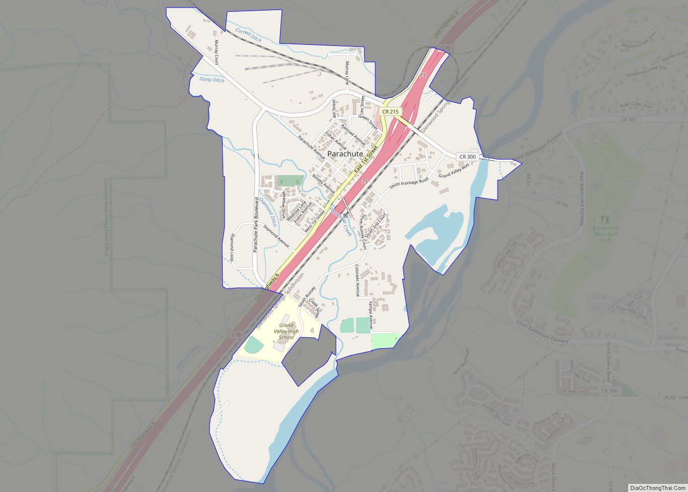
The Town of Parachute is a home rule municipality in Garfield County, Colorado, United States. The population was 1,390 at the 2020 census. The town is the birthplace of Willard Libby, recipient of the 1960 Nobel Prize in Chemistry. Parachute town overview: Name: Parachute town LSAD Code: 43 LSAD Description: town (suffix) State: Colorado County: … Read more

Map of Paonia town

Map of Paonia town

Paonia is a statutory town in Delta County, Colorado, United States. The population was 1,447 at the 2020 census. Paonia town overview: Name: Paonia town LSAD Code: 43 LSAD Description: town (suffix) State: Colorado County: Delta County Elevation: 5,682 ft (1,732 m) Total Area: 0.82 sq mi (2.13 km²) Land Area: 0.82 sq mi (2.13 km²) Water Area: 0.00 sq mi (0.00 km²) Total Population: 1,447 … Read more

Map of Parshall CDP

Map of Parshall CDP, Colorado

Parshall is an unincorporated town, a post office, and a census-designated place (CDP) located in and governed by Grand County, Colorado, United States. The Parshall post office has the ZIP Code 80468. At the United States Census 2020, the population of the Parshall CDP was 42. Parshall CDP overview: Name: Parshall CDP LSAD Code: 57 … Read more

Map of Parker town, Colorado

Map of Parker town, Colorado

Parker is a home rule municipality in Douglas County, Colorado, United States. As a self-declared “town” under the home rule statutes, Parker is the second most populous town in the county; Castle Rock is the most populous (the community of Highlands Ranch, with a population of over 100,000, is an unincorporated CDP). In recent years, … Read more

Map of Peetz town

Map of Peetz town

Peetz is a Statutory Town in Logan County, Colorado, United States. The population was 213 at the 2020 census. Peetz is home to the RE-5 School District and Peetz K-12 School. Peetz town overview: Name: Peetz town LSAD Code: 43 LSAD Description: town (suffix) State: Colorado County: Logan County Elevation: 4,436 ft (1,352 m) Total Area: 0.22 sq mi … Read more

Map of Perry Park CDP

Map of Perry Park CDP

Perry Park is an unincorporated community and a census-designated place (CDP) located in Douglas County, Colorado, United States. The CDP is a part of the Denver–Aurora–Lakewood, CO Metropolitan Statistical Area. The population of the Perry Park CDP was 1,932 at the United States Census 2020. The Perry Park Metropolitan District and the Perry Park Water … Read more

Map of Peoria CDP, Colorado

Map of Peoria CDP, Colorado

Peoria is an unincorporated community and a census-designated place (CDP) located in and governed by Arapahoe County, Colorado, United States. The CDP is a part of the Denver–Aurora–Lakewood, CO Metropolitan Statistical Area. The population of the Peoria CDP was 153 at the United States Census 2020. The Byers post office (ZIP code 80103) serves the … Read more

Map of Penrose CDP

Map of Penrose CDP

Penrose is a census-designated place (CDP) and post office located in and governed by Fremont County, Colorado, United States. The CDP is a part of the Cañon City, CO Micropolitan Statistical Area. The Penrose post office has the ZIP Code 81240. At the United States Census 2020, the population of the Penrose CDP was 3,685. … Read more

Map of Piedra CDP

Map of Piedra CDP

Piedra is an unincorporated community and a census-designated place (CDP) located in and governed by Hinsdale County, Colorado, United States. The population of the Piedra CDP was 31 at the United States Census 2020. The Pagosa Springs post office (Zip Code 81147) serves the area. Piedra CDP overview: Name: Piedra CDP LSAD Code: 57 LSAD … Read more

Map of Phippsburg CDP

Map of Phippsburg CDP

Phippsburg is a census-designated place (CDP) and a post office in and governed by Routt County, Colorado, United States. The population was 234 at the 2020 census. The CDP is a part of the Steamboat Springs, CO Micropolitan Statistical Area. The Phippsburg post office has the ZIP Code 80469 (post office boxes). Phippsburg CDP overview: … Read more

Map of Peyton CDP

Map of Peyton CDP

Peyton is an unincorporated town, a post office, and a census-designated place (CDP) located in and governed by El Paso County, Colorado, United States. The CDP is a part of the Colorado Springs, CO Metropolitan Statistical Area. The Peyton post office has the ZIP Code 80831. At the United States Census 2020, the population of … Read more

Map of Pitkin town

Map of Pitkin town, Colorado

Pitkin is a Statutory Town in Gunnison County, Colorado, United States. The population was 72 at the 2020 census. Pitkin was founded in 1879, and is said to be Colorado’s first mining camp west of the Continental Divide. Originally named Quartzville, it was renamed to honor Governor Frederick Walker Pitkin. Pitkin town overview: Name: Pitkin … Read more