Map of High Point city

Map of High Point CDP, Florida

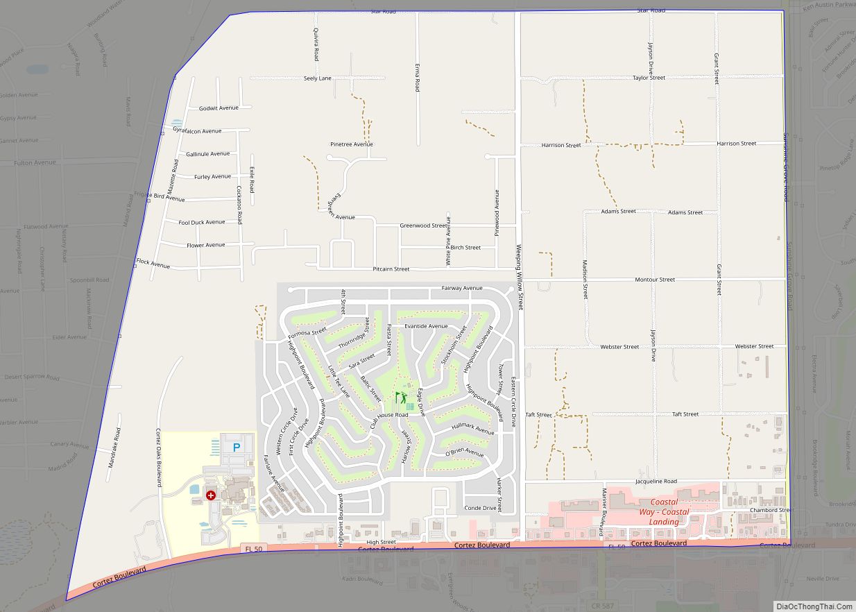
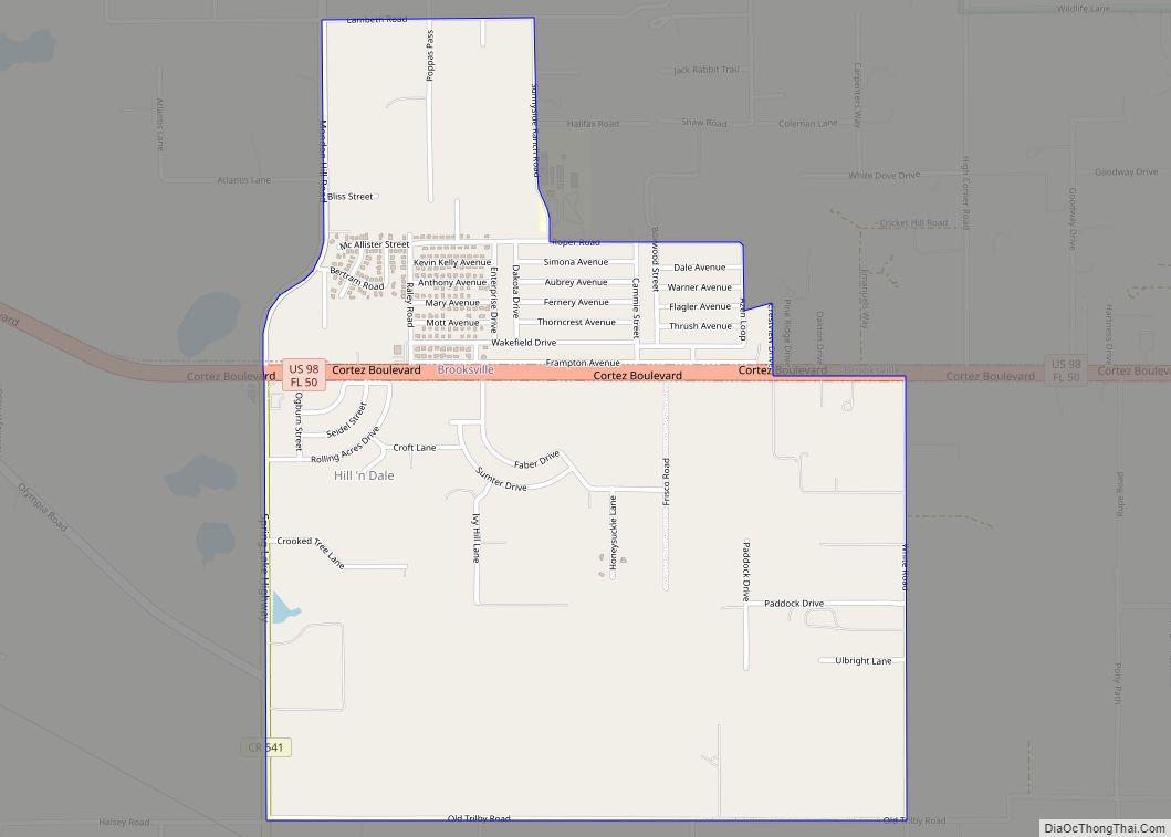
High Point is an unincorporated area and census-designated place (CDP) in Hernando County, Florida, United States. The population was 3,686 at the 2010 census. High Point CDP overview: Name: High Point CDP LSAD Code: 57 LSAD Description: CDP (suffix) State: Florida County: Hernando County Elevation: 70 ft (20 m) Total Area: 4.98 sq mi (12.90 km²) Land Area: 4.96 sq mi (12.85 km²) … Read more

Map of Hialeah Gardens city

Map of Hialeah Gardens city

Hialeah Gardens is a city in Miami-Dade County, Florida, United States. The population was 23,068 at the 2020 census, up from 21,744 in 2010. The population density is 7,160 persons per square mile, made up of mostly single-story development. Hialeah Gardens city overview: Name: Hialeah Gardens city LSAD Code: 25 LSAD Description: city (suffix) State: … Read more

Map of Hernando CDP

Map of Hernando CDP, Florida

Hernando is a census-designated place in Citrus County, Florida, United States. The population was 9,054 at the 2010 census. At one time it was a city but it was disincorporated in the 1970s. Hernando CDP overview: Name: Hernando CDP LSAD Code: 57 LSAD Description: CDP (suffix) State: Florida County: Citrus County Elevation: 56 ft (17 m) Total … Read more

Map of Highland City CDP

Map of Highland City CDP

Highland City is a census-designated place (CDP) in Polk County, Florida, United States. The population was 2,051 at the 2000 census. It is part of the Lakeland–Winter Haven Metropolitan Statistical Area. Highland City CDP overview: Name: Highland City CDP LSAD Code: 57 LSAD Description: CDP (suffix) State: Florida County: Polk County Elevation: 118 ft (36 m) Total … Read more

Map of Highland Beach town

Map of Highland Beach town, Florida

Highland Beach is a town in Palm Beach County, Florida, United States. It is situated 49 miles north of Miami and 20 miles south of Palm Beach. As of the 2010 census, the population was 3,539. Highland Beach town overview: Name: Highland Beach town LSAD Code: 43 LSAD Description: town (suffix) State: Florida County: Palm … Read more

Map of High Springs city

Map of High Springs city

High Springs is a city in Alachua County, Florida, United States. It is the fourth-largest city in Alachua County and seventh-largest in North Central Florida. The population was 6,215 at the 2020 census. High Springs city overview: Name: High Springs city LSAD Code: 25 LSAD Description: city (suffix) State: Florida County: Alachua County Elevation: 66 ft … Read more

Map of Hillcrest Heights town

Map of Hillcrest Heights town, Florida

Hillcrest Heights is a town in Polk County, Florida, United States. The population was 254 at the 2010 census. As of 2018, the population recorded by the U.S. Census Bureau is 294. It is part of the Lakeland–Winter Haven Metropolitan Statistical Area. Hillcrest Heights town overview: Name: Hillcrest Heights town LSAD Code: 43 LSAD Description: … Read more

Map of Hill 'n Dale CDP

Map of Hill ‘n Dale CDP

Hill ‘n Dale is a census-designated place (CDP) in Hernando County, Florida, United States. The population was 1,934 at the 2010 census. Hill ‘n Dale CDP overview: Name: Hill ‘n Dale CDP LSAD Code: 57 LSAD Description: CDP (suffix) State: Florida County: Hernando County Elevation: 108 ft (33 m) Total Area: 2.20 sq mi (5.70 km²) Land Area: 2.20 sq mi (5.69 km²) … Read more

Map of Highland Park village

Map of Highland Park village, Florida

Highland Park is a village in Polk County, Florida, United States. The population was 230 at the 2010 census. It is part of the Lakeland–Winter Haven Metropolitan Statistical Area. Highland Park village overview: Name: Highland Park village LSAD Code: 47 LSAD Description: village (suffix) State: Florida County: Polk County Elevation: 135 ft (41 m) Total Area: 1.09 sq mi … Read more

Map of Hillsboro Pines CDP

Map of Hillsboro Pines CDP

Hillsboro Pines is a census-designated place (CDP) in Broward County, Florida, United States. The population was 446 at the 2010 census. Hillsboro Pines CDP overview: Name: Hillsboro Pines CDP LSAD Code: 57 LSAD Description: CDP (suffix) State: Florida County: Broward County Total Area: 0.21 sq mi (0.56 km²) Land Area: 0.21 sq mi (0.55 km²) Water Area: 0.00 sq mi (0.01 km²) Total Population: … Read more

Map of Hillsboro Beach town

Map of Hillsboro Beach town

Hillsboro Beach, officially the Town of Hillsboro Beach, is a town in Broward County, Florida, United States. Its population was 1,875 at the 2010 census. It is part of the Miami metropolitan area, which had 5,564,635 people at the 2010 census. Hillsboro Beach town overview: Name: Hillsboro Beach town LSAD Code: 43 LSAD Description: town … Read more

Map of Hilliard town

Map of Hilliard town, Florida

Hilliard is a town in Nassau County, Florida, United States; north-west of Jacksonville. As of the 2020 census, the population was 2,967. Hilliard was named “2003 Rural Community of the Year” by Florida governor Jeb Bush, for its collaboration with the YMCA to establish a local chapter, which included a swimming pool and exercise facility. … Read more