Hialeah Gardens is a city in Miami-Dade County, Florida, United States. The population was 23,068 at the 2020 census, up from 21,744 in 2010. The population density is 7,160 persons per square mile, made up of mostly single-story development.
| Name: | Hialeah Gardens city |
|---|---|
| LSAD Code: | 25 |
| LSAD Description: | city (suffix) |
| State: | Florida |
| County: | Miami-Dade County |
| Incorporated: | December 1, 1948 |
| Elevation: | 7 ft (2 m) |
| Total Area: | 3.67 sq mi (9.51 km²) |
| Land Area: | 3.22 sq mi (8.34 km²) |
| Water Area: | 0.45 sq mi (1.16 km²) |
| Total Population: | 23,068 |
| Population Density: | 7,159.53/sq mi (2,764.36/km²) |
| Area code: | 305, 786 |
| FIPS code: | 1230025 |
| GNISfeature ID: | 0305060 |
| Website: | www.cityofhialeahgardens.com |
Online Interactive Map
Click on ![]() to view map in "full screen" mode.
to view map in "full screen" mode.
Hialeah Gardens location map. Where is Hialeah Gardens city?


History
The municipality sprouted from humble beginnings at Walter C. Ohlerts Tourist Camp. By way of 26 unanimous votes, the town of Hialeah Gardens achieved incorporation in December 1948.
In February 1949, Hialeah Gardens adopted its first building code, its first traffic ordinance, and the first laws regarding hunting. Hialeah Gardens served mainly as a rural community in which one of its main industries was raising horses. This existed until 1968 when the city adopted an aggressive land use and zoning master plan to lead the growth of the city. Only a small number of small businesses existed along the Okeechobee Road corridor. The city’s close proximity to major roadways, such as Okeechobee Road (U.S. Route 27 / State Road 25) and the Palmetto Expressway (State Road 826), provided the opportunity for Hialeah Gardens to become one of the fastest growing municipalities in the county.
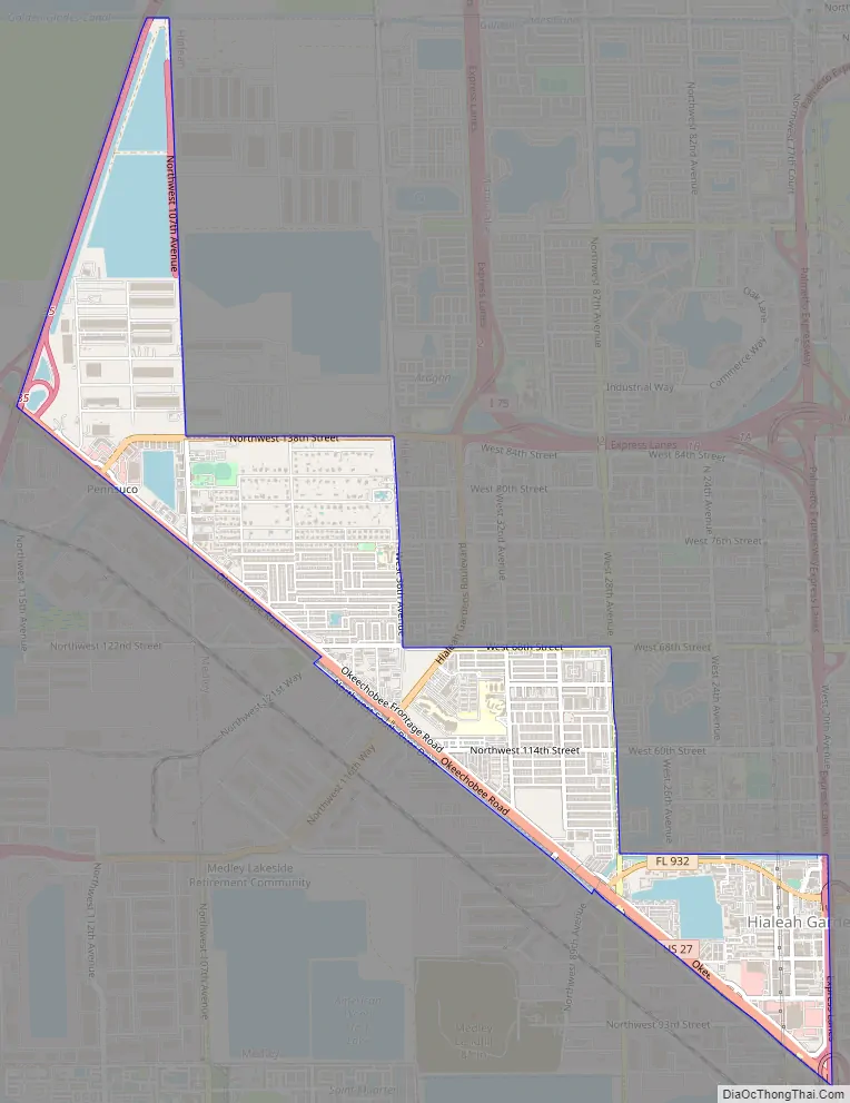
Hialeah Gardens Road Map
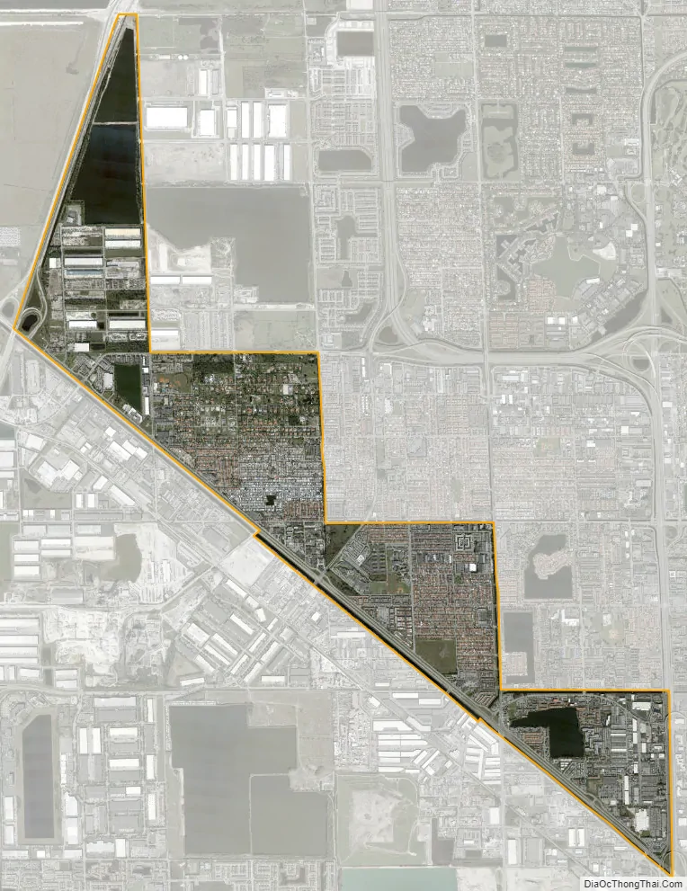
Hialeah Gardens city Satellite Map
Geography
Hialeah Gardens is located northwest of downtown Miami at 25°52′42″N 80°20′53″W / 25.87833°N 80.34806°W / 25.87833; -80.34806 (25.878342, –80.348072). It is bordered to the north and east by the city of Hialeah and to the southwest by the town of Medley. U.S. Route 27 (Okeechobee Road) runs along the border with Medley, leading southeast 10 miles (16 km) to its southern terminus at U.S. Route 1 in eastern Miami, and northwest 22 miles (35 km) to Interstate 75 at the former Andytown.
According to the United States Census Bureau, Hialeah has a total area of 3.67 square miles (9.5 km). 3.22 square miles (8.3 km) of it are land, and 0.45 square miles (1.2 km) of it (12.21%) are water.
Surrounding areas
- Unincorporated Miami-Dade County, Hialeah
- Unincorporated Miami-Dade County Hialeah
- Unincorporated Miami-Dade County, Medley Hialeah
- Medley Hialeah
- Medley
See also
Map of Florida State and its subdivision:- Alachua
- Baker
- Bay
- Bradford
- Brevard
- Broward
- Calhoun
- Charlotte
- Citrus
- Clay
- Collier
- Columbia
- Desoto
- Dixie
- Duval
- Escambia
- Flagler
- Franklin
- Gadsden
- Gilchrist
- Glades
- Gulf
- Hamilton
- Hardee
- Hendry
- Hernando
- Highlands
- Hillsborough
- Holmes
- Indian River
- Jackson
- Jefferson
- Lafayette
- Lake
- Lee
- Leon
- Levy
- Liberty
- Madison
- Manatee
- Marion
- Martin
- Miami-Dade
- Monroe
- Nassau
- Okaloosa
- Okeechobee
- Orange
- Osceola
- Palm Beach
- Pasco
- Pinellas
- Polk
- Putnam
- Saint Johns
- Saint Lucie
- Santa Rosa
- Sarasota
- Seminole
- Sumter
- Suwannee
- Taylor
- Union
- Volusia
- Wakulla
- Walton
- Washington
- Alabama
- Alaska
- Arizona
- Arkansas
- California
- Colorado
- Connecticut
- Delaware
- District of Columbia
- Florida
- Georgia
- Hawaii
- Idaho
- Illinois
- Indiana
- Iowa
- Kansas
- Kentucky
- Louisiana
- Maine
- Maryland
- Massachusetts
- Michigan
- Minnesota
- Mississippi
- Missouri
- Montana
- Nebraska
- Nevada
- New Hampshire
- New Jersey
- New Mexico
- New York
- North Carolina
- North Dakota
- Ohio
- Oklahoma
- Oregon
- Pennsylvania
- Rhode Island
- South Carolina
- South Dakota
- Tennessee
- Texas
- Utah
- Vermont
- Virginia
- Washington
- West Virginia
- Wisconsin
- Wyoming


