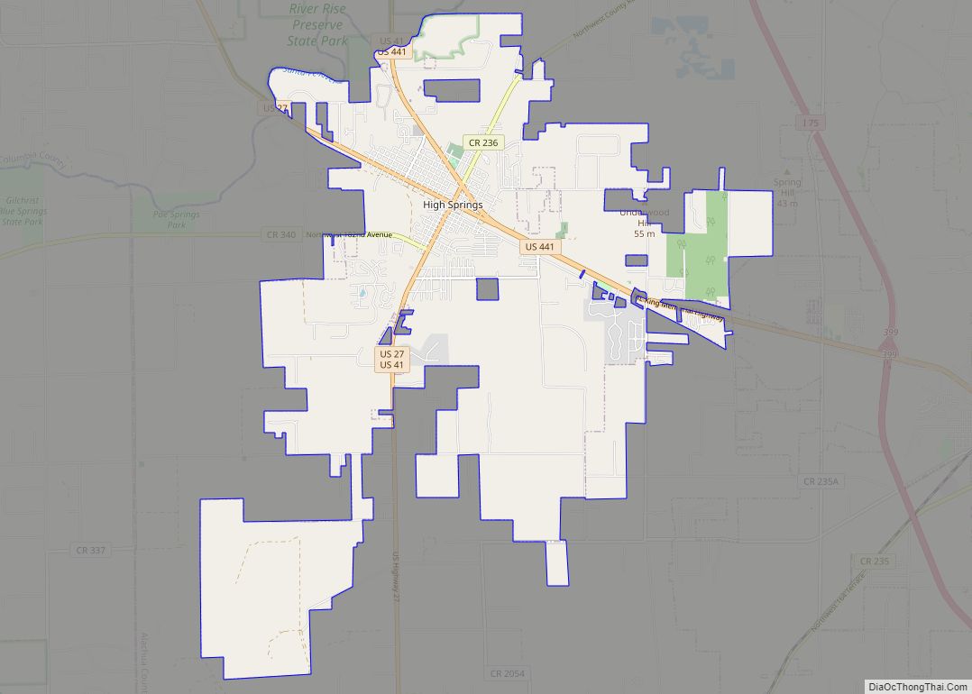
High Springs is a city in Alachua County, Florida, United States. It is the fourth-largest city in Alachua County and seventh-largest in North Central Florida. The population was 6,215 at the 2020 census.
| Name: | High Springs city |
|---|---|
| LSAD Code: | 25 |
| LSAD Description: | city (suffix) |
| State: | Florida |
| County: | Alachua County |
| Elevation: | 66 ft (20 m) |
| Total Area: | 21.97 sq mi (56.89 km²) |
| Land Area: | 21.89 sq mi (56.69 km²) |
| Water Area: | 0.08 sq mi (0.20 km²) |
| Total Population: | 6,215 |
| Population Density: | 283.95/sq mi (109.63/km²) |
| ZIP code: | 32643, 32655 |
| Area code: | 386 |
| FIPS code: | 1230525 |
| GNISfeature ID: | 0307633 |
| Website: | highsprings.us |
Online Interactive Map
Click on ![]() to view map in "full screen" mode.
to view map in "full screen" mode.
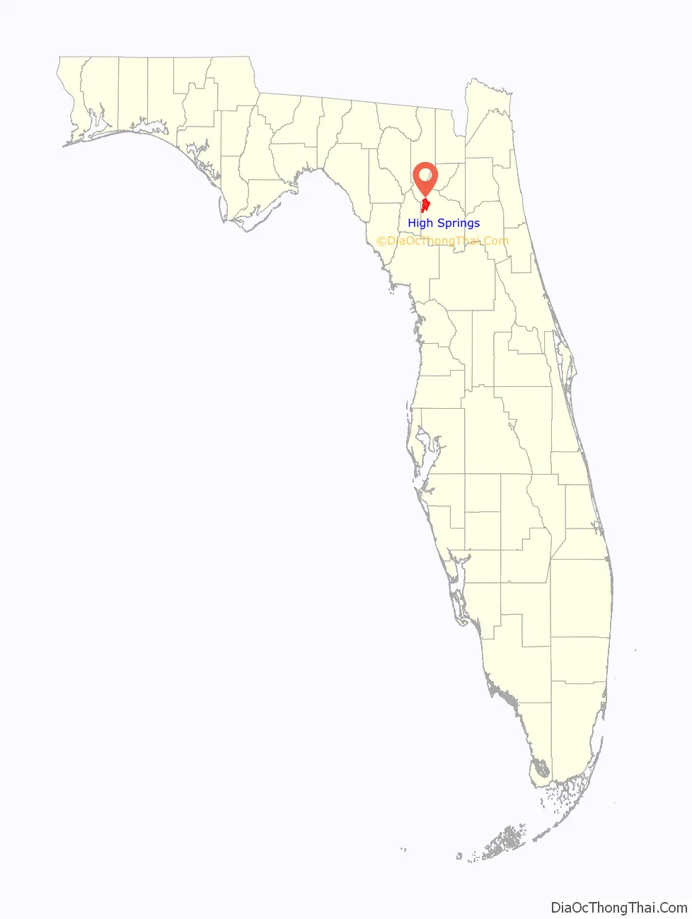
High Springs location map. Where is High Springs city?

History
The present-day area of High Springs was first settled on a permanent basis by English-speaking people during the late 1830s. One of the earliest settlements in the vicinity was at Crockett Springs, located about three miles east of present-day High Springs. Settlers who were living there during the 1840s included Fernando Underwood and Marshal Blanton. A discernible town began to develop in the early 1880s after the Savannah, Florida & Western Railway was constructed and several phosphate mines were established. A railroad station and a post office called Santaffey were established in 1884. The post office was renamed Santa Fe a few months later, then Orion the next year, and in 1888 it became High Springs, and the town was officially incorporated in 1892. The town had a population over 1,500 at the end of the 1890s and was the second largest by population in the county.
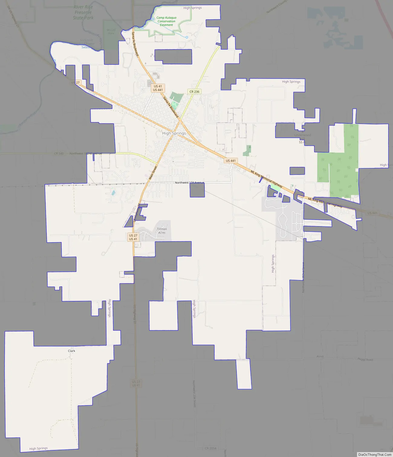
High Springs Road Map
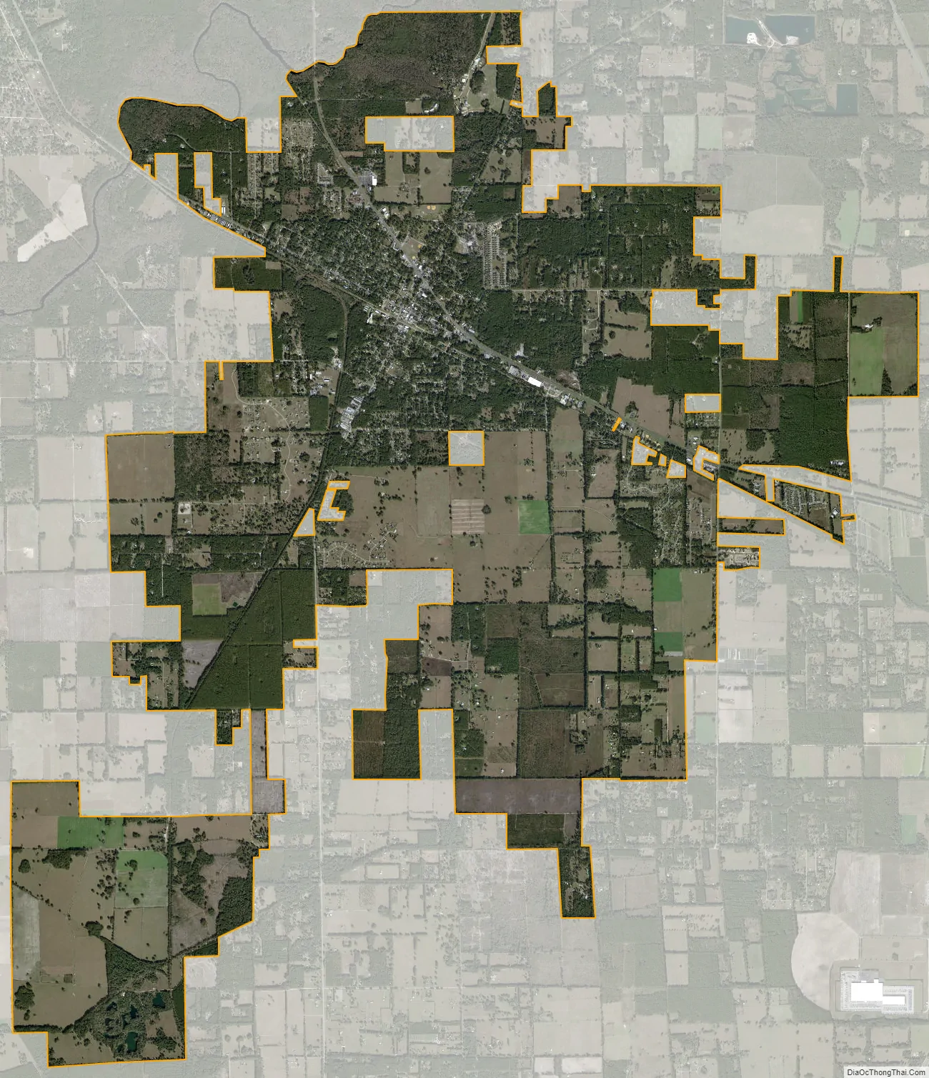
High Springs city Satellite Map
Geography
High Springs is located at 28°49′N 82°36′W / 28.817°N 82.600°W / 28.817; -82.600 (29.8245, –82.5953).
According to the United States Census Bureau, the city has a total area of 22.0 square miles (57.1 km), of which 22.0 square miles (56.9 km) is land and 0.077 square miles (0.2 km) (0.36%) is water.
Climate
See also
Map of Florida State and its subdivision:- Alachua
- Baker
- Bay
- Bradford
- Brevard
- Broward
- Calhoun
- Charlotte
- Citrus
- Clay
- Collier
- Columbia
- Desoto
- Dixie
- Duval
- Escambia
- Flagler
- Franklin
- Gadsden
- Gilchrist
- Glades
- Gulf
- Hamilton
- Hardee
- Hendry
- Hernando
- Highlands
- Hillsborough
- Holmes
- Indian River
- Jackson
- Jefferson
- Lafayette
- Lake
- Lee
- Leon
- Levy
- Liberty
- Madison
- Manatee
- Marion
- Martin
- Miami-Dade
- Monroe
- Nassau
- Okaloosa
- Okeechobee
- Orange
- Osceola
- Palm Beach
- Pasco
- Pinellas
- Polk
- Putnam
- Saint Johns
- Saint Lucie
- Santa Rosa
- Sarasota
- Seminole
- Sumter
- Suwannee
- Taylor
- Union
- Volusia
- Wakulla
- Walton
- Washington
- Alabama
- Alaska
- Arizona
- Arkansas
- California
- Colorado
- Connecticut
- Delaware
- District of Columbia
- Florida
- Georgia
- Hawaii
- Idaho
- Illinois
- Indiana
- Iowa
- Kansas
- Kentucky
- Louisiana
- Maine
- Maryland
- Massachusetts
- Michigan
- Minnesota
- Mississippi
- Missouri
- Montana
- Nebraska
- Nevada
- New Hampshire
- New Jersey
- New Mexico
- New York
- North Carolina
- North Dakota
- Ohio
- Oklahoma
- Oregon
- Pennsylvania
- Rhode Island
- South Carolina
- South Dakota
- Tennessee
- Texas
- Utah
- Vermont
- Virginia
- Washington
- West Virginia
- Wisconsin
- Wyoming