Hilliard is a town in Nassau County, Florida, United States; north-west of Jacksonville. As of the 2020 census, the population was 2,967.
Hilliard was named “2003 Rural Community of the Year” by Florida governor Jeb Bush, for its collaboration with the YMCA to establish a local chapter, which included a swimming pool and exercise facility.
| Name: | Hilliard town |
|---|---|
| LSAD Code: | 43 |
| LSAD Description: | town (suffix) |
| State: | Florida |
| County: | Nassau County |
| Elevation: | 59 ft (18 m) |
| Total Area: | 5.51 sq mi (14.26 km²) |
| Land Area: | 5.51 sq mi (14.26 km²) |
| Water Area: | 0.00 sq mi (0.00 km²) |
| Total Population: | 2,967 |
| Population Density: | 538.77/sq mi (208.01/km²) |
| ZIP code: | 32046 |
| Area code: | 904 |
| FIPS code: | 1230750 |
| GNISfeature ID: | 0284033 |
| Website: | www.townofhilliard.com |
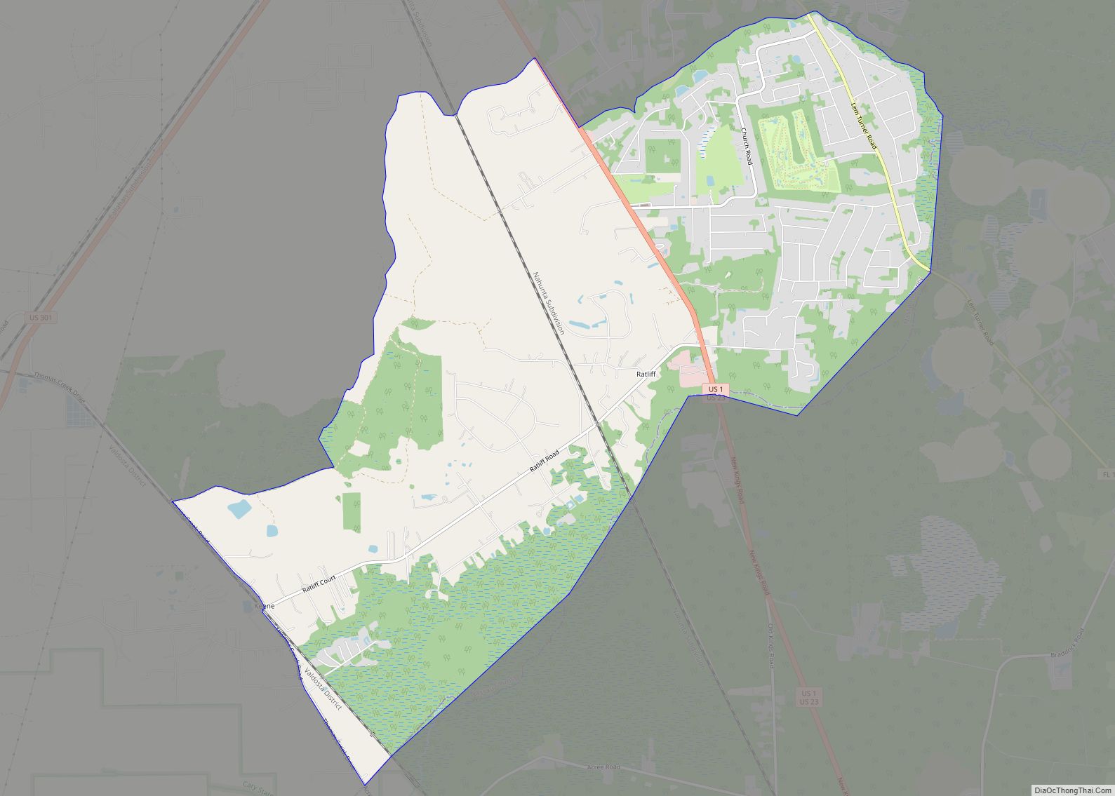
Online Interactive Map
Click on ![]() to view map in "full screen" mode.
to view map in "full screen" mode.
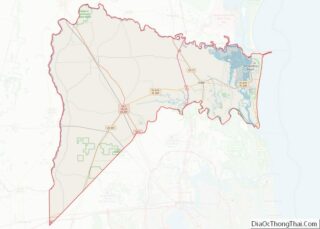
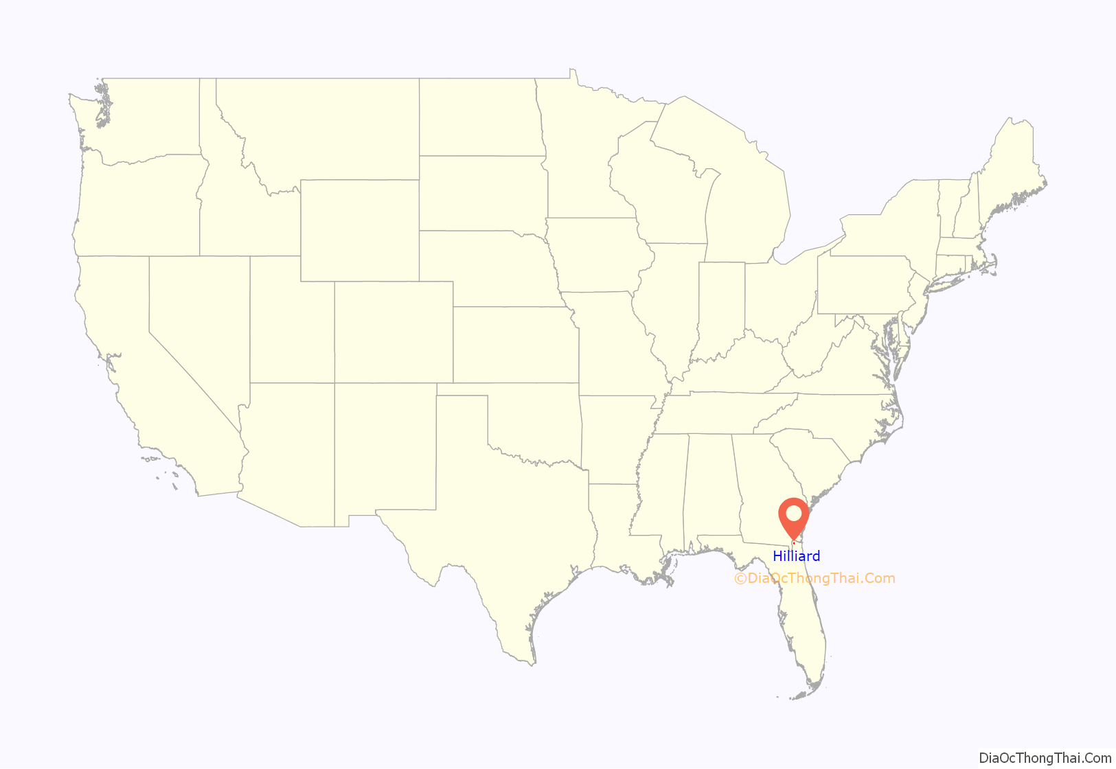
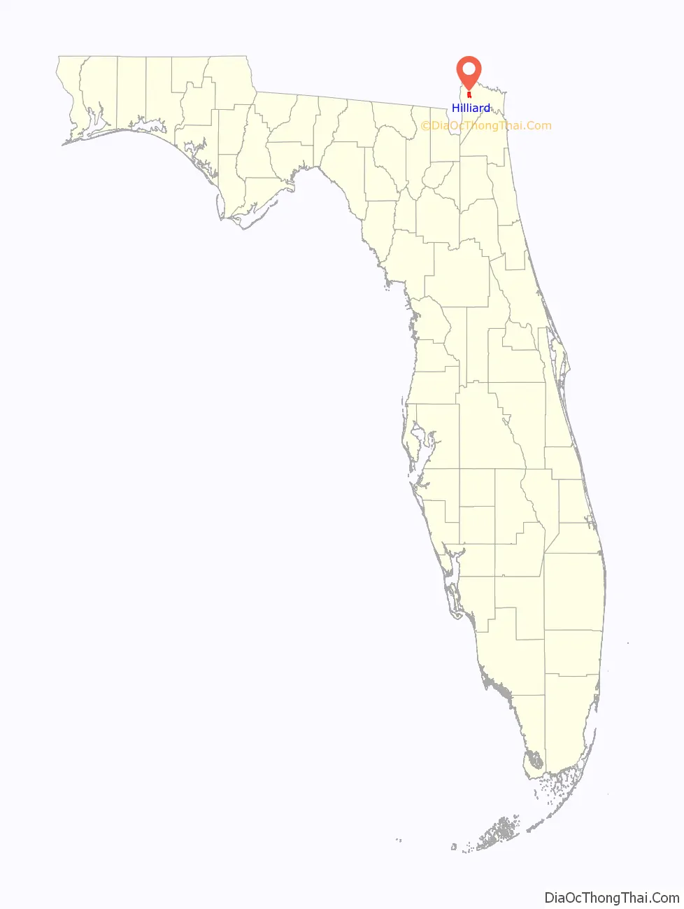
Hilliard location map. Where is Hilliard town?
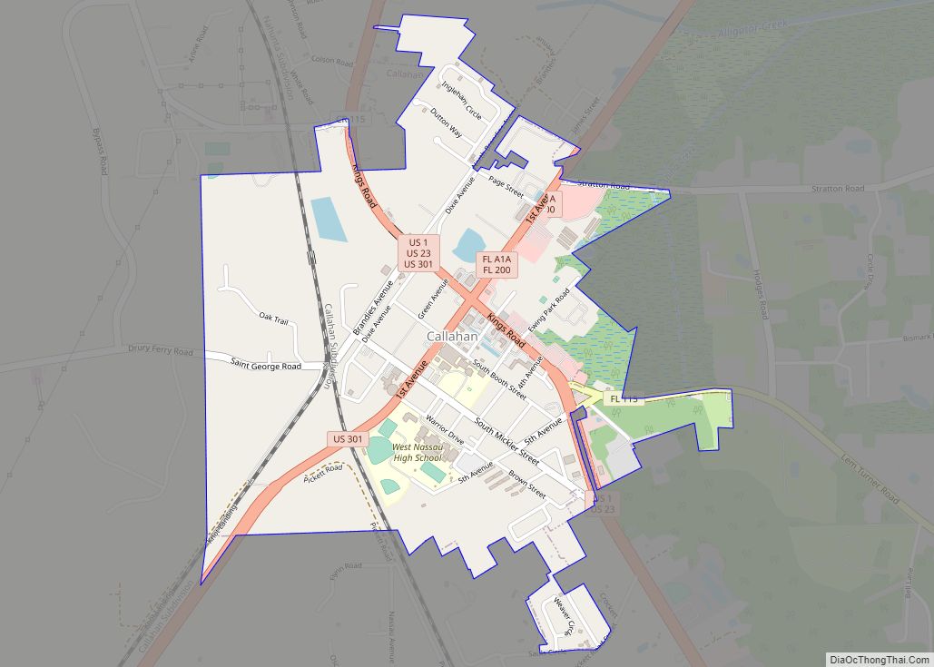
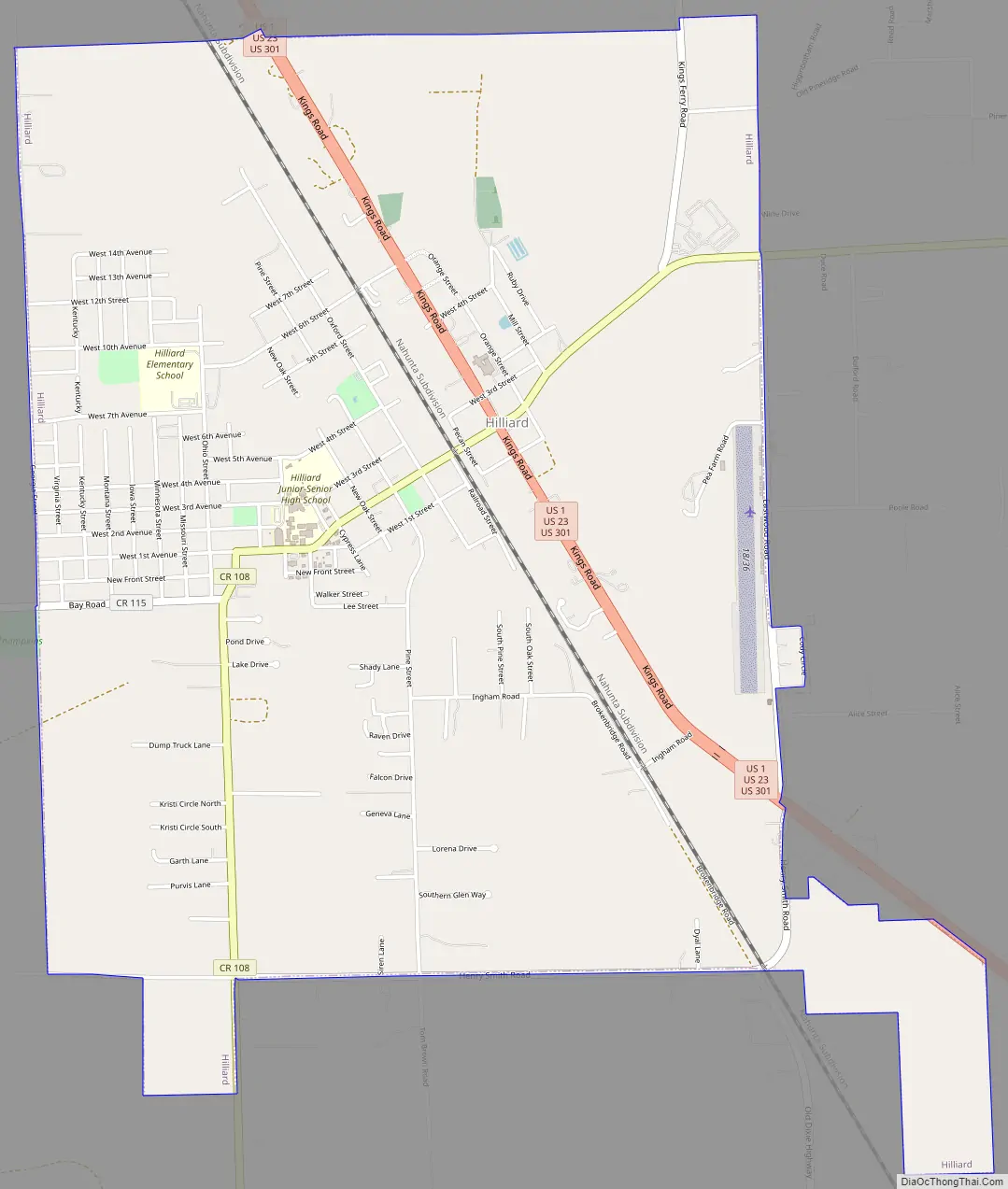
Hilliard Road Map
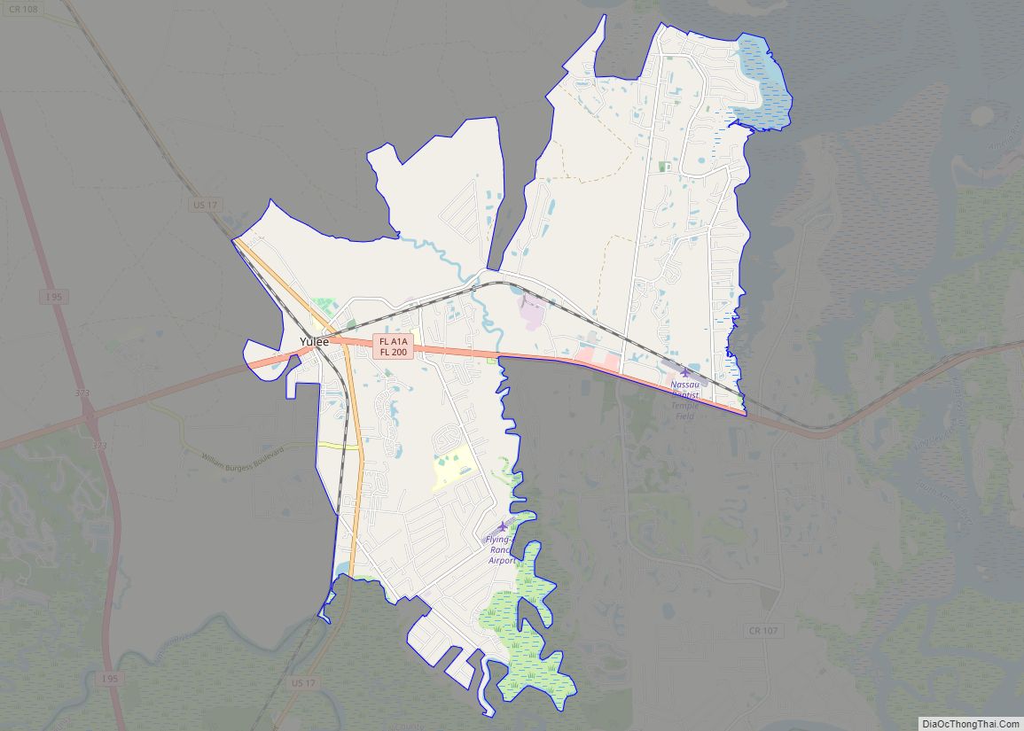
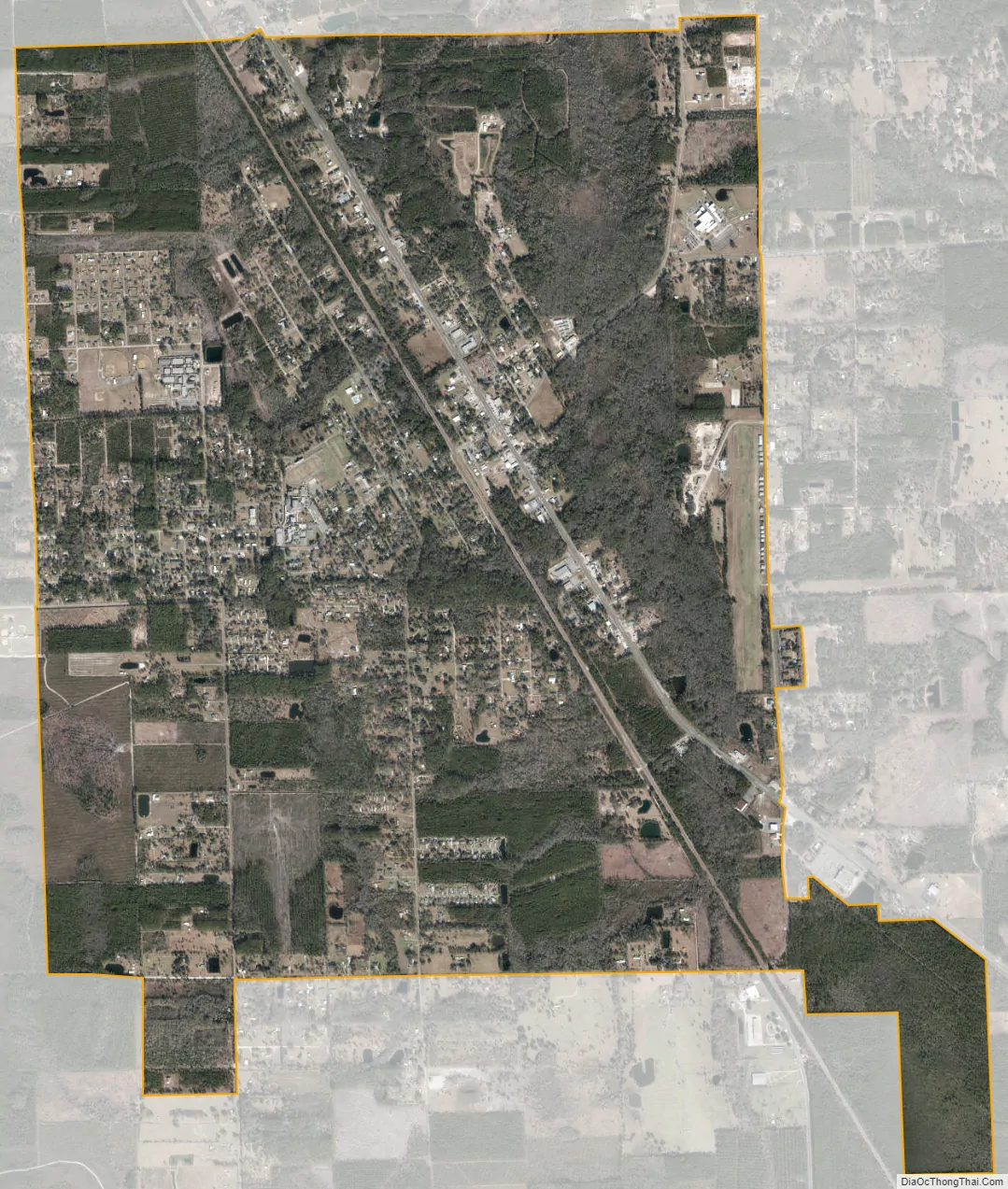
Hilliard city Satellite Map
Geography
Hilliard is near the Florida-Georgia border, and within the Jacksonville metropolitan area.
According to the United States Census Bureau, the town has a total area of 5.5 square miles (14 km), all land.
See also
Map of Florida State and its subdivision:- Alachua
- Baker
- Bay
- Bradford
- Brevard
- Broward
- Calhoun
- Charlotte
- Citrus
- Clay
- Collier
- Columbia
- Desoto
- Dixie
- Duval
- Escambia
- Flagler
- Franklin
- Gadsden
- Gilchrist
- Glades
- Gulf
- Hamilton
- Hardee
- Hendry
- Hernando
- Highlands
- Hillsborough
- Holmes
- Indian River
- Jackson
- Jefferson
- Lafayette
- Lake
- Lee
- Leon
- Levy
- Liberty
- Madison
- Manatee
- Marion
- Martin
- Miami-Dade
- Monroe
- Nassau
- Okaloosa
- Okeechobee
- Orange
- Osceola
- Palm Beach
- Pasco
- Pinellas
- Polk
- Putnam
- Saint Johns
- Saint Lucie
- Santa Rosa
- Sarasota
- Seminole
- Sumter
- Suwannee
- Taylor
- Union
- Volusia
- Wakulla
- Walton
- Washington
- Alabama
- Alaska
- Arizona
- Arkansas
- California
- Colorado
- Connecticut
- Delaware
- District of Columbia
- Florida
- Georgia
- Hawaii
- Idaho
- Illinois
- Indiana
- Iowa
- Kansas
- Kentucky
- Louisiana
- Maine
- Maryland
- Massachusetts
- Michigan
- Minnesota
- Mississippi
- Missouri
- Montana
- Nebraska
- Nevada
- New Hampshire
- New Jersey
- New Mexico
- New York
- North Carolina
- North Dakota
- Ohio
- Oklahoma
- Oregon
- Pennsylvania
- Rhode Island
- South Carolina
- South Dakota
- Tennessee
- Texas
- Utah
- Vermont
- Virginia
- Washington
- West Virginia
- Wisconsin
- Wyoming