Map of Holiday CDP

Map of Holiday CDP

Holiday is a census-designated place (CDP) in Pasco County, Florida, United States. It is a suburb of the Tampa-St. Petersburg-Clearwater, Florida Metropolitan Statistical Area. The population was 22,403 as of the 2010 census. In the early 1960s, William W. Boyd, president of First Federal Savings and Loan Association of Tarpon Springs, noted the name Holiday … Read more

Map of Holden Heights CDP

Map of Holden Heights CDP

Holden Heights is a census-designated place and unincorporated area in Orange County, Florida, United States. The population was 3,679 at the 2010 census. The ZIP code serving the CDP is 32839. It is part of the Orlando–Kissimmee Metropolitan Statistical Area. Holden Heights CDP overview: Name: Holden Heights CDP LSAD Code: 57 LSAD Description: CDP (suffix) … Read more

Map of Hobe Sound CDP

Map of Hobe Sound CDP

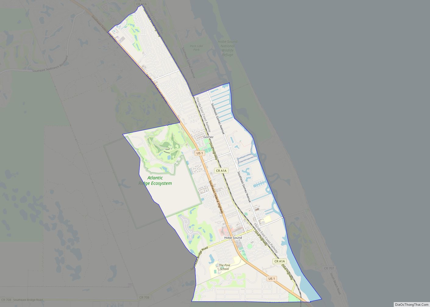
Hobe Sound is an unincorporated area and census-designated place (CDP) in Martin County, Florida, United States, located along Florida’s Treasure Coast. The population was 13,163 at the 2020 census, up from 11,521 in 2010. Hobe Sound CDP overview: Name: Hobe Sound CDP LSAD Code: 57 LSAD Description: CDP (suffix) State: Florida County: Martin County Elevation: … Read more

Map of Holmes Beach city

Map of Holmes Beach city

Holmes Beach is a city on Anna Maria Island in Manatee County, Florida, United States. As of the 2020 census, it had a population of 3,010, down from 3,836 at the 2010 census. It is part of the Bradenton-Sarasota-Venice, Florida Metropolitan Statistical Area. The city occupies the central part of Anna Maria Island and is … Read more

Map of Holly Hill city

Map of Holly Hill city, Florida

Holly Hill is a city in Volusia County, Florida, United States. The population was 11,659 at the 2010 census. Holly Hill’s city limits lie entirely on the Florida mainland, unlike the larger cities on either side of it, Daytona Beach and Ormond Beach, which encompass both the mainland and the barrier island (beach front) across … Read more

Map of Holley CDP

Map of Holley CDP, Florida

Holley is an unincorporated community and census-designated place in Santa Rosa County, Florida, United States. Its population was 1,630 as of the 2010 census. Florida State Road 87 passes through the community. For almost all cases, the community of Holley, is considered to be a neighborhood or character area of the larger community of Navarre, … Read more

Map of Homestead city

Map of Homestead city, Florida

Homestead is a city within Miami-Dade County in the U.S. state of Florida, between Biscayne National Park to the east and Everglades National Park to the west. The population was 80,737 as of the 2020 census. Homestead is primarily a Miami suburb and a major agricultural area. It is a principal city of the Miami … Read more

Map of Homestead Base CDP

Map of Homestead Base CDP

Homestead Base is a census-designated place (CDP) in Miami-Dade County, Florida, United States. The population was 999 at the 2020 census. The CDP comprises the extent of Homestead Air Reserve Base plus some surrounding land. Homestead Base CDP overview: Name: Homestead Base CDP LSAD Code: 57 LSAD Description: CDP (suffix) State: Florida County: Miami-Dade County … Read more

Map of Homeland CDP, Florida

Map of Homeland CDP, Florida

Homeland is an unincorporated community in Polk County, Florida, United States. It has a post office, a general store, and historical park. It is part of the Lakeland–Winter Haven Metropolitan Statistical Area. Homeland CDP overview: Name: Homeland CDP LSAD Code: 57 LSAD Description: CDP (suffix) State: Florida County: Polk County Elevation: 140 ft (40 m) Total Area: … Read more

Map of Horizon West CDP

Map of Horizon West CDP

Horizon West is a census-designated place and unincorporated area in Orange County, Florida, United States. The population was 14,000 at the 2010 census. It is part of the Orlando–Kissimmee–Sanford, Florida Metropolitan Statistical Area. Horizon West includes five designated mixed-use villages, namely the Village of Bridgewater, Lakeside Village, Hickory Nut, Village I and Village F., surrounded … Read more

Map of Homosassa CDP

Map of Homosassa CDP

Homosassa is a census-designated place (CDP) in Citrus County, Florida, United States. The population was 2,578 at the 2010 census. Homosassa CDP overview: Name: Homosassa CDP LSAD Code: 57 LSAD Description: CDP (suffix) State: Florida County: Citrus County Elevation: 0 ft (0 m) Total Area: 8.33 sq mi (21.58 km²) Land Area: 7.81 sq mi (20.23 km²) Water Area: 0.52 sq mi (1.35 km²) Total Population: … Read more

Map of Homosassa Springs CDP

Map of Homosassa Springs CDP

Homosassa Springs is an unincorporated community and census-designated place (CDP) in Citrus County, Florida, United States. The population was 14,283 as of 2020. Homosassa Springs is the principal city of the Homosassa Springs, Florida, Metropolitan Statistical Area. The name derives from the warm spring located in Homosassa Springs Wildlife State Park that attracts manatees to … Read more