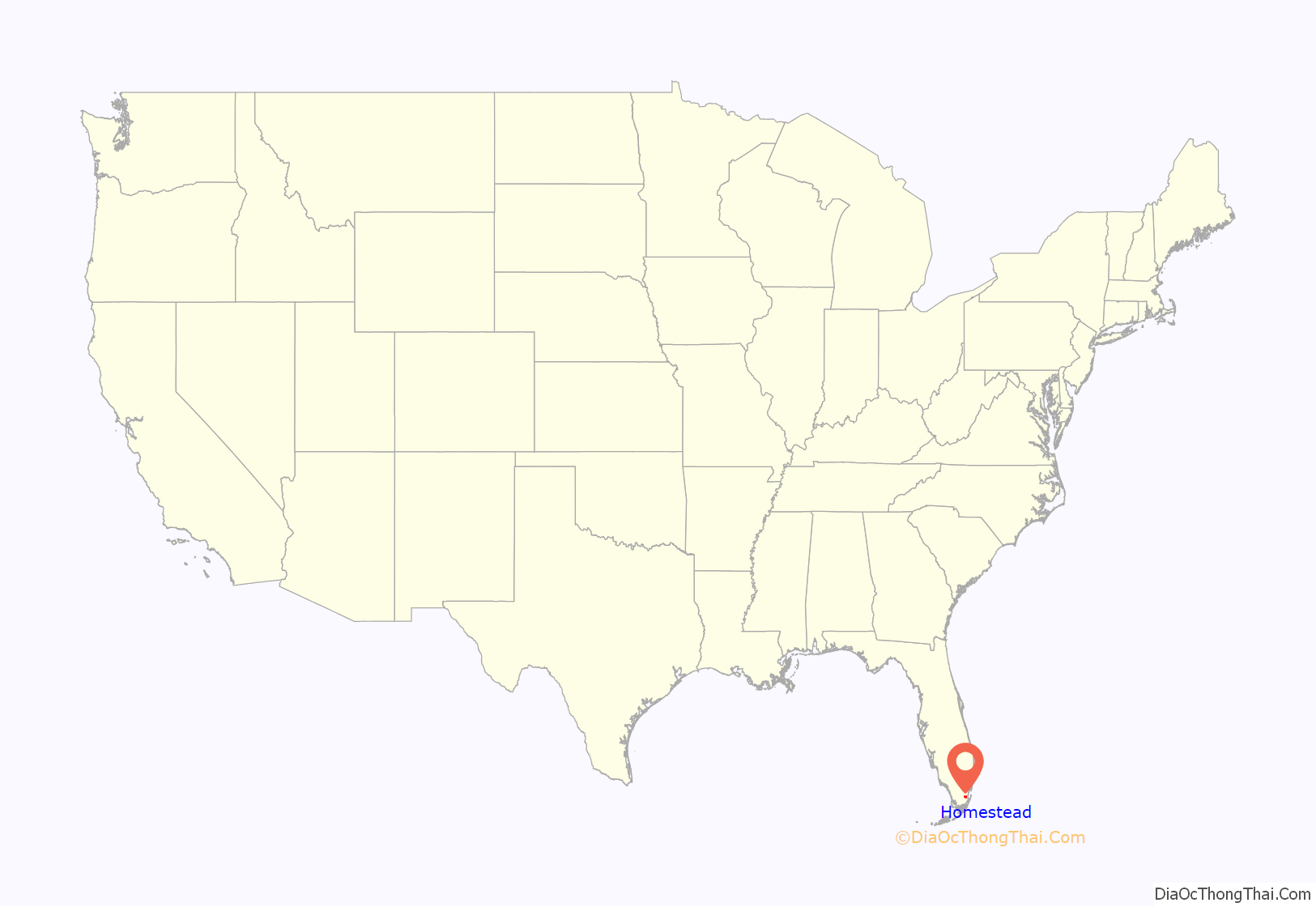
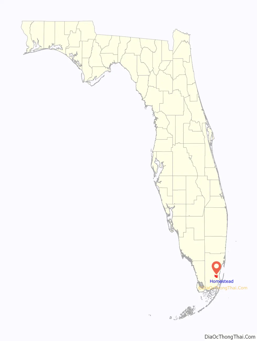
Homestead is a city within Miami-Dade County in the U.S. state of Florida, between Biscayne National Park to the east and Everglades National Park to the west. The population was 80,737 as of the 2020 census. Homestead is primarily a Miami suburb and a major agricultural area. It is a principal city of the Miami metropolitan area, which was home to an estimated 6,012,331 people at the 2015 census. It is located approximately 26 miles (42 km) southwest of Miami, and 25 miles (40 km) northwest of Key Largo.
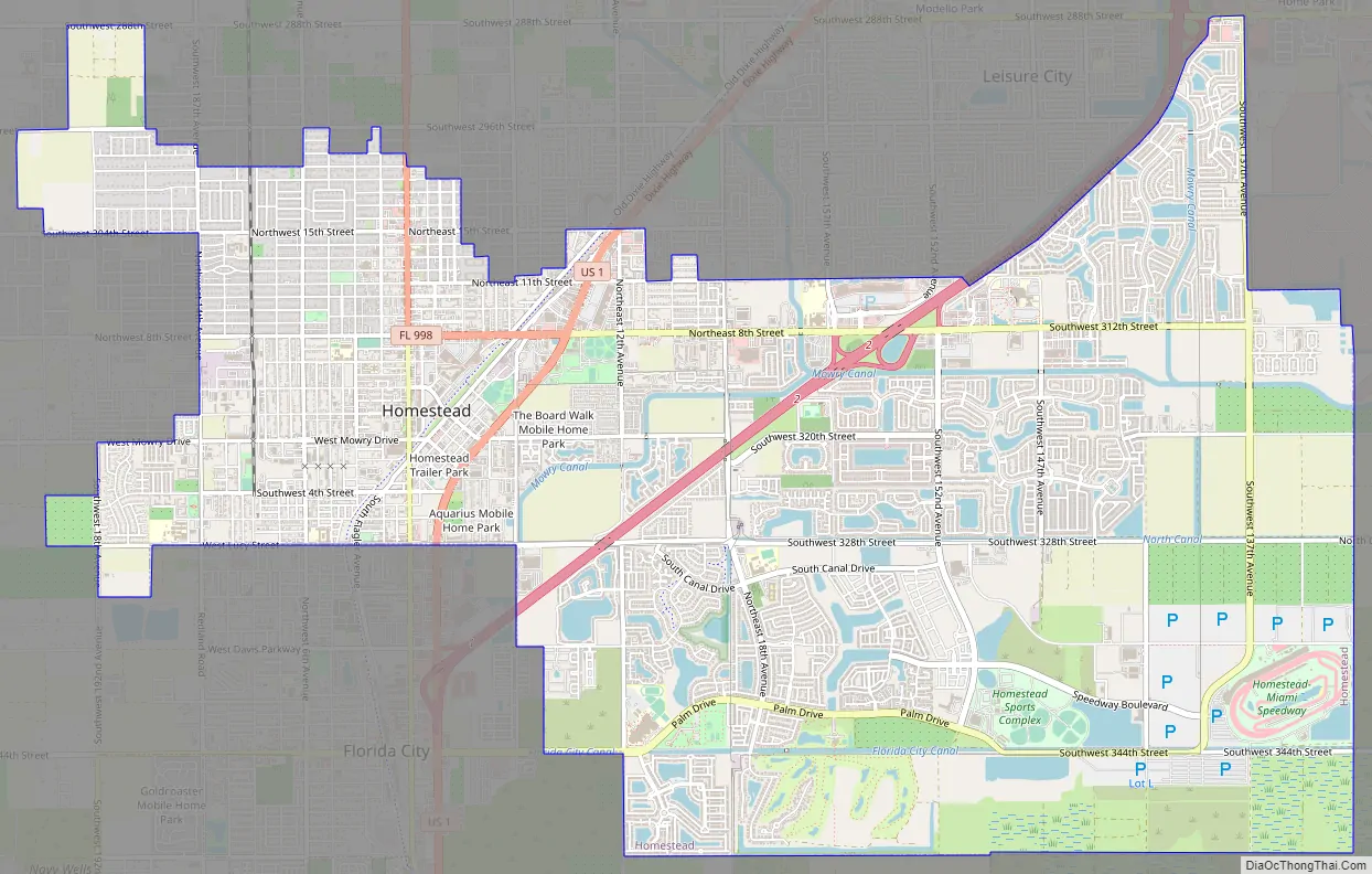
The city of Homestead is located near the southern terminus of the Homestead Extension of Florida’s Turnpike where it ends at its junction with U.S. 1. Homestead is immediately north and east of Florida City, and these two cities comprise the greater Homestead-Florida City area. Some of the notable unincorporated communities in the area are Redland, Leisure City, Naranja, and Princeton.
| Name: | Homestead city |
|---|---|
| LSAD Code: | 25 |
| LSAD Description: | city (suffix) |
| State: | Florida |
| County: | Miami-Dade County |
| Incorporated: | February 8, 1913 |
| Elevation: | 3 ft (1 m) |
| Total Area: | 15.58 sq mi (40.36 km²) |
| Land Area: | 15.08 sq mi (39.07 km²) |
| Water Area: | 0.50 sq mi (1.29 km²) 0.63% |
| Total Population: | 80,737 |
| Population Density: | 5,352.49/sq mi (2,066.63/km²) |
| ZIP code: | 33000-33099 |
| Area code: | 305 and 786 |
| FIPS code: | 1232275 |
| GNISfeature ID: | 0284214 |
| Website: | www.CityOfHomestead.com |
Online Interactive Map
Click on ![]() to view map in "full screen" mode.
to view map in "full screen" mode.
Homestead location map. Where is Homestead city?
History
Homestead was incorporated in 1913 and is the second oldest city in Miami-Dade County next to the city of Miami. The name originates from when the Florida East Coast Railway extension to Key West was being built. The rail line was passing through an area opened up for homesteading, and as the construction camp at the end of the line did not have a particular name, construction materials and supplies for the workers were consigned to “Homestead Country”, shortened to “Homestead” by the engineers who mapped the area. Homestead and neighboring South Miami-Dade County communities bore the brunt of Category 5 Hurricane Andrew on August 24, 1992.
Homestead Road Map
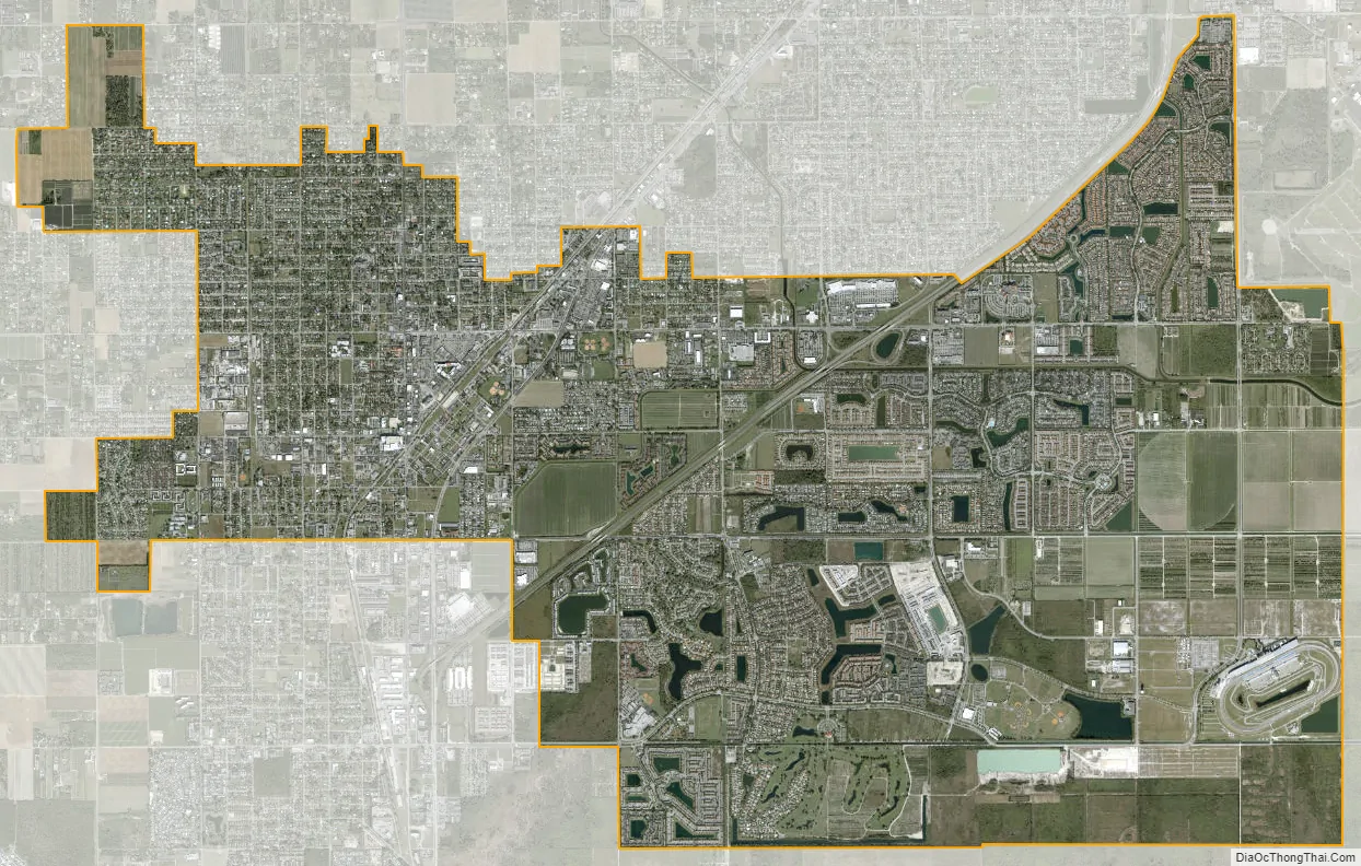
Homestead city Satellite Map
Geography
According to the United States Census Bureau, the city has a total area of 14.4 square miles (37 km). 14.3 square miles (37 km) of it is land and 0.1 square miles (0.26 km) of it (0.63%) is water.
Homestead is a small-sized city. At its greatest north-south points – along SW 137th Avenue (Speedway Boulevard) – its city limits extend only 4 miles (6 km) – from SW 288th Street (Biscayne Drive) at the north end to (theoretical) SW 352nd Street at the south end. At its greatest east-west points – along SW 328th Street (North Canal Drive / Lucy Street) – its city limits extend 6 miles (10 km) – from (theoretical) SW 132nd Avenue at the east end to SW 192nd Avenue at the west end. U.S. 1 – known as Homestead Boulevard within the city limits – extends through a rather narrow northeast / southwest corridor of the city from SW 304th Street (Kings Highway) at the north end to SW 328th Street (Lucy Street) at the south end. It is at this point at the south end that Homestead and Florida City share a common border. (North of the north end at SW 304th Street is known as Unincorporated Miami-Dade County, but it is locally known as the community of Leisure City).
Major east-west streets within Homestead include SW 304th Street / NE & NW 15th Street (Kings Highway), SW 312th Street / NE & NW 8th Street (Campbell Drive), SW 320th Street (Mowry Drive), SW 328th Street / SE & SW 8th Street (North Canal Drive / Lucy Street), and SW 344th Street / SE 24th Street (Palm Drive).
The original Homestead Air Force Base was once located several miles to the northeast of Homestead, but due to annexation of formerly unincorporated land immediately to the east and northeast of the original city limits during the late-1990s the city and the far southwestern perimeter of the (now) Homestead Air Reserve Base share a common border for a small portion along SW 137th Avenue (Speedway Boulevard).
A noteworthy tourist attraction within Leisure City is Coral Castle, built by a jilted lover, Edward Leedskalnin, over the course of 28 years from 1923 to 1951. The Fruit and Spice Park is also of interest.
Climate
Homestead experiences a tropical monsoon climate (Köppen climate classification Am) that borders on a tropical savanna climate (Aw). Summers are hot and humid and high temperatures average between 90° and 92 °F (32° to 33 °C). Winters are warm and dry. The all-time record high temperature is 100 °F (38 °C), on 21 July 1942. Lows in summer average between 70° and 75 °F (21° to 24 °C), with low temperatures in all times of year averaging 5 degrees cooler than coastal Miami, mainly because of its inland and rural location. In winter, the area sees cold fronts bring cold weather for short periods from November to March. The lowest temperature ever recorded is 26 °F (–3 °C), on 13 December 1934, which was recorded at Homestead Air Force Base, some 10 miles east of the town. High temperatures in winter average between 68° and 80 °F (18° to 26 °C), and lows average between 57° and 64 °F (8° to 14 °C). Summer is the season when most of the rain occurs. Homestead has a wet season lasting from mid-May to early October. The dry season sees some rain, with most of it coming with the passing of cold fronts. Snow flurries were reported to have been observed in the air at Homestead Air Force Base, on January 20, 1977, and marked the farthest south that snow flurries have ever been reported in the lower 48 United States.
In August 1992, the Category 5 hurricane Andrew devastated the town, as well as nearby Homestead Air Force Base. Hurricane Katrina caused flooding in Homestead in August 2005. The following October, Hurricane Wilma damaged light poles, grandstands, garages, and sections of catch fence at the Homestead–Miami Speedway, a motor racetrack built in the years following Hurricane Andrew. After Hurricane Wilma, a Homestead man was killed in a tractor accident while clearing debris.
When Hurricane Irma struck Florida in September 2017, parts of Homestead lost electric power. South Dade Center, a low-income housing project for farmworkers, was flooded with rainwater. Residents were without electricity and waste collection for about a week without relief.
See also
Map of Florida State and its subdivision:- Alachua
- Baker
- Bay
- Bradford
- Brevard
- Broward
- Calhoun
- Charlotte
- Citrus
- Clay
- Collier
- Columbia
- Desoto
- Dixie
- Duval
- Escambia
- Flagler
- Franklin
- Gadsden
- Gilchrist
- Glades
- Gulf
- Hamilton
- Hardee
- Hendry
- Hernando
- Highlands
- Hillsborough
- Holmes
- Indian River
- Jackson
- Jefferson
- Lafayette
- Lake
- Lee
- Leon
- Levy
- Liberty
- Madison
- Manatee
- Marion
- Martin
- Miami-Dade
- Monroe
- Nassau
- Okaloosa
- Okeechobee
- Orange
- Osceola
- Palm Beach
- Pasco
- Pinellas
- Polk
- Putnam
- Saint Johns
- Saint Lucie
- Santa Rosa
- Sarasota
- Seminole
- Sumter
- Suwannee
- Taylor
- Union
- Volusia
- Wakulla
- Walton
- Washington
- Alabama
- Alaska
- Arizona
- Arkansas
- California
- Colorado
- Connecticut
- Delaware
- District of Columbia
- Florida
- Georgia
- Hawaii
- Idaho
- Illinois
- Indiana
- Iowa
- Kansas
- Kentucky
- Louisiana
- Maine
- Maryland
- Massachusetts
- Michigan
- Minnesota
- Mississippi
- Missouri
- Montana
- Nebraska
- Nevada
- New Hampshire
- New Jersey
- New Mexico
- New York
- North Carolina
- North Dakota
- Ohio
- Oklahoma
- Oregon
- Pennsylvania
- Rhode Island
- South Carolina
- South Dakota
- Tennessee
- Texas
- Utah
- Vermont
- Virginia
- Washington
- West Virginia
- Wisconsin
- Wyoming


