Map of Lutz CDP

Map of Lutz CDP

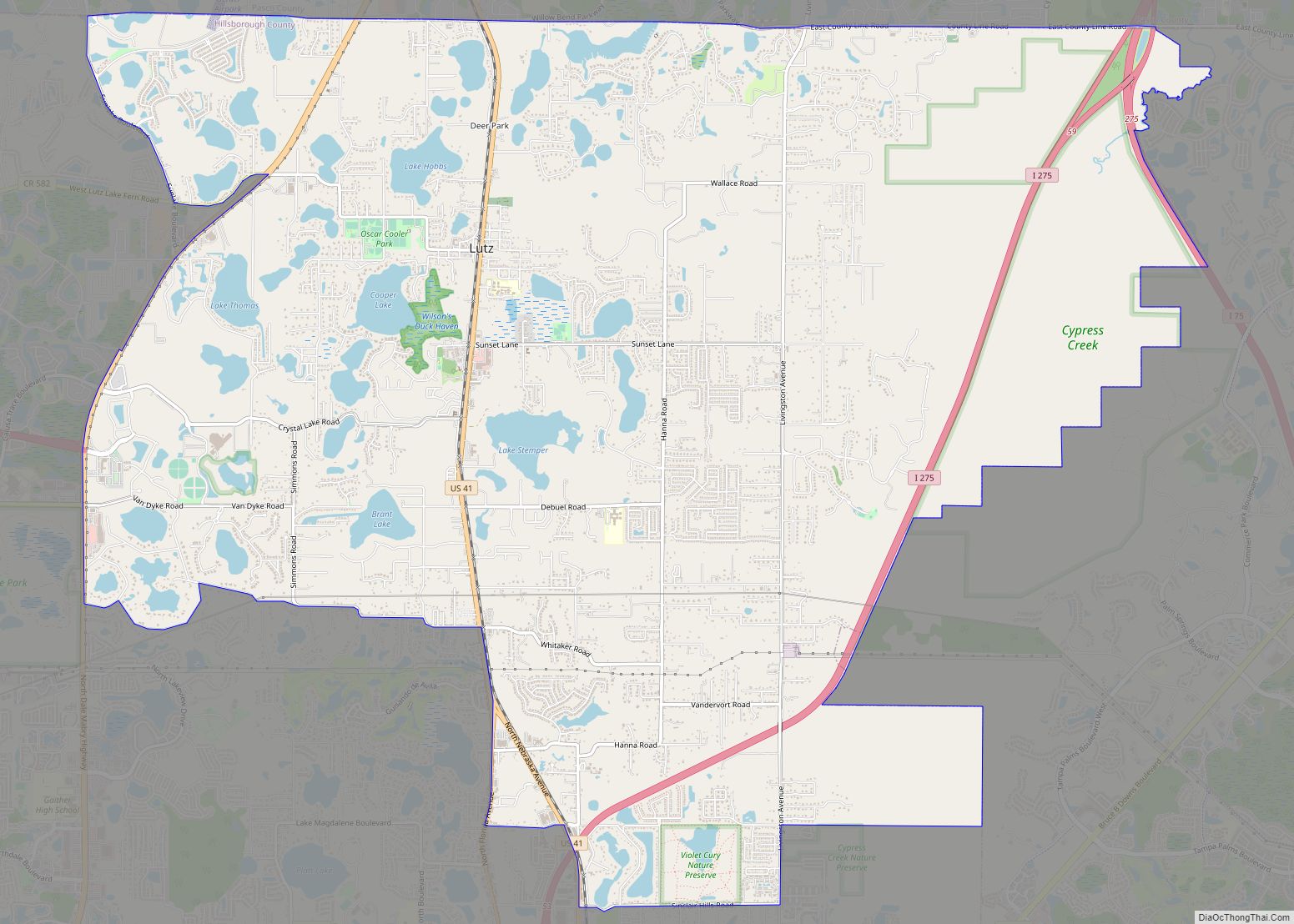
Lutz /ˈluːts/ is an unincorporated community in Hillsborough County and Pasco County, Florida, United States, 15 miles (24 km) north of Tampa. While there is a census-designated area of Lutz, the community itself extends beyond those boundaries into other census-designated areas. Lutz CDP overview: Name: Lutz CDP LSAD Code: 57 LSAD Description: CDP (suffix) State: Florida … Read more

Map of Loxahatchee Groves town

Map of Loxahatchee Groves town

Loxahatchee Groves is a town in Palm Beach County, Florida, United States. As of the 2010 census, the town had a population of 3,180. Loxahatchee Groves was incorporated November 1, 2006, as the 38th municipality in Palm Beach County. The first election for town council members was held on March 13, 2007. The area had … Read more

Map of Lower Grand Lagoon CDP

Map of Lower Grand Lagoon CDP

Lower Grand Lagoon is a census-designated place (CDP) in Bay County, Florida, United States. The population was 3,881 at the 2010 census. It is part of the Panama City–Lynn Haven–Panama City Beach Metropolitan Statistical Area. Lower Grand Lagoon CDP overview: Name: Lower Grand Lagoon CDP LSAD Code: 57 LSAD Description: CDP (suffix) State: Florida County: … Read more

Map of Madeira Beach city

Map of Madeira Beach city

Madeira Beach (/məˈdɛərə/ mə-DAIR-ə) is a city in Pinellas County, Florida, United States, bordered on the west by the Gulf of Mexico, and on the east by St. Petersburg. As of the 2020 census, the population was 3,895. Madeira Beach is known to be a quaint beach town that attracts affluent, preppy college students during … Read more

Map of Macclenny city

Map of Macclenny city

Macclenny is a city and the county seat of Baker County, Florida. Located just west of Jacksonville, it is one of the principal municipalities comprising Greater Jacksonville. The population was 7,304 at the 2020 census, up from 6,374 in 2010. Macclenny city overview: Name: Macclenny city LSAD Code: 25 LSAD Description: city (suffix) State: Florida … Read more

Map of Lynn Haven city

Map of Lynn Haven city

Lynn Haven is a city in Bay County, Florida, United States, north of Panama City. The population was 18,493 at the 2010 census. Like many communities in Bay County, the city was severely damaged by Category 5 Hurricane Michael on October 10, 2018. Lynn Haven city overview: Name: Lynn Haven city LSAD Code: 25 LSAD … Read more

Map of Malabar town

Map of Malabar town

Malabar is a town in Brevard County, Florida. The population was 2,757 at the 2010 United States Census. It is part of the Palm Bay–Melbourne–Titusville Metropolitan Statistical Area. Malabar town overview: Name: Malabar town LSAD Code: 43 LSAD Description: town (suffix) State: Florida County: Brevard County Elevation: 23 ft (7 m) Total Area: 13.27 sq mi (34.36 km²) Land Area: … Read more

Map of Maitland city

Map of Maitland city, Florida

Maitland is a suburban city in Orange County, Florida, United States, part of the Greater Orlando area. The population was 19,543 at the 2020 census. The area’s history is exhibited at the Maitland Historical Museum; the city also hosts the Maitland Art Center, as well as notable examples of Mayan Revival architecture and Fantasy architecture, … Read more

Map of Madison city, Florida

Map of Madison city, Florida

Madison is a city in and the county seat of Madison County, on the central northern border of Florida, United States. The population was 2,912 at the 2020 census. Madison city overview: Name: Madison city LSAD Code: 25 LSAD Description: city (suffix) State: Florida County: Madison County Elevation: 190 ft (60 m) Total Area: 2.69 sq mi (7.0 km²) Land … Read more

Map of Manasota Key CDP

Map of Manasota Key CDP

Manasota Key is a census-designated place (CDP) consisting mainly of the community of Englewood Beach in Charlotte County, Florida, United States. The population of the CDP was 1,326 at the 2020 census. It is part of the Sarasota-Bradenton-Punta Gorda Combined Statistical Area. Manasota Key CDP overview: Name: Manasota Key CDP LSAD Code: 57 LSAD Description: … Read more

Map of Manalapan town

Map of Manalapan town

Manalapan is a town in Palm Beach County, Florida, United States. The population was 419 at the 2020 United States census. Manalapan town overview: Name: Manalapan town LSAD Code: 43 LSAD Description: town (suffix) State: Florida County: Palm Beach County Elevation: 3 ft (1 m) Total Area: 10.52 sq mi (27.25 km²) Land Area: 0.45 sq mi (1.16 km²) Water Area: 10.07 sq mi (26.09 km²) … Read more

Map of Malone town

Map of Malone town, Florida

Malone is a town in Jackson County, Florida, United States. The population was 2,088 at the 2010 census. Malone town overview: Name: Malone town LSAD Code: 43 LSAD Description: town (suffix) State: Florida County: Jackson County Elevation: 141 ft (43 m) Total Area: 3.05 sq mi (7.90 km²) Land Area: 3.05 sq mi (7.90 km²) Water Area: 0.00 sq mi (0.00 km²) Total Population: 1,959 Population … Read more