Loxahatchee Groves is a town in Palm Beach County, Florida, United States. As of the 2010 census, the town had a population of 3,180. Loxahatchee Groves was incorporated November 1, 2006, as the 38th municipality in Palm Beach County. The first election for town council members was held on March 13, 2007. The area had been settled since 1917, although Loxahatchee Groves did not become a municipality until 2006. The town bills itself as “Florida’s Last Frontier”. Loxahatchee Groves was incorporated primarily in order to protect the area from the encroaching urbanization of South Florida, as nearby cities continued to develop and to preserve the area’s rural character.
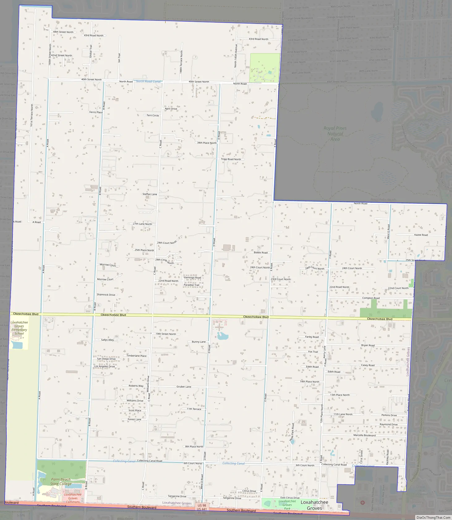
The town derives its name from the Loxahatchee River. “Loxahatchee” is from the Seminole words lowchow (turtle) and hatchee (river), thus translating to “river of turtles”. Loxahatchee Groves is bounded on the east by Royal Palm Beach, on the south by Wellington, and on the west and the north by The Acreage and Loxahatchee. It has an area of approximately 12.5 square miles (32.4 km).
| Name: | Loxahatchee Groves town |
|---|---|
| LSAD Code: | 43 |
| LSAD Description: | town (suffix) |
| State: | Florida |
| County: | Palm Beach County |
| Incorporated: | November 1, 2006 |
| Elevation: | 5 ft (16 m) |
| Total Area: | 12.53 sq mi (32.45 km²) |
| Land Area: | 12.51 sq mi (32.40 km²) |
| Water Area: | 0.02 sq mi (0.04 km²) |
| Total Population: | 3,355 |
| Population Density: | 268.16/sq mi (103.54/km²) |
| ZIP code: | 33470 |
| Area code: | 561 |
| FIPS code: | 1241577 |
| GNISfeature ID: | 286185 |
| Website: | www.loxahatcheegrovesfl.gov |
Online Interactive Map
Click on ![]() to view map in "full screen" mode.
to view map in "full screen" mode.
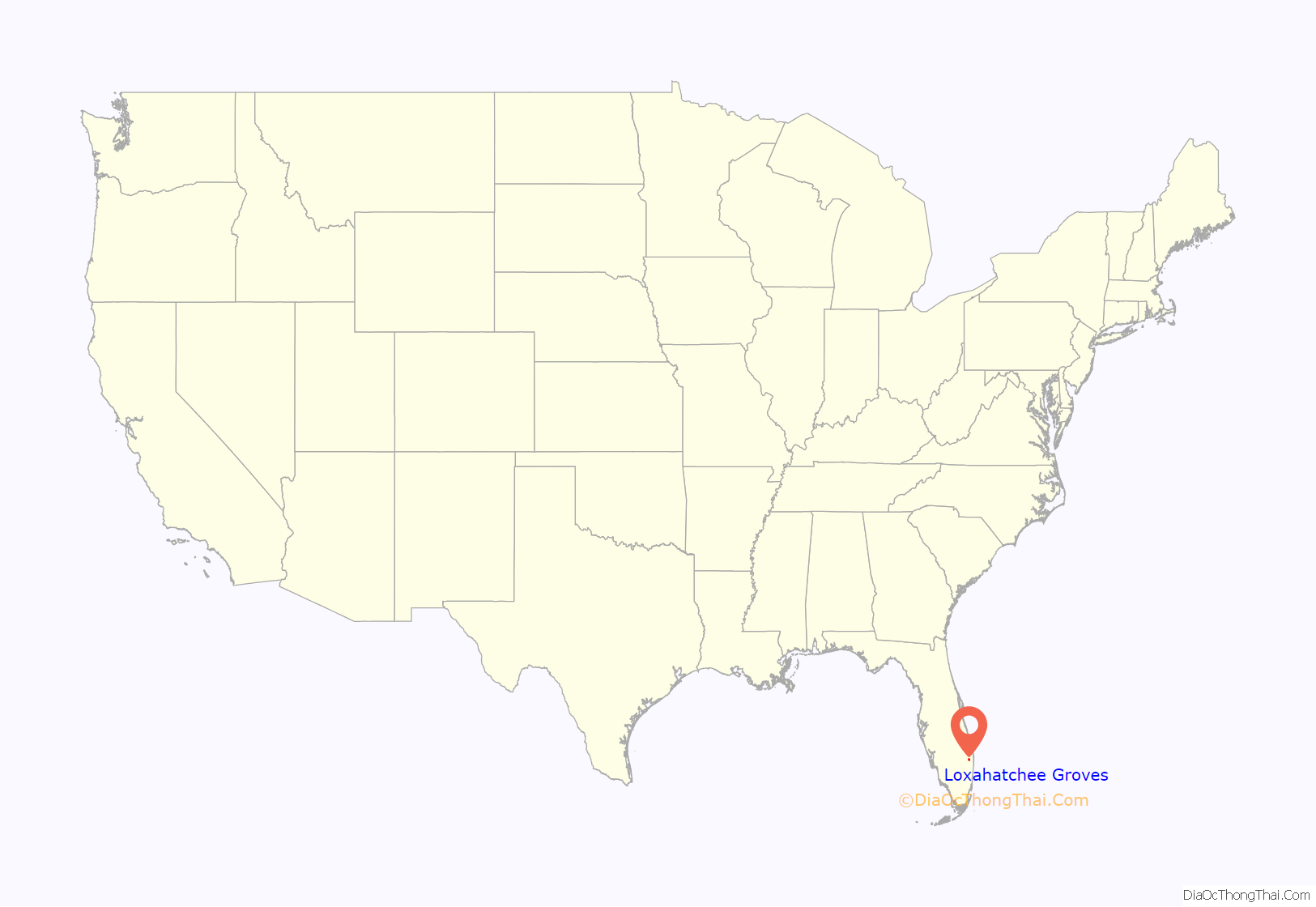
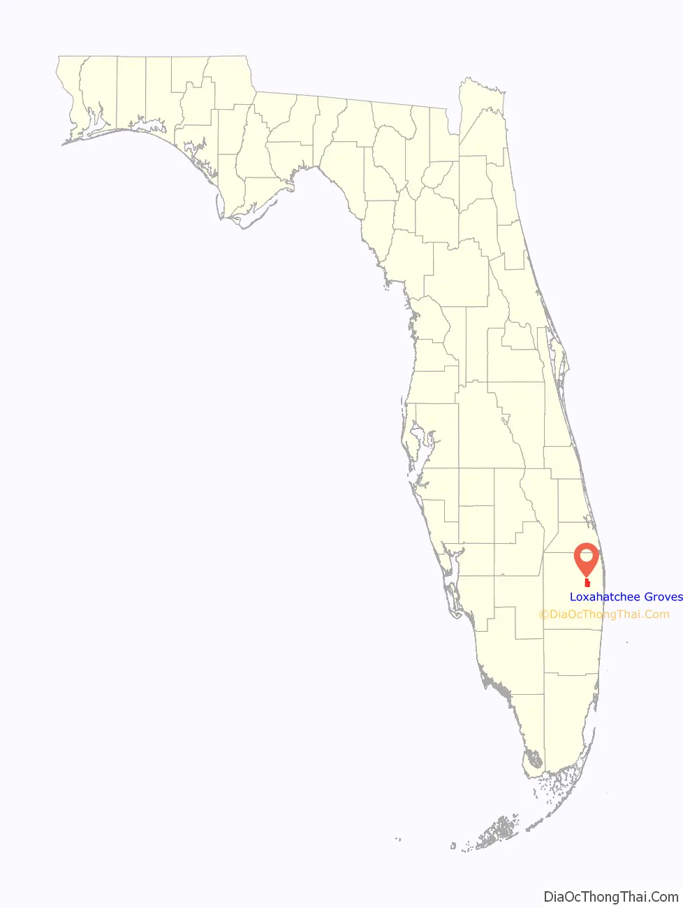
Loxahatchee Groves location map. Where is Loxahatchee Groves town?
History
The area now known as Loxahatchee Groves was originally a portion of the 2,000,000 acres (8,100 km) of land purchased by the Southern States Land and Timber Company in 1902. After the West Palm Beach Canal (C-51), which connected Lake Okeechobee at Canal Point to West Palm Beach, was completed in 1917, George Frederick Bensel, the Southern States sales manager, envisioned a “waterfront” farming community along the canal. Bensel, and company engineer Torvald Garfield “T. G.” Thorgesen, created the first topographical map of Loxahatchee Groves during the following three years. Bensel, Thorgesen, and others then established the Palm Beach Loxahatchee Company, and bought 6,500 acres (26 km) from the Southern States Land and Timber Company, naming the land “Loxahatchee Farms”. The Palm Beach Loxahatchee Company built almost 30 mi (48 km) of canals and roads, which were to be maintained by the Loxahatchee Groves Drainage District, that now is known as the Loxahatchee Groves Water Control District.
Bensel opened a combined gas station, grocery store, and post office in 1925. Loxahatchee Groves received extensive damage during the 1928 Okeechobee hurricane, with almost every home knocked off of its foundations. Bensel’s brother Thomas began a project in the 1930s which encouraged the residents to plant citrus, resulting in about 56,000 new trees being planted. A water pump was built at State Road 80 (Southern Boulevard) and D Road during that time. The pump allowed water to be drawn from the West Palm Beach Canal. The Palm Beach Loxahatchee Company sold Loxahatchee Groves to Loxahatchee Investments in 1958.
The production of citrus and tomatoes decreased following George Bensel’s death in 1961. Significant development in Royal Palm Beach and Wellington took place in the 1980s and 1990s. Some residents of Loxahatchee Groves believed that the rural lifestyle and the landscape of the area were under threat.
A movement for incorporating Loxahatchee Groves, for the purpose of preserving the rural lifestyle of the area, began in 2003 as a consequence. The residents voted 458–350 in favor of incorporation, on October 10, 2006, making Loxahatchee Groves the 38th municipality in Palm Beach County. The first election for town council members was held on March 13, 2007. Dave Autrey, David Browning, Marge Herzog, Bill Louda, and Dennis Lipp were the first elected council members, while Browning was selected to be mayor and Herzog was chosen to be vice mayor at the first town council meeting on March 29. Prior to the election, a political forum for the candidates was hosted at a naturist resort, drawing a crowd of about 100 people.
Loxahatchee Groves Road Map
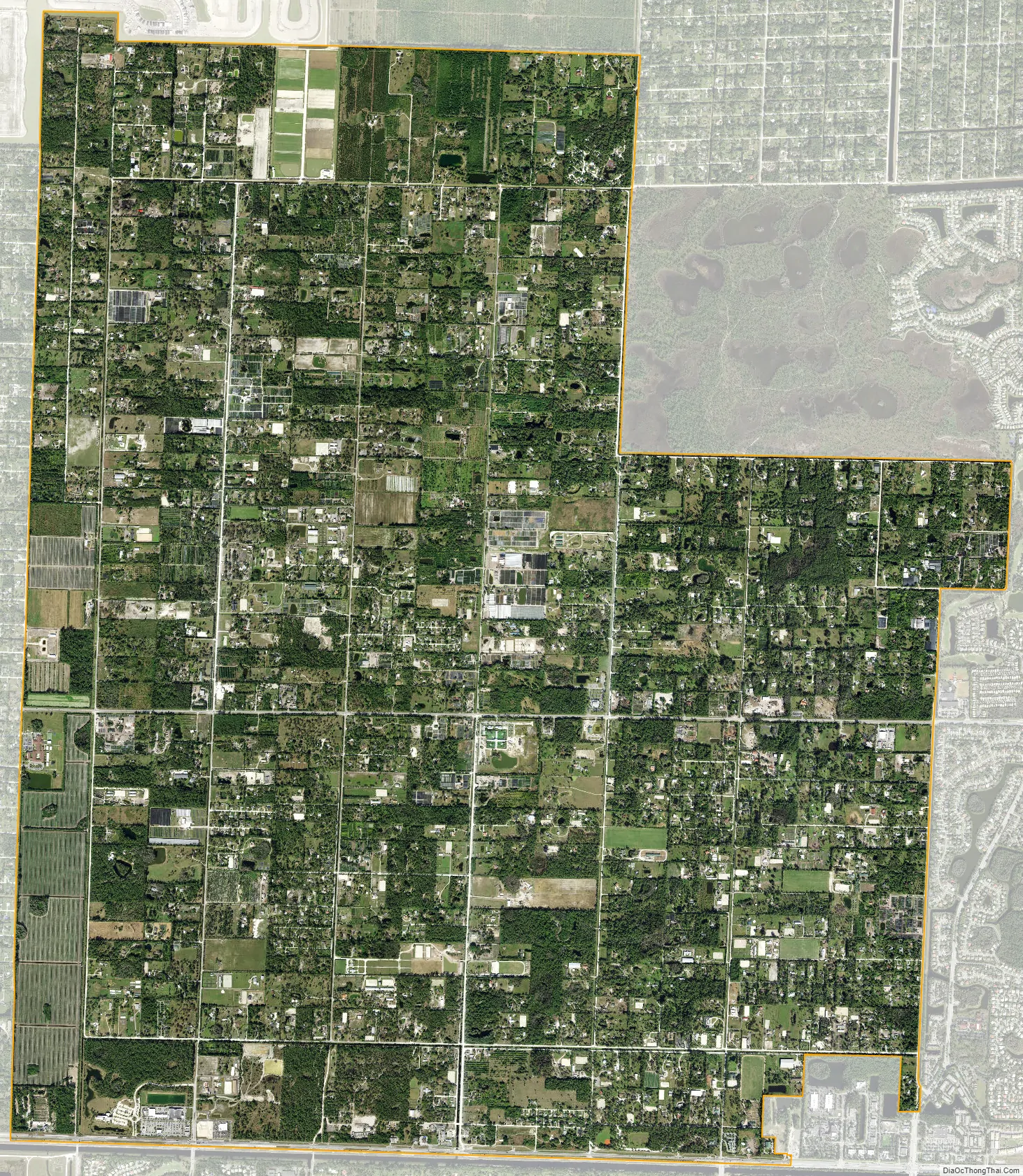
Loxahatchee Groves city Satellite Map
See also
Map of Florida State and its subdivision:- Alachua
- Baker
- Bay
- Bradford
- Brevard
- Broward
- Calhoun
- Charlotte
- Citrus
- Clay
- Collier
- Columbia
- Desoto
- Dixie
- Duval
- Escambia
- Flagler
- Franklin
- Gadsden
- Gilchrist
- Glades
- Gulf
- Hamilton
- Hardee
- Hendry
- Hernando
- Highlands
- Hillsborough
- Holmes
- Indian River
- Jackson
- Jefferson
- Lafayette
- Lake
- Lee
- Leon
- Levy
- Liberty
- Madison
- Manatee
- Marion
- Martin
- Miami-Dade
- Monroe
- Nassau
- Okaloosa
- Okeechobee
- Orange
- Osceola
- Palm Beach
- Pasco
- Pinellas
- Polk
- Putnam
- Saint Johns
- Saint Lucie
- Santa Rosa
- Sarasota
- Seminole
- Sumter
- Suwannee
- Taylor
- Union
- Volusia
- Wakulla
- Walton
- Washington
- Alabama
- Alaska
- Arizona
- Arkansas
- California
- Colorado
- Connecticut
- Delaware
- District of Columbia
- Florida
- Georgia
- Hawaii
- Idaho
- Illinois
- Indiana
- Iowa
- Kansas
- Kentucky
- Louisiana
- Maine
- Maryland
- Massachusetts
- Michigan
- Minnesota
- Mississippi
- Missouri
- Montana
- Nebraska
- Nevada
- New Hampshire
- New Jersey
- New Mexico
- New York
- North Carolina
- North Dakota
- Ohio
- Oklahoma
- Oregon
- Pennsylvania
- Rhode Island
- South Carolina
- South Dakota
- Tennessee
- Texas
- Utah
- Vermont
- Virginia
- Washington
- West Virginia
- Wisconsin
- Wyoming


