Madison is a city in and the county seat of Madison County, on the central northern border of Florida, United States. The population was 2,912 at the 2020 census.
| Name: | Madison city |
|---|---|
| LSAD Code: | 25 |
| LSAD Description: | city (suffix) |
| State: | Florida |
| County: | Madison County |
| Elevation: | 190 ft (60 m) |
| Total Area: | 2.69 sq mi (7.0 km²) |
| Land Area: | 2.64 sq mi (6.8 km²) |
| Water Area: | 0.05 sq mi (0.1 km²) |
| Total Population: | 2,912 |
| Population Density: | 1,104.70/sq mi (426.53/km²) |
| ZIP code: | 32340-32341 |
| Area code: | 850 |
| FIPS code: | 1242425 |
| GNISfeature ID: | 0286274 |
| Website: | www.cityofmadisonfl.com |
Online Interactive Map
Click on ![]() to view map in "full screen" mode.
to view map in "full screen" mode.
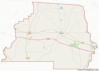
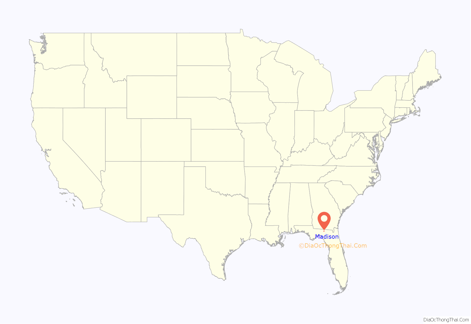
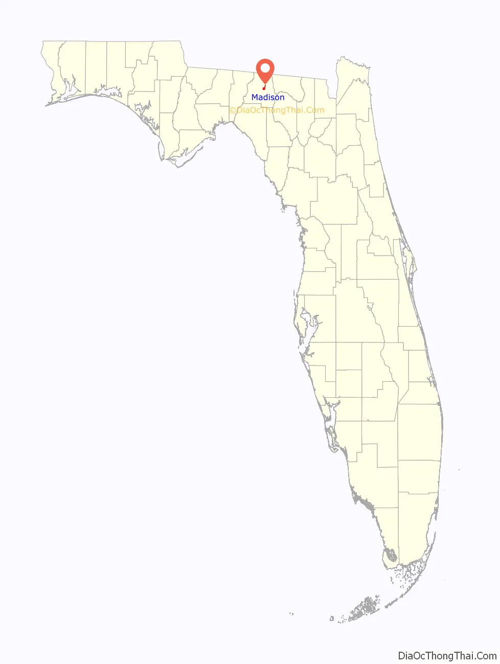
Madison location map. Where is Madison city?
History
The territory now known as Madison County was ruled at various times by Great Britain, Spain, and finally the United States. This area was developed for cotton plantations dependent on the labor of enslaved African Americans. After the Civil War and emancipation, many freedmen and their descendants stayed in the region, working as sharecroppers or tenant farmers.
Racial violence of whites against blacks increased after the Reconstruction era, reaching a peak near the turn of the 20th century. The following blacks were lynched in Madison: Savage and James in 1882, Charles Martin, 1 February 1899; both James Denson and his stepson, 7 January 1901; and an unidentified man, 9 February 1906.
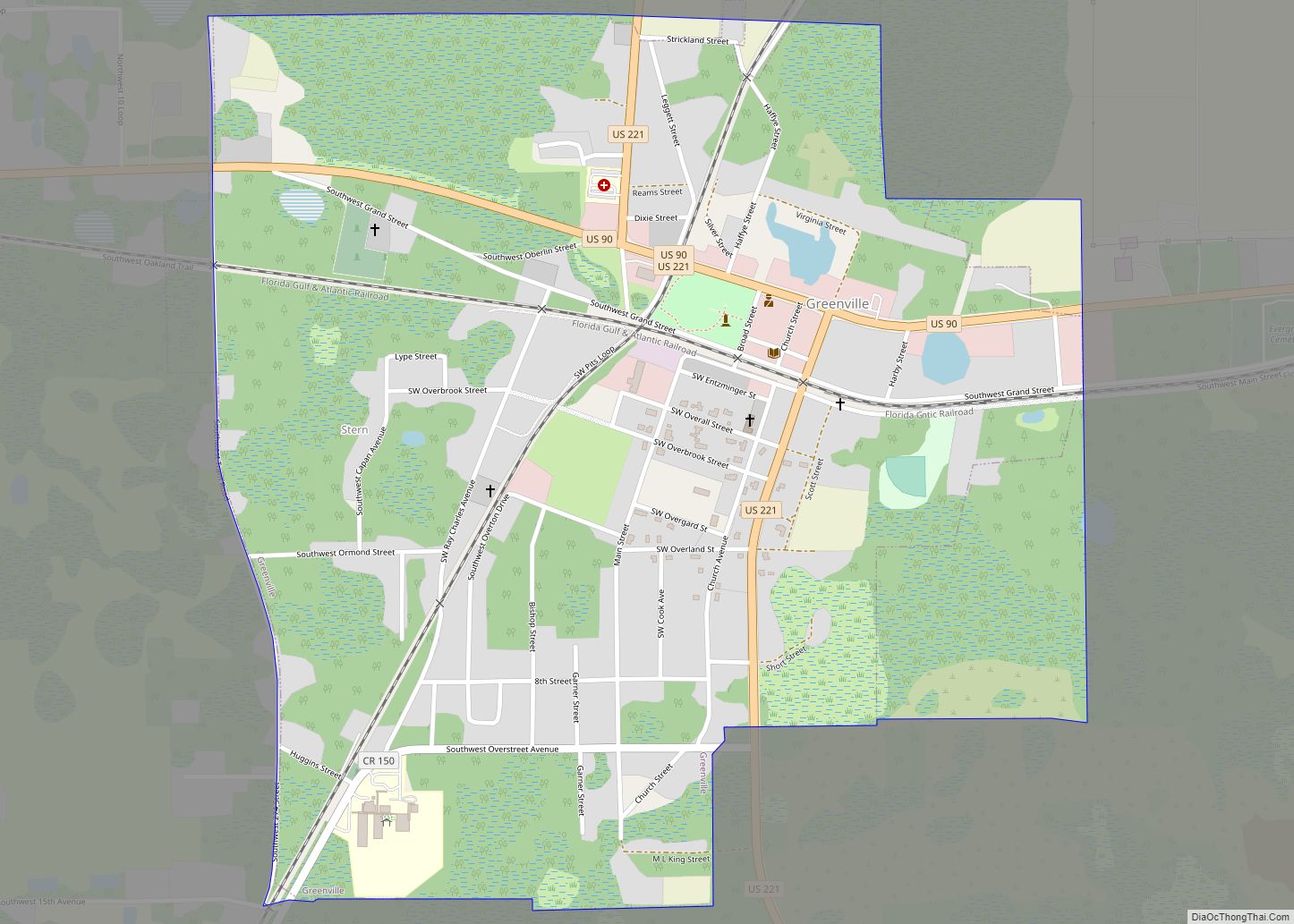
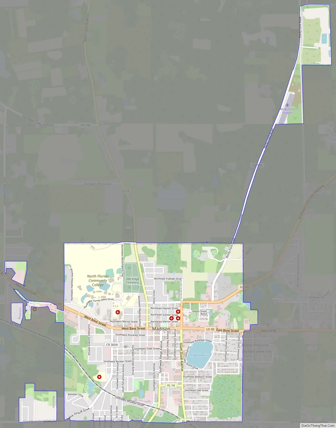
Madison Road Map
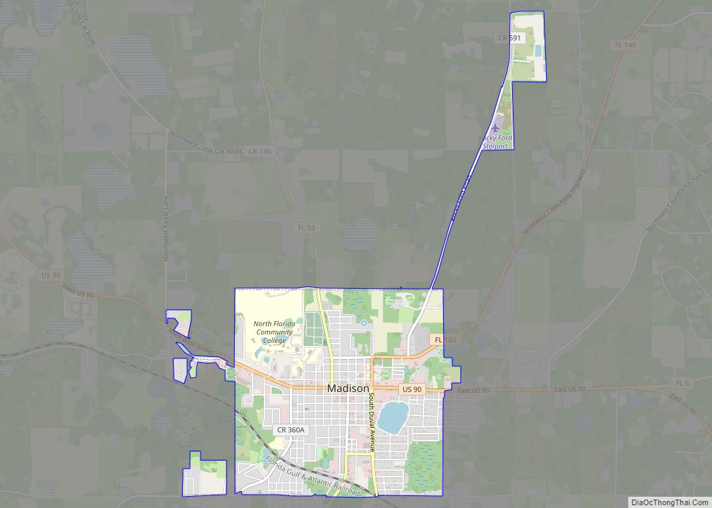
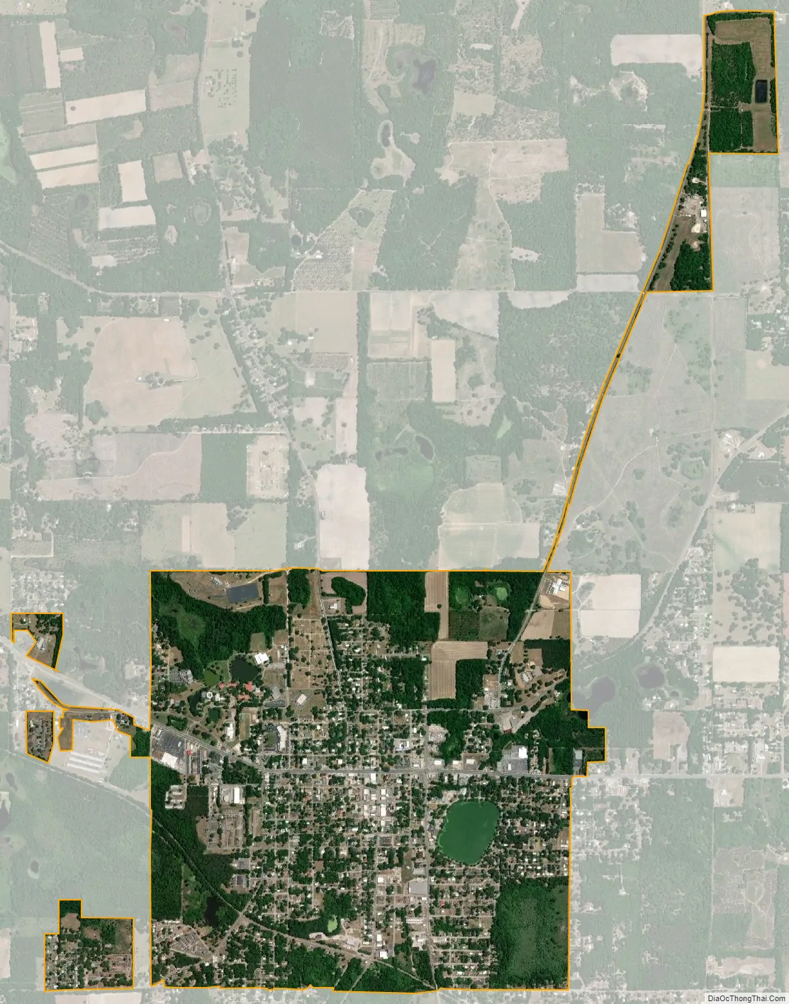
Madison city Satellite Map
Geography
Madison is located slightly east of the center of Madison County at 30°28′N 83°25′W (30.466, –83.415). U.S. Route 90 passes through the center of town, leading west 56 miles (90 km) to Tallahassee, the state capital, and southeast 52 miles (84 km) to Lake City. Interstate 10 passes 4 miles (6 km) to the south of Madison with access from exits 251 and 258.
According to the United States Census Bureau, the city has a total area of 2.7 square miles (7.0 km), of which 0.05 square miles (0.13 km), or 1.93%, are water.
Climate
See also
Map of Florida State and its subdivision:- Alachua
- Baker
- Bay
- Bradford
- Brevard
- Broward
- Calhoun
- Charlotte
- Citrus
- Clay
- Collier
- Columbia
- Desoto
- Dixie
- Duval
- Escambia
- Flagler
- Franklin
- Gadsden
- Gilchrist
- Glades
- Gulf
- Hamilton
- Hardee
- Hendry
- Hernando
- Highlands
- Hillsborough
- Holmes
- Indian River
- Jackson
- Jefferson
- Lafayette
- Lake
- Lee
- Leon
- Levy
- Liberty
- Madison
- Manatee
- Marion
- Martin
- Miami-Dade
- Monroe
- Nassau
- Okaloosa
- Okeechobee
- Orange
- Osceola
- Palm Beach
- Pasco
- Pinellas
- Polk
- Putnam
- Saint Johns
- Saint Lucie
- Santa Rosa
- Sarasota
- Seminole
- Sumter
- Suwannee
- Taylor
- Union
- Volusia
- Wakulla
- Walton
- Washington
- Alabama
- Alaska
- Arizona
- Arkansas
- California
- Colorado
- Connecticut
- Delaware
- District of Columbia
- Florida
- Georgia
- Hawaii
- Idaho
- Illinois
- Indiana
- Iowa
- Kansas
- Kentucky
- Louisiana
- Maine
- Maryland
- Massachusetts
- Michigan
- Minnesota
- Mississippi
- Missouri
- Montana
- Nebraska
- Nevada
- New Hampshire
- New Jersey
- New Mexico
- New York
- North Carolina
- North Dakota
- Ohio
- Oklahoma
- Oregon
- Pennsylvania
- Rhode Island
- South Carolina
- South Dakota
- Tennessee
- Texas
- Utah
- Vermont
- Virginia
- Washington
- West Virginia
- Wisconsin
- Wyoming