Map of Okahumpka CDP

Map of Okahumpka CDP

Okahumpka is an unincorporated community and census-designated place (CDP) in Lake County, Florida, United States. The population was 267 at the 2010 census. It is part of the Orlando–Kissimmee Metropolitan Statistical Area. It is the location of the Historic Campbell House, listed on the National Register of Historic Places. Okahumpka CDP overview: Name: Okahumpka CDP … Read more

Map of Oldsmar city

Map of Oldsmar city

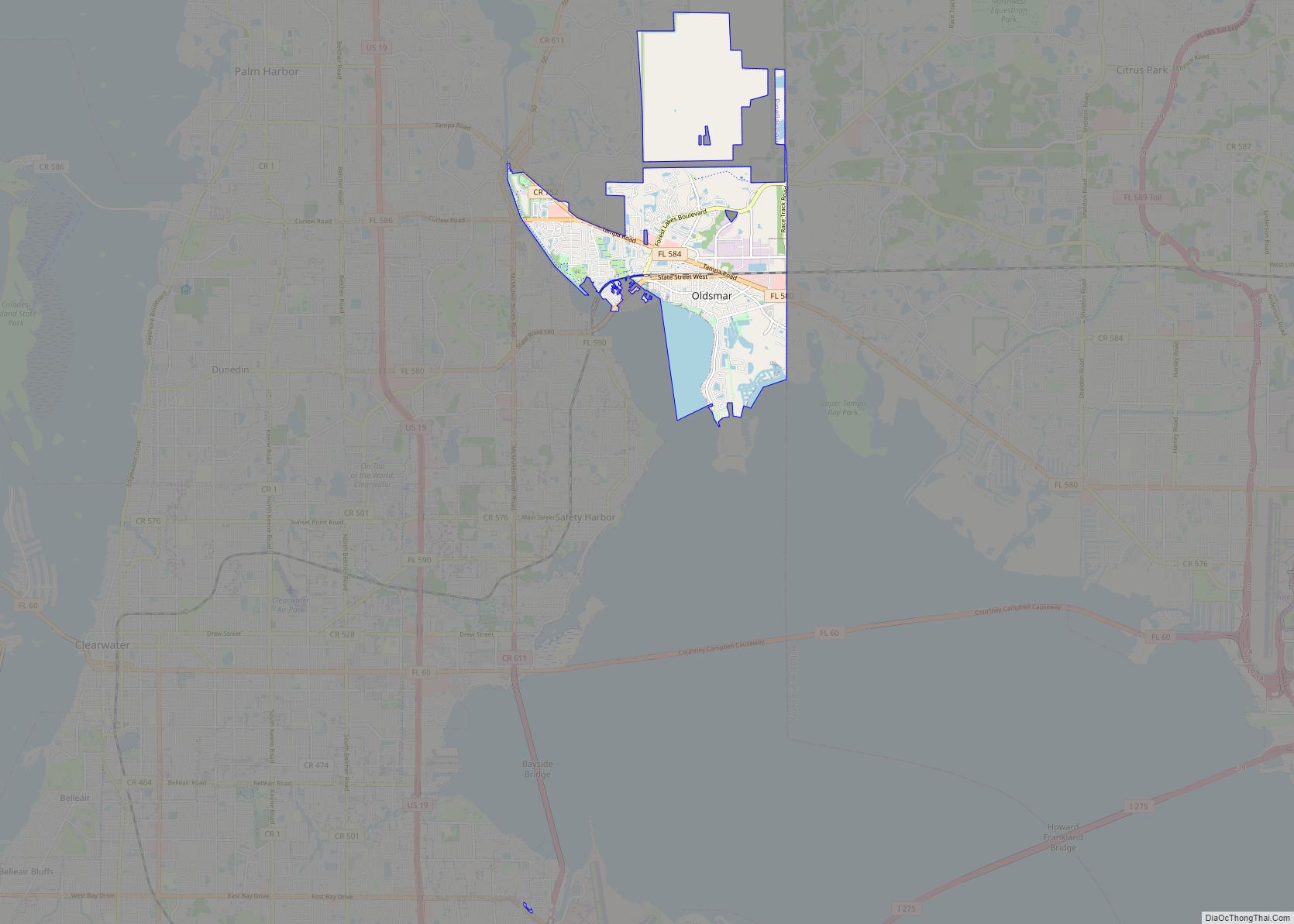
Oldsmar is a city in Pinellas County, Florida, United States. As of the 2020 census, the city had a population of 14,898. The Oldsmar name dates to April 12, 1916 when automobile pioneer Ransom E. Olds purchased 37,541 acres (151.92 km) of land north of Tampa Bay to establish a planned community. Oldsmar city overview: Name: … Read more

Map of Okeechobee city

Map of Okeechobee city

Okeechobee (US: /oʊkiˈtʃoʊbi/ OH-kee-CHOH-bee) is a city in and the county seat of Okeechobee County, Florida, United States. As of the 2020 United States Census, the city’s population was 5,254. The Lake Okeechobee area was severely damaged in the 1928 Okeechobee Hurricane, the first recorded Category 5 hurricane in the North Atlantic. This was one … Read more

Map of Ona CDP

Map of Ona CDP

Ona is an unincorporated community and census-designated place in Hardee County, Florida, United States. Its population was 199 as of the 2020 census. Ona has a post office with ZIP code 33865, which opened on October 11, 1897. State Road 64 and a CSX Transportation line pass through the community. Ona CDP overview: Name: Ona … Read more

Map of Olympia Heights CDP

Map of Olympia Heights CDP

Olympia Heights is a census-designated place in Miami-Dade County, Florida, United States. The population was 12,873 at the 2020 census. Olympia Heights CDP overview: Name: Olympia Heights CDP LSAD Code: 57 LSAD Description: CDP (suffix) State: Florida County: Miami-Dade County Elevation: 7 ft (2 m) Total Area: 3.06 sq mi (7.92 km²) Land Area: 2.71 sq mi (7.01 km²) Water Area: 0.35 sq mi (0.91 km²) … Read more

Map of Olga CDP

Map of Olga CDP

Olga is an unincorporated community and census-designated place (CDP) in Lee County, Florida, United States. The population was 1,952 at the 2010 census, up from 1,398 at the 2000 census. It is part of the Cape Coral-Fort Myers, Florida Metropolitan Statistical Area. Olga CDP overview: Name: Olga CDP LSAD Code: 57 LSAD Description: CDP (suffix) … Read more

Map of Orange Park town

Map of Orange Park town

Orange Park is a town in Clay County, Florida, United States. It is a suburb of Jacksonville, in neighboring Duval County. The population was 8,412 at the 2010 census. The name “Orange Park” is additionally applied to a wider area of northern Clay County outside the town limits, covering such communities as Fleming Island, Lakeside, … Read more

Map of Orange City city

Map of Orange City, Florida

Orange City is a city in Volusia County, Florida, United States. As of the 2010 United States Census, the city had a population of 10,599. It is a part of the Deltona–Daytona Beach–Ormond Beach metropolitan area, which was home to 590,289 people in 2010. Orange City overview: Name: Orange City LSAD Code: 25 LSAD Description: … Read more

Map of Opa-locka city

Map of Opa-locka city

Opa-locka /ˈoʊpəˌlɒkə/ is a city in Miami-Dade County, Florida, United States. As of the 2020 census, the population was 16,463, up from 15,219 in 2010. The city was developed by Glenn Curtiss. Developed based on a One Thousand and One Nights theme, Opa-locka has the largest collection of Moorish Revival architecture in the Western Hemisphere, … Read more

Map of Oriole Beach CDP

Map of Oriole Beach CDP

Oriole Beach is an unincorporated community located in Santa Rosa County, Florida, United States on Santa Rosa Sound. It lies east of Gulf Breeze on the Fairpoint Peninsula, and about three miles north of Pensacola Beach. Oriole Beach is part of the Pensacola–Ferry Pass–Brent Metropolitan Statistical Area. Oriole Beach CDP overview: Name: Oriole Beach CDP … Read more

Map of Orchid town

Map of Orchid town

Orchid is a town in Indian River County, Florida, United States. The population was 415 at the 2010 census and was the ninth highest-income place in the United States. It is ranked sixth in Florida locations by per capita income. Orchid is part of the Sebastian–Vero Beach Metropolitan Statistical Area. Most of the town is … Read more

Map of Orangetree CDP

Map of Orangetree CDP

Orangetree is a census-designated place (CDP) in Collier County, Florida, United States. The population was 4,406 at the 2010 census, up from 950 in 2000. It is part of the Naples–Marco Island Metropolitan Statistical Area. Orangetree CDP overview: Name: Orangetree CDP LSAD Code: 57 LSAD Description: CDP (suffix) State: Florida County: Collier County Elevation: 13 ft … Read more