Map of Spencer city, Idaho

Map of Spencer city, Idaho

Spencer is an incorporated hamlet in Clark County, Idaho, United States. It serves as the base for the state’s opal mine and is called the “Opal Capital of America”: the mine proper is located 5–6 miles outside of town. The population was 37 at the 2010 census. Spencer city overview: Name: Spencer city LSAD Code: … Read more

Map of Soda Springs city, Idaho

Map of Soda Springs city, Idaho

Soda Springs is a city in Caribou County, Idaho, United States. Its population was 3,058 at the time of the 2010 census. The city has been the county seat of Caribou County since the county was organized in 1919. In the 1860s, Soda Springs served as the seat of Oneida County. Soda Springs city overview: … Read more

Map of Smiths Ferry CDP

Map of Smiths Ferry CDP

Smiths Ferry is a census-designated place in Valley County, Idaho, United States. Its population was 75 as of the 2010 census. Situated where the North Fork of the Payette River briefly calms and widens, its elevation is 4,554 feet (1,388 m) above sea level. A ferry at the river was established by Clinton Meyers in 1887 … Read more

Map of Smelterville city

Map of Smelterville city

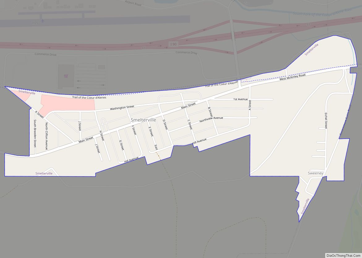
Smelterville is a city in Shoshone County, Idaho, United States. The population was 627 at the 2010 census. The town was named in 1929 by a voice vote of its residents; the other choices were Van Rena and Silver City (already used in southwestern Idaho). The presence of the Bunker Hill smelter, which started operating … Read more

Map of Star city

Map of Star city, Idaho

Star is a city in northwestern Ada County, Idaho, with parts stretching into neighboring Canyon County. The population was 5,793 at the 2010 census, up from 1,795 in 2000. It was named in the 19th century by travelers on their way to Middleton and Boise who used the star on the school house to find … Read more

Map of Stanley city, Idaho

Map of Stanley city, Idaho

Stanley is a town in the Sawtooth Valley in Custer County, Idaho, United States. The population was 116 at the 2020 census; up from 63 in 2010. The center of population of Idaho in 2000 was located in Stanley. Stanley city overview: Name: Stanley city LSAD Code: 25 LSAD Description: city (suffix) State: Idaho County: … Read more

Map of St. Maries city

Map of St. Maries city

St. Maries (pronounced like “St. Mary’s”) is a city in north central Idaho, the largest in rural Benewah County and its county seat. Its population was 2,402 at the 2010 census, down from 2,652 in 2000. St. Maries city overview: Name: St. Maries city LSAD Code: 25 LSAD Description: city (suffix) State: Idaho County: Benewah … Read more

Map of St. Charles city, Idaho

Map of St. Charles city, Idaho

St. Charles is a city in southern Bear Lake County, Idaho, United States, that is located near the northwestern shore of Bear Lake. Its population was 131 at the 2010 census, down from 156 in 2000. St. Charles city overview: Name: St. Charles city LSAD Code: 25 LSAD Description: city (suffix) State: Idaho County: Bear … Read more

Map of St. Anthony city, Idaho

Map of St. Anthony city, Idaho

St. Anthony is a city in and the county seat of Fremont County, Idaho, United States. The population was 3,542 at the 2010 census, up from 3,342 in 2000. It is part of the Rexburg, Idaho Micropolitan Statistical Area. St. Anthony city overview: Name: St. Anthony city LSAD Code: 25 LSAD Description: city (suffix) State: … Read more

Map of Sugar City, Idaho

Map of Sugar City, Idaho

Sugar City is a city in Madison County, Idaho, United States. The population was 1,715 at the 2020 census, up from 1,514 in 2010. It is part of the Rexburg Micropolitan Statistical Area. Sugar City overview: Name: Sugar City LSAD Code: 25 LSAD Description: city (suffix) State: Idaho County: Madison County Elevation: 4,895 ft (1,492 m) Total … Read more

Map of Stites city

Map of Stites city

Stites is a city in Idaho County, Idaho, United States. In the lower canyon of the South Fork of the Clearwater River, it is about four miles (6 km) upstream and south of Kooskia on State Highway 13. The population was 221 at the 2010 census, down from 226 in 2000. Stites city overview: Name: Stites … Read more

Map of State Line city

Map of State Line city, Idaho

Stateline, officially the City of State Line, and historically known as State Line Village, is a city in Kootenai County, Idaho, United States, and is both the easternmost suburb of Spokane, Washington and the westernmost suburb of Coeur d’Alene, Idaho. The population was 38 at the 2010 census. The city is known for the adult … Read more