Map of Challis city

Map of Challis city

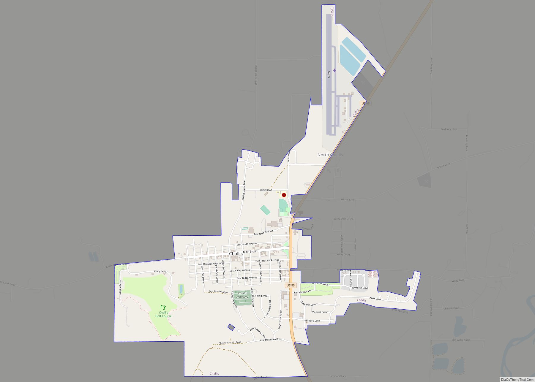
Challis is the largest city in Custer County, Idaho, United States. It is the county seat and its population was 1,081 at the 2010 census. The 2020 census shows 902 residents, a 16.6% drop. Challis city overview: Name: Challis city LSAD Code: 25 LSAD Description: city (suffix) State: Idaho County: Custer County Elevation: 5,253 ft (1,601 m) … Read more

Map of Coeur d'Alene city

Map of Coeur d’Alene city

Coeur d’Alene city overview: Name: Coeur d’Alene city LSAD Code: 25 LSAD Description: city (suffix) State: Idaho County: Kootenai County Founded: 1878 Incorporated: August 22, 1887 (Town) Elevation: 2,188 ft (667 m) Land Area: 16.06 sq mi (41.58 km²) Water Area: 0.76 sq mi (1.98 km²) Population Density: 3,392.4/sq mi (1,309.8/km²) ZIP code: 83814, 83815 Area code: 208 FIPS code: 1616750 GNISfeature ID: 0379485 … Read more

Map of Clifton city, Idaho

Map of Clifton city, Idaho

Clifton is a city in Franklin County, Idaho, United States. The population was 259 at the 2010 census. It is part of the Logan, Utah-Idaho Metropolitan Statistical Area. Clifton city overview: Name: Clifton city LSAD Code: 25 LSAD Description: city (suffix) State: Idaho County: Franklin County Elevation: 4,852 ft (1,479 m) Total Area: 2.30 sq mi (5.95 km²) Land Area: … Read more

Map of Clayton city, Idaho

Map of Clayton city, Idaho

Clayton is a city in Custer County, Idaho, United States. The population was 7 at the 2010 census, down from 27 in 2000. It is adjacent to the Salmon River. Clayton city overview: Name: Clayton city LSAD Code: 25 LSAD Description: city (suffix) State: Idaho County: Custer County Elevation: 5,489 ft (1,673 m) Total Area: 0.01 sq mi (0.03 km²) … Read more

Map of Council city

Map of Council city

Council is a city in and the county seat of Adams County, Idaho, United States. The population was 839 at the 2010 census. Council city overview: Name: Council city LSAD Code: 25 LSAD Description: city (suffix) State: Idaho County: Adams County Elevation: 2,927 ft (892 m) Total Area: 1.08 sq mi (2.80 km²) Land Area: 1.05 sq mi (2.73 km²) Water Area: 0.03 sq mi … Read more

Map of Cottonwood city, Idaho

Map of Cottonwood city, Idaho

Cottonwood is a city in Idaho County, Idaho. On the Camas Prairie in north central Idaho, the population was 900 at the 2010 census, down from 944 in 2000. It is just west of U.S. Route 95, between Grangeville and Lewiston. Cottonwood city overview: Name: Cottonwood city LSAD Code: 25 LSAD Description: city (suffix) State: … Read more

Map of Conkling Park CDP

Map of Conkling Park CDP

Conkling Park is a census-designated place in Kootenai County, Idaho, United States. Its population was 43 as of the 2010 census. Conkling Park CDP overview: Name: Conkling Park CDP LSAD Code: 57 LSAD Description: CDP (suffix) State: Idaho County: Kootenai County Elevation: 2,208 ft (673 m) Total Area: 1.045 sq mi (2.71 km²) Land Area: 1.045 sq mi (2.71 km²) Water Area: 0 sq mi … Read more

Map of Crouch city

Map of Crouch city

Crouch is a city in Boise County, Idaho, United States. The population was 162 at the 2010 census. It is part of the Boise City–Nampa, Idaho Metropolitan Statistical Area. In 2018, it has multiple commercial businesses for tourists and residents: a small grocery mart, a hardware store, three restaurants, a bar, The Starlight Mountain Theater, … Read more

Map of Craigmont city

Map of Craigmont city

Craigmont is a city in the northwest United States in Lewis County, Idaho. Located on the Camas Prairie in north central Idaho, it is within the Nez Perce Indian Reservation. The population was 501 at the 2010 census, down from 556 in 2000. Craigmont city overview: Name: Craigmont city LSAD Code: 25 LSAD Description: city … Read more

Map of Culdesac city

Map of Culdesac city

Culdesac is a city in Nez Perce County, Idaho, United States. The population was 380 at the 2010 census. It is part of the Lewiston, ID-WA Metropolitan Statistical Area. Culdesac city overview: Name: Culdesac city LSAD Code: 25 LSAD Description: city (suffix) State: Idaho County: Nez Perce County Elevation: 1,644 ft (501 m) Total Area: 0.22 sq mi (0.58 km²) … Read more

Map of De Smet CDP

Map of De Smet CDP, Idaho

De Smet (also spelled Desmet) is an unincorporated census-designated place in the northwestern United States, located on the Coeur d’Alene Reservation in Benewah County, Idaho. U.S. Route 95 passes nearby and the community is located about a mile (1.6 km) south of Tensed, which was originally also to be titled Desmet before the name was ordered … Read more

Map of Dayton city, Idaho

Map of Dayton city, Idaho

Dayton is a city in Franklin County, Idaho, United States. The population was 463 at the 2010 census. It is part of the Logan, Utah-Idaho Metropolitan Statistical Area. Dayton city overview: Name: Dayton city LSAD Code: 25 LSAD Description: city (suffix) State: Idaho County: Franklin County Elevation: 4,823 ft (1,470 m) Total Area: 6.72 sq mi (17.39 km²) Land Area: … Read more