Council is a city in and the county seat of Adams County, Idaho, United States. The population was 839 at the 2010 census.
| Name: | Council city |
|---|---|
| LSAD Code: | 25 |
| LSAD Description: | city (suffix) |
| State: | Idaho |
| County: | Adams County |
| Elevation: | 2,927 ft (892 m) |
| Total Area: | 1.08 sq mi (2.80 km²) |
| Land Area: | 1.05 sq mi (2.73 km²) |
| Water Area: | 0.03 sq mi (0.07 km²) |
| Total Population: | 839 |
| Population Density: | 847.39/sq mi (327.24/km²) |
| ZIP code: | 83612 |
| Area code: | 208, 986 |
| FIPS code: | 1618820 |
| GNISfeature ID: | 0396336 |
| Website: | www.councilidaho.org |
Online Interactive Map
Click on ![]() to view map in "full screen" mode.
to view map in "full screen" mode.
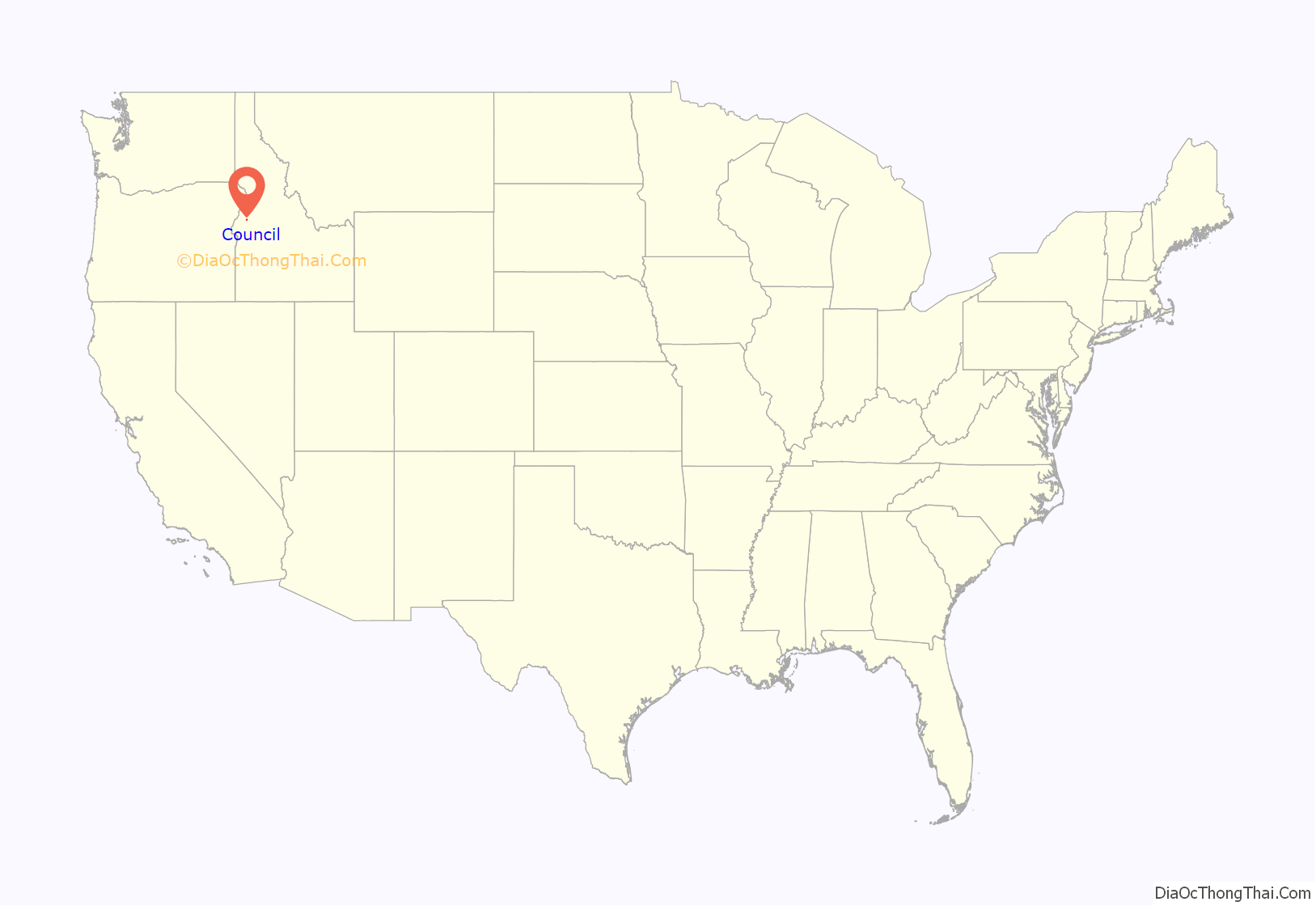
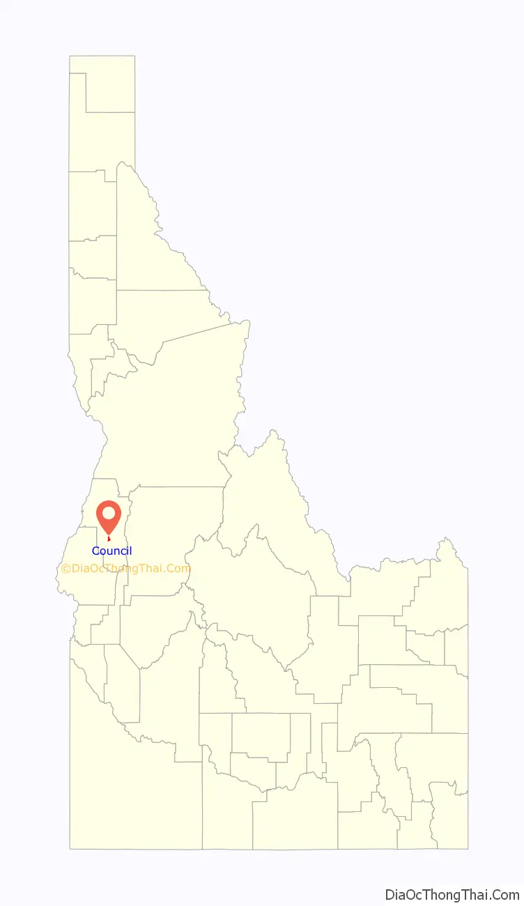
Council location map. Where is Council city?
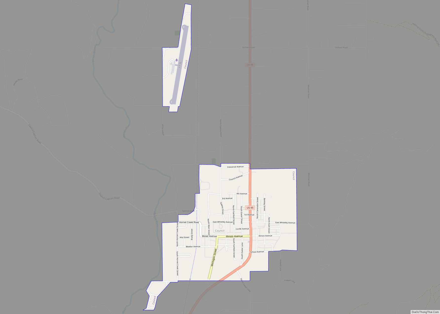
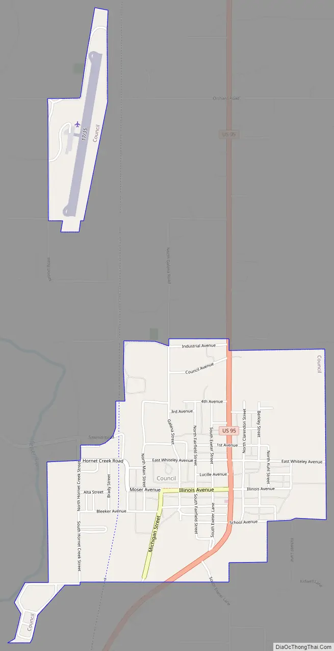
Council Road Map
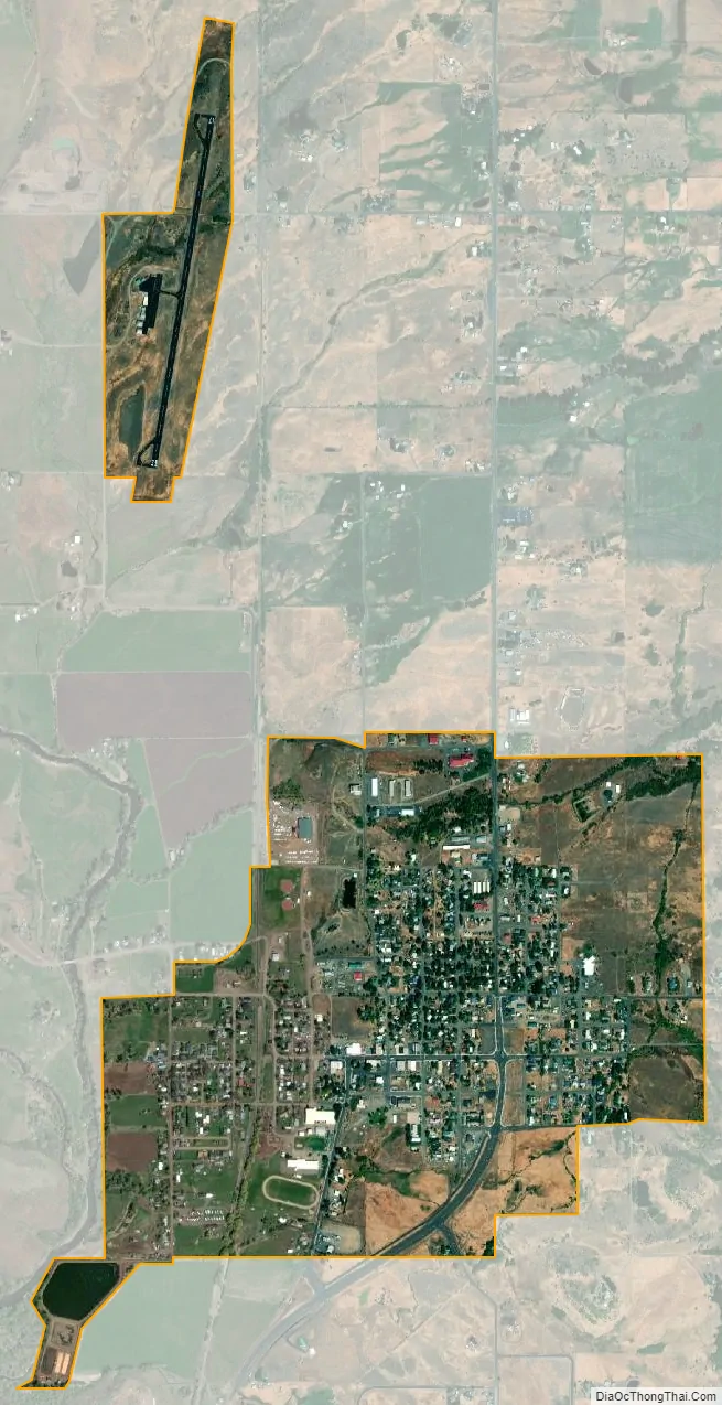
Council city Satellite Map
Geography
Council is located at 44°43′48″N 116°26′10″W / 44.73000°N 116.43611°W / 44.73000; -116.43611 (44.730083, -116.436213).
According to the United States Census Bureau, the city has a total area of 1.03 square miles (2.67 km), of which, 1.00 square mile (2.59 km) is land and 0.03 square miles (0.08 km) is water.
Council experiences the typical continental Mediterranean climate (Köppen Dsa) of northern Idaho, with cold, snowy winters and hot, dry summers. It differs from cities like Moscow and Bonners Ferry in having substantially hotter summers, with average maxima as much as 7 °F or 4 °C higher and absolute maxima among the highest in the northwestern United States. The average annual precipitation for Council is 24 inches, and the average annual snowfall is around 47 inches.
See also
Map of Idaho State and its subdivision:- Ada
- Adams
- Bannock
- Bear Lake
- Benewah
- Bingham
- Blaine
- Boise
- Bonner
- Bonneville
- Boundary
- Butte
- Camas
- Canyon
- Caribou
- Cassia
- Clark
- Clearwater
- Custer
- Elmore
- Franklin
- Fremont
- Gem
- Gooding
- Idaho
- Jefferson
- Jerome
- Kootenai
- Latah
- Lemhi
- Lewis
- Lincoln
- Madison
- Minidoka
- Nez Perce
- Oneida
- Owyhee
- Payette
- Power
- Shoshone
- Teton
- Twin Falls
- Valley
- Washington
- Alabama
- Alaska
- Arizona
- Arkansas
- California
- Colorado
- Connecticut
- Delaware
- District of Columbia
- Florida
- Georgia
- Hawaii
- Idaho
- Illinois
- Indiana
- Iowa
- Kansas
- Kentucky
- Louisiana
- Maine
- Maryland
- Massachusetts
- Michigan
- Minnesota
- Mississippi
- Missouri
- Montana
- Nebraska
- Nevada
- New Hampshire
- New Jersey
- New Mexico
- New York
- North Carolina
- North Dakota
- Ohio
- Oklahoma
- Oregon
- Pennsylvania
- Rhode Island
- South Carolina
- South Dakota
- Tennessee
- Texas
- Utah
- Vermont
- Virginia
- Washington
- West Virginia
- Wisconsin
- Wyoming