| Name: | Coeur d’Alene city |
|---|---|
| LSAD Code: | 25 |
| LSAD Description: | city (suffix) |
| State: | Idaho |
| County: | Kootenai County |
| Founded: | 1878 |
| Incorporated: | August 22, 1887 (Town) |
| Elevation: | 2,188 ft (667 m) |
| Land Area: | 16.06 sq mi (41.58 km²) |
| Water Area: | 0.76 sq mi (1.98 km²) |
| Population Density: | 3,392.4/sq mi (1,309.8/km²) |
| ZIP code: | 83814, 83815 |
| Area code: | 208 |
| FIPS code: | 1616750 |
| GNISfeature ID: | 0379485 |
| Website: | cdaid.org |
Online Interactive Map
Click on ![]() to view map in "full screen" mode.
to view map in "full screen" mode.
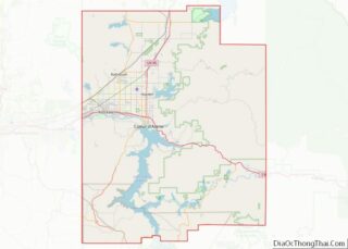
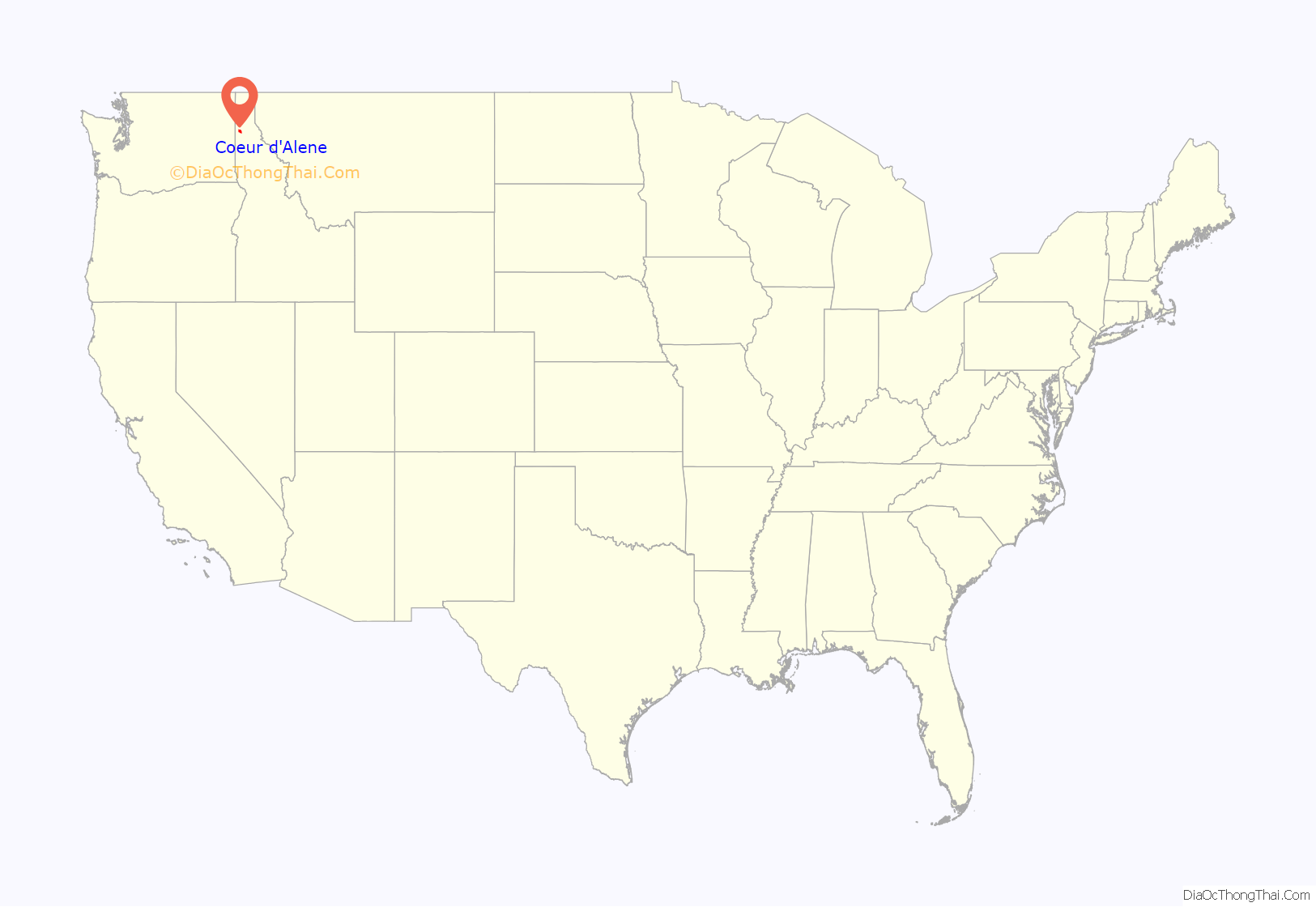
Coeur d’Alene location map. Where is Coeur d’Alene city?

History
The Coeur d’Alene people called themselves Schitsu’umsh in Coeur d’Alene, one of the Salishan languages, meaning “those who are found here” or “the found ones.” These Native Americans lived along the rivers and lakes of the region, in a territory of 4,000,000 acres (16,000 km) extending from eastern Washington to Montana; these tribes primarily located their villages and camps near food gathering or processing sites. The camps featured conical lodges constructed from poles and mats sewn from tule or animal hides. The Coeur d’Alene people were hunter-gatherers who practiced subsistence hunting of wild game and fishing during the salmon runs, and then foraging for berries and other edibles along the shores of the region’s numerous lakes and rivers. The introduction of the horse c. 1760 made hunting and transportation more efficient.
The area was extensively explored by fur trader David Thompson of the North West Company starting in 1807 and in 1809 he established the Kullyspell House trading post on Lake Pend Oreille. Thompson, who usually used native names to describe the places and people he came across, ascribed the name of ‘Pointed Hearts’ to one of the tribes he traded with and “Pointed Heart Lake” for the lake they lived near. Since Thompson traveled with French-speaking Iroquois guides and scouts, it has been speculated that they may have been the first to refer to the tribe as the Coeur d’Alene. As French was the spoken language of the Canadian fur traders, it is likely that “pointed heart” has its origins in the French transliteration of Cœur or “heart”, d’ or “in the middle of” and Alêne or “awl”, meaning the tribal traders had hearts as sharp as the tip of an awl – or that they were sharp businessmen.
The Oregon boundary dispute (or Oregon question) arose as a result of competing British and American claims to the Pacific Northwest of North America in the first half of the 19th century. The British had trading ties extending from Canada and had started settlements at Fort Vancouver and at Fort Astoria on the Pacific coast near the mouth of the Columbia River. The Oregon Treaty of 1846 ended the disputed joint occupation of the area in present-day Idaho when Britain ceded all rights to land south of the 49th parallel to the United States.
In another territorial dispute, the U.S. government through Washington Territory Governor Isaac Stevens began to negotiate treaties that would begin to move the various tribes of the region onto reservation lands to make way for American settlement. This angered the Coeur d’Alene, as several treaty re-negotiations continually reduced their tribal lands. The tribe also perceived the planned construction a military wagon road as a precursor to a land-grab by the United States. These talks and increasing settler encroachment sparked armed hostilities between the native Coeur d’Alene, Spokane and Palouse and the settler populations that resulted in an initial victory for the tribes at the Battle of Steptoe Butte but were followed up with George Wright’s campaign that subdued the natives. The Coeur d’Alene Reservation is located in Benewah and Kootenai counties south of Coeur d’Alene in communities focused around Worley and Plummer. In 1859, with U.S. funding in place, Governor Stevens appointed John Mullan to survey the interior of the Northwestern United States for possible railroad routes and oversee the construction of the 611-mile (983 km) Mullan Road that bears his name, from Fort Walla Walla on the Columbia River through the Rocky Mountains to Fort Benton on the Missouri River.
With the discovery of gold in the western United States and the establishment of Idaho Territory in 1863, there was an increase in settlers to the region. When General William Tecumseh Sherman was commander of the U.S. Army during the Indian Wars and following the defeat of General George Armstrong Custer at the Battle of Little Big Horn, he erected several forts in the west. During a tour of the Inland Northwest on his way to Fort Walla Walla on the Mullan Road, he was impressed by the scenery of the area and ordered a fort constructed on the lake in 1877 and gave it the name Fort Coeur d’Alene. The fort which gave the city its name was established in 1878 and the name of the fort was later changed to Fort Sherman to honor the general.
Miners and prospectors came to the region after gold and silver deposits were found in the Coeur d’Alene Mountains and the Northern Pacific Railroad came to the village in 1883. The village became the location where ore from the mining district was ferried and transferred to the rail lines from steamboats that traveled down from the Coeur d’Alene River from the Cataldo Mission. The township was officially incorporated by petition on August 22, 1887. In the 1890s, two significant miners’ uprisings took place in the Coeur d’Alene Mining District, where the workers struggled with high risk and low pay. In 1892, the union’s discovery of a labor spy in their midst, in the person of Charlie Siringo, a sometime cowboy and Pinkerton agent, resulted in a labor strike that developed into a shooting war between miners and the company in Burke Canyon. When the mine owners planned to reduce wages of some workers to offset increased operating costs, the miners declared a strike against the reduction of wages and the increase in work hours and demanded a “living wage” be paid to every man working underground – the common laborer as well as the skilled in a stand for industrial unionism. To restore order to the state of rebellion in Shoshone County, Governor N. B. Willey declared martial law and sent federal troops to arrest and detain the union miners, but not before dozens of casualties including six deaths and the destruction of the Frisco Mill. Six hundred miners were put into “bullpens” without any hearings or formal charges. Labor disputes between some company mines and the union continued into the next decade. A similar labor confrontation in 1899 took place after the union was launching an organizing drive of the few mines not yet fully unionized, where miners working in the Bunker Hill and Sullivan mines were receiving fifty cents to a dollar less per day than other miners. With no success in the effort, on April 29, 250 union members seized a train in Burke at gunpoint, according to the engineer, Levi “Al” Hutton. At each stop through Burke Canyon, more miners climbed aboard what was dubbed the “Dynamite Express” toward the site of the $250,000 Bunker Hill mine near Wardner; the miners then carried 3,000 pounds (1,400 kg) of dynamite into the mill and completely destroyed it. The crowd also burned down the company office, the boarding house, and the home of the mine manager. Like in the 1892 strike, martial law was declared by Governor Frank Steunenberg and wholesale arrests and mass incarcerations were done to bring back order. Harry Orchard, who owned a share of the Hercules Mine at one point and played a significant role in the Colorado Labor Wars, returned to Idaho to assassinate former governor Steunenberg in 1905. The bombing assassination led to a nationally publicized trial in Boise.
After a U.S. Geological Survey done in the 1890s, it became widely known that there were large quantities of white pine, a highly prized softwood, in the Coeur d’Alene Mountains. The lumber industry from the eastern US began to inventory the timberlands, acquire land, and invest in facilities across much of northern Idaho. This was welcome relief to the town of Coeur d’Alene, which had been reeling from the Panic of 1893, a flood in 1894, and the closure of Fort Sherman. The city experienced significant growth from the timber boom and the development of the railroads, steamboats, and tourism that accompanied it; Coeur d’Alene incorporated as a city on September 4, 1906, and by 1908 it had become the county seat. From 1900 to 1915, there were hundreds of homes constructed across 70 newly platted additions. With the advent of the automobile and the internal combustion engine, trucks and chainsaws, the felling and transporting of trees became more productive and efficient and lumber production reached its height in the late 1910s and 1920s; in 1925 there were seven lumber mills operating in the area and they were producing 500 million board feet of lumber.
After the 1929 stock market crash and during the Great Depression, the lumber industry demand began to wane and by the mid-1930s about half the woodworkers in North Idaho were laid off and the surviving mills were producing only 160 million board feet of lumber per year. Although it was a tough time, accomplishments during the Depression years included the establishment of Coeur d’Alene Junior College (North Idaho College) in 1933, the construction of Northwest Boulevard through the Works Progress Administration program in 1937, and the building of the popular Playfair Pier amusement park on the lake in the early 1940s. The Playfair Pier opened on July 4, 1942 (and existed until 1974) in City Park and included a variety of rides and attractions such as a miniature roller coaster, a Ferris wheel, a carousel, and some of the usual carnival games. Coeur d’Alene benefited from its proximity to the Farragut Naval Training Station, established in 1942 on the south end of Lake Pend Oreille, which employed 22,000 people and needed 98 million board feet of lumber to build 650 buildings.
Due to the scenic lake, tourism has always been a factor in the local economy. In the early 1900s, it had become popular in Spokane to travel and picnic in the park, shop in town, and take steamboat cruises on the lake and up the Saint Joe River. Coeur d’Alene had also received national publicity in magazines, where it had been called a “wonderland” and “the Lucerne of America.” However, tourism began to become a mainstay of the economy with the completion of highway infrastructure projects in the 1950s and 1960s, and the Coeur d’Alene Chamber of Commerce began to promote the city as a tourist destination as well. As tourism increased, there was more demand for lodging facilities, convention space, restaurants, and cultural activities. By 1976, the city had over 30 motels with about 1,500 rooms. On June 14, 1958, the city hosted the first Diamond Cup Hydroplane race, which was one of the largest events in its history and garnered national publicity and media coverage. The event was attended by 30,000 people, and it was considered a success by the Diamond Cup organizers. The race was held at Lake Coeur d’Alene for the next eight years; it was discontinued due to persistent difficulties in raising funds for the event.
After decades of heavy reliance on logging, in the 1980s, the city featured a more balanced economy with manufacturing, retail, and service sectors. Tourism has taken on even more prominence and has become one of the main drivers of the local economy since the start of the 1980s, when there was new investment into recreational tourism in the area. In 1982, a $2 million Wild Waters aquatic theme park was built, and in the spring of 1986 there was the opening of the $60 million ($148 million in 2021 dollars), 18-story Coeur d’alene Resort. The waterfront resort featured a well-manicured frontage and a publicly accessible floating boardwalk that gave visitors the impression of a park-like environment and attracted the attention of publications nationwide. The actions of the Aryan Nations, a white supremacist group founded by Richard Butler in 1974, also attracted media attention. Butler’s acolytes, many of whom were transplants like him, were linked to several robberies, murders, and three bombings, including the bombing of a Spokesman-Review office. In 1986, Coeur d’Alene was presented the Raoul Wallenberg Award for its stand in peacefully countering the message of the white supremacists that moved into the area. Coeur d’Alene also won the All-America City Award in 1990. The Aryan Nations went bankrupt and ceased operations in 2000 when the Southern Poverty Law Center filed a lawsuit after the assault of a Native American woman. The lawsuit resulted in a $6.3 million judgment and the closure of their Hayden compound.
In the 1990s, the Coeur d’Alene area starting experiencing substantial population growth; many of these initial transplants came from California, citing earthquakes, crime, and overcrowding as reasons for their move. This northward migration coincided with watershed events such as the 1992 Los Angeles riots and the 1994 Northridge earthquake. The surrounding area got increased tourist attention when Silverwood Theme Park, which opened in 1988 on an airstrip with an authentic steam train and carnival rides, installed the Corkscrew roller coaster in 1990 that it purchased from Knott’s Berry Farm. Additional rides such as the Timber Terror and Tremors roller coasters in the 1990s and the 20-acre (0.081 km) Boulder Beach water park in 2003 made Silverwood into a regional theme park, which attracts visitors primarily from the Spokane, Tri-Cities, and Seattle areas of Washington as well as some from the Canadian provinces of British Columbia and Alberta. In 2014, McEuen Park on the downtown waterfront reopened to the public after undergoing a major $20 million renovation that transformed it from a park with baseball diamonds into a multi-use park with a variety of athletic facilities, a playground, and a dog park. The state of Idaho is the fastest-growing state in the country. According to Census Bureau data in 2018, the city and county were among the fastest growing metropolitan areas in the nation with a net migration of about 3,200 residents from 2015 to 2016. The newest transplants are still mainly from other western states and are moving for economic as well as political reasons, seeking a lower cost of living, more affordable housing, an outdoor lifestyle, and a place that is more conservative.
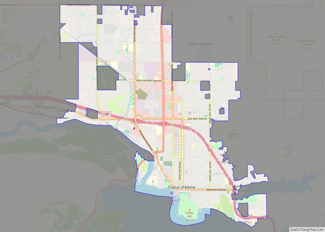
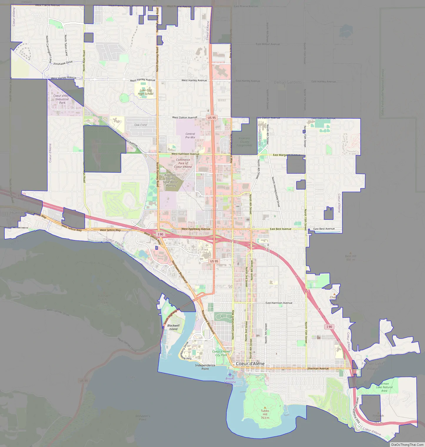
Coeur d’Alene Road Map
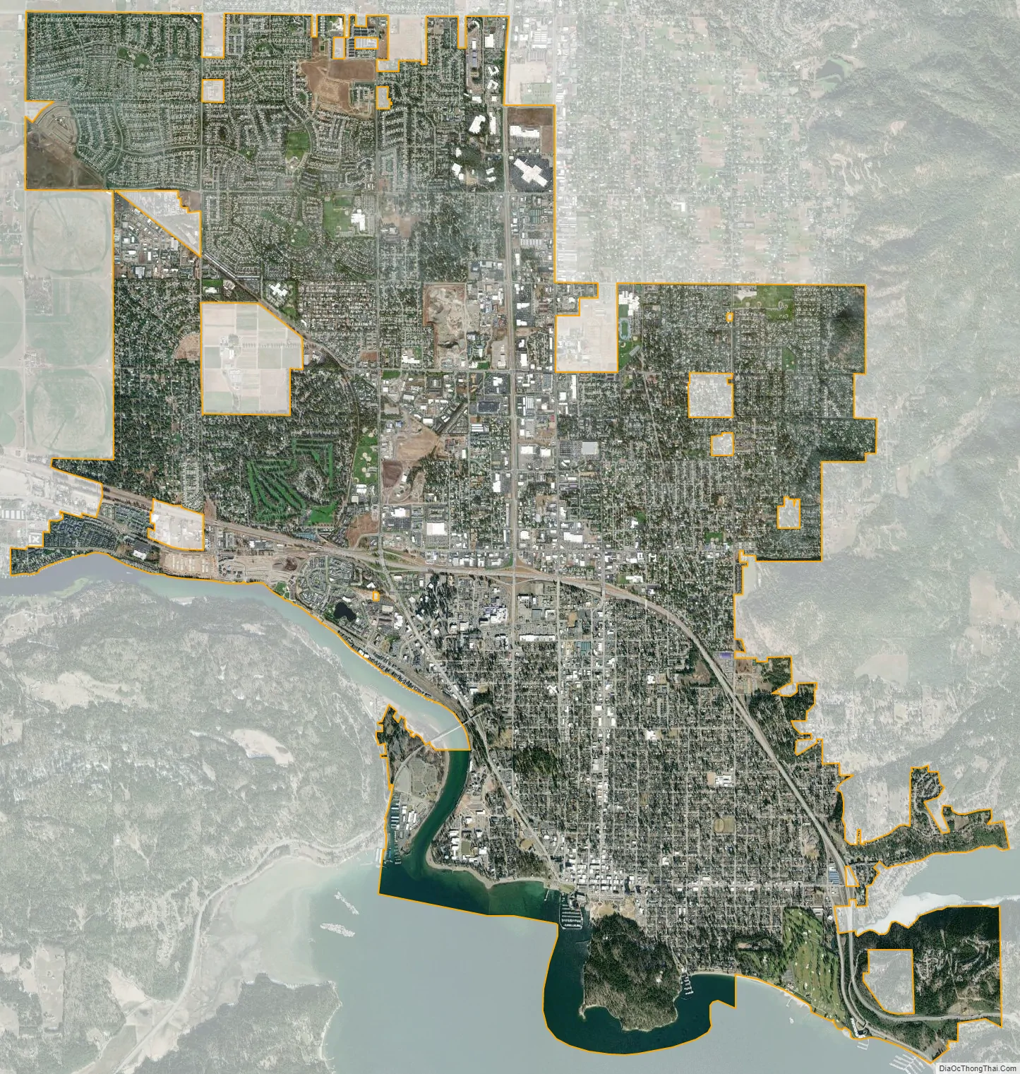
Coeur d’Alene city Satellite Map
Geography
According to the United States Census Bureau, the city has a total area of 16.08 square miles (41.65 km), of which 15.57 square miles (40.33 km) is land and 0.51 square miles (1.32 km) is water.
Coeur d’Alene is 30 miles (48 km) east of downtown Spokane, Washington, and 259 miles (415 km) east of Seattle. The city is part of the Spokane–Coeur d’Alene combined statistical area and the Inland Northwest region, consisting of eastern Washington, northern Idaho, northwestern Montana, and northeastern Oregon.
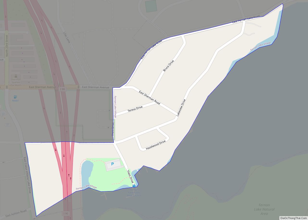
The city is located on the north shore of Lake Coeur d’Alene, near the outlet of the Spokane River, and is in the Northern Rockies ecoregion. Lake Coeur d’Alene is a natural dam-controlled lake that is 25 miles (40 km) long and 1 mile (1.6 km) to 3 miles (4.8 km) wide and fed by the Coeur d’Alene and Saint Joe rivers. Although the Post Falls Dam on the Spokane River near Post Falls controls the lake levels, the lake is usually kept at natural levels from January to June. To the immediate southeast is Fernan Lake and to the northeast of the city is Hayden Lake and even further northeast in northern Kootenai County is Lake Pend Oreille, which is among the largest and deepest natural lakes in the western United States with a surface area of 85,960 acres (347.9 km) and maximum depth of 1,152 feet (351 m). These lakes, like others in the Spokane Valley and Rathdrum Prairie, were formed by the Missoula Floods, which ended 12,000 to 15,000 years ago. The Coeur d’Alene Mountains of the Bitterroot Range rise to the east of the city to a maximum elevation of 7,352 feet (2,241 m) at Cherry Peak.
The wooded lands east of the city, the Coeur d’Alene National Forest, have been designated for protection and management by the Idaho Panhandle National Forests. These thick forests include groves of ancient western redcedar and host over 300 wildlife species including woodland caribou, Canada lynx, grizzly bear, and wolves. The large lakes in the Idaho panhandle attract birds on the Pacific Flyway, and bird watching is popular on Lake Coeur d’Alene, especially from November to February when bald eagles come annually to feed on the spawning kokanee. The Cougar Bay Nature Preserve on the northeast portion of Lake Coeur d’Alene is the closest and most accessible nature preserve for wildlife viewing, as it is located a few minutes from downtown Coeur d’Alene.
Environmental concerns have come as a result of upstream hardrock mining and smelting operations in the Silver Valley. The Coeur d’Alene Basin, including Lake Coeur d’Alene, is polluted with heavy metals such as lead and was designated a superfund site in 1983 that spans 1,500 square miles (3,884.98 km) and 166 miles (267 km) of the Coeur d’Alene River. The majority of the lake bed is covered in a layer of contaminated sediment and local health officials at the Panhandle Health District advise the lake’s visitors to wash anything that has come into contact with potentially lead-laced soil or dust in the Coeur d’Alene River basin.
Climate
Coeur d’Alene has, depending on the definition, a dry-summer continental climate (Köppen Dsb) or a warm-summer Mediterranean climate (Csb), characterized by a cold, moist climate in winter, and very warm, dry conditions in summer. The daily mean temperature ranges from 31.2 °F (−0.4 °C) in January and December to 70.1 °F (21.2 °C) in July. Temperatures exceed 90 °F (32 °C) on 18.3 days per year, only occasionally reaching 100 °F (38 °C), and there may be several nights below 10 °F (−12 °C). The average first and last freezes of the season are October 17 and April 28, respectively. The city straddles the border between USDA Plant Hardiness Zones 6B and 7A. The Spokane–Coeur d’Alene area has many microclimates that can have different weather patterns and observations from the nearby official reporting stations used by the National Weather Service due to the diversity of the topography and other factors. For instance, northern Idaho experiences more precipitation in rain and snow than eastern Washington from weather systems originating from the Pacific Ocean because it is on the windward side of the Rocky Mountains. Average annual rainfall is 25 inches (64 cm) and the average annual snowfall is 46 inches (120 cm). Northern Idaho weather is influenced by both maritime and continental weather systems. Moist air masses from the coast are released as precipitation over the North Central Rockies forests, creating the North American inland temperate rainforest, and dry air masses from Canada and the Great Plains contribute to dry summer months. Coeur d’Alene can have noticeably milder nights and cooler days due to the moderating effect on the climate of large bodies of water such as Lake Coeur d’Alene.
Cityscape
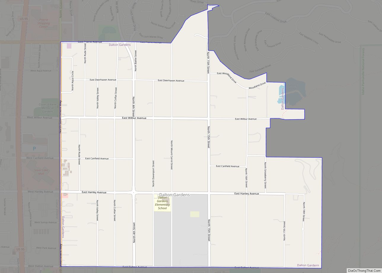
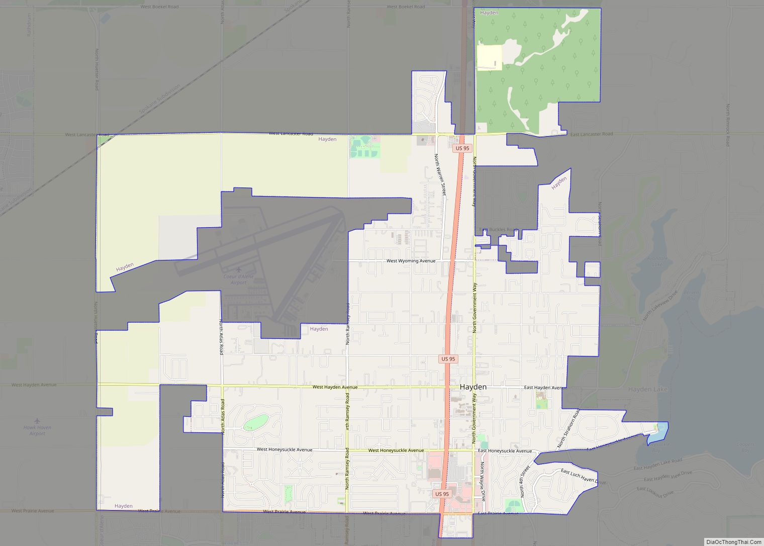
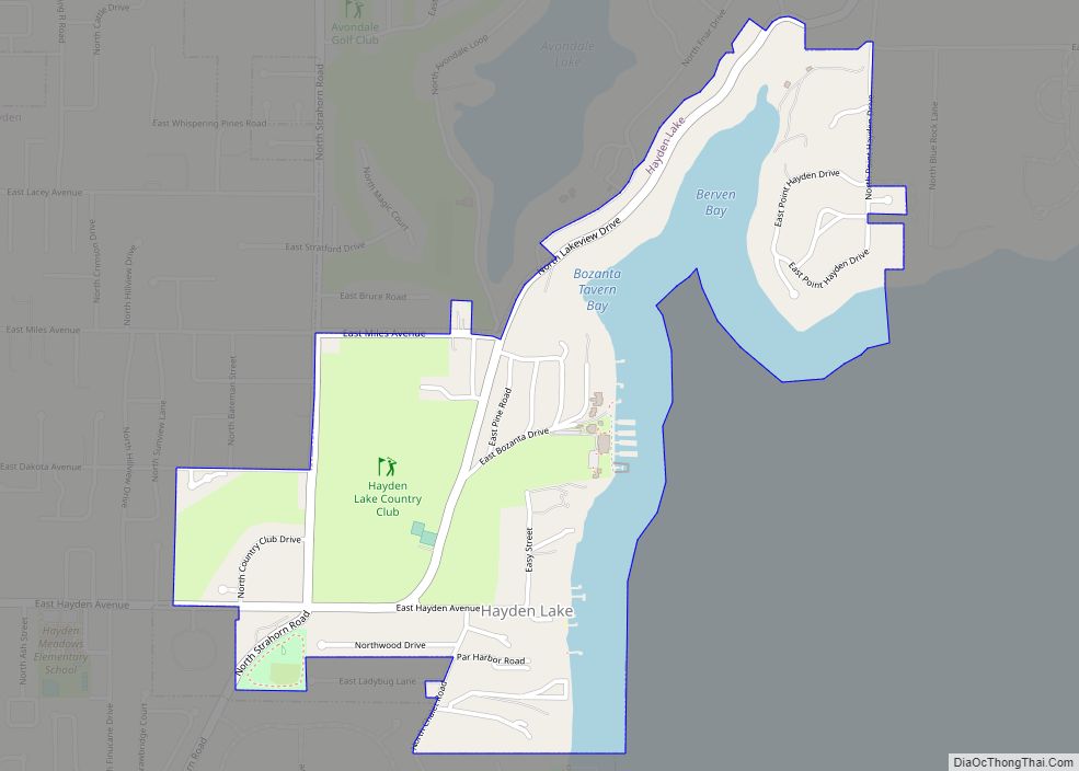
As Coeur d’Alene has grown from a fort town, different neighborhoods and suburbs have grown around it. The downtown city center of Coeur d’Alene is in the southeast of the urban area as the presence of Hayden Lake and Lake Fernan and the Coeur d’Alene mountains inhibit development to the east and Lake Coeur d’Alene and the Spokane River limit development to the south and southwest. Historic additions from the early 1900s were added close to the city center a few blocks from downtown, such as on East Sherman Avenue, East Lakeshore Drive near Sanders Beach, and near present-day City Park. Today, the city has many neighborhoods, the largest being Coeur d’Alene city center, Post Falls and Hayden. The Coeur d’Alene city center has several parks and attractions and as a community gathering place, it has heavy foot traffic on fair weather summer weekends. The largest building in the city, the 216-foot (66 m) Coeur d’Alene Resort Lake Tower, is in the city center. The downtown area is of increasing interest to higher density multifamily apartment and condominium-type developments to cope with the growth in housing demand and due to a lack of space and concerns about urban sprawl. Investment in residential and retail development has been intensive along the Interstate 90 corridor and has made Post Falls near the Washington state line become Kootenai County’s second largest city. Due to its central location between Spokane and Coeur d’Alene, the city is host to a growing list of retail stores such as Walmart and Cabela’s, and is considered a bedroom community of Spokane. The historic Post Falls Dam and surrounding Falls Park on the Spokane River is a local landmark. Hayden is the third largest city in the Coeur d’Alene metropolitan area, and it is known for the eponymous Hayden Lake that was once the historic center of the community. The shores of the lake are filled with summer cabins and large mansions. The historic Hayden Lake Country Club, which lies at the center of the Hayden Lake community, was built in 1907 along with a rail connection with the Spokane and Inland Empire Railroad that same year which brought in many tourists to the resort and Honeysuckle Beach. With the rising use of the automobile, the center of town shifted away from the lake and railroad and reoriented toward Government Way.
See also
Map of Idaho State and its subdivision:- Ada
- Adams
- Bannock
- Bear Lake
- Benewah
- Bingham
- Blaine
- Boise
- Bonner
- Bonneville
- Boundary
- Butte
- Camas
- Canyon
- Caribou
- Cassia
- Clark
- Clearwater
- Custer
- Elmore
- Franklin
- Fremont
- Gem
- Gooding
- Idaho
- Jefferson
- Jerome
- Kootenai
- Latah
- Lemhi
- Lewis
- Lincoln
- Madison
- Minidoka
- Nez Perce
- Oneida
- Owyhee
- Payette
- Power
- Shoshone
- Teton
- Twin Falls
- Valley
- Washington
- Alabama
- Alaska
- Arizona
- Arkansas
- California
- Colorado
- Connecticut
- Delaware
- District of Columbia
- Florida
- Georgia
- Hawaii
- Idaho
- Illinois
- Indiana
- Iowa
- Kansas
- Kentucky
- Louisiana
- Maine
- Maryland
- Massachusetts
- Michigan
- Minnesota
- Mississippi
- Missouri
- Montana
- Nebraska
- Nevada
- New Hampshire
- New Jersey
- New Mexico
- New York
- North Carolina
- North Dakota
- Ohio
- Oklahoma
- Oregon
- Pennsylvania
- Rhode Island
- South Carolina
- South Dakota
- Tennessee
- Texas
- Utah
- Vermont
- Virginia
- Washington
- West Virginia
- Wisconsin
- Wyoming