Map of Milford village, Illinois

Map of Milford village, Illinois

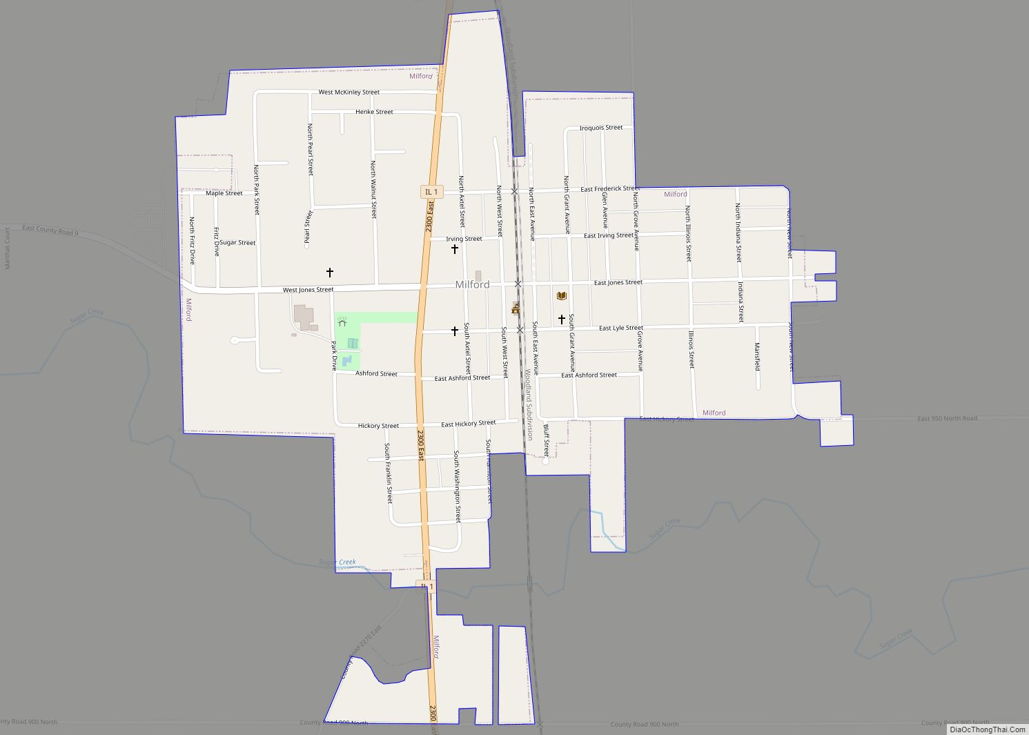
Milford is a village in Milford Township, Iroquois County, Illinois, United States. The population was 1,306 at the 2010 census. The village’s name comes from its location, where the Old Hubbard Trail forded Sugar Creek and where a gristmill stood in 1836 (“the mill at the ford”). Milford village overview: Name: Milford village LSAD Code: … Read more

Map of Millbrook village, Illinois

Map of Millbrook village, Illinois

Millbrook is a village in Kendall County, Illinois, United States. It was incorporated on November 5, 2002, and had a population of 335 at the 2010 census. The village is part of the Chicago metropolitan area. Millbrook village overview: Name: Millbrook village LSAD Code: 47 LSAD Description: village (suffix) State: Illinois County: Kendall County Elevation: … Read more

Map of Mill Shoals village

Map of Mill Shoals village

Mill Shoals is a village in Wayne and White counties in the U.S. State of Illinois. The population was 235 at the 2000 census, down to 176 at the 2020 census. In Fall 2022, Drew Lane Consultants LLC conducted a village-wide survey that totaled population at 157. The Village of Mill Shoals is located 4 … Read more

Map of Millington village

Map of Millington village, Illinois

Millington is a village in Kendall and LaSalle counties in the U.S. state of Illinois. The population was 617 at the 2020 census, down from 665 at the 2010 census. The Kendall County portion of Millington is part of the Chicago–Naperville–Joliet Metropolitan Statistical Area, while the LaSalle County portion is part of the Ottawa Micropolitan … Read more

Map of Milledgeville village, Illinois

Map of Milledgeville village, Illinois

Milledgeville is a village in Carroll County, Illinois, United States. The population of the village was 1,026 at the 2020 census. The town was named for the mill at the edge of the village, which was torn down in 1908. Milledgeville village overview: Name: Milledgeville village LSAD Code: 47 LSAD Description: village (suffix) State: Illinois … Read more

Map of Milton village, Illinois

Map of Milton village, Illinois

Milton is a village in Pike County, Illinois, United States. The population was 271 at the 2010 census, a decline from 274 in 2000. Milton village overview: Name: Milton village LSAD Code: 47 LSAD Description: village (suffix) State: Illinois County: Pike County Elevation: 676 ft (206 m) Total Area: 0.39 sq mi (1.00 km²) Land Area: 0.39 sq mi (1.00 km²) Water Area: … Read more

Map of Millstadt village

Map of Millstadt village

Millstadt is a village in St. Clair County, Illinois, United States, located at the crossing of Illinois Routes 163 (locally, “Jefferson Avenue”) and 158 (locally, “Washington Avenue”). The village is known for its German heritage, with more than half its people of German descent. The population was 4,011 at the 2010 census, but a more … Read more

Map of Minier village

Map of Minier village

Minier is a village in Tazewell County, Illinois, United States. The population was 1,154 at the 2020 census. Minier is part of the Peoria, Illinois Metropolitan Statistical Area. Minier village overview: Name: Minier village LSAD Code: 47 LSAD Description: village (suffix) State: Illinois County: Tazewell County Elevation: 637 ft (194 m) Total Area: 0.57 sq mi (1.49 km²) Land Area: … Read more

Map of Mineral village, Illinois

Map of Mineral village, Illinois

Mineral is a village in Bureau County, Illinois, United States. The population was 206 at the 2020 census, down from 237 at the 2010 census. It is part of the Ottawa Micropolitan Statistical Area. Mineral village overview: Name: Mineral village LSAD Code: 47 LSAD Description: village (suffix) State: Illinois County: Bureau County Total Area: 0.553 sq mi … Read more

Map of Minooka village

Map of Minooka village

Minooka is a village in Grundy, Kendall, and Will counties, Illinois, United States. The population was 10,924 at the 2010 census, up from 3,971 at the 2000 census. The village is part of the Chicago metropolitan area. The Chicago, Rock Island and Pacific Railroad served the town at Minooka Station. Minooka village overview: Name: Minooka … Read more

Map of Minonk city

Map of Minonk city

Minonk is a city in Minonk Township, Woodford County, Illinois, United States. The population was 2,078 at the 2010 census, down from 2,168 in 2000. It is part of the Peoria, Illinois Metropolitan Statistical Area. Minonk city overview: Name: Minonk city LSAD Code: 25 LSAD Description: city (suffix) State: Illinois County: Woodford County Elevation: 747 ft … Read more

Map of Modesto village, Illinois

Map of Modesto village, Illinois

Modesto is a village in Macoupin County, Illinois, United States. The population was 182 at the 2020 census, down from 252 in 2000. Modesto village overview: Name: Modesto village LSAD Code: 47 LSAD Description: village (suffix) State: Illinois County: Macoupin County Elevation: 678 ft (207 m) Total Area: 0.56 sq mi (1.45 km²) Land Area: 0.56 sq mi (1.45 km²) Water Area: 0.00 sq mi … Read more