Millington is a village in Kendall and LaSalle counties in the U.S. state of Illinois. The population was 617 at the 2020 census, down from 665 at the 2010 census.
The Kendall County portion of Millington is part of the Chicago–Naperville–Joliet Metropolitan Statistical Area, while the LaSalle County portion is part of the Ottawa Micropolitan Statistical Area.
| Name: | Millington village |
|---|---|
| LSAD Code: | 47 |
| LSAD Description: | village (suffix) |
| State: | Illinois |
| County: | Kendall County, LaSalle County |
| Elevation: | 564 ft (172 m) |
| Total Area: | 0.76 sq mi (1.98 km²) |
| Land Area: | 0.71 sq mi (1.83 km²) |
| Water Area: | 0.06 sq mi (0.14 km²) |
| Total Population: | 617 |
| Population Density: | 871.47/sq mi (336.32/km²) |
| ZIP code: | 60537 |
| Area code: | 815 |
| FIPS code: | 1749308 |
| GNISfeature ID: | 2399361 |
| Website: | www.millingtonil.com |
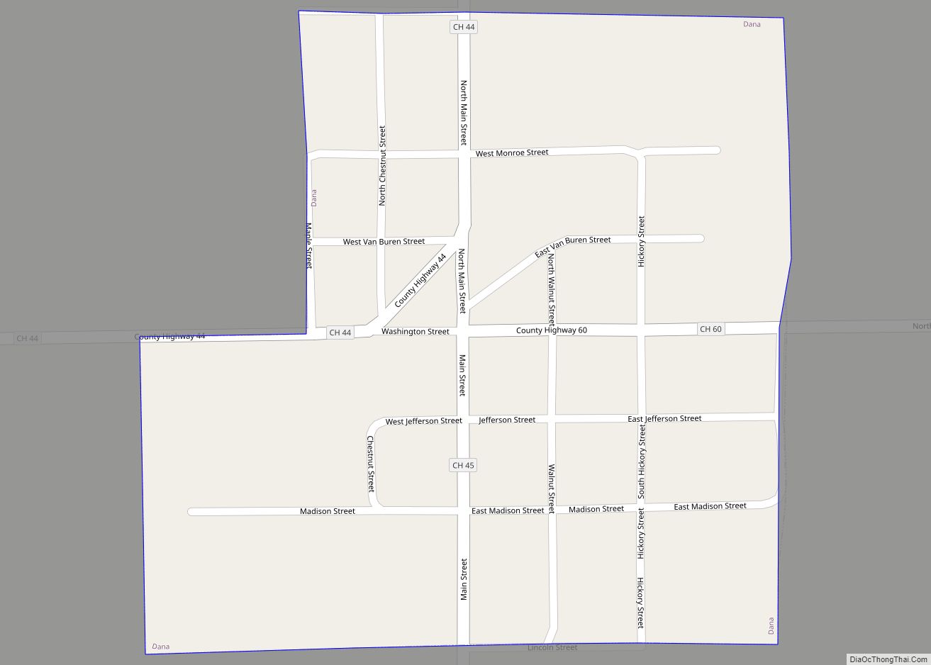
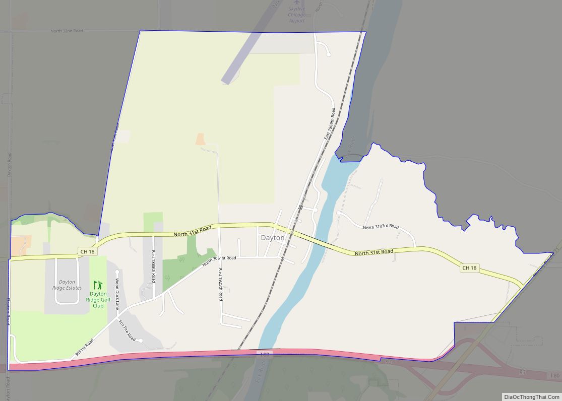
Online Interactive Map
Click on ![]() to view map in "full screen" mode.
to view map in "full screen" mode.
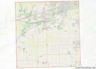
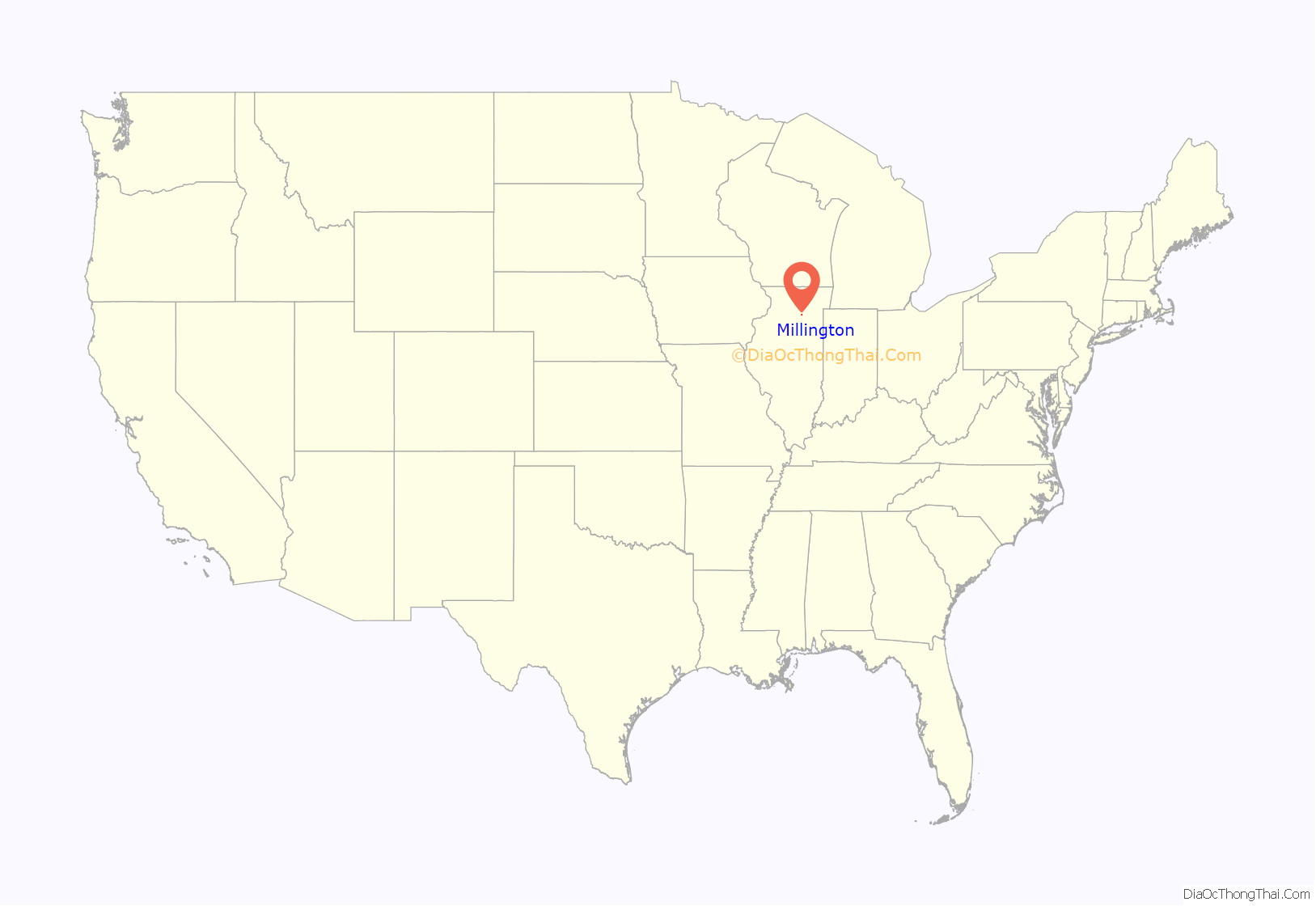
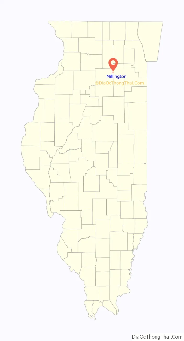
Millington location map. Where is Millington village?
History
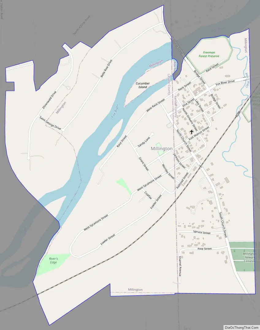
In the fall of 1834 the nucleus of the village was begun when George Markley and Samuel Jackson staked out the first claim and built a log cabin on the river bank near the house where Sam Adams now lives(408 Church St.). They claimed some 600 acres on both sides of the river and the next spring the dam to furnish waterpower for a sawmill which was also begun in 1835. The mill was located on the south side of the river.
Samuel Jackson came from Pennsylvania. A loyal Democrat, he supported the presidential campaign of Andrew Jackson with such vigor that he wore the nickname of “General” for the rest of his life. He was a member of the County Commissioners Court of Kendall County when the new court buildings were built. He married Eunice Tubbs.
The Millington Newark Cemetery is located on Church Street on the southern edge of the village, on top of the hill overlooking the village center. It is populated with over 3,000 graves, including a Revolutionary War veteran buried on the north side.
Samuel’s brother, Jesse Jackson, came from Pennsylvania for a visit and was so pleased with the location that he bought out Markley’s interest and moved his family here in 1836. His was the first frame house in Millington. That year the sawmill was completed and put into operation.
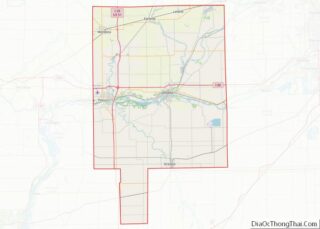
Millington Road Map
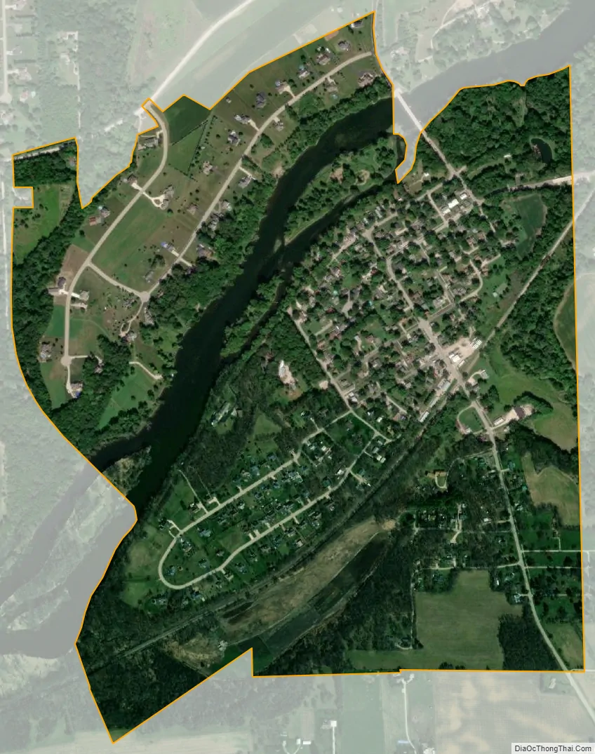
Millington city Satellite Map
Geography
Millington is in the western part of Kendall County and the northeastern part of LaSalle County at 41°33′43″N 88°35′59″W / 41.562020°N 88.599606°W / 41.562020; -88.599606. In the 2010 census, 245 of Millington’s residents lived in Kendall County and 420 lived in LaSalle County. The actual boundary line of the counties is not clearly defined in town, although a road farther south, named “Sandhill Road” in Kendall County and “N. 4201 Rd.” in LaSalle County, clearly shows the county line, especially in the winter, as LaSalle County is slower in plowing the road, while the Kendall County portion is somewhat clear.
According to the 2021 census gazetteer files, Millington has a total area of 0.76 square miles (1.97 km), of which 0.71 square miles (1.84 km) (or 92.79%) is land and 0.06 square miles (0.16 km) (or 7.21%) is water. It lies mostly on the southeast side of the Fox River, except for a neighborhood along Belle Rive Drive on the northwest side of the river.
Millington is 2 miles (3 km) north of Newark, 7 miles (11 km) south of Sandwich, and 11 miles (18 km) southwest of Yorkville. Joliet is 30 miles (48 km) to the east, and Aurora is 22 miles (35 km) to the northeast.
See also
Map of Illinois State and its subdivision:- Adams
- Alexander
- Bond
- Boone
- Brown
- Bureau
- Calhoun
- Carroll
- Cass
- Champaign
- Christian
- Clark
- Clay
- Clinton
- Coles
- Cook
- Crawford
- Cumberland
- De Kalb
- De Witt
- Douglas
- Dupage
- Edgar
- Edwards
- Effingham
- Fayette
- Ford
- Franklin
- Fulton
- Gallatin
- Greene
- Grundy
- Hamilton
- Hancock
- Hardin
- Henderson
- Henry
- Iroquois
- Jackson
- Jasper
- Jefferson
- Jersey
- Jo Daviess
- Johnson
- Kane
- Kankakee
- Kendall
- Knox
- La Salle
- Lake
- Lake Michigan
- Lawrence
- Lee
- Livingston
- Logan
- Macon
- Macoupin
- Madison
- Marion
- Marshall
- Mason
- Massac
- McDonough
- McHenry
- McLean
- Menard
- Mercer
- Monroe
- Montgomery
- Morgan
- Moultrie
- Ogle
- Peoria
- Perry
- Piatt
- Pike
- Pope
- Pulaski
- Putnam
- Randolph
- Richland
- Rock Island
- Saint Clair
- Saline
- Sangamon
- Schuyler
- Scott
- Shelby
- Stark
- Stephenson
- Tazewell
- Union
- Vermilion
- Wabash
- Warren
- Washington
- Wayne
- White
- Whiteside
- Will
- Williamson
- Winnebago
- Woodford
- Alabama
- Alaska
- Arizona
- Arkansas
- California
- Colorado
- Connecticut
- Delaware
- District of Columbia
- Florida
- Georgia
- Hawaii
- Idaho
- Illinois
- Indiana
- Iowa
- Kansas
- Kentucky
- Louisiana
- Maine
- Maryland
- Massachusetts
- Michigan
- Minnesota
- Mississippi
- Missouri
- Montana
- Nebraska
- Nevada
- New Hampshire
- New Jersey
- New Mexico
- New York
- North Carolina
- North Dakota
- Ohio
- Oklahoma
- Oregon
- Pennsylvania
- Rhode Island
- South Carolina
- South Dakota
- Tennessee
- Texas
- Utah
- Vermont
- Virginia
- Washington
- West Virginia
- Wisconsin
- Wyoming