Map of Washta city

Map of Washta city

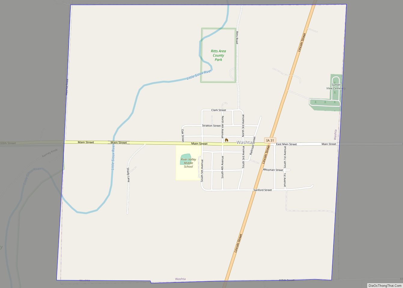
Washta is a city in Cherokee County, Iowa, United States. The population was 209 at the time of the 2020 census. It is called “The Coldest Spot in Iowa”, recording a temperature of −47 °F (−44 °C) without wind chill on January 12, 1912. Washta’s name dates back to 1868 when a local man named Whisman turned … Read more

Map of Washington city, Iowa

Map of Washington city, Iowa

Washington is a city in and the county seat of Washington County, Iowa, United States. It is part of the Iowa City, Iowa Metropolitan Statistical Area. The population was 7,352 at the time of the 2020 census. Washington city overview: Name: Washington city LSAD Code: 25 LSAD Description: city (suffix) State: Iowa County: Washington County … Read more

Map of Waucoma city

Map of Waucoma city

Waucoma is a city in Fayette County, Iowa, United States. The population was 229 at the time of the 2020 census. Waucoma city overview: Name: Waucoma city LSAD Code: 25 LSAD Description: city (suffix) State: Iowa County: Fayette County Elevation: 1,043 ft (318 m) Total Area: 0.47 sq mi (1.21 km²) Land Area: 0.47 sq mi (1.21 km²) Water Area: 0.00 sq mi (0.00 km²) Total … Read more

Map of Watkins CDP, Iowa

Map of Watkins CDP, Iowa

Watkins is an unincorporated community and census-designated place in southeastern Benton County, Iowa, United States. As of the 2010 census, it had a population of 118. Watkins lies along local roads south of the city of Vinton, the county seat of Benton County. Its elevation is 830 feet (250 m) above sea level. Although Watkins is … Read more

Map of Waterville city

Map of Waterville city, Iowa

Waterville is a city in Paint Creek Township, Allamakee County, Iowa, United States. The population was 109 at the time of the 2020 census. Waterville city overview: Name: Waterville city LSAD Code: 25 LSAD Description: city (suffix) State: Iowa County: Allamakee County Elevation: 883 ft (269 m) Total Area: 0.35 sq mi (0.91 km²) Land Area: 0.35 sq mi (0.91 km²) Water Area: … Read more

Map of Waverly city, Iowa

Map of Waverly city, Iowa

Waverly is a city in Bremer County, Iowa, United States. The population was 10,394 at the time of the 2020 census. It is the county seat of Bremer County and is part of the Waterloo–Cedar Falls Metropolitan Statistical Area. The sister city of Waverly is the German city of Eisenach, which is famous for the … Read more

Map of Waukon city

Map of Waukon city

Waukon is a city in Makee Township, Allamakee County, Iowa, United States, and the county seat of Allamakee County. The population was 3,827 at the time of the 2020 census. Waukon city overview: Name: Waukon city LSAD Code: 25 LSAD Description: city (suffix) State: Iowa County: Allamakee County Elevation: 1,237 ft (377 m) Total Area: 2.84 sq mi (7.35 km²) … Read more

Map of Waukee city

Map of Waukee city

Waukee is a city in Dallas County, Iowa, United States. The population was 23,940 at the time of the 2020 U.S. Census. It is part of the Des Moines – West Des Moines Metropolitan Statistical Area. In 2017, Apple Inc. chose Waukee as the location of a massive $1.38 billion data center campus. Waukee city … Read more

Map of Webster City city

Map of Webster City

Webster City is a city in Hamilton County, Iowa, United States. The population was 7,825 at the 2020 census. It is the county seat of Hamilton County. Webster City is known as ‘Boone River Country’, as the Boone River meanders along the east side of the city. Webster City overview: Name: Webster City LSAD Code: … Read more

Map of Webb city, Iowa

Map of Webb city, Iowa

Webb is a city in Clay County, Iowa, United States. The population was 138 in the 2020 census, a decline from 165 in 2000. Webb city overview: Name: Webb city LSAD Code: 25 LSAD Description: city (suffix) State: Iowa County: Clay County Elevation: 1,375 ft (419 m) Total Area: 0.50 sq mi (1.30 km²) Land Area: 0.50 sq mi (1.30 km²) Water Area: … Read more

Map of Wayland city

Map of Wayland city, Iowa

Wayland is a village in Jefferson Township, Henry County, Iowa, United States. The population was 964 at the time of the 2020 census. Wayland city overview: Name: Wayland city LSAD Code: 25 LSAD Description: city (suffix) State: Iowa County: Henry County Elevation: 732 ft (223 m) Total Area: 1.06 sq mi (2.76 km²) Land Area: 1.06 sq mi (2.76 km²) Water Area: 0.00 sq mi … Read more

Map of Wellman city

Map of Wellman city, Iowa

Wellman is a city in Washington County, Iowa, United States. It is part of the Iowa City, Iowa Metropolitan Statistical Area. The population was 1,524 at the time of the 2020 census. Wellman city overview: Name: Wellman city LSAD Code: 25 LSAD Description: city (suffix) State: Iowa County: Washington County Elevation: 699 ft (213 m) Total Area: … Read more