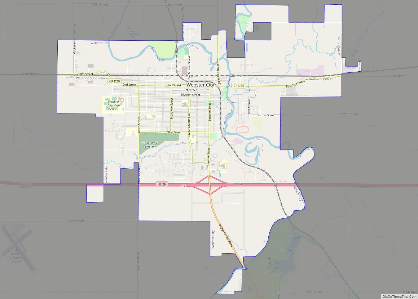
Webster City is a city in Hamilton County, Iowa, United States. The population was 7,825 at the 2020 census. It is the county seat of Hamilton County. Webster City is known as ‘Boone River Country’, as the Boone River meanders along the east side of the city.
| Name: | Webster City city |
|---|---|
| LSAD Code: | 25 |
| LSAD Description: | city (suffix) |
| State: | Iowa |
| County: | Hamilton County |
| Elevation: | 1,040 ft (317 m) |
| Total Area: | 8.91 sq mi (23.07 km²) |
| Land Area: | 8.89 sq mi (23.03 km²) |
| Water Area: | 0.01 sq mi (0.04 km²) |
| Total Population: | 7,825 |
| Population Density: | 879.91/sq mi (339.73/km²) |
| ZIP code: | 50595 |
| Area code: | 515 |
| FIPS code: | 1983145 |
| GNISfeature ID: | 0462774 |
| Website: | www.webstercity.com |
Online Interactive Map
Click on ![]() to view map in "full screen" mode.
to view map in "full screen" mode.
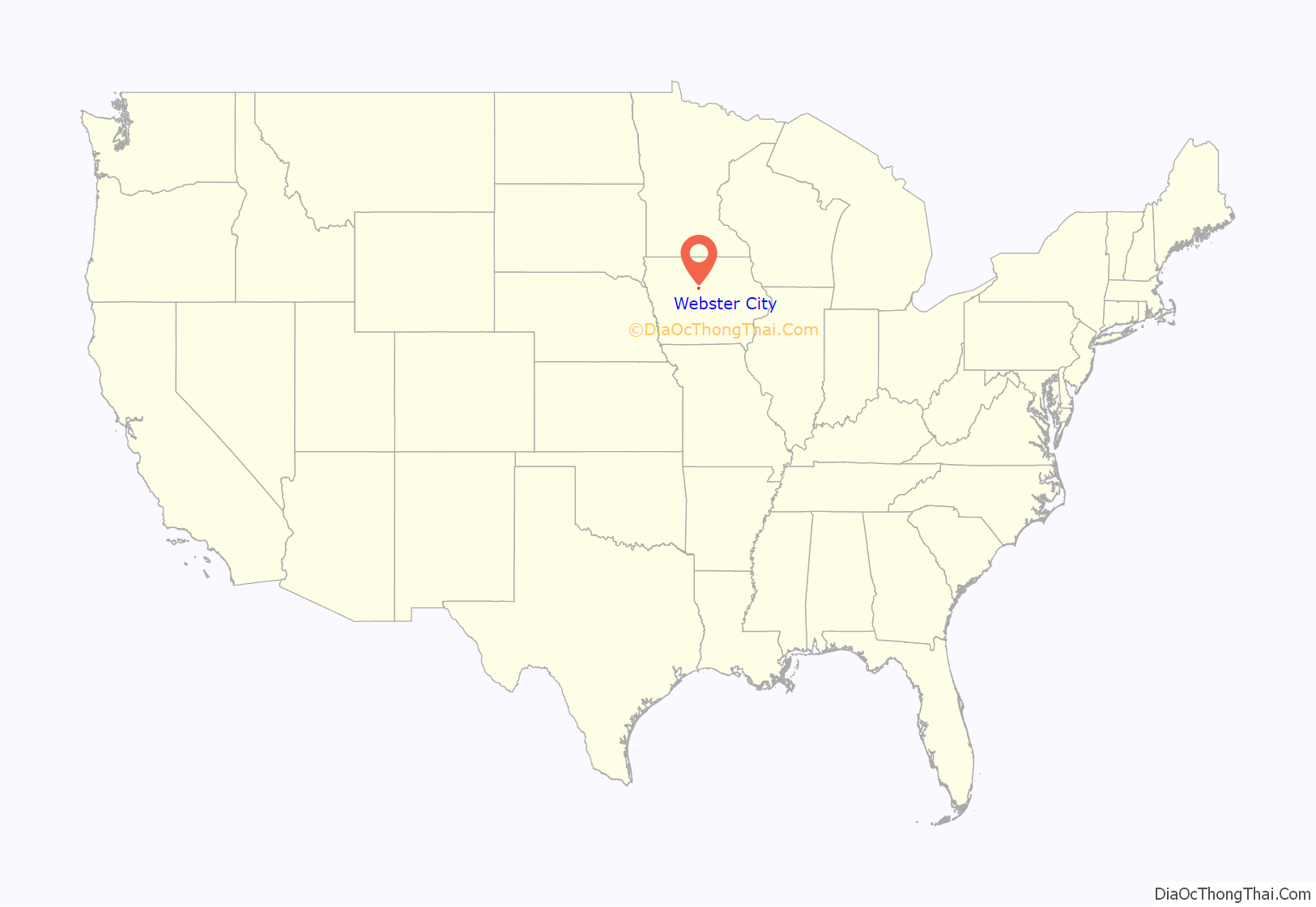
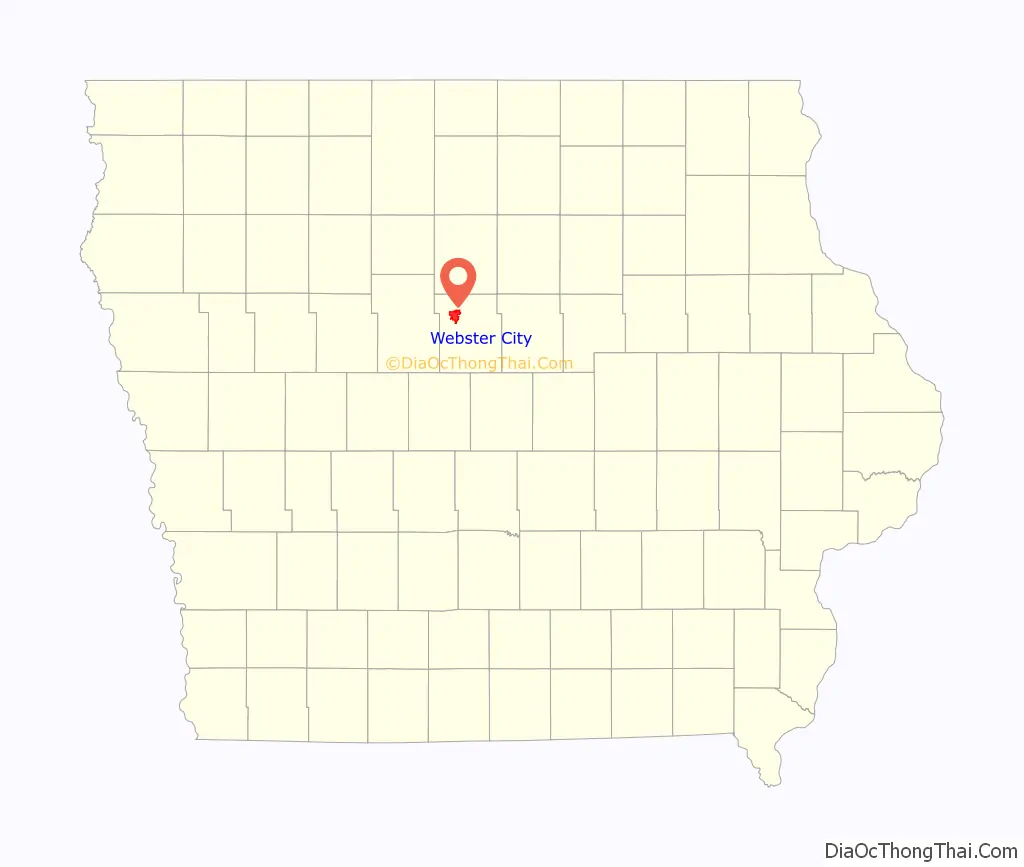
Webster City location map. Where is Webster City city?
History
Webster City was originally called Newcastle by settlers of European descent. Under the latter name it was changed in 1854 by Wilson Brewer. In 1855, Walter C. Willson came to Newcastle.
Willson was elected to the Iowa State House the next year and, with John F. Duncombe, crafted a bill to divide the very large Webster County in half. Newcastle would be renamed “Webster City,” named after Daniel Webster of Massachusetts and would become the county seat of the new county. Willson suggested “Hamilton County” after William W. Hamilton, the president of the State Senate. He helped pass the legislation. The law took effect on January 1, 1857, renaming Webster City and designating it as the county seat of the newly organized Hamilton County. Willson was also instrumental in getting the Dubuque & Sioux City rail line to be constructed through Webster City on its way to Fort Dodge. He personally oversaw the laying of track.
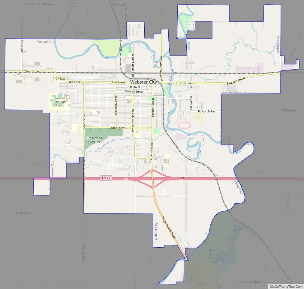
Webster City Road Map
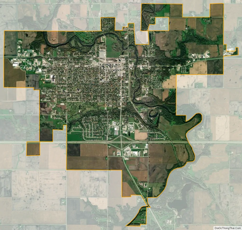
Webster City city Satellite Map
Geography
Webster City is located at 42°27′59″N 93°49′14″W / 42.46639°N 93.82056°W / 42.46639; -93.82056 (42.466300, -93.820582).
According to the United States Census Bureau, the city has a total area of 8.88 square miles (23.00 km), of which 8.86 square miles (22.95 km) is land and 0.02 square miles (0.05 km) is water.
See also
Map of Iowa State and its subdivision:- Adair
- Adams
- Allamakee
- Appanoose
- Audubon
- Benton
- Black Hawk
- Boone
- Bremer
- Buchanan
- Buena Vista
- Butler
- Calhoun
- Carroll
- Cass
- Cedar
- Cerro Gordo
- Cherokee
- Chickasaw
- Clarke
- Clay
- Clayton
- Clinton
- Crawford
- Dallas
- Davis
- Decatur
- Delaware
- Des Moines
- Dickinson
- Dubuque
- Emmet
- Fayette
- Floyd
- Franklin
- Fremont
- Greene
- Grundy
- Guthrie
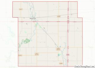
- Hamilton
- Hancock
- Hardin
- Harrison
- Henry
- Howard
- Humboldt
- Ida
- Iowa
- Jackson
- Jasper
- Jefferson
- Johnson
- Jones
- Keokuk
- Kossuth
- Lee
- Linn
- Louisa
- Lucas
- Lyon
- Madison
- Mahaska
- Marion
- Marshall
- Mills
- Mitchell
- Monona
- Monroe
- Montgomery
- Muscatine
- O'Brien
- Osceola
- Page
- Palo Alto
- Plymouth
- Pocahontas
- Polk
- Pottawattamie
- Poweshiek
- Ringgold
- Sac
- Scott
- Shelby
- Sioux
- Story
- Tama
- Taylor
- Union
- Van Buren
- Wapello
- Warren
- Washington
- Wayne
- Webster
- Winnebago
- Winneshiek
- Woodbury
- Worth
- Wright
- Alabama
- Alaska
- Arizona
- Arkansas
- California
- Colorado
- Connecticut
- Delaware
- District of Columbia
- Florida
- Georgia
- Hawaii
- Idaho
- Illinois
- Indiana
- Iowa
- Kansas
- Kentucky
- Louisiana
- Maine
- Maryland
- Massachusetts
- Michigan
- Minnesota
- Mississippi
- Missouri
- Montana
- Nebraska
- Nevada
- New Hampshire
- New Jersey
- New Mexico
- New York
- North Carolina
- North Dakota
- Ohio
- Oklahoma
- Oregon
- Pennsylvania
- Rhode Island
- South Carolina
- South Dakota
- Tennessee
- Texas
- Utah
- Vermont
- Virginia
- Washington
- West Virginia
- Wisconsin
- Wyoming