Map of Cunningham CDP, Kentucky

Map of Cunningham CDP, Kentucky

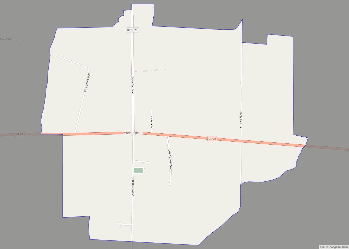
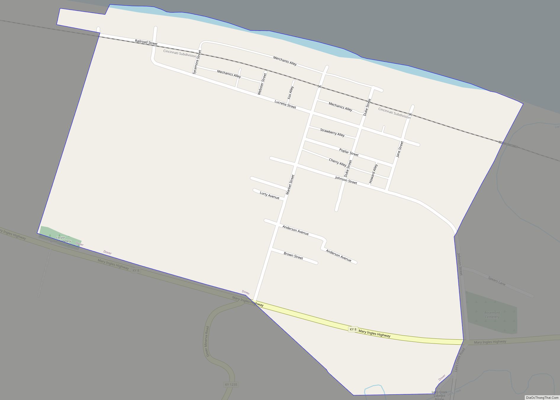
Cunningham is an unincorporated community in Carlisle County, Kentucky, United States. It is the home to the Cunningham Strawberry Festival. Cunningham CDP overview: Name: Cunningham CDP LSAD Code: 57 LSAD Description: CDP (suffix) State: Kentucky County: Carlisle County Elevation: 397 ft (121 m) Total Area: 1.05 sq mi (2.73 km²) Land Area: 1.05 sq mi (2.72 km²) Water Area: 0.01 sq mi (0.01 km²) Total Population: … Read more

Map of Dayton city, Kentucky

Map of Dayton city, Kentucky

The City of Dayton, Kentucky, is a home rule-class city along a bend of the Ohio River in Campbell County, Kentucky, in the United States. The population was 5,338 at the 2010 census. It is less than 3 miles (5 km) from downtown Cincinnati, Ohio. Dayton city overview: Name: Dayton city LSAD Code: 25 LSAD Description: … Read more

Map of Dawson Springs city

Map of Dawson Springs city

Dawson Springs is a home rule-class city in Hopkins and Caldwell counties in the U.S. state of Kentucky. As of the 2020 census, the population of the city was 2,452. Dawson Springs city overview: Name: Dawson Springs city LSAD Code: 25 LSAD Description: city (suffix) State: Kentucky County: Caldwell County, Hopkins County Elevation: 420 ft (130 m) … Read more

Map of Dexter CDP, Kentucky

Map of Dexter CDP, Kentucky

Dexter is an unincorporated community and census-designated place (CDP) in Calloway County, Kentucky, United States. Its population was 277 as of the 2010 census. Dexter CDP overview: Name: Dexter CDP LSAD Code: 57 LSAD Description: CDP (suffix) State: Kentucky County: Calloway County Elevation: 443 ft (135 m) Total Area: 0.55 sq mi (1.43 km²) Land Area: 0.55 sq mi (1.42 km²) Water Area: … Read more

Map of Doe Valley CDP

Map of Doe Valley CDP

Doe Valley is an unincorporated community and census-designated place (CDP) in Meade County, Kentucky, United States. Its population was 2,270 as of the 2020 census. Doe Valley was originally conceived as a planned residential community in 1965. Doe Valley CDP overview: Name: Doe Valley CDP LSAD Code: 57 LSAD Description: CDP (suffix) State: Kentucky County: … Read more

Map of Dixon city, Kentucky

Map of Dixon city, Kentucky

Dixon is a home rule-class city in and the county seat of Webster County, Kentucky, United States. The population was 933 at the 2020 census. Dixon is located at the junction of US 41A and KY 132. It was established with a courthouse and post office in 1860 when the county was formed. Dixon city … Read more

Map of Diablock CDP

Map of Diablock CDP

Diablock is a census-designated place, unincorporated community and coal town in Perry County, Kentucky, United States. Its population was 453 as of the 2010 census. The town’s post office has closed. Diablock CDP overview: Name: Diablock CDP LSAD Code: 57 LSAD Description: CDP (suffix) State: Kentucky County: Perry County Elevation: 915 ft (279 m) Total Area: 0.21 sq mi … Read more

Map of Drakesboro city

Map of Drakesboro city

Drakesboro is a home rule-class city in Muhlenberg County, Kentucky, United States. The population was 515 at the 2010 census. Incorporated in 1888, the city was named for early pioneer William Drake. Drakesboro city overview: Name: Drakesboro city LSAD Code: 25 LSAD Description: city (suffix) State: Kentucky County: Muhlenberg County Elevation: 443 ft (135 m) Total Area: … Read more

Map of Dover city, Kentucky

Map of Dover city, Kentucky

Dover is a home rule-class city in Mason County, Kentucky, United States. The population was 221 at the 2020 census, down from 252 in 2010. It is part of the Maysville Micropolitan Statistical Area. Dover city overview: Name: Dover city LSAD Code: 25 LSAD Description: city (suffix) State: Kentucky County: Mason County Elevation: 518 ft (158 m) … Read more

Map of Douglass Hills city

Map of Douglass Hills city

Douglass Hills is a home rule-class city in eastern Jefferson County, Kentucky, United States. The population was 5,484 at the 2010 census, down from 5,718 at the 2000 census. Douglass Hills city overview: Name: Douglass Hills city LSAD Code: 25 LSAD Description: city (suffix) State: Kentucky County: Jefferson County Elevation: 709 ft (216 m) Total Area: 1.33 sq mi … Read more

Map of Dunmor CDP

Map of Dunmor CDP

Dunmor is an unincorporated community and census-designated place (CDP) in Muhlenberg and Logan counties, Kentucky, United States. As of the 2010 census it had a population of 317. Dunmor CDP overview: Name: Dunmor CDP LSAD Code: 57 LSAD Description: CDP (suffix) State: Kentucky County: Muhlenberg County, Logan County Elevation: 591 ft (180 m) Total Area: 2.61 sq mi (6.76 km²) … Read more

Map of Dry Ridge city

Map of Dry Ridge city, Kentucky

Dry Ridge is a home rule-class city in Grant County, Kentucky, in the United States. The population was 2,191 at the 2010 census, up from 1,995 at the 2000 census. From around 1910 to 1960, the city’s economy was dominated by business related to its mineral water wells, purported to have healing properties. Dry Ridge … Read more