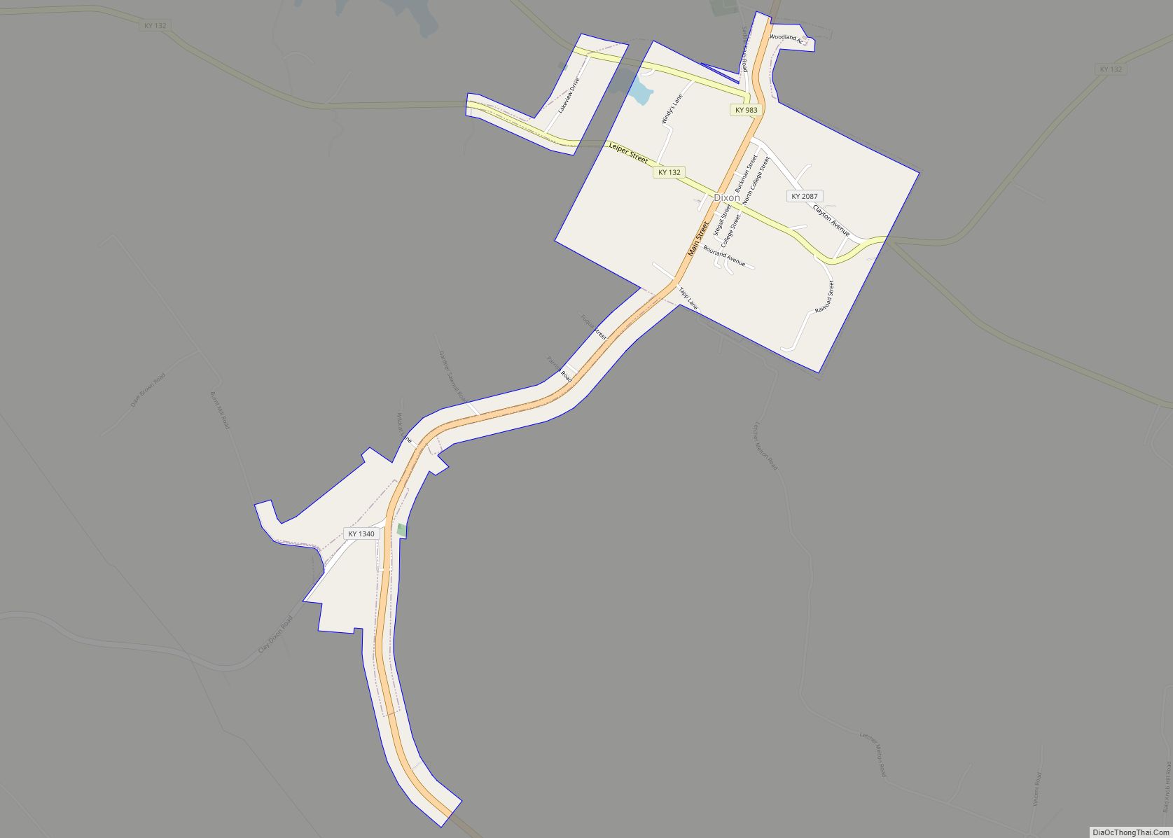
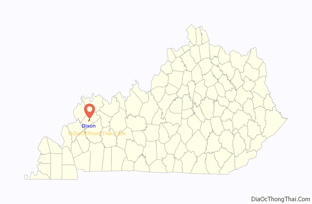
Dixon is a home rule-class city in and the county seat of Webster County, Kentucky, United States. The population was 933 at the 2020 census. Dixon is located at the junction of US 41A and KY 132. It was established with a courthouse and post office in 1860 when the county was formed.
| Name: | Dixon city |
|---|---|
| LSAD Code: | 25 |
| LSAD Description: | city (suffix) |
| State: | Kentucky |
| County: | Webster County |
| Elevation: | 531 ft (162 m) |
| Total Area: | 1.26 sq mi (3.27 km²) |
| Land Area: | 1.25 sq mi (3.24 km²) |
| Water Area: | 0.01 sq mi (0.04 km²) |
| Total Population: | 933 |
| Population Density: | 747.00/sq mi (288.35/km²) |
| ZIP code: | 42409 |
| Area code: | 270 & 364 |
| FIPS code: | 2121682 |
| GNISfeature ID: | 0490922 |
| Website: | www.cityofdixon.net |
Online Interactive Map
Click on ![]() to view map in "full screen" mode.
to view map in "full screen" mode.
Dixon location map. Where is Dixon city?

History
Revolutionary War veteran William Jenkins in 1794 established a stagecoach inn five miles (8 km) north of the town’s present site on the old Indian trail between Nashville and St. Louis.
The town was incorporated on February 6, 1861, and was named after Archibald Dixon, lieutenant governor of the state from 1844 to 1848 and U.S. Senator from 1852 to 1855). The notorious Harpe brothers, murderous outlaws, terrorized the area in the late 18th century.
The downtown area has several historic homes and was the site of a number of Civil War skirmishes.
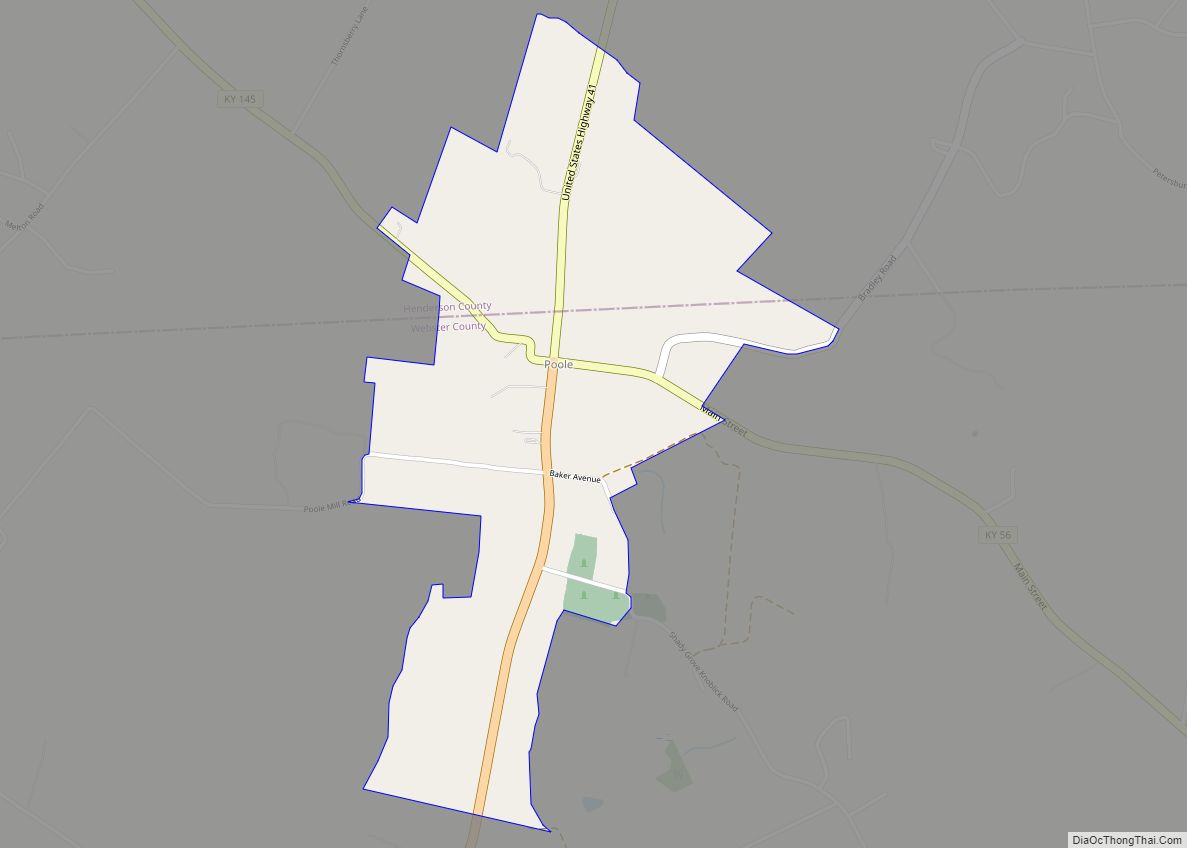
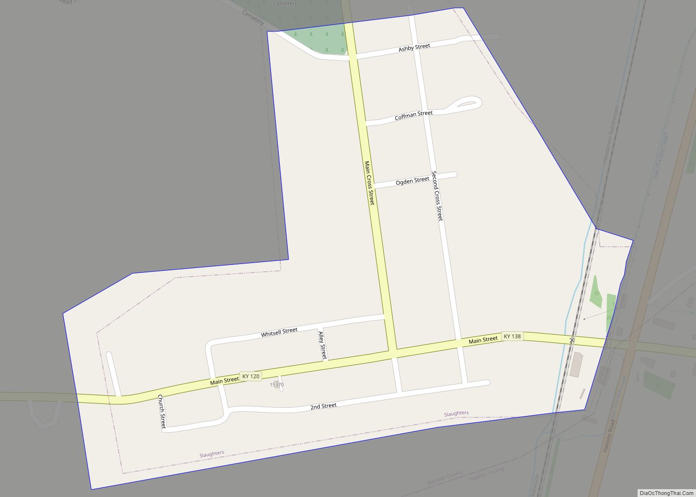
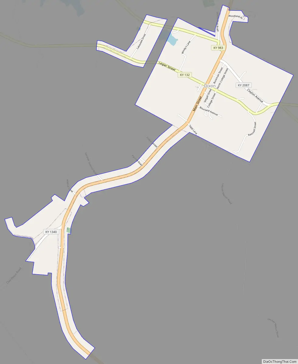
Dixon Road Map
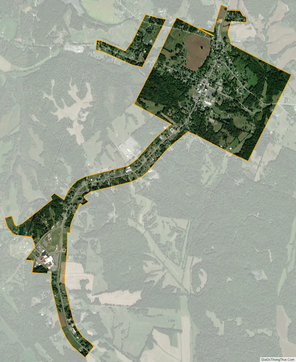
Dixon city Satellite Map
Geography
Dixon is located at 37°30′36″N 87°41′55″W / 37.510094°N 87.698539°W / 37.510094; -87.698539.
According to the United States Census Bureau, the city has a total area of 1.0 square mile (2.6 km), of which, 0.9 square miles (2.3 km) of it is land and 1.04% is water.
See also
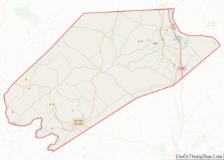
Map of Kentucky State and its subdivision:- Adair
- Allen
- Anderson
- Ballard
- Barren
- Bath
- Bell
- Boone
- Bourbon
- Boyd
- Boyle
- Bracken
- Breathitt
- Breckinridge
- Bullitt
- Butler
- Caldwell
- Calloway
- Campbell
- Carlisle
- Carroll
- Carter
- Casey
- Christian
- Clark
- Clay
- Clinton
- Crittenden
- Cumberland
- Daviess
- Edmonson
- Elliott
- Estill
- Fayette
- Fleming
- Floyd
- Franklin
- Fulton
- Gallatin
- Garrard
- Grant
- Graves
- Grayson
- Green
- Greenup
- Hancock
- Hardin
- Harlan
- Harrison
- Hart
- Henderson
- Henry
- Hickman
- Hopkins
- Jackson
- Jefferson
- Jessamine
- Johnson
- Kenton
- Knott
- Knox
- Larue
- Laurel
- Lawrence
- Lee
- Leslie
- Letcher
- Lewis
- Lincoln
- Livingston
- Logan
- Lyon
- Madison
- Magoffin
- Marion
- Marshall
- Martin
- Mason
- McCracken
- McCreary
- McLean
- Meade
- Menifee
- Mercer
- Metcalfe
- Monroe
- Montgomery
- Morgan
- Muhlenberg
- Nelson
- Nicholas
- Ohio
- Oldham
- Owen
- Owsley
- Pendleton
- Perry
- Pike
- Powell
- Pulaski
- Robertson
- Rockcastle
- Rowan
- Russell
- Scott
- Shelby
- Simpson
- Spencer
- Taylor
- Todd
- Trigg
- Trimble
- Union
- Warren
- Washington
- Wayne
- Webster
- Whitley
- Wolfe
- Woodford
- Alabama
- Alaska
- Arizona
- Arkansas
- California
- Colorado
- Connecticut
- Delaware
- District of Columbia
- Florida
- Georgia
- Hawaii
- Idaho
- Illinois
- Indiana
- Iowa
- Kansas
- Kentucky
- Louisiana
- Maine
- Maryland
- Massachusetts
- Michigan
- Minnesota
- Mississippi
- Missouri
- Montana
- Nebraska
- Nevada
- New Hampshire
- New Jersey
- New Mexico
- New York
- North Carolina
- North Dakota
- Ohio
- Oklahoma
- Oregon
- Pennsylvania
- Rhode Island
- South Carolina
- South Dakota
- Tennessee
- Texas
- Utah
- Vermont
- Virginia
- Washington
- West Virginia
- Wisconsin
- Wyoming