Dry Ridge is a home rule-class city in Grant County, Kentucky, in the United States. The population was 2,191 at the 2010 census, up from 1,995 at the 2000 census. From around 1910 to 1960, the city’s economy was dominated by business related to its mineral water wells, purported to have healing properties.
| Name: | Dry Ridge city |
|---|---|
| LSAD Code: | 25 |
| LSAD Description: | city (suffix) |
| State: | Kentucky |
| County: | Grant County |
| Elevation: | 951 ft (290 m) |
| Total Area: | 5.08 sq mi (13.16 km²) |
| Land Area: | 5.05 sq mi (13.07 km²) |
| Water Area: | 0.04 sq mi (0.09 km²) |
| Total Population: | 2,102 |
| Population Density: | 416.49/sq mi (160.81/km²) |
| ZIP code: | 41035 |
| Area code: | 859 |
| FIPS code: | 2122582 |
| GNISfeature ID: | 0491228 |
| Website: | cdrky.org |
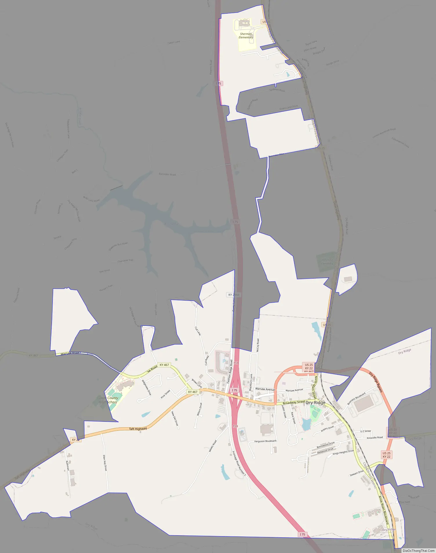
Online Interactive Map
Click on ![]() to view map in "full screen" mode.
to view map in "full screen" mode.
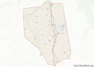
Dry Ridge location map. Where is Dry Ridge city?


History
The community now known as Dry Ridge was settled about 1792 as “Campbell’s Station” near a spring said to have medicinal qualities.
A post office called “Dry Ridge” was established in 1815 at an inn. Dry Ridge takes its name from a ridge surrounded by inns where travelers stopped for water before proceeding.
In 1909, the city was incorporated, the last incorporated in Grant County. That same year, a creamery company found mineral water which was believed to have medical properties. During the early part of the 20th century, Dry Ridge was the home of Kentucky Carlsbad Mineral Water Bottling Company, and home of the Carlsbad Hotel completed in 1911. People came to Dry Ridge from all over the eastern United States to take the mineral water of what was known as the Kentucky Carlsbad Springs, although it was not a spring, but a well. The hotel was destroyed by fire on February 25, 1927.
In 1937, a water distribution system was created with water from Williamstown, Kentucky‘s lake.
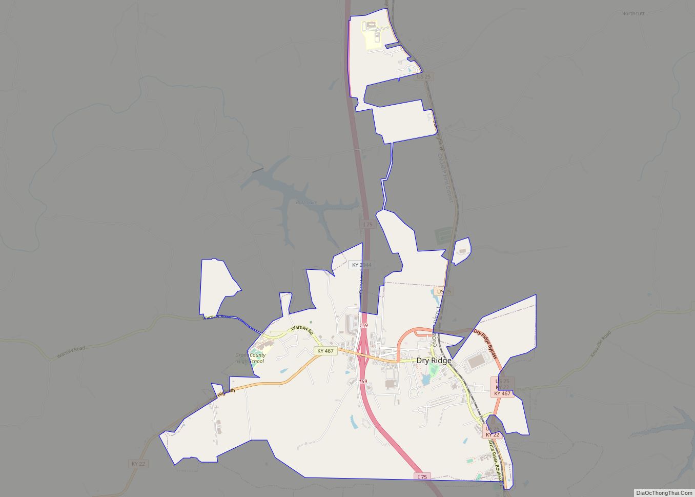
Dry Ridge Road Map
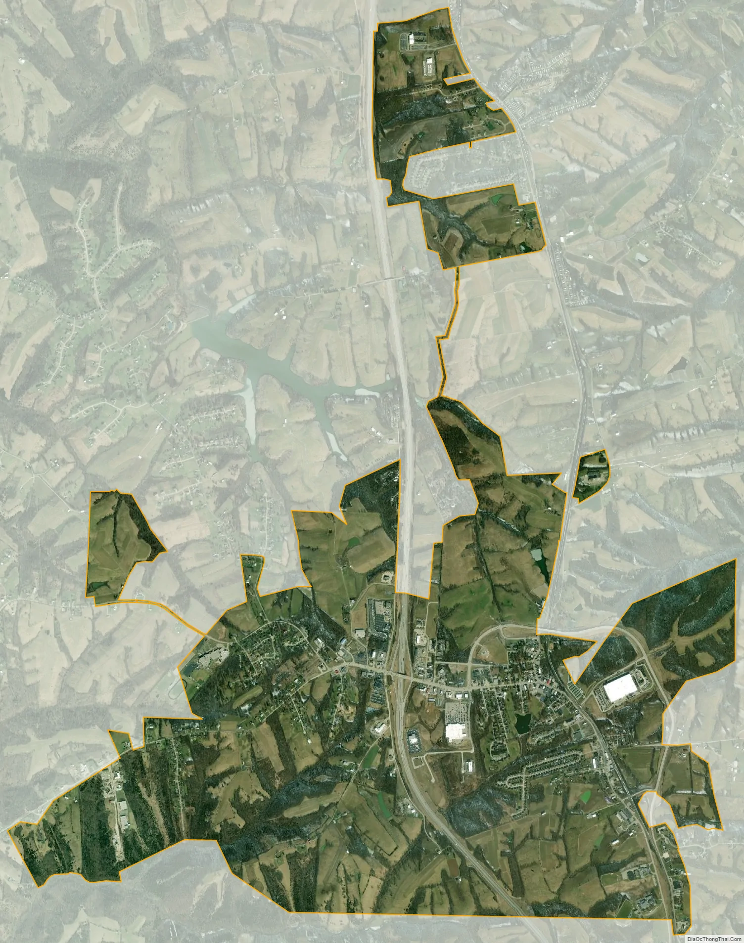
Dry Ridge city Satellite Map
Geography
Dry Ridge is located north of the center of Grant County at 38°40′56″N 84°35′47″W / 38.68222°N 84.59639°W / 38.68222; -84.59639 (38.682242, -84.596370). It is bordered to the south by the city of Williamstown, the county seat. Interstate 75 passes through Dry Ridge, with access from Exit 159. I-75 leads north 35 miles (56 km) to Cincinnati and south 49 miles (79 km) to Lexington. U.S. Route 25 (Main Street) runs through the center of Dry Ridge, leading north 7 miles (11 km) to Crittenden and south 4 miles (6 km) to the center of Williamstown.
According to the United States Census Bureau, Dry Ridge has a total area of 4.6 square miles (11.8 km), of which 0.03 square miles (0.09 km), or 0.72%, is water.
See also
Map of Kentucky State and its subdivision:- Adair
- Allen
- Anderson
- Ballard
- Barren
- Bath
- Bell
- Boone
- Bourbon
- Boyd
- Boyle
- Bracken
- Breathitt
- Breckinridge
- Bullitt
- Butler
- Caldwell
- Calloway
- Campbell
- Carlisle
- Carroll
- Carter
- Casey
- Christian
- Clark
- Clay
- Clinton
- Crittenden
- Cumberland
- Daviess
- Edmonson
- Elliott
- Estill
- Fayette
- Fleming
- Floyd
- Franklin
- Fulton
- Gallatin
- Garrard
- Grant
- Graves
- Grayson
- Green
- Greenup
- Hancock
- Hardin
- Harlan
- Harrison
- Hart
- Henderson
- Henry
- Hickman
- Hopkins
- Jackson
- Jefferson
- Jessamine
- Johnson
- Kenton
- Knott
- Knox
- Larue
- Laurel
- Lawrence
- Lee
- Leslie
- Letcher
- Lewis
- Lincoln
- Livingston
- Logan
- Lyon
- Madison
- Magoffin
- Marion
- Marshall
- Martin
- Mason
- McCracken
- McCreary
- McLean
- Meade
- Menifee
- Mercer
- Metcalfe
- Monroe
- Montgomery
- Morgan
- Muhlenberg
- Nelson
- Nicholas
- Ohio
- Oldham
- Owen
- Owsley
- Pendleton
- Perry
- Pike
- Powell
- Pulaski
- Robertson
- Rockcastle
- Rowan
- Russell
- Scott
- Shelby
- Simpson
- Spencer
- Taylor
- Todd
- Trigg
- Trimble
- Union
- Warren
- Washington
- Wayne
- Webster
- Whitley
- Wolfe
- Woodford
- Alabama
- Alaska
- Arizona
- Arkansas
- California
- Colorado
- Connecticut
- Delaware
- District of Columbia
- Florida
- Georgia
- Hawaii
- Idaho
- Illinois
- Indiana
- Iowa
- Kansas
- Kentucky
- Louisiana
- Maine
- Maryland
- Massachusetts
- Michigan
- Minnesota
- Mississippi
- Missouri
- Montana
- Nebraska
- Nevada
- New Hampshire
- New Jersey
- New Mexico
- New York
- North Carolina
- North Dakota
- Ohio
- Oklahoma
- Oregon
- Pennsylvania
- Rhode Island
- South Carolina
- South Dakota
- Tennessee
- Texas
- Utah
- Vermont
- Virginia
- Washington
- West Virginia
- Wisconsin
- Wyoming