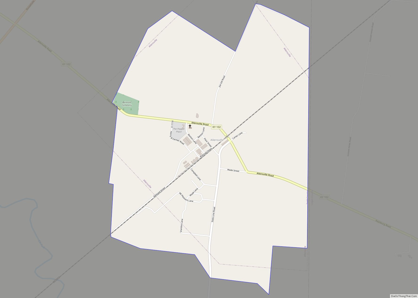
Map of Annville CDP

Map of Annville CDP, Kentucky

Annville is an unincorporated community, a census-designated place (CDP), and the largest community in Jackson County, KY. As of the 2020 census, the population was 1,102. The community was established in 1878 and named for local resident Nancy Ann Johnson. The community offers a few services such as a post office, grocery store, gas station, … Read more

Map of Arlington city, Kentucky

Map of Arlington city, Kentucky

Arlington is a home rule-class city in Carlisle County, Kentucky, in the United States. The population was 324 at the 2010 census, a drop from 395 in 2000. It was formally incorporated by the state assembly in 1876. Arlington city overview: Name: Arlington city LSAD Code: 25 LSAD Description: city (suffix) State: Kentucky County: Carlisle … Read more

Map of Arjay CDP

Map of Arjay CDP

Arjay is an unincorporated community and coal town in Bell County, Kentucky, United States. Arjay is located on Kentucky Route 66 4 miles (6.4 km) northeast of Pineville. Arjay has a post office with ZIP code 40902, which opened on February 23, 1911. The community’s name comes from the initials of coal operator R. J. Asher. … Read more

Map of Anthoston CDP

Map of Anthoston CDP

Anthoston is an unincorporated community and census-designated place (CDP) in Henderson County, Kentucky, United States. It is 6 miles (10 km) south of Henderson, the county seat, between U.S. Route 41 to the west and Interstate 69, the former Pennyrile Parkway, to the east. There is no direct access to it from I-69. Anthoston Had a … Read more

Map of Auburn city, Kentucky

Map of Auburn city, Kentucky

Auburn is a home rule-class city in Logan County, Kentucky, in the United States. The population was 1,340 at the 2010 census. Auburn city overview: Name: Auburn city LSAD Code: 25 LSAD Description: city (suffix) State: Kentucky County: Logan County Elevation: 640 ft (195 m) Total Area: 1.83 sq mi (4.75 km²) Land Area: 1.83 sq mi (4.74 km²) Water Area: 0.00 sq mi (0.00 km²) … Read more

Map of Ashland city, Kentucky

Map of Ashland city, Kentucky

Ashland is a home rule-class city in Boyd County, Kentucky, United States. The largest city in Boyd County, Ashland is located upon a southern bank of the Ohio River at the state border with Ohio and near West Virginia. The population was 21,625 at the 2020 census. Ashland is a principal city of the Huntington–Ashland … Read more

Map of Artemus CDP

Map of Artemus CDP

Artemus (also, Nip and Tuck) is an unincorporated community and census-designated place in Knox County, Kentucky, United States. As of the 2010 United States Census the population was 590. Artemus CDP overview: Name: Artemus CDP LSAD Code: 57 LSAD Description: CDP (suffix) State: Kentucky County: Knox County Elevation: 1,001 ft (305 m) Total Area: 1.35 sq mi (3.51 km²) Land … Read more

Map of Auxier CDP

Map of Auxier CDP

Auxier is an unincorporated community and census-designated place (CDP) in Floyd County, Kentucky, United States. The 2010 United States Census reported that Auxier’s population was 669, of which 661 persons were white and 2 persons were black. Auxier CDP overview: Name: Auxier CDP LSAD Code: 57 LSAD Description: CDP (suffix) State: Kentucky County: Floyd County … Read more

Map of Augusta city, Kentucky

Map of Augusta city, Kentucky

Augusta is a home rule-class city in Bracken County, Kentucky, in the United States. It is sited upon the southern bank of the Ohio River. As of the 2010 census, the city population was 1,190. When Bracken County was organized in 1796, Augusta was the county seat. In 1839, a new county courthouse was built … Read more

Map of Audubon Park city

Map of Audubon Park city, Kentucky

Audubon Park is a home rule-class city in central Jefferson County, Kentucky, United States. The population was 1,473 at the 2010 census. It is located about 5 miles (8 km) south of downtown Louisville and is surrounded on all sides by the city of Louisville. Audubon Park city overview: Name: Audubon Park city LSAD Code: 25 … Read more

Map of Barbourmeade city

Map of Barbourmeade city

Barbourmeade is a home rule-class city in Jefferson County, Kentucky, United States. It was formally incorporated by the state assembly in 1962. The population was 1,218 at the 2010 census. The community derives its name from Thomas and Richard Barbour, early settlers for whom Barbour Lane is named. Barbourmeade incorporated as a city in October … Read more

Map of Bandana CDP

Map of Bandana CDP

Bandana is a census-designated place (CDP) in Ballard County, Kentucky, United States. As of the 2020 census it had a population of 177. Bandana CDP overview: Name: Bandana CDP LSAD Code: 57 LSAD Description: CDP (suffix) State: Kentucky County: Ballard County Elevation: 358 ft (109 m) Total Area: 1.89 sq mi (4.89 km²) Land Area: 1.89 sq mi (4.89 km²) Water Area: 0.00 sq mi … Read more