Ashland is a home rule-class city in Boyd County, Kentucky, United States. The largest city in Boyd County, Ashland is located upon a southern bank of the Ohio River at the state border with Ohio and near West Virginia. The population was 21,625 at the 2020 census. Ashland is a principal city of the Huntington–Ashland metropolitan area, referred to locally as the “Tri-State area”, home to 359,862 residents as of 2020. Ashland serves as an important economic and medical center for northeastern Kentucky.
| Name: | Ashland city |
|---|---|
| LSAD Code: | 25 |
| LSAD Description: | city (suffix) |
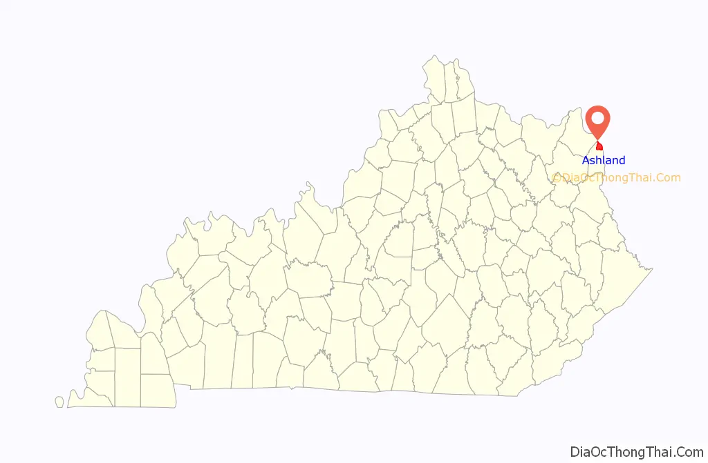
| State: | Kentucky |
| County: | Boyd County |
| Incorporated: | Ashland, 1854 |
| Elevation: | 551 ft (168 m) |
| Land Area: | 10.73 sq mi (27.80 km²) |
| Water Area: | 0.03 sq mi (0.08 km²) |
| Population Density: | 2,014.44/sq mi (777.76/km²) |
| ZIP code: | 41101, 41102, 41105 |
| Area code: | 606 |
| FIPS code: | 2102368 |
| GNISfeature ID: | 0486092 |
| Website: | www.ashlandky.gov |
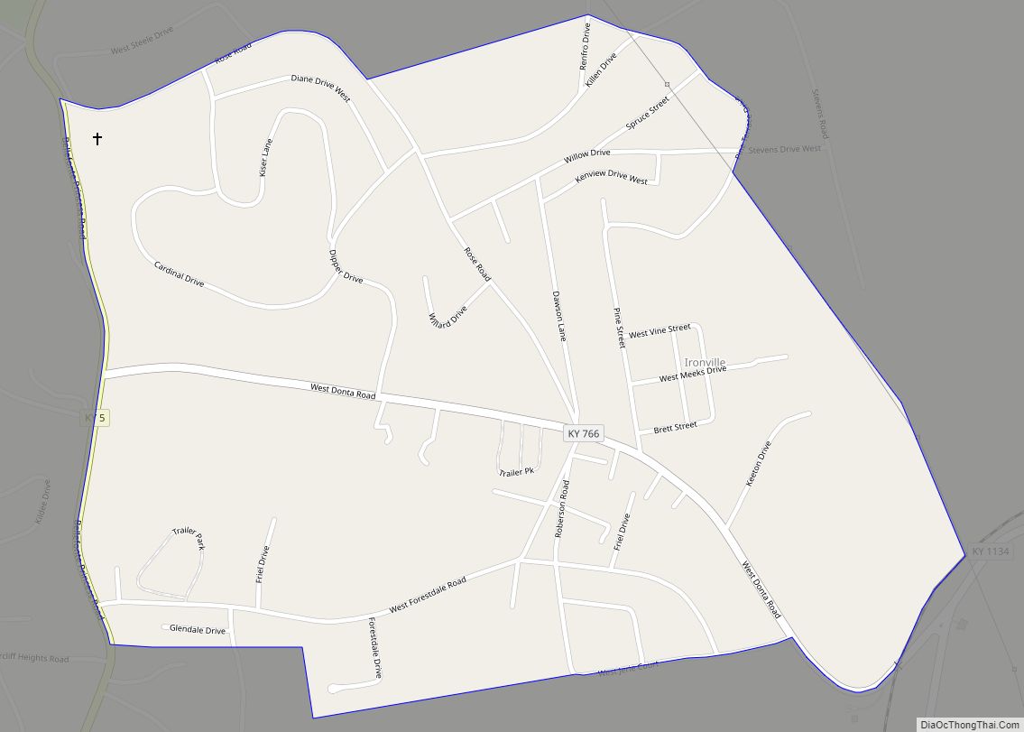
Online Interactive Map
Click on ![]() to view map in "full screen" mode.
to view map in "full screen" mode.
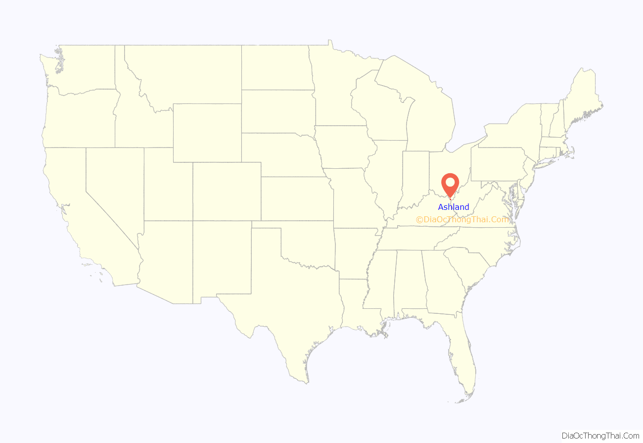
Ashland location map. Where is Ashland city?
History
Ashland dates back to the migration of the Poage family from the Shenandoah Valley via the Cumberland Gap in 1786. They erected a homestead along the Ohio River and named it Poage’s Landing. Also called Poage Settlement, the community that developed around it remained an extended-family affair until the mid-19th century. In 1854, the city name was changed to Ashland, after Henry Clay’s Lexington estate and to reflect the city’s growing industrial base. The city’s early industrial growth was a result of the Ohio Valley’s pig iron industry and, particularly, the 1854 charter of the Kentucky Iron, Coal, and Manufacturing Company by the Kentucky General Assembly. The city was formally incorporated by the General Assembly two years later in 1856. Major industrial employers in the first half of the 20th century included Armco, Ashland Oil and Refining Company, the C&O Railroad, Allied Chemical & Dye Company’s Semet Solvay, and Mansbach Steel.
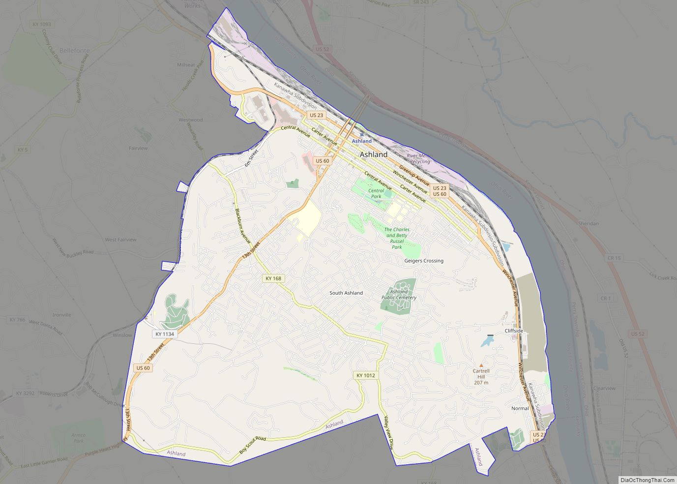
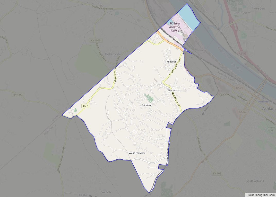
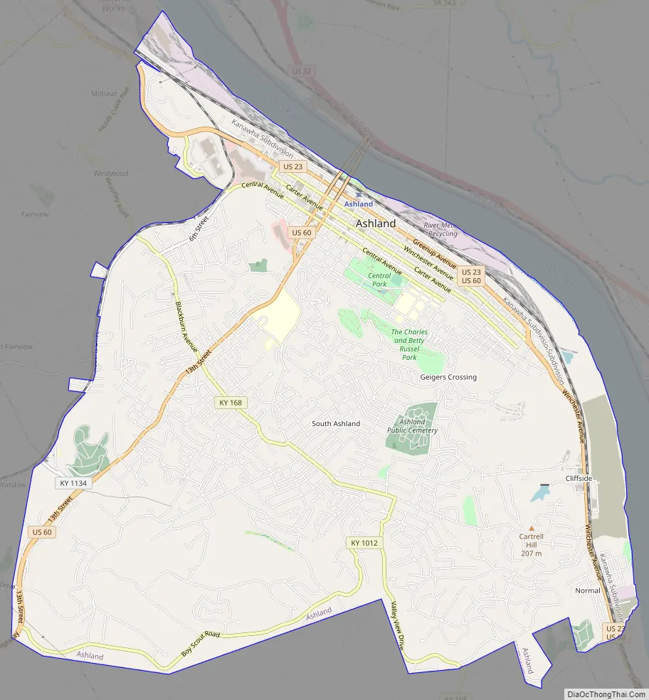
Ashland Road Map
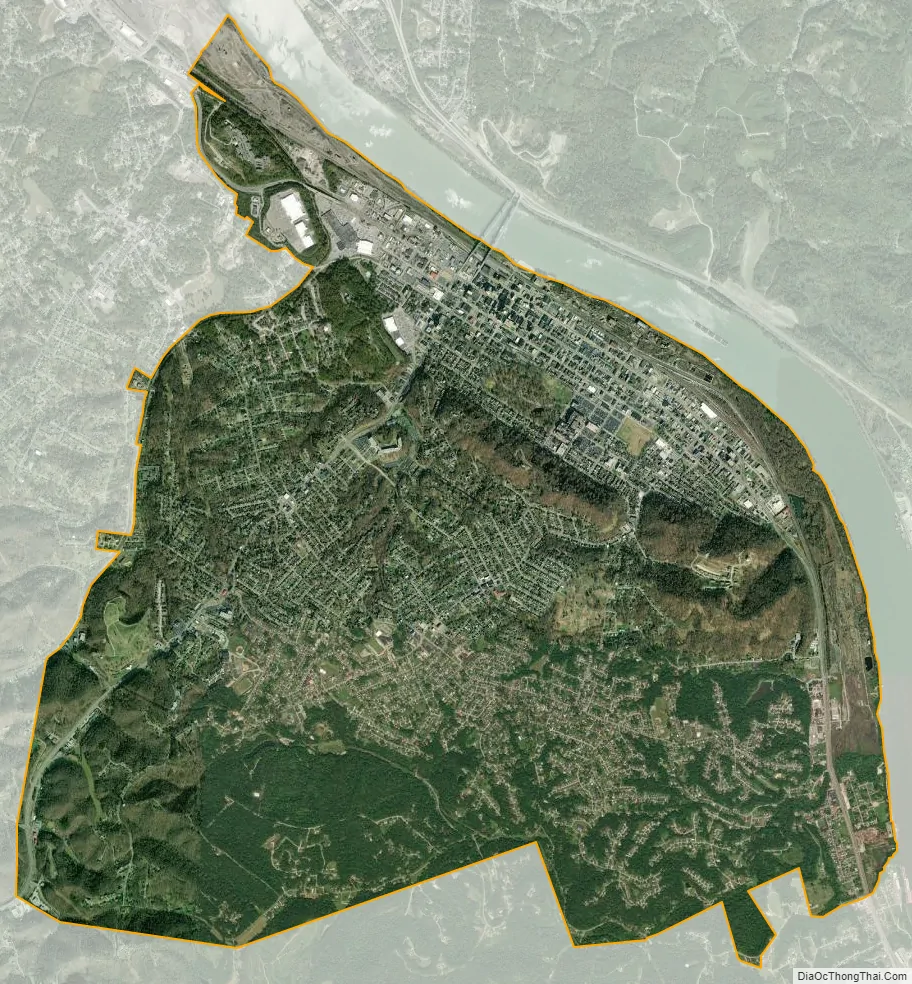
Ashland city Satellite Map
Geography
Ashland is located at 38°27′50″N 82°38′30″W / 38.464017°N 82.641571°W / 38.464017; -82.641571 (38.464017, −82.641571). It lies within the ecoregion of the Western Allegheny Plateau.
According to the United States Census Bureau, the city has a total area of 10.8 square miles (27.9 km), of which 10.7 square miles (27.8 km) is land and 0.039 square miles (0.1 km), or 0.30%, is water.
Cityscape
Ashland’s central business district extends from 12th Street to 18th Street, and from Carter Avenue to Greenup Avenue. It includes many historically preserved and notable buildings, such as the Paramount Arts Center and the Ashland Bank Building, which is built to Manhattan height and style standards and serves as a reminder of what Ashland leaders hoped it would become.
Climate
Ashland is in the humid subtropical climate zone, and distinctly experiences all four seasons, with vivid fall foliage and occasional snow in winter. The average high is 88 °F in July, the warmest month, with the average lows of 19 °F occurring in January, the coolest month. The highest recorded temperature was 105 °F in July 1954. The lowest recorded temperature was −25 °F in January 1994. Average annual precipitation is 42.8 inches (1,090 mm), with the wettest month being July, averaging 4.7 inches (120 mm).
See also
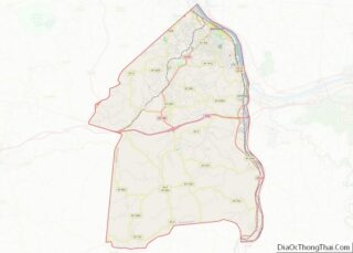
Map of Kentucky State and its subdivision:- Adair
- Allen
- Anderson
- Ballard
- Barren
- Bath
- Bell
- Boone
- Bourbon
- Boyd
- Boyle
- Bracken
- Breathitt
- Breckinridge
- Bullitt
- Butler
- Caldwell
- Calloway
- Campbell
- Carlisle
- Carroll
- Carter
- Casey
- Christian
- Clark
- Clay
- Clinton
- Crittenden
- Cumberland
- Daviess
- Edmonson
- Elliott
- Estill
- Fayette
- Fleming
- Floyd
- Franklin
- Fulton
- Gallatin
- Garrard
- Grant
- Graves
- Grayson
- Green
- Greenup
- Hancock
- Hardin
- Harlan
- Harrison
- Hart
- Henderson
- Henry
- Hickman
- Hopkins
- Jackson
- Jefferson
- Jessamine
- Johnson
- Kenton
- Knott
- Knox
- Larue
- Laurel
- Lawrence
- Lee
- Leslie
- Letcher
- Lewis
- Lincoln
- Livingston
- Logan
- Lyon
- Madison
- Magoffin
- Marion
- Marshall
- Martin
- Mason
- McCracken
- McCreary
- McLean
- Meade
- Menifee
- Mercer
- Metcalfe
- Monroe
- Montgomery
- Morgan
- Muhlenberg
- Nelson
- Nicholas
- Ohio
- Oldham
- Owen
- Owsley
- Pendleton
- Perry
- Pike
- Powell
- Pulaski
- Robertson
- Rockcastle
- Rowan
- Russell
- Scott
- Shelby
- Simpson
- Spencer
- Taylor
- Todd
- Trigg
- Trimble
- Union
- Warren
- Washington
- Wayne
- Webster
- Whitley
- Wolfe
- Woodford
- Alabama
- Alaska
- Arizona
- Arkansas
- California
- Colorado
- Connecticut
- Delaware
- District of Columbia
- Florida
- Georgia
- Hawaii
- Idaho
- Illinois
- Indiana
- Iowa
- Kansas
- Kentucky
- Louisiana
- Maine
- Maryland
- Massachusetts
- Michigan
- Minnesota
- Mississippi
- Missouri
- Montana
- Nebraska
- Nevada
- New Hampshire
- New Jersey
- New Mexico
- New York
- North Carolina
- North Dakota
- Ohio
- Oklahoma
- Oregon
- Pennsylvania
- Rhode Island
- South Carolina
- South Dakota
- Tennessee
- Texas
- Utah
- Vermont
- Virginia
- Washington
- West Virginia
- Wisconsin
- Wyoming