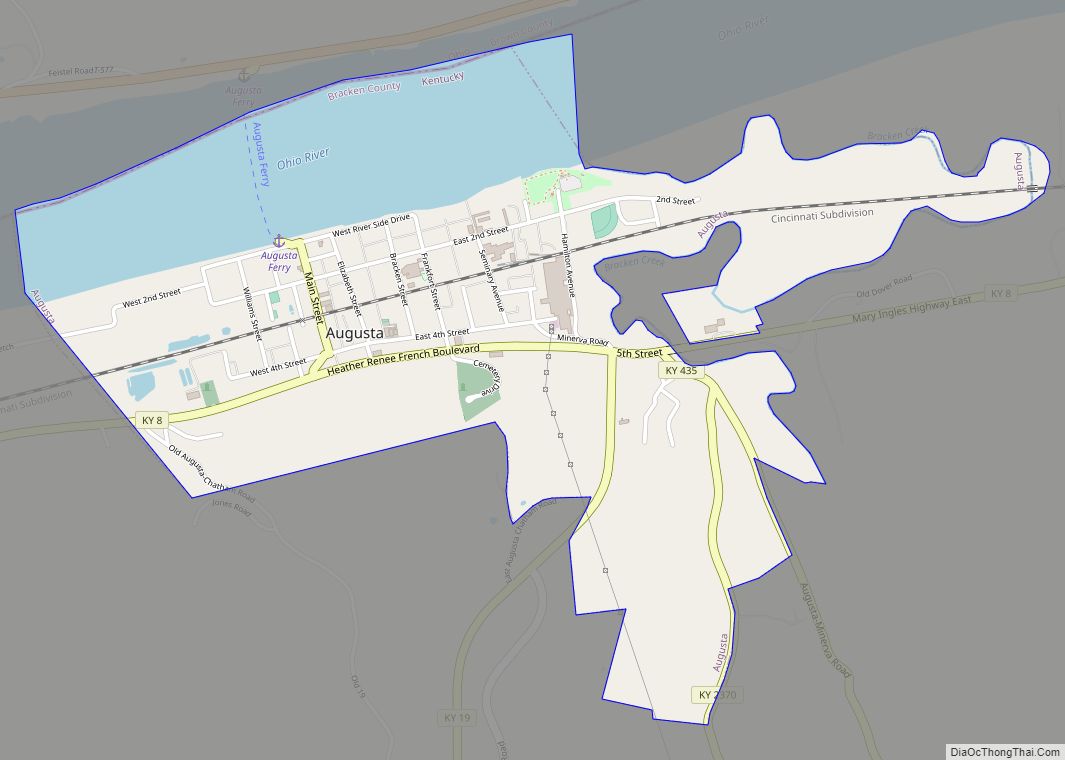
Augusta is a home rule-class city in Bracken County, Kentucky, in the United States. It is sited upon the southern bank of the Ohio River. As of the 2010 census, the city population was 1,190. When Bracken County was organized in 1796, Augusta was the county seat. In 1839, a new county courthouse was built at a more central location in Brooksville. The city was formally incorporated by the state assembly in 1850.
| Name: | Augusta city |
|---|---|
| LSAD Code: | 25 |
| LSAD Description: | city (suffix) |
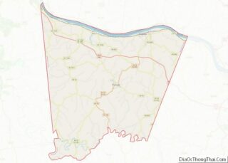
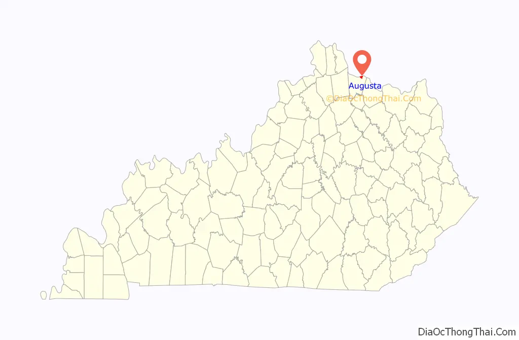
| State: | Kentucky |
| County: | Bracken County |
| Elevation: | 515 ft (157 m) |
| Total Area: | 1.62 sq mi (4.19 km²) |
| Land Area: | 1.19 sq mi (3.08 km²) |
| Water Area: | 0.43 sq mi (1.11 km²) 26.67% |
| Total Population: | 1,096 |
| Population Density: | 921.01/sq mi (355.51/km²) |
| ZIP code: | 41002 |
| Area code: | 606 |
| FIPS code: | 2102674 |
| GNISfeature ID: | 0486141 |
| Website: | www.augustaky.com |
Online Interactive Map
Click on ![]() to view map in "full screen" mode.
to view map in "full screen" mode.
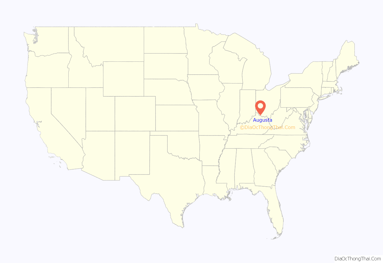
Augusta location map. Where is Augusta city?
History
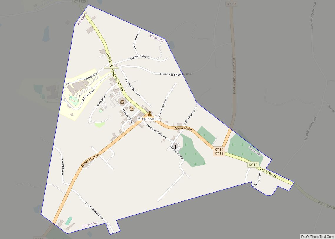
Augusta was founded by Philip Buckner in 1786 as a trading post along the Ohio River. The city was named after Augusta County, Virginia. The city grew quickly and in 1796 became county seat of the new Bracken County. The county seat was moved to Oxford, then back to Augusta, then finally to Brooksville in 1839.
In 1862, Confederate Colonel Basil W. Duke attacked the town as part of the Kentucky Campaign. While he was able to drive off a pair of Union gunboats in the Ohio River and defeat the local Unionist militia in house-to-house fighting, heavy losses forced him to abandon plans to cross into Ohio.
The city was home to five separate schools, one private and four public. The most famous built was the Augusta College, which served the entire Bracken area until 1887 when the high school was moved into that spot. The college continued to serve the city until October 31, 1896.
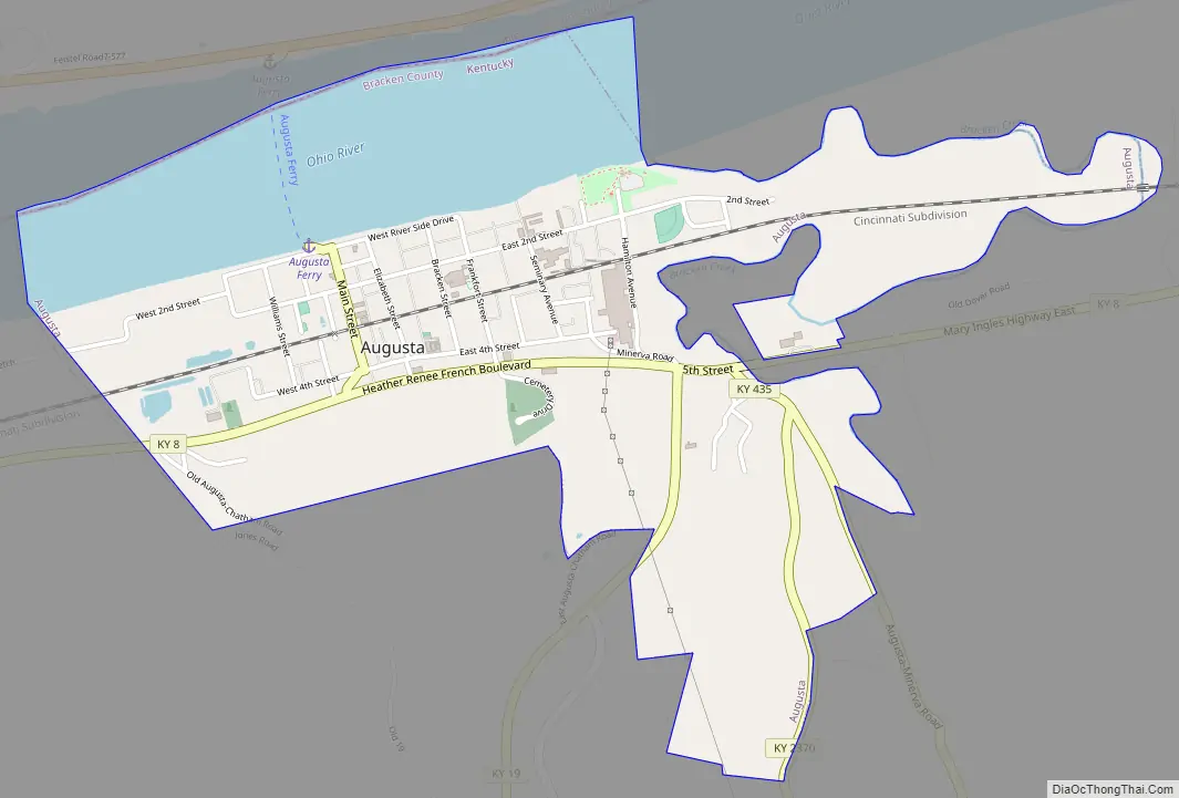
Augusta Road Map
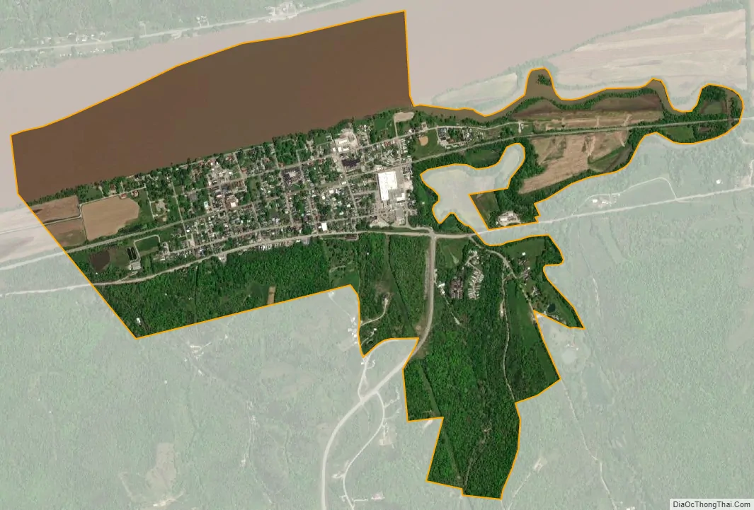
Augusta city Satellite Map
Geography
Augusta is located in northeastern Kentucky at 38°46′21″N 84°0′6″W / 38.77250°N 84.00167°W / 38.77250; -84.00167 (38.772556, -84.001530). Kentucky Route 8 (Fifth Street) is the main road through the city. Route 8 leads northwest 42 miles (68 km) to downtown Cincinnati and southeast 19 miles (31 km) to Maysville. The Augusta Ferry crosses the Ohio River into Lewis Township, Brown County, Ohio, near Higginsport.
According to the United States Census Bureau, Augusta has a total area of 1.6 square miles (4.2 km), of which 1.4 square miles (3.5 km) is land and 0.27 square miles (0.7 km), or 16.6%, is water.
See also
Map of Kentucky State and its subdivision:- Adair
- Allen
- Anderson
- Ballard
- Barren
- Bath
- Bell
- Boone
- Bourbon
- Boyd
- Boyle
- Bracken
- Breathitt
- Breckinridge
- Bullitt
- Butler
- Caldwell
- Calloway
- Campbell
- Carlisle
- Carroll
- Carter
- Casey
- Christian
- Clark
- Clay
- Clinton
- Crittenden
- Cumberland
- Daviess
- Edmonson
- Elliott
- Estill
- Fayette
- Fleming
- Floyd
- Franklin
- Fulton
- Gallatin
- Garrard
- Grant
- Graves
- Grayson
- Green
- Greenup
- Hancock
- Hardin
- Harlan
- Harrison
- Hart
- Henderson
- Henry
- Hickman
- Hopkins
- Jackson
- Jefferson
- Jessamine
- Johnson
- Kenton
- Knott
- Knox
- Larue
- Laurel
- Lawrence
- Lee
- Leslie
- Letcher
- Lewis
- Lincoln
- Livingston
- Logan
- Lyon
- Madison
- Magoffin
- Marion
- Marshall
- Martin
- Mason
- McCracken
- McCreary
- McLean
- Meade
- Menifee
- Mercer
- Metcalfe
- Monroe
- Montgomery
- Morgan
- Muhlenberg
- Nelson
- Nicholas
- Ohio
- Oldham
- Owen
- Owsley
- Pendleton
- Perry
- Pike
- Powell
- Pulaski
- Robertson
- Rockcastle
- Rowan
- Russell
- Scott
- Shelby
- Simpson
- Spencer
- Taylor
- Todd
- Trigg
- Trimble
- Union
- Warren
- Washington
- Wayne
- Webster
- Whitley
- Wolfe
- Woodford
- Alabama
- Alaska
- Arizona
- Arkansas
- California
- Colorado
- Connecticut
- Delaware
- District of Columbia
- Florida
- Georgia
- Hawaii
- Idaho
- Illinois
- Indiana
- Iowa
- Kansas
- Kentucky
- Louisiana
- Maine
- Maryland
- Massachusetts
- Michigan
- Minnesota
- Mississippi
- Missouri
- Montana
- Nebraska
- Nevada
- New Hampshire
- New Jersey
- New Mexico
- New York
- North Carolina
- North Dakota
- Ohio
- Oklahoma
- Oregon
- Pennsylvania
- Rhode Island
- South Carolina
- South Dakota
- Tennessee
- Texas
- Utah
- Vermont
- Virginia
- Washington
- West Virginia
- Wisconsin
- Wyoming