Map of Seneca Gardens city

Map of Seneca Gardens city

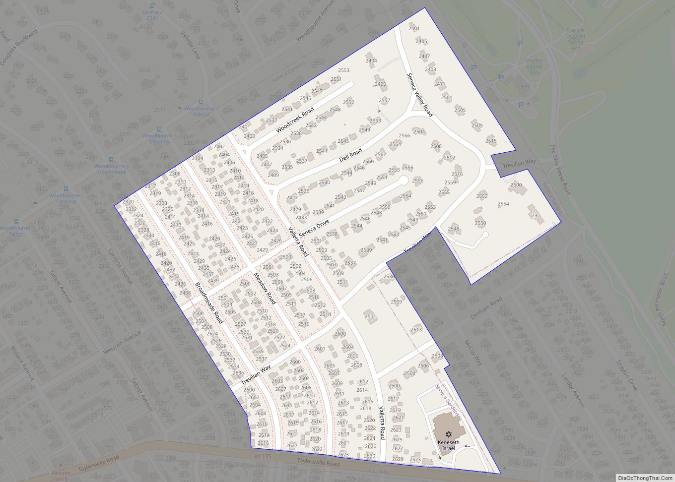
Seneca Gardens is a home rule-class city in Jefferson County, Kentucky, United States, and a part of the Louisville Metro government. With the single exception of the Keneseth Israel Synagogue, all buildings within city limits are residential. The population was 696 as of the 2010 census. Seneca Gardens city overview: Name: Seneca Gardens city LSAD … Read more

Map of Silver Grove city

Map of Silver Grove city

Silver Grove is a home rule-class city along the Ohio River in Campbell County, Kentucky, in the United States. The population was 1,102 during the 2010 U.S. Census. Silver Grove city overview: Name: Silver Grove city LSAD Code: 25 LSAD Description: city (suffix) State: Kentucky County: Campbell County Elevation: 495 ft (151 m) Total Area: 1.64 sq mi (4.25 km²) … Read more

Map of Shively city

Map of Shively city

Shively is a home rule-class city in Jefferson County, Kentucky, United States, and a suburb of Louisville within the Louisville Metro government. As of the 2010 census, the city’s population was 15,264, reflecting an increase of 107 (+0.7%) from 15,157 in 2000. Shively city overview: Name: Shively city LSAD Code: 25 LSAD Description: city (suffix) … Read more

Map of Shepherdsville city

Map of Shepherdsville city

Shepherdsville is a home rule-class city on the Salt River in Bullitt County, Kentucky, in the United States. It is the second largest city and seat of its county, located just south of Louisville. The population was 14,201 during the 2020 U.S. Census. Shepherdsville city overview: Name: Shepherdsville city LSAD Code: 25 LSAD Description: city … Read more

Map of Smithfield city, Kentucky

Map of Smithfield city, Kentucky

Smithfield is a home rule-class city in Henry County, Kentucky, United States. The population was 106 at the 2010 census. The mayor of Smithfield is Greg Gephart. Smithfield city overview: Name: Smithfield city LSAD Code: 25 LSAD Description: city (suffix) State: Kentucky County: Henry County Elevation: 876 ft (267 m) Total Area: 0.14 sq mi (0.35 km²) Land Area: 0.14 sq mi … Read more

Map of Slaughters city

Map of Slaughters city

Slaughters is a home rule-class city in Webster County, Kentucky, United States. The population was 238 at the 2000 census. Slaughters lies just west of US 41 and 9.5 mi (15.3 km) east of Dixon. CSX Transportation runs through Slaughters and operates a siding track that is named after the city. Slaughters city overview: Name: Slaughters city … Read more

Map of Simpsonville city

Map of Simpsonville city, Kentucky

Simpsonville is a home rule-class city in Shelby County, Kentucky, in the United States. It is located 8 miles west of Shelbyville, Kentucky and 23 miles east of Louisville situated along U.S. 60. The population was 2,484 during the 2010 U.S. Census. Simpsonville city overview: Name: Simpsonville city LSAD Code: 25 LSAD Description: city (suffix) … Read more

Map of Somerset city, Kentucky

Map of Somerset city, Kentucky

Somerset is a home rule-class city in Pulaski County, Kentucky, United States. The city population was 11,924 according to the 2020 census. It is the seat of Pulaski County. Somerset city overview: Name: Somerset city LSAD Code: 25 LSAD Description: city (suffix) State: Kentucky County: Pulaski County Elevation: 971 ft (296 m) Total Area: 14.09 sq mi (36.48 km²) Land … Read more

Map of Smiths Grove city

Map of Smiths Grove city

Smiths Grove is a home rule-class city in Warren County, Kentucky, United States. The population was 714 at the 2010 census. It is included in the Bowling Green, Kentucky Metropolitan Statistical Area. Smiths Grove city overview: Name: Smiths Grove city LSAD Code: 25 LSAD Description: city (suffix) State: Kentucky County: Warren County Elevation: 636 ft (194 m) … Read more

Map of Smithland city, Kentucky

Map of Smithland city, Kentucky

Smithland is a home rule-class city in Livingston County, Kentucky, United States, at the confluence of the Ohio and Cumberland Rivers. The population was 301 at the 2010 census, a drop from 401 in 2000. It is the county seat of Livingston County. Smithland is part of the Paducah, KY-IL Micropolitan Statistical Area. Smithland city … Read more

Map of South Park View city

Map of South Park View city

South Park View is a home rule-class city in Jefferson County, Kentucky, United States. The population was 0 at the 2020 census. The community was named for its location near South Park Hill, elevation 902 feet (275 m), the highest point in Jefferson County. It is the smallest incorporated city in the commonwealth of Kentucky and … Read more

Map of South Carrollton city

Map of South Carrollton city

South Carrollton is a home rule-class city in Muhlenberg County, Kentucky, United States. The population was 184 at the 2000 census. Founded as Randolph Old Farm in 1838, an early pioneer changed the name of the city to honor his son, Carroll. The name was prefixed with south in order to disambiguate the city from … Read more