Sonora is a home rule-class city in Hardin County, Kentucky, United States. The population was 513 at the 2010 census, up from 350 at the 2000 census. It is included in the Elizabethtown, Kentucky Metropolitan Statistical Area.
| Name: | Sonora city |
|---|---|
| LSAD Code: | 25 |
| LSAD Description: | city (suffix) |
| State: | Kentucky |
| County: | Hardin County |
| Elevation: | 725 ft (221 m) |
| Total Area: | 1.36 sq mi (3.53 km²) |
| Land Area: | 1.36 sq mi (3.51 km²) |
| Water Area: | 0.01 sq mi (0.02 km²) |
| Total Population: | 565 |
| Population Density: | 416.67/sq mi (160.90/km²) |
| ZIP code: | 42776 |
| Area code: | 270 & 364 |
| FIPS code: | 2171724 |
| GNISfeature ID: | 0503878 |
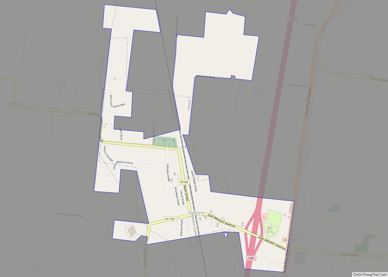
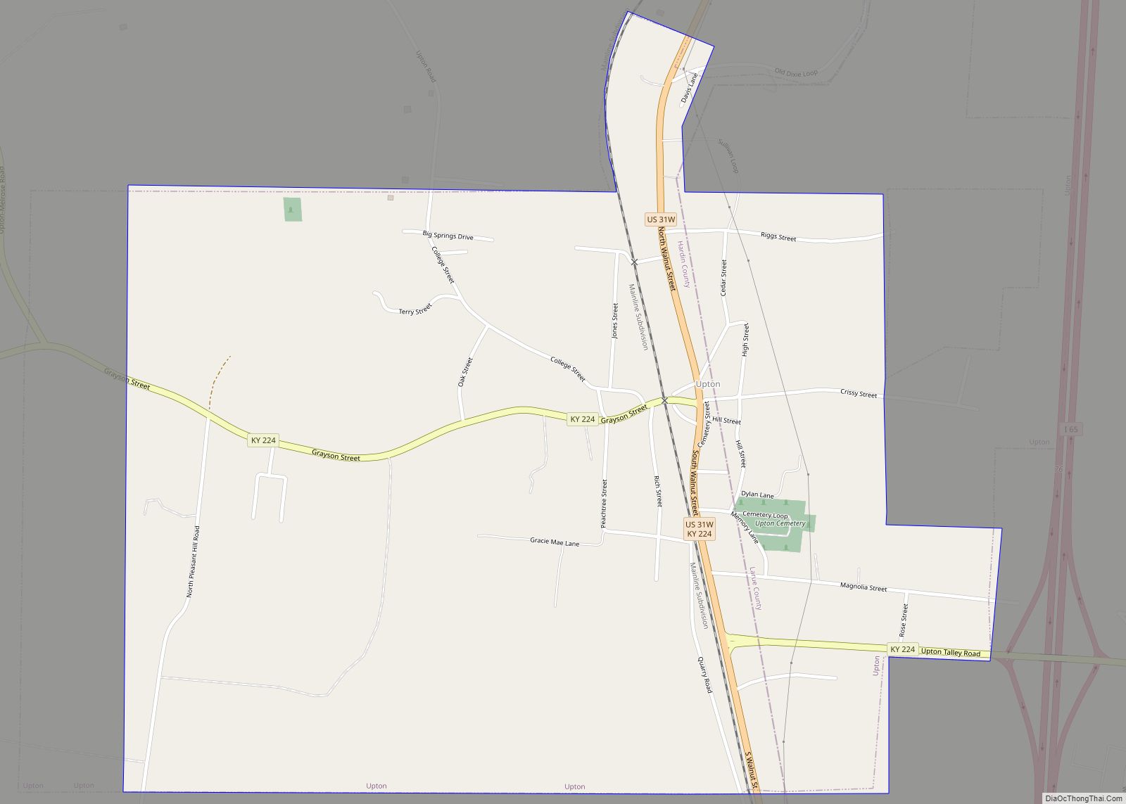
Online Interactive Map
Click on ![]() to view map in "full screen" mode.
to view map in "full screen" mode.
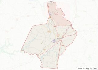
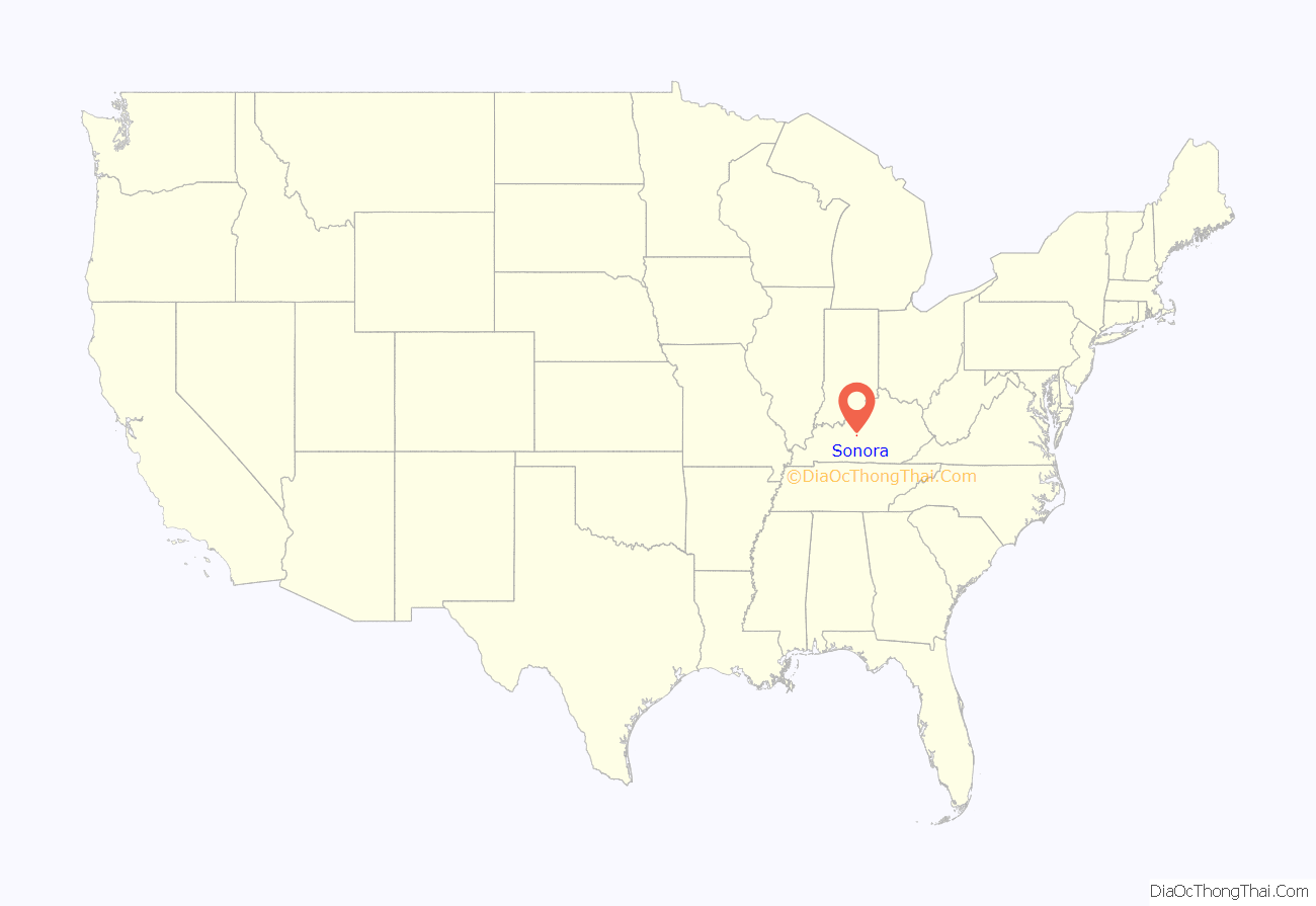
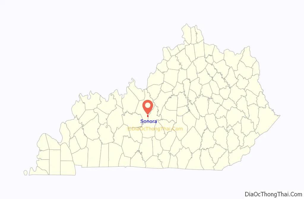
Sonora location map. Where is Sonora city?
History
Sonora began as an L&N Railroad construction camp known as “Bucksnort” in the late 1850s. This name is believed to have been inspired by the sounds of early locomotives, which the workers thought resembled deer snorts. When a depot was established at the site in 1859, the name was changed to “Sonora”. This may have referred to Sonora, Mexico, the home of a railroad contractor.
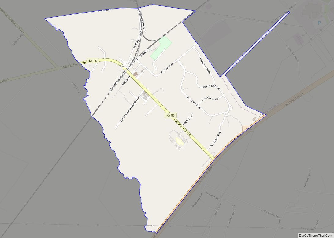
Sonora Road Map
Sonora city Satellite Map

Geography
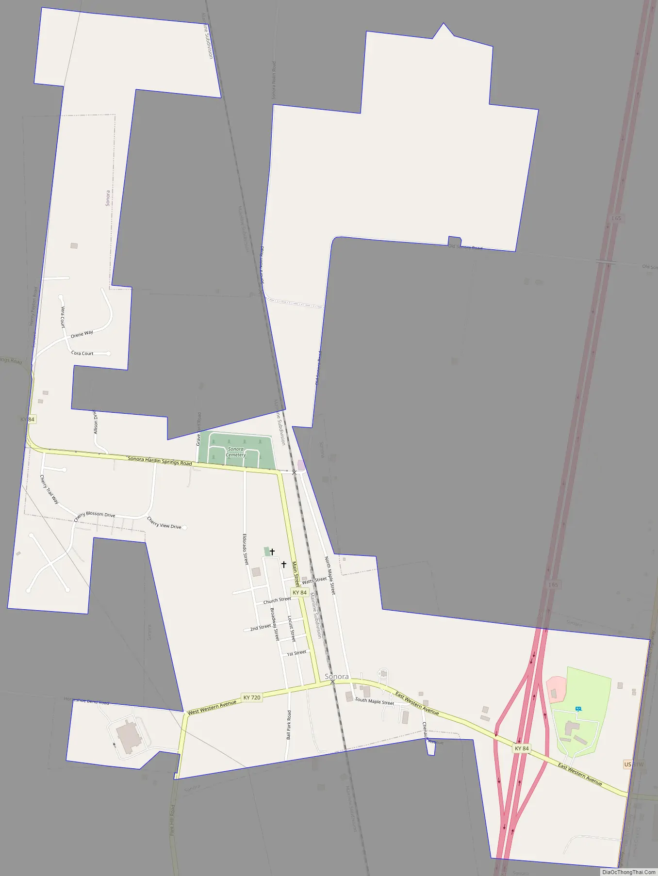
Sonora is located in southeastern Hardin County at 37°31′33″N 85°53′40″W / 37.52583°N 85.89444°W / 37.52583; -85.89444 (37.525783, -85.894373). The city is concentrated around the intersection of Kentucky Route 84 and Kentucky Route 720, with its municipal boundaries stretching eastward to the Hardin-LaRue county line. Interstate 65 passes through the eastern end of the city, with access from Exit 81. I-65 leads north 13 miles (21 km) to Elizabethtown, the county seat, and south 18 miles (29 km) to Munfordville.
According to the United States Census Bureau, the city has a total area of 1.2 square miles (3.0 km), of which 0.01 square miles (0.03 km), or 0.98%, are water.
See also
Map of Kentucky State and its subdivision:- Adair
- Allen
- Anderson
- Ballard
- Barren
- Bath
- Bell
- Boone
- Bourbon
- Boyd
- Boyle
- Bracken
- Breathitt
- Breckinridge
- Bullitt
- Butler
- Caldwell
- Calloway
- Campbell
- Carlisle
- Carroll
- Carter
- Casey
- Christian
- Clark
- Clay
- Clinton
- Crittenden
- Cumberland
- Daviess
- Edmonson
- Elliott
- Estill
- Fayette
- Fleming
- Floyd
- Franklin
- Fulton
- Gallatin
- Garrard
- Grant
- Graves
- Grayson
- Green
- Greenup
- Hancock
- Hardin
- Harlan
- Harrison
- Hart
- Henderson
- Henry
- Hickman
- Hopkins
- Jackson
- Jefferson
- Jessamine
- Johnson
- Kenton
- Knott
- Knox
- Larue
- Laurel
- Lawrence
- Lee
- Leslie
- Letcher
- Lewis
- Lincoln
- Livingston
- Logan
- Lyon
- Madison
- Magoffin
- Marion
- Marshall
- Martin
- Mason
- McCracken
- McCreary
- McLean
- Meade
- Menifee
- Mercer
- Metcalfe
- Monroe
- Montgomery
- Morgan
- Muhlenberg
- Nelson
- Nicholas
- Ohio
- Oldham
- Owen
- Owsley
- Pendleton
- Perry
- Pike
- Powell
- Pulaski
- Robertson
- Rockcastle
- Rowan
- Russell
- Scott
- Shelby
- Simpson
- Spencer
- Taylor
- Todd
- Trigg
- Trimble
- Union
- Warren
- Washington
- Wayne
- Webster
- Whitley
- Wolfe
- Woodford
- Alabama
- Alaska
- Arizona
- Arkansas
- California
- Colorado
- Connecticut
- Delaware
- District of Columbia
- Florida
- Georgia
- Hawaii
- Idaho
- Illinois
- Indiana
- Iowa
- Kansas
- Kentucky
- Louisiana
- Maine
- Maryland
- Massachusetts
- Michigan
- Minnesota
- Mississippi
- Missouri
- Montana
- Nebraska
- Nevada
- New Hampshire
- New Jersey
- New Mexico
- New York
- North Carolina
- North Dakota
- Ohio
- Oklahoma
- Oregon
- Pennsylvania
- Rhode Island
- South Carolina
- South Dakota
- Tennessee
- Texas
- Utah
- Vermont
- Virginia
- Washington
- West Virginia
- Wisconsin
- Wyoming