Map of Kensington town, Maryland

Map of Kensington town, Maryland

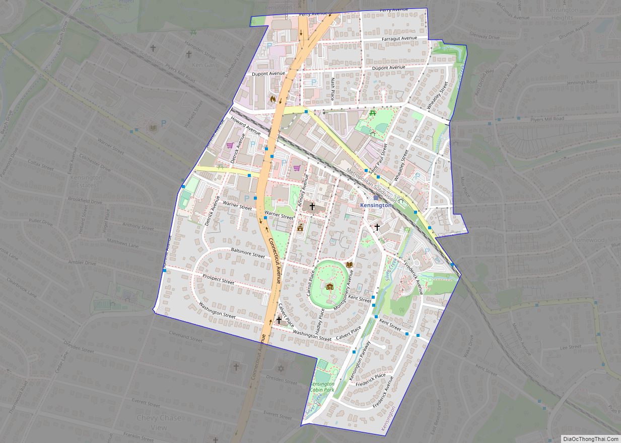
Kensington is a town in Montgomery County, Maryland, United States. The population was 2,213 at the 2010 United States Census. Greater Kensington encompasses the entire 20895 ZIP code, with a population of 19,054. Kensington town overview: Name: Kensington town LSAD Code: 43 LSAD Description: town (suffix) State: Maryland County: Montgomery County Incorporated: 1894 Elevation: 285 ft … Read more

Map of Kennedyville CDP

Map of Kennedyville CDP

Kennedyville is an unincorporated community and census-designated place in Kent County, Maryland, United States. As of the 2010 census it had a population of 199. Knocks Folly, Shrewsbury Church, and Woodland Hall are listed on the National Register of Historic Places. Kennedyville CDP overview: Name: Kennedyville CDP LSAD Code: 57 LSAD Description: CDP (suffix) State: … Read more

Map of Kemps Mill CDP

Map of Kemps Mill CDP

Kemps Mill is an unincorporated community and census-designated place in Washington County, Maryland, United States. Its population was 126 as of the 2010 census. It is named after a 1739 built mill structure which still stands in 2020 and has operated under a variety of names through almost three centuries. The mill dam creates a … Read more

Map of Kingstown CDP

Map of Kingstown CDP, Maryland

Kingstown is a census-designated place (CDP) in Queen Anne’s County, Maryland, United States. The population was 1,644 at the 2000 census. Kingstown CDP overview: Name: Kingstown CDP LSAD Code: 57 LSAD Description: CDP (suffix) State: Maryland County: Queen Anne’s County Elevation: 16 ft (5 m) Total Area: 2.58 sq mi (6.68 km²) Land Area: 2.27 sq mi (5.87 km²) Water Area: 0.31 sq mi (0.81 km²) … Read more

Map of Kettering CDP

Map of Kettering CDP, Maryland

Kettering is an unincorporated area and census-designated place in Prince George’s County, Maryland, United States. At the 2020 United States Census, the population was 14,424,. Kettering is adjacent to Prince George’s Community College, the upscale gated community of Woodmore, Six Flags America, Evangel Temple megachurch, and the community of Largo at the end of the … Read more

Map of Kent Narrows CDP

Map of Kent Narrows CDP

Kent Narrows is a census-designated place and town in Queen Anne’s County, Maryland, United States. As of the 2000 census, the town had a population of 567. Kent Narrows CDP overview: Name: Kent Narrows CDP LSAD Code: 57 LSAD Description: CDP (suffix) State: Maryland County: Queen Anne’s County Elevation: 7 ft (2 m) Total Area: 3.22 sq mi (8.33 km²) … Read more

Map of Klondike CDP

Map of Klondike CDP

Klondike is an unincorporated community and census-designated place (CDP) in Allegany County, Maryland, United States. As of the 2010 census it had a population of 118. It is located in western Allegany County, 5 miles (8 km) southwest of Frostburg, at the foot of Big Savage Mountain.It is built at the site of the Klondike Mine, … Read more

Map of Kitzmiller town

Map of Kitzmiller town

Kitzmiller is a town in Garrett County, Maryland, United States. The population was 321 at the 2010 census. Kitzmiller town overview: Name: Kitzmiller town LSAD Code: 43 LSAD Description: town (suffix) State: Maryland County: Garrett County Elevation: 1,604 ft (489 m) Total Area: 0.25 sq mi (0.65 km²) Land Area: 0.22 sq mi (0.58 km²) Water Area: 0.03 sq mi (0.07 km²) Total Population: 300 Population … Read more

Map of Kingsville CDP

Map of Kingsville CDP, Maryland

Kingsville is a semi-rural, unincorporated community and census-designated place in Baltimore County, Maryland, United States. It is a close-knit and rustic community bounded by the Little Gunpowder Falls river (to the northeast) and the Big Gunpowder Falls river (to the southwest) which join to form the Gunpowder River. The population of Kingsville was 4,318 at … Read more

Map of La Vale CDP

Map of La Vale CDP

LaVale is a census-designated place (CDP) in Allegany County, Maryland, United States. It is part of the Cumberland, MD-WV Metropolitan Statistical Area. The population was 3,551 at the 2010 census. La Vale CDP overview: Name: La Vale CDP LSAD Code: 57 LSAD Description: CDP (suffix) State: Maryland County: Allegany County Elevation: 784 ft (239 m) Total Area: … Read more

Map of La Plata town

Map of La Plata town, Maryland

La Plata /ləˈpleɪtə/ lə-PLAY-tə) is a town in Charles County, Maryland, United States. The population was 10,159 at the 2020 census. It is the county seat of Charles County. La Plata town overview: Name: La Plata town LSAD Code: 43 LSAD Description: town (suffix) State: Maryland County: Charles County Incorporated: 1888 Elevation: 190 ft (58 m) Total … Read more

Map of Konterra CDP

Map of Konterra CDP

Konterra is an unincorporated area and census-designated place (CDP) in Prince George’s County, Maryland, United States. The population was 3,158 at the 2020 census. Parts of Konterra were previously defined by the U.S. Census Bureau as being in the West Laurel census-designated place. Konterra CDP overview: Name: Konterra CDP LSAD Code: 57 LSAD Description: CDP … Read more