Konterra is an unincorporated area and census-designated place (CDP) in Prince George’s County, Maryland, United States. The population was 3,158 at the 2020 census.
Parts of Konterra were previously defined by the U.S. Census Bureau as being in the West Laurel census-designated place.
| Name: | Konterra CDP |
|---|---|
| LSAD Code: | 57 |
| LSAD Description: | CDP (suffix) |
| State: | Maryland |
| County: | Prince George’s County |
| Elevation: | 138 ft (42 m) |
| Total Area: | 6.13 sq mi (15.87 km²) |
| Land Area: | 6.07 sq mi (15.71 km²) |
| Water Area: | 0.06 sq mi (0.16 km²) |
| Total Population: | 3,158 |
| Population Density: | 520.69/sq mi (201.03/km²) |
| Area code: | 301, 240 |
| FIPS code: | 2444715 |
Online Interactive Map
Click on ![]() to view map in "full screen" mode.
to view map in "full screen" mode.
Konterra location map. Where is Konterra CDP?


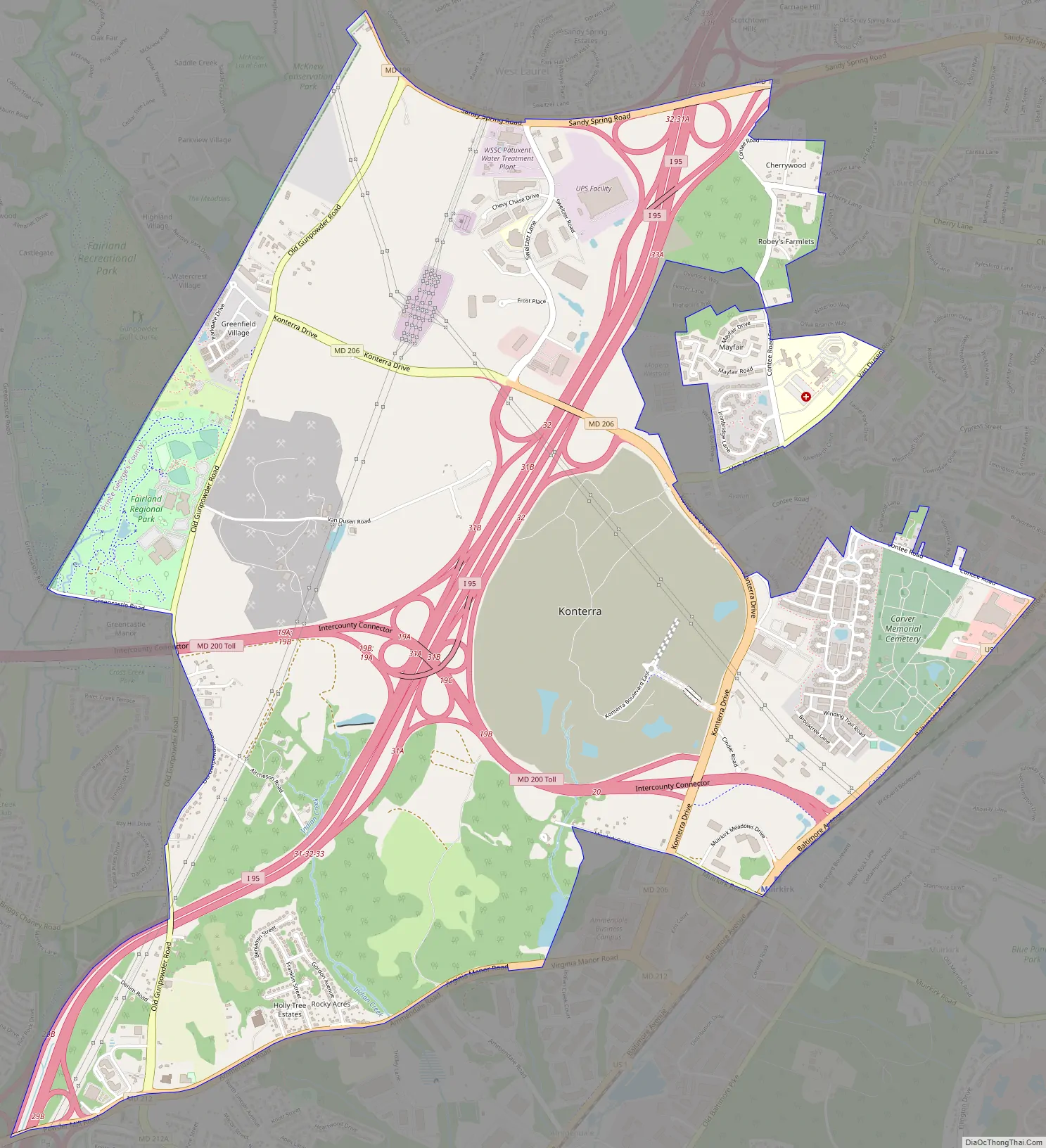
Konterra Road Map
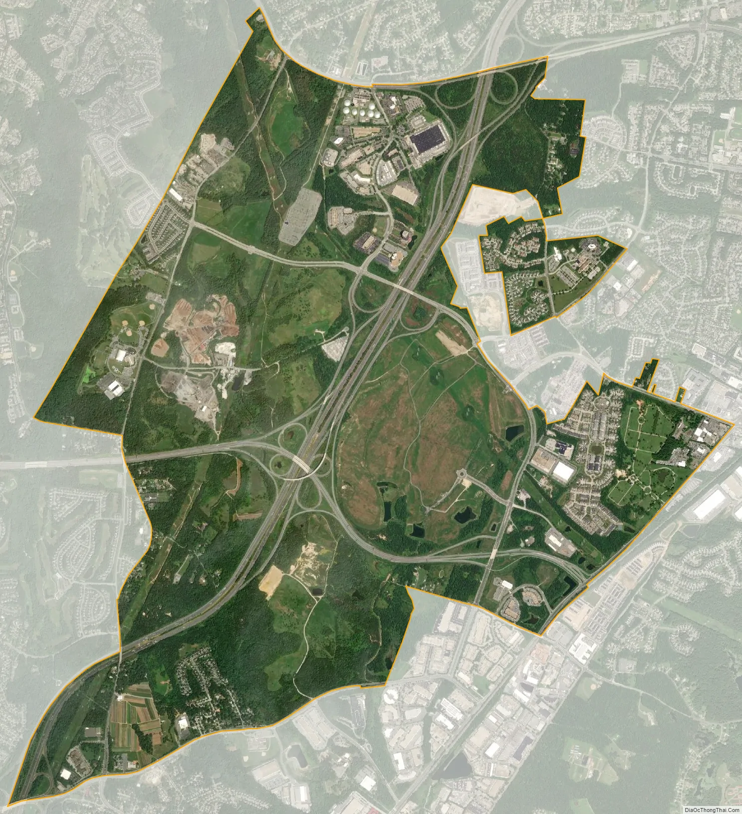
Konterra city Satellite Map
Geography
Konterra is located at 39°04′13″N 76°53′55″W / 39.0702°N 76.8986°W / 39.0702; -76.8986.
According to the United States Census Bureau, the CDP has a total area of 6.4 square miles (16.5 km), of which 6.3 square miles (16.4 km) is land and 0.04 square miles (0.1 km), or 1.05%, is water.
Konterra is located in northern Prince George’s County, around the interchange of Interstate 95 and Maryland Route 200. The city of Laurel borders the CDP to the northeast. West Laurel lies to the north, and South Laurel is to the east. Beltsville is to the south, and Calverton is to the southwest. To the northwest, in Montgomery County, is Burtonsville.
See also
Map of Maryland State and its subdivision: Map of other states:- Alabama
- Alaska
- Arizona
- Arkansas
- California
- Colorado
- Connecticut
- Delaware
- District of Columbia
- Florida
- Georgia
- Hawaii
- Idaho
- Illinois
- Indiana
- Iowa
- Kansas
- Kentucky
- Louisiana
- Maine
- Maryland
- Massachusetts
- Michigan
- Minnesota
- Mississippi
- Missouri
- Montana
- Nebraska
- Nevada
- New Hampshire
- New Jersey
- New Mexico
- New York
- North Carolina
- North Dakota
- Ohio
- Oklahoma
- Oregon
- Pennsylvania
- Rhode Island
- South Carolina
- South Dakota
- Tennessee
- Texas
- Utah
- Vermont
- Virginia
- Washington
- West Virginia
- Wisconsin
- Wyoming


