Kensington is a town in Montgomery County, Maryland, United States. The population was 2,213 at the 2010 United States Census. Greater Kensington encompasses the entire 20895 ZIP code, with a population of 19,054.
| Name: | Kensington town |
|---|---|
| LSAD Code: | 43 |
| LSAD Description: | town (suffix) |
| State: | Maryland |
| County: | Montgomery County |
| Incorporated: | 1894 |
| Elevation: | 285 ft (87 m) |
| Total Area: | 0.50 sq mi (1.30 km²) |
| Land Area: | 0.50 sq mi (1.30 km²) |
| Water Area: | 0.00 sq mi (0.00 km²) |
| Total Population: | 2,122 |
| Population Density: | 4,218.69/sq mi (1,630.37/km²) |
| ZIP code: | 20895 |
| FIPS code: | 2443500 |
| GNISfeature ID: | 0590589 |
| Website: | tok.md.gov |
Online Interactive Map
Click on ![]() to view map in "full screen" mode.
to view map in "full screen" mode.
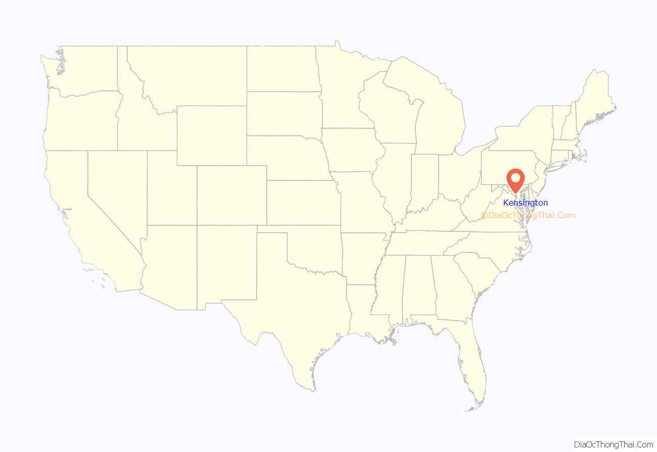
Kensington location map. Where is Kensington town?

History
The area around the Rock Creek basin where Kensington is located was primarily agricultural until 1873, when the B&O Railroad completed the Metropolitan Branch which traversed Montgomery County. A community arose where the new railroad line intersected the old Rockville-to-Bladensburg road. This early settlement was first known as Knowles Station. In the early 1890s, Washington, D.C. developer Brainard Warner began purchasing land parcels to build a planned Victorian community, complete with church, library and a local newspaper. Fascinated by a recent trip to London, Warner named his subdivision Kensington Park, the 10th and largest subdivision in the area which became the Town of Kensington. Upon incorporation in 1894, Warner convinced the Mayor and Council to name the town Kensington. The historic core of Kensington was listed on the National Register of Historic Places, as the Kensington Historic District in 1980.
Originally a farming community at Knowles Station, Kensington developed into a summer refuge for Washington, D.C., residents wishing to escape the capital’s humid summers. As years passed and its residents increasingly remained year round, Kensington evolved into a commuter suburb. The large southernmost section originally mapped out by Warner remains largely unchanged since inception, and is a historically preserved zone. Indeed, the only major changes in the town’s basic layout have been the bridging over of the original railroad crossing in 1937, and the extension and widening of Connecticut Avenue, the town’s main thoroughfare, in 1957.
In March 1975, Kensington gained attention regionally due to the disappearance of Sheila and Katherine Lyon. The sisters walked to Wheaton Plaza, a local shopping mall where they were seen by witnesses including their brother. However, they never returned home. The case was not resolved until 2017.
The town gained national attention three times in a 10-month span early in the 21st century as a result of events which occurred within a mere quarter-mile radius. In December 2001, the town responded to complaints from anonymous citizens by banning Santa Claus from the annual holiday parade. Protesters arrived at the parade en masse, including dozens of Santas riding everything from motorcycles to fire trucks. Eight months later, an Amtrak train derailed adjacent to the town center when the tracks separated at an overheated joint, injuring 72 people, though there were no fatalities. Then, on October 2, 2002, Lori Ann Lewis-Rivera became the fifth victim of the snipers who terrorized the Washington area that month, while cleaning her car at a Kensington gas station. (See Beltway sniper attacks.)
Kensington again received national attention in November 2020, when a train bridge that crosses the 495 Beltway ahead of the Washington D.C. Temple was vandalised with the message “Surrender Donald”. Many thought that this was a response to then-President Donald Trump’s refusal to concede in the 2020 United States presidential election.
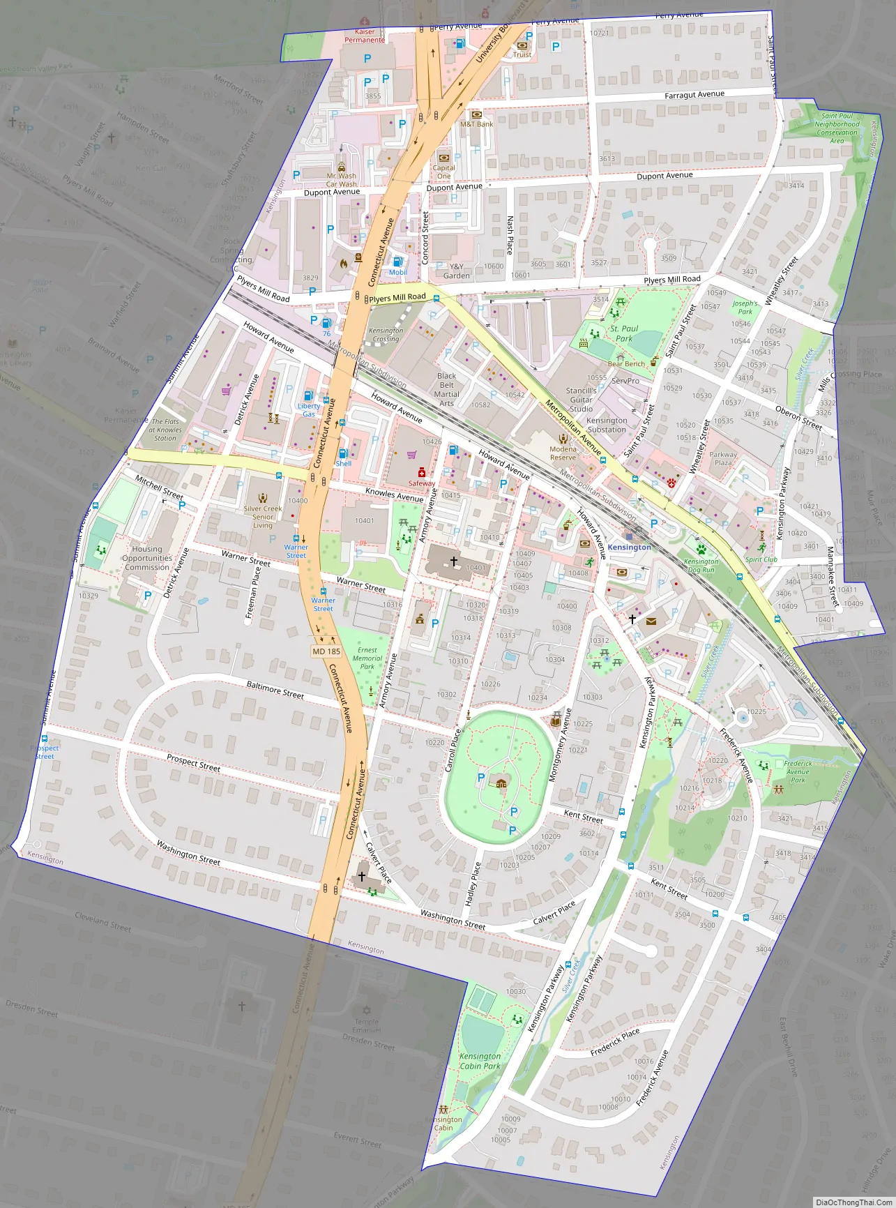
Kensington Road Map
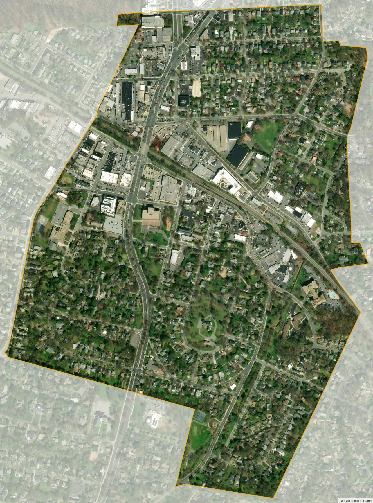
Kensington city Satellite Map
Geography
Kensington is located in Montgomery County, northwest of Silver Spring, northeast of Bethesda, west of Wheaton and southeast of Rockville. Its latitude is 39°1′48″N, longitude 77°4′30″W.
According to the United States Census Bureau, the town has a total area of 0.48 square miles (1.24 km), all land.
While the town proper is but one-half square mile in size, the Kensington Post Office serves a much larger area and extends into North Bethesda and the Wheaton Planning District. Residents within this ZIP code (20895) generally refer to Kensington as their home town even though they technically do not reside in “The Town of Kensington”.
The look and white color of the Washington D.C. Temple located in Greater Kensington, coupled with its location near the Capital Beltway, have made it a local landmark. D.C.-area traffic reports often refer to the “Mormon temple” or “temple”.
See also
Map of Maryland State and its subdivision: Map of other states:- Alabama
- Alaska
- Arizona
- Arkansas
- California
- Colorado
- Connecticut
- Delaware
- District of Columbia
- Florida
- Georgia
- Hawaii
- Idaho
- Illinois
- Indiana
- Iowa
- Kansas
- Kentucky
- Louisiana
- Maine
- Maryland
- Massachusetts
- Michigan
- Minnesota
- Mississippi
- Missouri
- Montana
- Nebraska
- Nevada
- New Hampshire
- New Jersey
- New Mexico
- New York
- North Carolina
- North Dakota
- Ohio
- Oklahoma
- Oregon
- Pennsylvania
- Rhode Island
- South Carolina
- South Dakota
- Tennessee
- Texas
- Utah
- Vermont
- Virginia
- Washington
- West Virginia
- Wisconsin
- Wyoming


