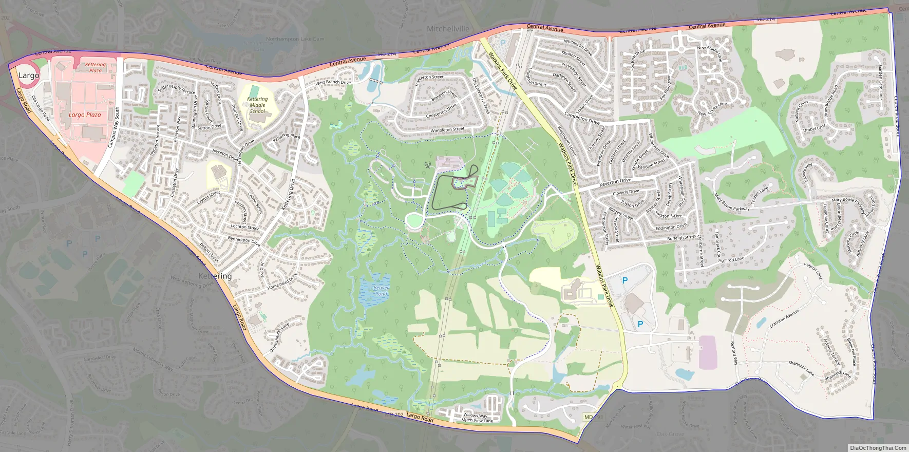
Kettering is an unincorporated area and census-designated place in Prince George’s County, Maryland, United States. At the 2020 United States Census, the population was 14,424,. Kettering is adjacent to Prince George’s Community College, the upscale gated community of Woodmore, Six Flags America, Evangel Temple megachurch, and the community of Largo at the end of the Washington Metro Blue Line. Watkins Regional Park in Kettering offers a large playground, a colorful carousel, miniature golf, a miniature train ride, and various animals.
| Name: | Kettering CDP |
|---|---|
| LSAD Code: | 57 |
| LSAD Description: | CDP (suffix) |
| State: | Maryland |
| County: | Prince George’s County |
| Elevation: | 138 ft (42 m) |
| Total Area: | 5.51 sq mi (14.28 km²) |
| Land Area: | 5.49 sq mi (14.23 km²) |
| Water Area: | 0.02 sq mi (0.05 km²) |
| Total Population: | 14,424 |
| Population Density: | 2,625.89/sq mi (1,013.79/km²) |
| ZIP code: | 20774-20775 |
| Area code: | 301, 240 |
| FIPS code: | 2443900 |
| GNISfeature ID: | 1714445 |
Online Interactive Map
Click on ![]() to view map in "full screen" mode.
to view map in "full screen" mode.
Kettering location map. Where is Kettering CDP?


Kettering Road Map
Kettering city Satellite Map

Geography
Kettering is located at 38°53′42″N 76°47′47″W / 38.895012°N 76.796471°W / 38.895012; -76.796471.
According to the United States Census Bureau, the CDP has a total area of 5.5 square miles (14 km), all land.
See also
Map of Maryland State and its subdivision: Map of other states:- Alabama
- Alaska
- Arizona
- Arkansas
- California
- Colorado
- Connecticut
- Delaware
- District of Columbia
- Florida
- Georgia
- Hawaii
- Idaho
- Illinois
- Indiana
- Iowa
- Kansas
- Kentucky
- Louisiana
- Maine
- Maryland
- Massachusetts
- Michigan
- Minnesota
- Mississippi
- Missouri
- Montana
- Nebraska
- Nevada
- New Hampshire
- New Jersey
- New Mexico
- New York
- North Carolina
- North Dakota
- Ohio
- Oklahoma
- Oregon
- Pennsylvania
- Rhode Island
- South Carolina
- South Dakota
- Tennessee
- Texas
- Utah
- Vermont
- Virginia
- Washington
- West Virginia
- Wisconsin
- Wyoming


