Map of Leslie city, Michigan

Map of Leslie city, Michigan

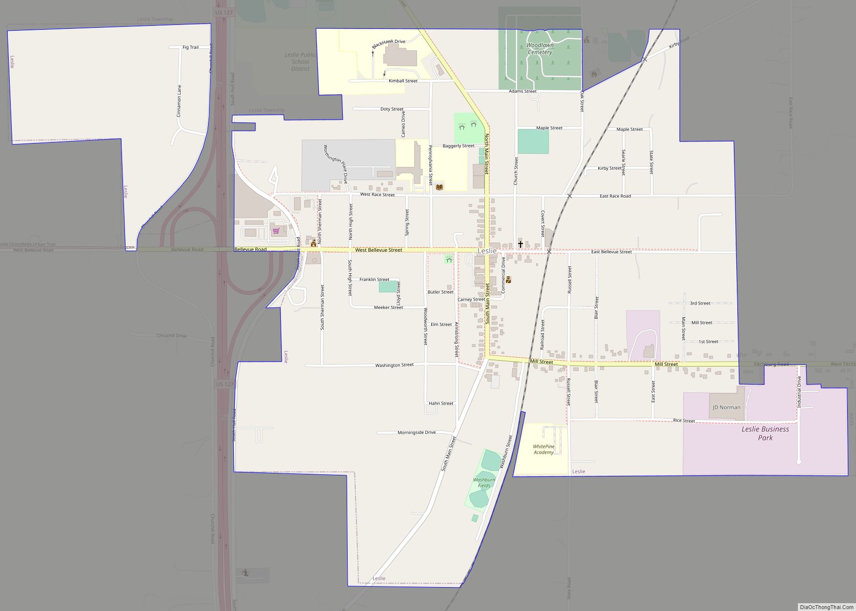
Leslie is a city in Ingham County in the U.S. state of Michigan. The population was 1,851 at the 2010 census. The city is surrounded by Leslie Township, but the two are administered autonomously. Leslie city overview: Name: Leslie city LSAD Code: 25 LSAD Description: city (suffix) State: Michigan County: Ingham County Incorporated: 1869 (village)1968 … Read more

Map of Linden city, Michigan

Map of Linden city, Michigan

Linden is a city in southern Genesee County, Michigan, United States. Its population was 4,142 at the 2020 census. It is part of the Flint metropolitan area. Linden city overview: Name: Linden city LSAD Code: 25 LSAD Description: city (suffix) State: Michigan County: Genesee County Incorporated: 1871 (village)1988 (city) Elevation: 873 ft (266 m) Total Area: 2.42 sq mi … Read more

Map of Lincoln village, Michigan

Map of Lincoln village, Michigan

Lincoln is a village in Alcona County in the U.S. state of Michigan. The population was 305 at the 2020 census. The village is situated on the boundary between Gustin Township on the south and Hawes Township on the north. The Lincoln 48742 ZIP Code covers a much larger area extending into the townships of … Read more

Map of Lincoln Park city, Michigan

Map of Lincoln Park city, Michigan

Lincoln Park is a city in Wayne County in the U.S. state of Michigan. The population was 38,144 at the 2010 census, down from 40,008 at the 2000 census. With a population density of 6,476.1/sq mi (2,500.4/km) at the 2010 census, Lincoln Park is the second most-densely populated municipality in the state after Hamtramck. Lincoln Park … Read more

Map of Livonia city, Michigan

Map of Livonia city, Michigan

Livonia is a city in Wayne County in the U.S. state of Michigan. The population was 95,535 at the 2020 census, which ranked it as Michigan’s ninth most-populated municipality. Livonia is a part of Metro Detroit and is located about 2 miles (3.2 km) west of the city limits of Detroit, separated only by Redford Township. … Read more

Map of Litchfield city, Michigan

Map of Litchfield city, Michigan

Litchfield is a city in Hillsdale County in the U.S. state of Michigan. The population was 1,399 at the 2020 census. The city is surrounded by Litchfield Township, but the two are administered autonomously. Litchfield city overview: Name: Litchfield city LSAD Code: 25 LSAD Description: city (suffix) State: Michigan County: Hillsdale County Incorporated: 1877 (village)1970 … Read more

Map of Luna Pier city

Map of Luna Pier city

Luna Pier is a city in Monroe County in the U.S. state of Michigan. The population was 1,382 at the 2020 census. The city is located 6.0 miles (9.7 km) north of the Ohio state border along the coast of Lake Erie. Previously known as Lakewood, it was established in the early 1900s and incorporated as … Read more

Map of Ludington city

Map of Ludington city

Ludington (/ˈlʌdɪŋtən/ LUH-ding-tən) is a city in the U.S. state of Michigan. It is the county seat and the largest city in Mason County. As of the 2020 census, the city population was 7,655. The city is located at the mouth of the Pere Marquette River at Lake Michigan. Nearby are Ludington State Park (which … Read more

Map of Lowell city, Michigan

Map of Lowell city, Michigan

Lowell is a city in Kent County of the U.S. state of Michigan. The population was 3,783 at the 2010 census. Lowell is part of the Grand Rapids metropolitan area and is about 15 miles (24.1 km) east of the city of Grand Rapids. The city is mostly surrounded by Lowell Township to the south, but … Read more

Map of Lost Lake Woods CDP

Map of Lost Lake Woods CDP

Lost Lake Woods is an unincorporated community and census-designated place (CDP) in Alcona County in the U.S. state of Michigan. The population was 367 at the 2020 census. It is located within Alcona Township. Lost Lake Woods is a private community with control of over 11,000 acres (45 km) of woodlands. Entry into the community is … Read more

Map of Loomis CDP, Michigan

Map of Loomis CDP, Michigan

Loomis is an unincorporated community and census-designated place (CDP) in Isabella County in the U.S. state of Michigan. The population was 213 at the 2010 census. Loomis CDP overview: Name: Loomis CDP LSAD Code: 57 LSAD Description: CDP (suffix) State: Michigan County: Isabella County Elevation: 805 ft (245 m) Total Area: 2.82 sq mi (7.30 km²) Land Area: 2.80 sq mi (7.25 km²) … Read more

Map of Mackinaw City village

Map of Mackinaw City village

Mackinaw City (/ˈmækənɔː/ MAK-ə-naw) is a village at the northernmost point of the Lower Peninsula of Michigan. Divided between Cheboygan and Emmet counties, Mackinaw City is the located at the southern end of the Mackinac Bridge, which carries Interstate 75 over the Straits of Mackinac to the Upper Peninsula. Mackinaw City, along with St. Ignace, … Read more