Ludington (/ˈlʌdɪŋtən/ LUH-ding-tən) is a city in the U.S. state of Michigan. It is the county seat and the largest city in Mason County. As of the 2020 census, the city population was 7,655.
The city is located at the mouth of the Pere Marquette River at Lake Michigan. Nearby are Ludington State Park (which includes the Big Sable Point Light), Nordhouse Dunes Wilderness, and Manistee National Forest. Ludington is also the home port of the SS Badger, a vehicle and passenger ferry with daily service in the summer across Lake Michigan to Manitowoc, Wisconsin.
| Name: | Ludington city |
|---|---|
| LSAD Code: | 25 |
| LSAD Description: | city (suffix) |
| State: | Michigan |
| County: | Mason County |
| Incorporated: | 1873 |
| Elevation: | 591 ft (180 m) |
| Total Area: | 3.60 sq mi (9.34 km²) |
| Land Area: | 3.36 sq mi (8.70 km²) |
| Water Area: | 0.24 sq mi (0.63 km²) |
| Total Population: | 7,655 |
| Population Density: | 2,278.27/sq mi (879.56/km²) |
| Area code: | 231 |
| FIPS code: | 2649640 |
| GNISfeature ID: | 0631201 |
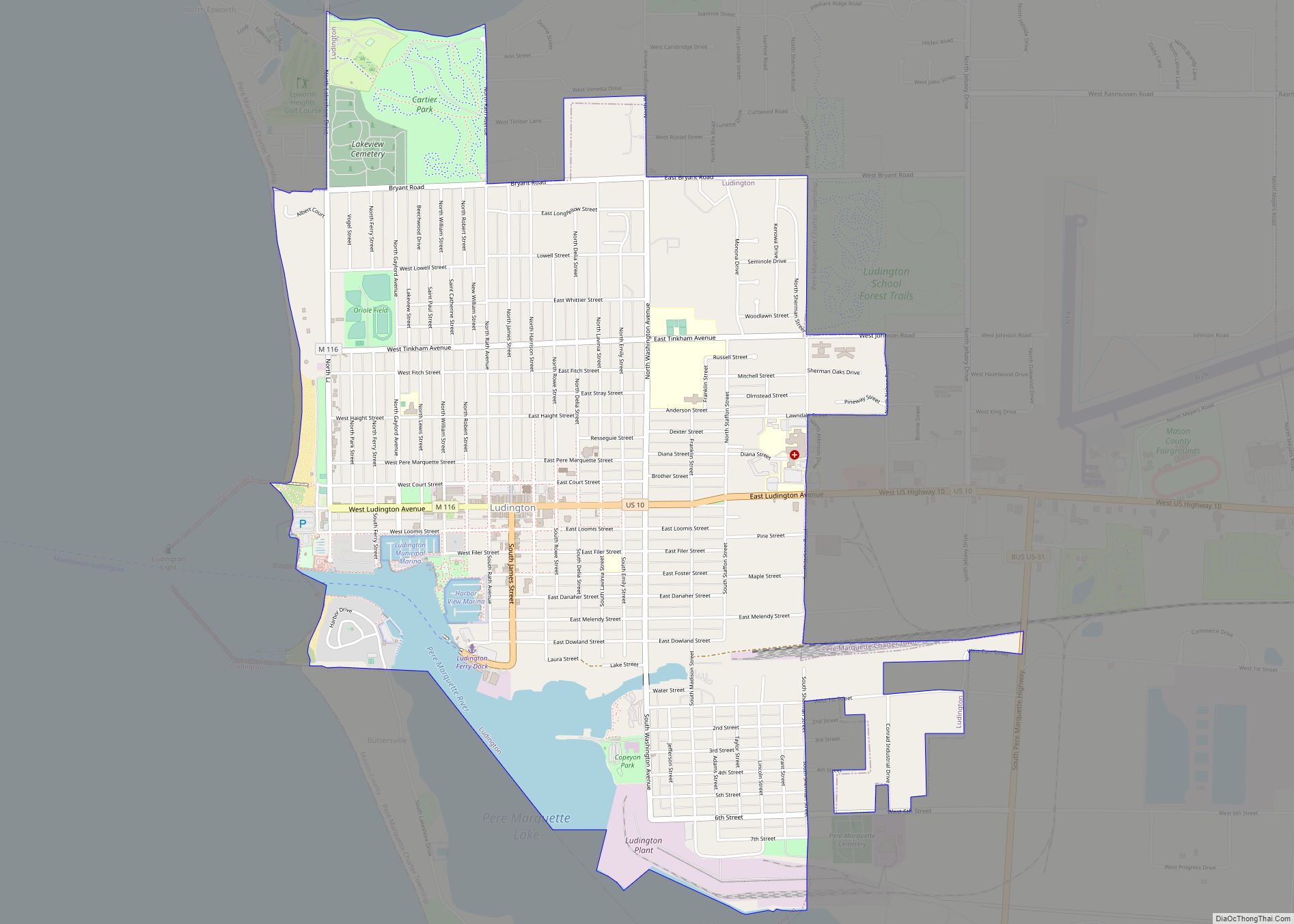
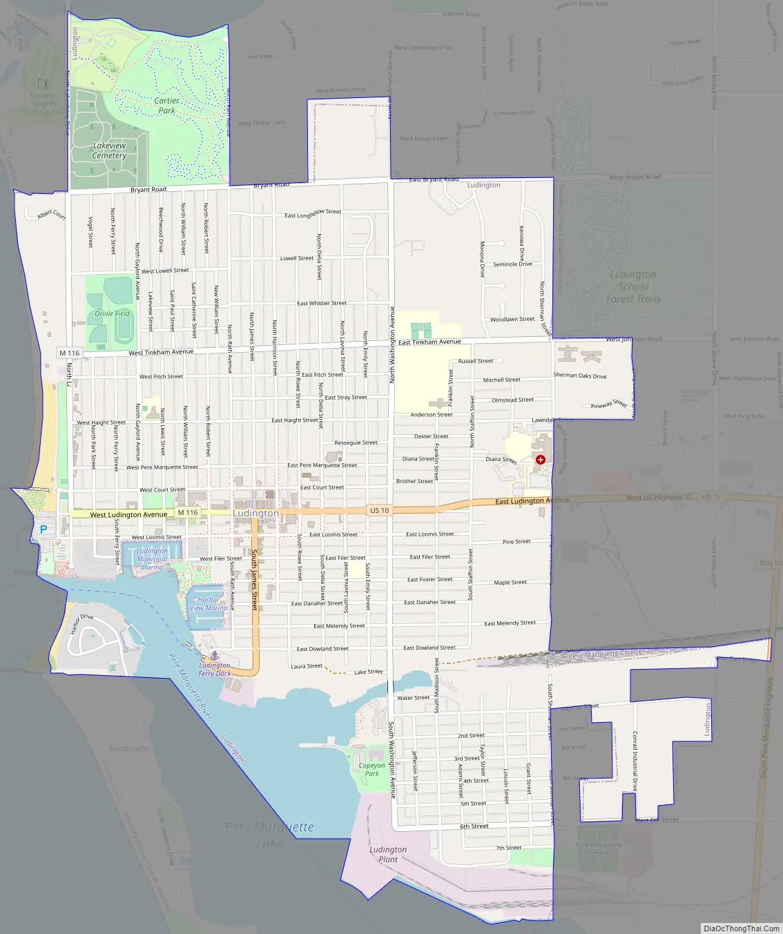
Online Interactive Map
Click on ![]() to view map in "full screen" mode.
to view map in "full screen" mode.
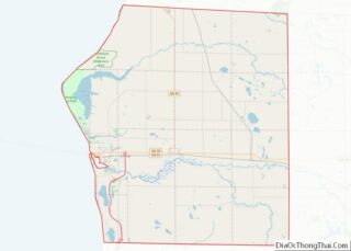
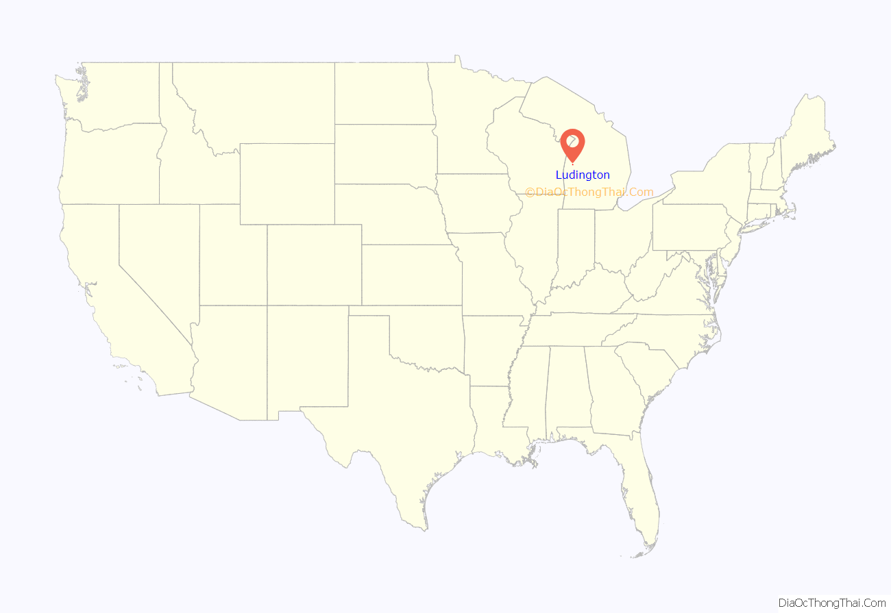
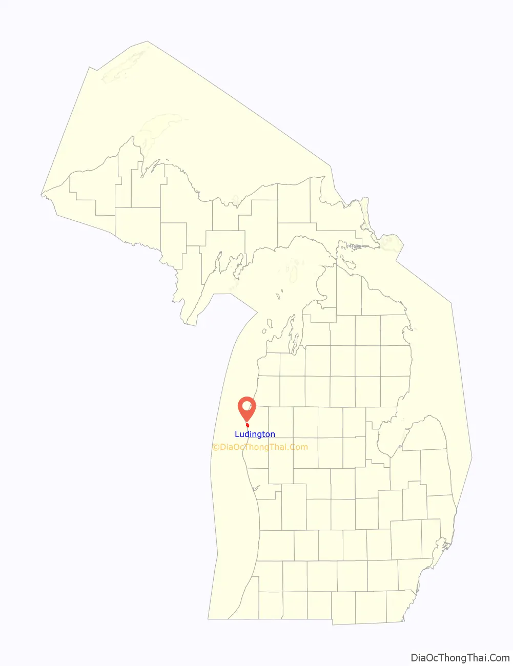
Ludington location map. Where is Ludington city?
History
In 1675, Father Jacques Marquette, French missionary and explorer, died and was laid to rest near the modern site of Ludington. A memorial and 40-foot iron cross were built in 1955 to mark the location.
In 1845, Burr Caswell moved to the area near the mouth of the Pere Marquette River as a location for trapping and fishing. In July 1847, when he brought his family to live there, they became the first permanent residents of European ancestry. Two years later they built a two-story wood-framed house on their farm. After the organization of Mason County in 1855, the first floor of this building was converted into the county’s first courthouse. Restored in 1976 by the Mason County Historical Society, the structure stands today as a part of White Pine Village, a museum consisting of several restored and replica Mason County buildings (see external links).
The town was originally named Pere Marquette, then later named after the industrialist James Ludington, whose logging operations the village developed around. Ludington was incorporated as a City in 1873, the same year that the County seat was moved from the Village of Lincoln to the City of Ludington. The area boom in the late 19th century was due to these sawmills and also the discovery of salt deposits.
By 1892, 162 million board feet (382,000 cubic metres or 13,500,000 cubic feet) of lumber and 52 million wood shingles had been produced by the Ludington sawmills. With all of this commerce occurring, Ludington became a major Great Lakes shipping port.
In 1875, the Flint and Pere Marquette Railroad (F&PM) began cross-lake shipping operations with the sidewheel steamer SS John Sherman. It became apparent quite early that the John Sherman was not large enough to handle the volume of freight and the F&PM Railroad contracted with the Goodrich Line of Steamers to handle the break bulk freight out of the Port of Ludington.
In 1897, the F&PM railroad constructed the first steel car ferry, the Pere Marquette. This was the beginning of the creation of a fleet of ferries to continue the rail cargo across Lake Michigan to Manitowoc, Wisconsin. The fleet was also expanded to carry cars and passengers across the lake. By the mid-1950s, Ludington had become the largest car ferry port in the world. Unfortunately, due to disuse and declining industry, this fleet eventually dwindled. Currently only one carferry, the SS Badger, makes regular trips across the lake from Ludington, one of only two lake-crossing car ferries on Lake Michigan.
During the late 1910s and early 1920s, Ludington was the home of the Ludington Mariners minor league baseball team. A team of the same name currently plays “old time base ball” in historical reenactments of the original version of the game.
Ludington Road Map
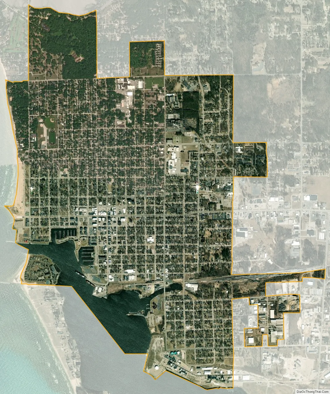
Ludington city Satellite Map
Geography
According to the United States Census Bureau, the city has a total area of 3.70 square miles (9.58 km), of which 3.37 square miles (8.73 km) is land and 0.33 square miles (0.85 km) (8.92%) is water.
The Ludington North Breakwall Light is at the end of the north pierhead on Lake Michigan. Ludington is part of Northern Michigan.
See also
Map of Michigan State and its subdivision:- Alcona
- Alger
- Allegan
- Alpena
- Antrim
- Arenac
- Baraga
- Barry
- Bay
- Benzie
- Berrien
- Branch
- Calhoun
- Cass
- Charlevoix
- Cheboygan
- Chippewa
- Clare
- Clinton
- Crawford
- Delta
- Dickinson
- Eaton
- Emmet
- Genesee
- Gladwin
- Gogebic
- Grand Traverse
- Gratiot
- Hillsdale
- Houghton
- Huron
- Ingham
- Ionia
- Iosco
- Iron
- Isabella
- Jackson
- Kalamazoo
- Kalkaska
- Kent
- Keweenaw
- Lake
- Lake Hurron
- Lake Michigan
- Lake St. Clair
- Lake Superior
- Lapeer
- Leelanau
- Lenawee
- Livingston
- Luce
- Mackinac
- Macomb
- Manistee
- Marquette
- Mason
- Mecosta
- Menominee
- Midland
- Missaukee
- Monroe
- Montcalm
- Montmorency
- Muskegon
- Newaygo
- Oakland
- Oceana
- Ogemaw
- Ontonagon
- Osceola
- Oscoda
- Otsego
- Ottawa
- Presque Isle
- Roscommon
- Saginaw
- Saint Clair
- Saint Joseph
- Sanilac
- Schoolcraft
- Shiawassee
- Tuscola
- Van Buren
- Washtenaw
- Wayne
- Wexford
- Alabama
- Alaska
- Arizona
- Arkansas
- California
- Colorado
- Connecticut
- Delaware
- District of Columbia
- Florida
- Georgia
- Hawaii
- Idaho
- Illinois
- Indiana
- Iowa
- Kansas
- Kentucky
- Louisiana
- Maine
- Maryland
- Massachusetts
- Michigan
- Minnesota
- Mississippi
- Missouri
- Montana
- Nebraska
- Nevada
- New Hampshire
- New Jersey
- New Mexico
- New York
- North Carolina
- North Dakota
- Ohio
- Oklahoma
- Oregon
- Pennsylvania
- Rhode Island
- South Carolina
- South Dakota
- Tennessee
- Texas
- Utah
- Vermont
- Virginia
- Washington
- West Virginia
- Wisconsin
- Wyoming