Map of Stevensville village, Michigan

Map of Stevensville village, Michigan

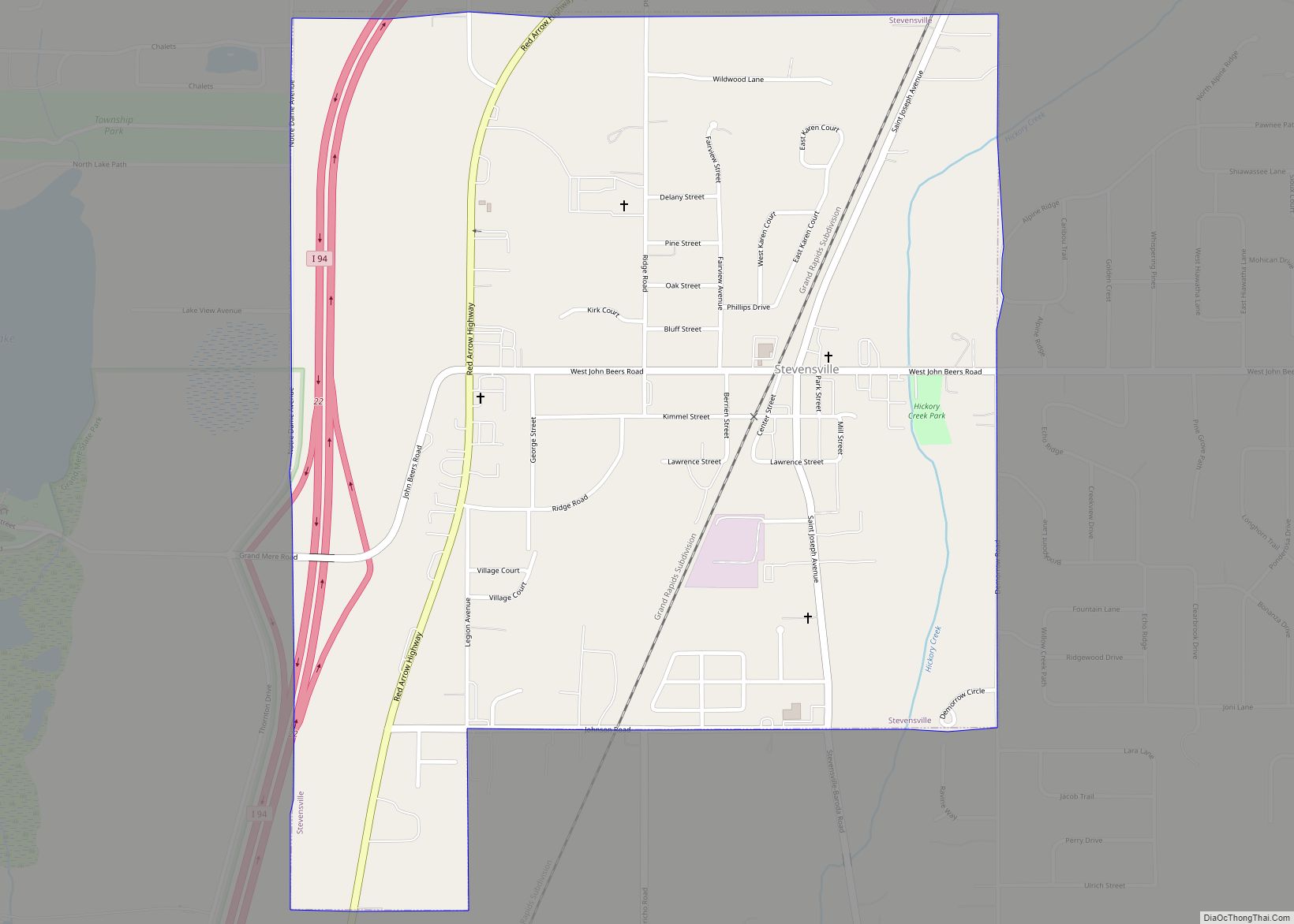
Stevensville is a village in Berrien County in the U.S. state of Michigan. The village lies within Lincoln Township. The population was 1,147 at the 2020 census. Stevensville village overview: Name: Stevensville village LSAD Code: 47 LSAD Description: village (suffix) State: Michigan County: Berrien County Elevation: 636 ft (194 m) Total Area: 1.05 sq mi (2.71 km²) Land Area: 1.04 sq mi … Read more

Map of Tawas City city

Map of Tawas City

Tawas City is a city in and county seat of Iosco County in the U.S. state of Michigan. The population was 1,834 at the 2020 census. The city is mostly surrounded by Tawas Township, but the two area administered automously. Tawas City overview: Name: Tawas City LSAD Code: 25 LSAD Description: city (suffix) State: Michigan … Read more

Map of Sylvan Lake city

Map of Sylvan Lake city

Sylvan Lake is a city in Oakland County in the U.S. state of Michigan. The population was 1,720 at the 2010 census. As a northern suburb of Metro Detroit, Sylvan Lake is about 20 miles (32 km) northwest of the city of Detroit. The city also shares a northeastern border with the city of Pontiac. With … Read more

Map of Swartz Creek city

Map of Swartz Creek city

Swartz Creek is a city in Genesee County in the U.S. state of Michigan. The population was 5,758 at the 2010 census. The city is a suburb of Flint and has incorporated land formerly within Flint Charter Township, Gaines Township, and Clayton Township, but is administratively autonomous from all three. Swartz Creek city overview: Name: … Read more

Map of Suttons Bay village

Map of Suttons Bay village

Suttons Bay is a village in Leelanau County in the U.S. state of Michigan. The population was 613 at the 2020 census. Located within Suttons Bay Township, the community lies upon the shore of the eponymous Suttons Bay, a smaller inlet of Grand Traverse Bay, a bay of Lake Michigan. Suttons Bay village overview: Name: … Read more

Map of Sunfield village

Map of Sunfield village

Sunfield is a village in Eaton County in the U.S. state of Michigan. The population was 578 at the 2010 census. The village is located within Sunfield Township. Sunfield village overview: Name: Sunfield village LSAD Code: 47 LSAD Description: village (suffix) State: Michigan County: Eaton County Elevation: 863 ft (263 m) Total Area: 0.76 sq mi (1.97 km²) Land Area: … Read more

Map of Thompsonville village, Michigan

Map of Thompsonville village, Michigan

Thompsonville is a village in Benzie County in the U.S. state of Michigan. The village had a population of 451 at the 2020 census, up from 441 at the 2010 census. The village lies immediately north of the Manistee County line, and is divided between Colfax and Weldon townships. Crystal Mountain, one of Michigan’s largest … Read more

Map of Temperance CDP

Map of Temperance CDP

Temperance is an unincorporated community and census-designated place (CDP) in Monroe County in the U.S. state of Michigan. The population was 9,188 at the 2020 census. The CDP is located within Bedford Township. The community was established as early as 1859. The Temperance 48182 ZIP Code serves most of Bedford Township outside of the Lambertville … Read more

Map of Tekonsha village

Map of Tekonsha village

Tekonsha is a village in Tekonsha Township, Calhoun County in the U.S. state of Michigan. It is part of the Battle Creek, Michigan Metropolitan Statistical Area. The population was 717 at the 2010 census. Tekonsha is the birthplace of Talbert Abrams, famous as the “Father of Aerial Photography.” Tekonsha village overview: Name: Tekonsha village LSAD … Read more

Map of Tecumseh city, Michigan

Map of Tecumseh city, Michigan

Tecumseh is a city in Lenawee County in the U.S. state of Michigan, near the River Raisin. Tecumseh is about 60 miles (97 km) southwest of Detroit, 25 miles (40 km) south of Ann Arbor, and 40 miles (64 km) north of Toledo, Ohio. The main street of downtown is Chicago Boulevard, also designated as M-50. It crosses … Read more

Map of Taylor city, Michigan

Map of Taylor city, Michigan

Taylor is a city in Wayne County in the U.S. state of Michigan. Its population was 63,409 at the 2020 census. Taylor is the fifth most-populated city in Wayne County and the 17th most-populated city in Michigan. The area was originally a civil township known as Taylor Township, which was organized in 1848 and later … Read more

Map of Trowbridge Park CDP

Map of Trowbridge Park CDP

Trowbridge Park is an unincorporated community in Marquette Township, Marquette County, in the U.S. state of Michigan. It is also a census-designated place (CDP) for statistical purposes and has no legal status as an incorporated municipality. The CDP had a population of 2,287 at the 2020 census. The community is located within Marquette Township and … Read more