Map of Walker city, Michigan

Map of Walker city, Michigan

Walker is a city in Kent County in the U.S. state of Michigan. The population was 23,537 at the 2010 census. Walker was originally organized as Walker Township in 1837 and later incorporated as a city in 1962. It is part of the Grand Rapids metropolitan area and is bordered by the city of Grand … Read more

Map of Waldron village, Michigan

Map of Waldron village, Michigan

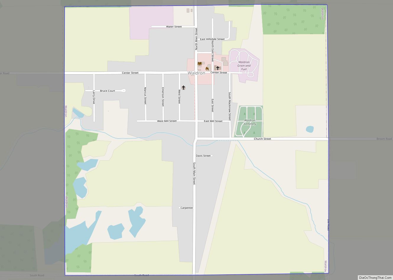
Waldron is a village in Hillsdale County in the U.S. state of Michigan. The population was 505 at the 2020 census. The village is located within Wright Township. Waldron village overview: Name: Waldron village LSAD Code: 47 LSAD Description: village (suffix) State: Michigan County: Hillsdale County Incorporated: 1905 Elevation: 899 ft (274 m) Total Area: 1.00 sq mi (2.59 km²) … Read more

Map of Wakefield city, Michigan

Map of Wakefield city, Michigan

Wakefield is a city in Gogebic County in the U.S. state of Michigan. The population was 1,851 at the 2010 census. Wakefield is located in the western Upper Peninsula about 10 miles (16 km) east of the Wisconsin border. The city is mostly surrounded by Wakefield Township, but the two are administered autonomously. U.S. Route 2 … Read more

Map of Walled Lake city

Map of Walled Lake city

Walled Lake is a city in Oakland County in the U.S. state of Michigan. The population was 6,999 at the 2010 census. The city is bordered by Commerce Township on the north and the city of Novi on the south. As a western suburb of Metro Detroit, Walled Lake is about 20 miles (32.2 km) northwest … Read more

Map of Walkerville village

Map of Walkerville village, Michigan

Walkerville is a village in Oceana County of the U.S. state of Michigan. The population was 247 at the 2010 census. The village is located within Leavitt Township. Walkerville village overview: Name: Walkerville village LSAD Code: 47 LSAD Description: village (suffix) State: Michigan County: Oceana County Elevation: 889 ft (271 m) Total Area: 1.24 sq mi (3.22 km²) Land Area: … Read more

Map of Wayland city, Michigan

Map of Wayland city, Michigan

Wayland is a city in Allegan County in the U.S. state of Michigan. The population was 4,079 at the 2010 census. The city is located at the northwest corner of Wayland Township, but is politically independent. The city has also incorporated a portion of land in the south of adjacent Leighton Township. U.S. Route 131 … Read more

Map of Waverly CDP, Michigan

Map of Waverly CDP, Michigan

Waverly is an unincorporated community in Eaton County in the U.S. state of Michigan. It is a census-designated place (CDP) for statistical purposes and has no legal status as a municipality. The population was 23,925 at the 2010 census, up from 16,194 at the 2000 census. Waverly is home to the Lansing Mall and Waverly … Read more

Map of Watervliet city

Map of Watervliet city, Michigan

Watervliet is a city in Berrien County in the U.S. state of Michigan. Located in the northeastern part of the county, the population was 1,735 at the 2010 census, down from 1,843 at the 2000 census. Mostly a rural farming community, the name comes from the Dutch for “where the waters meet.” The city is … Read more

Map of Watersmeet CDP

Map of Watersmeet CDP

Watersmeet is an unincorporated community and census-designated place (CDP) in Watersmeet Township, Michigan. As of the 2010 census, the CDP had a population of 428, out of a total population in the township of 1,417. The community was platted in 1884, designated as a station of the Milwaukee Lake Shore and Western Railroad. Watersmeet CDP … Read more

Map of Walloon Lake CDP

Map of Walloon Lake CDP

Walloon Lake is an unincorporated community and census-designated place (CDP) in Charlevoix County in the U.S. state of Michigan. The population of the CDP was 271 at the 2020 census. The community is located within Melrose Township. As an unincorporated community, Walloon Lake has no legal autonomy of its own but does have its own … Read more

Map of Wellston CDP

Map of Wellston CDP, Michigan

Wellston is an unincorporated community and census-designated place in Norman Township, Manistee County, Michigan, United States. Its population was 246 as of the 2020 census. The community is in the Manistee National Forest just south of M-55, about 20 miles east of Manistee and about 25 miles west of Cadillac. Wellston has a post office … Read more

Map of Weidman CDP

Map of Weidman CDP

Weidman is an unincorporated community in Isabella County, Michigan, United States. It is a census-designated place (CDP) for statistical purposes, but has no independent municipal authority. The population of the CDP was 959 at the 2010 census, up from 879 at the 2000 census. Weidman CDP overview: Name: Weidman CDP LSAD Code: 57 LSAD Description: … Read more