Wakefield is a city in Gogebic County in the U.S. state of Michigan. The population was 1,851 at the 2010 census.
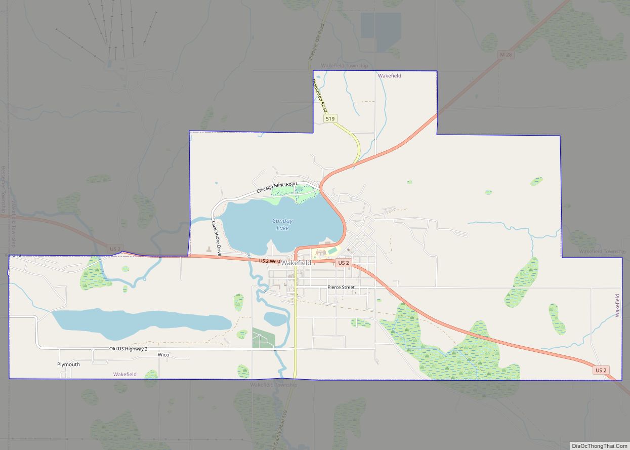
Wakefield is located in the western Upper Peninsula about 10 miles (16 km) east of the Wisconsin border. The city is mostly surrounded by Wakefield Township, but the two are administered autonomously. U.S. Route 2 passes through the city, and M-28 has its western terminus in the city.
It is home to Sunday Lake, Snow River Mountain Resort, Gogebic County Medical Care Facility, and Gogebic County Community Mental Health Authority. Once a mining town, the economy is now based upon the forest industry, goods and services, and tourism.
| Name: | Wakefield city |
|---|---|
| LSAD Code: | 25 |
| LSAD Description: | city (suffix) |
| State: | Michigan |
| County: | Gogebic County |
| Incorporated: | 1887 (village) 1919 (city) |
| Elevation: | 1,539 ft (469 m) |
| Total Area: | 8.44 sq mi (21.85 km²) |
| Land Area: | 7.87 sq mi (20.39 km²) |
| Water Area: | 0.57 sq mi (1.47 km²) |
| Total Population: | 1,702 |
| Population Density: | 216.21/sq mi (83.47/km²) |
| Area code: | 906 |
| FIPS code: | 2682780 |
| GNISfeature ID: | 1622046 |
Online Interactive Map
Click on ![]() to view map in "full screen" mode.
to view map in "full screen" mode.
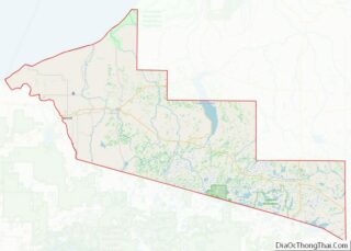
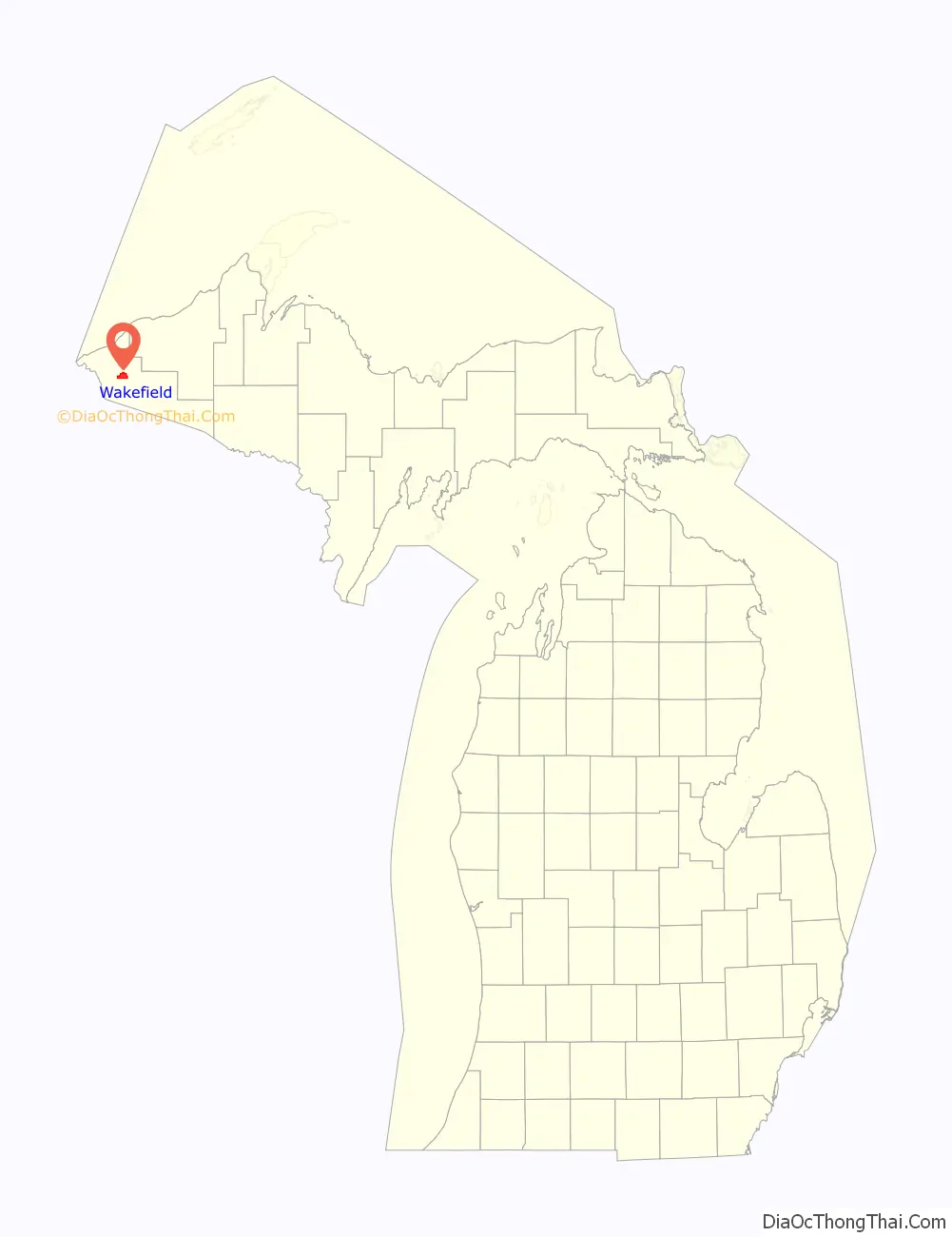
Wakefield location map. Where is Wakefield city?

History
Founding
George Mix Wakefield, born February 6, 1839, in Henderson, New York, a son of James Patterson Wakefield and Hannah B. Hall, had the town site of Wakefield platted in May 1886; the general location was already being referred to as “Wakefield” as early as the fall of 1884. His parents moved their family to Waukesha County, Wisconsin in October 1844. Mr. Wakefield became interested in logging and real estate and acquired vast tracts of land in the western Upper Peninsula of Michigan in the 1870s and 1880s. Together with various other capitalists he built sawmills and logged the pine forests of the area, and later became involved in mineral exploration. He was one of the parties who held interests in the mineral rights to the Sunday Lake mine, as well as a few nearby properties.
George M. Wakefield
Mr. Wakefield moved to Milwaukee, Wisconsin in 1879 and established a real estate business, dealing in timber and mineral lands in Michigan, Wisconsin, Texas, and Alaska. He was secretary-treasurer of the Ontonagon River Improvement and Boom Company, organized in 1880. They made it possible to float logs out to Lake Superior and built a sawmill on an island near the mouth of the Ontonagon River in Ontonagon, Michigan.
The G. M. Wakefield Mineral Land Company was formed in Milwaukee, Wisconsin on September 18, 1899, for the purpose of dealing in mineral lands, timber, agricultural lands, and real estate. George M. Wakefield, his wife and their son Vernon T. Wakefield were the stockholders with a capital stock of $50,000 divided into 500 shares. Most of the land held was in Township 47 North, between Wakefield and Lake Gogebic. Mr. Wakefield was also a major stockholder in the Beacon, Continental, Cosmos, International, and Summit mineral land companies.
The Wakefield ancestry is traced back to John Wakefield, who was born about 1614, probably in Gravesend, County Kent, England and immigrated to Virginia aboard the “America” in June 1635, along with his brothers Richard Wakefield and Thomas Wakefield. John Wakefield eventually settled at Martha’s Vineyard, Massachusetts.
Incorporation
Wakefield was incorporated as a village by the Gogebic County Board of Supervisors on November 20, 1887. It became incorporated as a city in 1919.
Mining boom
The founding of Wakefield and much of its early history was based upon the discovery of iron ore on the east end of Sunday Lake by George A. Fay in 1881. Upon its discovery, several mining companies rushed to the area and many mines opened. Villages such as Plymouth, Pike, Castile, and Comet got their names from these iron mines. The first mines in Wakefield were the Sunday Lake, Iron Chief, and the Brotherton. According to the Gogebic Range Directory of 1888, the output of these mines in 1886 was as follows: Sunday Lake, 13,00 tons; Iron Chief, 9,584 tons, and the Brotherton, about 3,500 tons.
Wakefield’s iron mines include:
- MIKADO Captain John Lester did pioneering work on the MIKADO in 1886. Development occurred off and on for several years, until the first ore was shipped in 1895. The mine is credited with shipping over one million tons from 1895 to 1917. Shipments from 1919 to 1952 were sent under the PLYMOUTH name. The MIKADO mine was located on the northwest end of the open pit, in Verona location.
- PILGRIM Explorations began on this location in the spring of 1886 under Captain Harry Letcher. Nothing was shipped until 1919–27 when the PILGRIM made shipments of twenty-two thousand tons. The PILGRIM was located just east of the MIKADO.
- PLYMOUTH The PLYMOUTH open-pit mine operated just to the west of the WAKEFIELD, but the PLYMOUTH was entirely an open pit operation, with the possible exception of a small amount of ore taken out of the No.3 shaft as it was being sunk. It began shipping in 1916 and closed on November 6, 1952, having shipped almost seventeen million tons.
- WAKEFIELD Drill exploration began on the WAKEFIELD property in July 1912, and two shafts were down by the following summer. The first ore shipment was made on October 15, 1913. The WAKEFIELD soon became an open-pit mine, shipping a total of almost fourteen million gross tons from 1913 to 1954.
- CITY OF CHICAGO Exploration began in the latter part of 1886 at this location on the north shore of Sunday lake. The SPARTA operated on the same location in 1888 and the CITY OF CHICAGO returned in 1896, eventually producing shipments of almost one hundred thousand tons of ore between 1896 and 1915. It was also called the SOUTH CHICAGO in 1915.
- SPARTA The former CITY OF CHICAGO exploration became the SPARTA in 1888. It was developed and shipped almost ten thousand tons from 1891 to 1895.
- ALPHA In the summer of 1886 the Alpha Iron Mining Company sank a shaft near the north shore of Sunday lake. By 1890 this location was taken over by the PIKE mine.
- PIKE Captain Robinson D. Pike (1838–1906) of Bayfield, Wisconsin took over the former ALPHA option in 1889. Ten years later the PIKE made its first shipment, with total shipments of over one hundred five thousand tons from 1899 to 1910. In 1927 the PIKE became part of the SUNDAY LAKE GROUP.
- BROTHERTON Frank H. Brotherton began mineral explorations near Sunday lake in the summer of 1883. The first iron ore was shipped from the mine in 1886, with total shipments amounting to two million six hundred ninety thousand tons by the time the mine closed in 1923.
- SUNDAY LAKE This location was first explored in 1881 by George Fay. Development picked up by 1884, and the first iron shipment left port at Ashland on November 19, 1885. The SUNDAY LAKE mine later encompassed all of Section 10 and the former BROTHERTON mine. Over seventeen million gross tons of ore went out from 1885 to 1961. The mine closed on February 16, 1961.
- IRON CHIEF Development of the IRON CHIEF mine began in 1884 under the Fink Mining Company. It was originally called the ASCHERMANN for Edward Aschermann (18341904) of Appleton, Wisconsin. The mine shipped about twelve thousand tons of iron ore in 1886 and 1887.
- CASTILE Captain Pentecost Mitchell (1861–1933) discovered iron ore on this location in 1886. The CASTILE began producing in 1906 and shipped almost nine hundred thousand tons of ore by the time it closed in 1923.
- METEOR The METEOR started as an exploration in 1890, called the NORTON. It was developed into a mine by 1900 and operated until 1904, shipping one hundred thirty-two thousand tons between 1899 and 1904. Over six million tons of stockpile ore went under the name NORTH MIKADO.
- COMET Captain Pentecost Mitchell found ore here and an exploration called the ECLlPSE was developed from 1886 to 1890. The COMET began in 1890 making its first ore shipment in August. The COMET was shut down in 1893 reopening in 1900 and operating until 1902 as part of the METEOR mine. It is credited with shipments of eighty-nine thousand tons in 1890–93.
- MORGAN The MORGAN mine east of Wakefield was developed in 1918–23 and made its first ore shipment on January 30, 1923. It operated until 1925 and shipped over fifty-eight thousand tons.
- VICAR The easternmost productive mine on the Gogebic Range covered most of Section 12, east of Wakefield. This location was once called the JONES & LAUGHLIN exploration and included the old PHOENIX exploration that dated back to 1887. The VICAR shipped about one hundred two thousand tons in 1950–51.
Wakefield Road Map
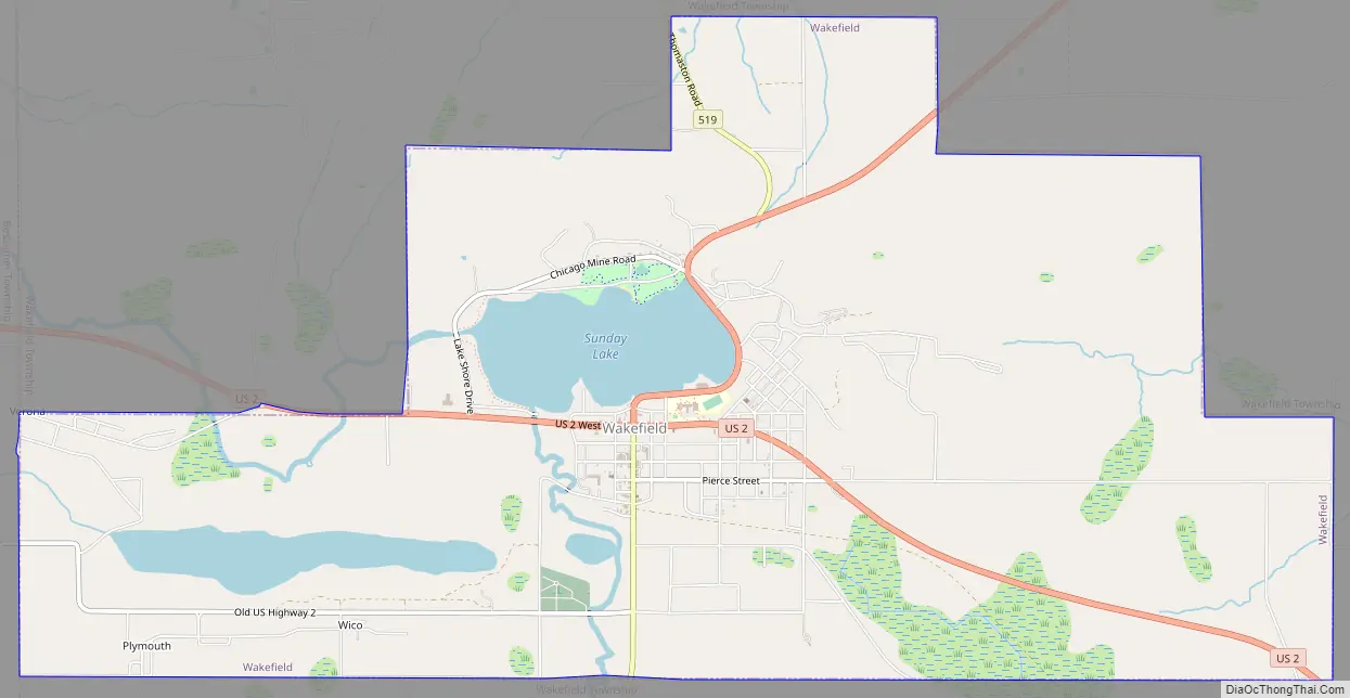
Wakefield city Satellite Map
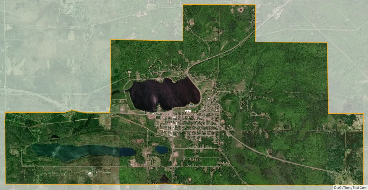
Geography
According to the United States Census Bureau, the city has a total area of 8.59 square miles (22.25 km), of which 8.02 square miles (20.77 km) is land and 0.57 square miles (1.48 km) is water.
See also
Map of Michigan State and its subdivision:- Alcona
- Alger
- Allegan
- Alpena
- Antrim
- Arenac
- Baraga
- Barry
- Bay
- Benzie
- Berrien
- Branch
- Calhoun
- Cass
- Charlevoix
- Cheboygan
- Chippewa
- Clare
- Clinton
- Crawford
- Delta
- Dickinson
- Eaton
- Emmet
- Genesee
- Gladwin
- Gogebic
- Grand Traverse
- Gratiot
- Hillsdale
- Houghton
- Huron
- Ingham
- Ionia
- Iosco
- Iron
- Isabella
- Jackson
- Kalamazoo
- Kalkaska
- Kent
- Keweenaw
- Lake
- Lake Hurron
- Lake Michigan
- Lake St. Clair
- Lake Superior
- Lapeer
- Leelanau
- Lenawee
- Livingston
- Luce
- Mackinac
- Macomb
- Manistee
- Marquette
- Mason
- Mecosta
- Menominee
- Midland
- Missaukee
- Monroe
- Montcalm
- Montmorency
- Muskegon
- Newaygo
- Oakland
- Oceana
- Ogemaw
- Ontonagon
- Osceola
- Oscoda
- Otsego
- Ottawa
- Presque Isle
- Roscommon
- Saginaw
- Saint Clair
- Saint Joseph
- Sanilac
- Schoolcraft
- Shiawassee
- Tuscola
- Van Buren
- Washtenaw
- Wayne
- Wexford
- Alabama
- Alaska
- Arizona
- Arkansas
- California
- Colorado
- Connecticut
- Delaware
- District of Columbia
- Florida
- Georgia
- Hawaii
- Idaho
- Illinois
- Indiana
- Iowa
- Kansas
- Kentucky
- Louisiana
- Maine
- Maryland
- Massachusetts
- Michigan
- Minnesota
- Mississippi
- Missouri
- Montana
- Nebraska
- Nevada
- New Hampshire
- New Jersey
- New Mexico
- New York
- North Carolina
- North Dakota
- Ohio
- Oklahoma
- Oregon
- Pennsylvania
- Rhode Island
- South Carolina
- South Dakota
- Tennessee
- Texas
- Utah
- Vermont
- Virginia
- Washington
- West Virginia
- Wisconsin
- Wyoming