Map of Brutus CDP

Map of Brutus CDP

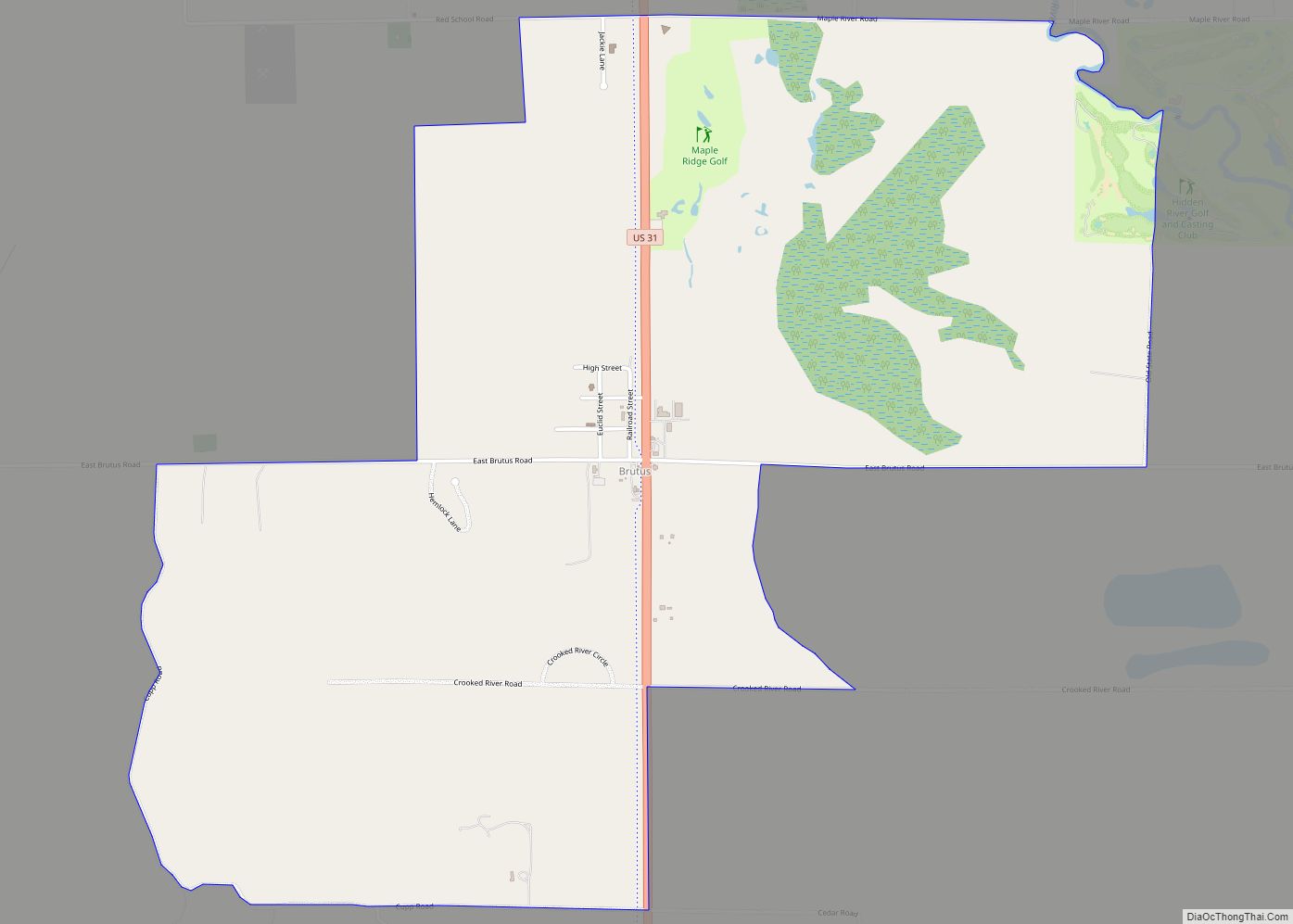
Brutus is an unincorporated community and census-designated place (CDP) in Emmet County in the U.S. state of Michigan. As of the 2010 census, the CDP had a population of 218. Brutus is located within Maple River Township. It was established with the building of an inn called the Brutus House in 1874. Brutus CDP overview: … Read more

Map of Brownlee Park CDP

Map of Brownlee Park CDP

Brownlee Park is a census-designated place (CDP) in Calhoun County in the U.S. state of Michigan.The population was 2,108 at the 2010 census. The CDP is immediately east of the city of Battle Creek and is part of the Battle Creek Metropolitan Statistical Area. The CDP includes both Brownlee Park and the adjacent community of … Read more

Map of Byron Center CDP

Map of Byron Center CDP

Byron Center is an unincorporated community and census-designated place (CDP) in Kent County in the U.S. state of Michigan. The population was 7,431 at the 2020 census, which is a significant increase from a population of 5,822 at the 2010 census. Byron Center is located within Byron Township. As an unincorporated community, Byron Center has … Read more

Map of Burton city

Map of Burton city, Michigan

Burton is a city in Genesee County in the state of Michigan and a suburb of Flint. The population was 29,999 at the 2010 census, making Burton the second largest city in Genesee County. Burton city overview: Name: Burton city LSAD Code: 25 LSAD Description: city (suffix) State: Michigan County: Genesee County Incorporated: 1972 (city) … Read more

Map of Burt CDP, Michigan

Map of Burt CDP, Michigan

Burt is a census-designated place (CDP) and Unincorporated community for statistical purposes in Taymouth Township, Saginaw County in the U.S. state of Michigan. The CDP’s population was 1,122 at the 2000 census. Burt is also the name of a post office with ZIP code 48417, which includes the area of the CDP as well as … Read more

Map of Burr Oak village, Michigan

Map of Burr Oak village, Michigan

Burr Oak is a village in St. Joseph County in the U.S. state of Michigan. As of the 2010 census, the village population was 828. The village is located within Burr Oak Township. Burr Oak village overview: Name: Burr Oak village LSAD Code: 47 LSAD Description: village (suffix) State: Michigan County: St. Joseph County Elevation: … Read more

Map of Burlington village, Michigan

Map of Burlington village, Michigan

Burlington is a village in Calhoun County in the U.S. state of Michigan. The population was 261 at the 2010 census. It is part of the Battle Creek, Michigan Metropolitan Statistical Area. The village is located within Burlington Township on M-60. Burlington village overview: Name: Burlington village LSAD Code: 47 LSAD Description: village (suffix) State: … Read more

Map of Caledonia village, Michigan

Map of Caledonia village, Michigan

Caledonia is a village in Kent County in the U.S. state of Michigan. The population was 1,622 at the 2020 census. The village is located within Caledonia Township about 15 miles (24.1 km) southeast of downtown Grand Rapids. Caledonia village overview: Name: Caledonia village LSAD Code: 47 LSAD Description: village (suffix) State: Michigan County: Kent County … Read more

Map of Cadillac city

Map of Cadillac city

Cadillac (/ˈkædəlæk/ KADD-ə-lack) is a city in and county seat of Wexford County in the U.S. state of Michigan. The population was 10,371 at the 2020 census, making it the second most-populated city in the Northern Michigan region, after Traverse City. Cadillac was settled as early as 1871 and formerly known as the village of … Read more

Map of Caberfae CDP

Map of Caberfae CDP

Caberfae (/kæbərfeɪ/ KAB-ər-fay) is an unincorporated community and census-designated place (CDP) in Wexford County in the U.S. state of Michigan. The community is located within Slagle Township to the north and South Branch Township to the south. The population of the CDP was 72 at the 2020 census. Caberfae CDP overview: Name: Caberfae CDP LSAD … Read more

Map of Byron village, Michigan

Map of Byron village, Michigan

Byron is a village in Shiawassee County in the U.S. state of Michigan. The population was 581 at the 2010 census. The village is located within Burns Township. Byron village overview: Name: Byron village LSAD Code: 47 LSAD Description: village (suffix) State: Michigan County: Shiawassee County Founded: 1824 Incorporated: 1873 Elevation: 830 ft (250 m) Total Area: … Read more

Map of Calumet village, Michigan

Map of Calumet village, Michigan

Calumet (/ˌkæljuˈmɛt/ KAL-yuu-MET or locally /ˌkæljəˈmɛt/ KAL-yə-MET) is a village in Calumet Township, Houghton County, in the U.S. state of Michigan‘s Upper Peninsula, that was once at the center of the mining industry of the Upper Peninsula. Also known as Red Jacket, the village includes the Calumet Downtown Historic District, listed on the National Register … Read more