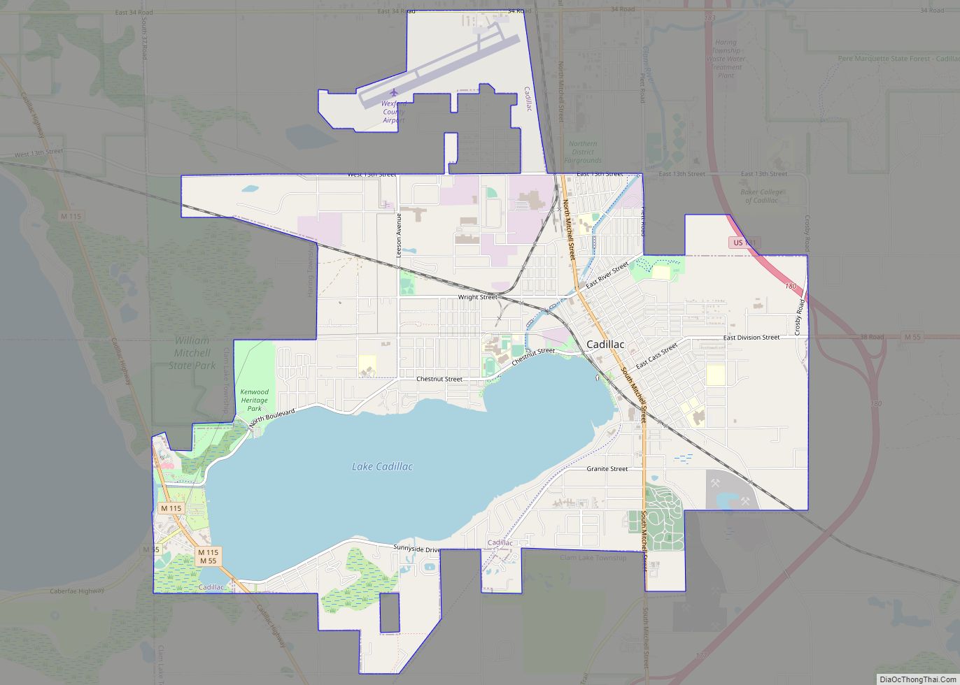
Cadillac (/ˈkædəlæk/ KADD-ə-lack) is a city in and county seat of Wexford County in the U.S. state of Michigan. The population was 10,371 at the 2020 census, making it the second most-populated city in the Northern Michigan region, after Traverse City.
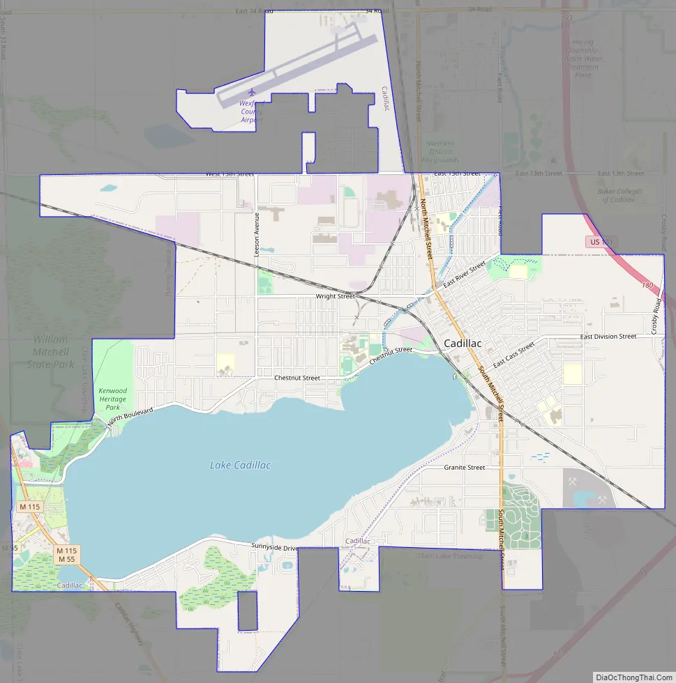
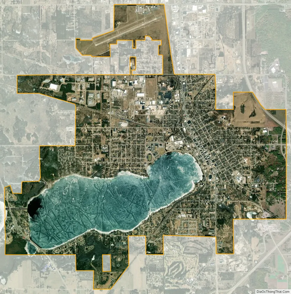
Cadillac was settled as early as 1871 and formerly known as the village of Clam Lake before incorporating as a city in 1877. The city is located upon the shores of Lake Cadillac, connected by the Clam Lake Canal to Lake Mitchell. The Clam River, which begins Cadillac, is part of the Muskegon River watershed. Cadillac is the junction of three major highways: US Highway 131, M-55, and M-115. The geographic center of Michigan is approximately five miles (8.0 km) north-northwest of Cadillac. Cadillac is the primary city of the Cadillac micropolitan area, which includes all of Wexford County and Missaukee County to the east, and had population of 48,725 at the 2020 census.
| Name: | Cadillac city |
|---|---|
| LSAD Code: | 25 |
| LSAD Description: | city (suffix) |
| State: | Michigan |
| County: | Wexford County |
| Incorporated: | 1875 (Clam Lake village) 1877 (city of Cadillac) |
| Elevation: | 1,309 ft (399 m) |
| Total Area: | 8.94 sq mi (23.16 km²) |
| Land Area: | 7.08 sq mi (18.34 km²) |
| Water Area: | 1.86 sq mi (4.82 km²) |
| Total Population: | 10,371 |
| Population Density: | 1,464.83/sq mi (565.56/km²) |
| Area code: | 231 |
| FIPS code: | 2612320 |
| GNISfeature ID: | 1619393 |
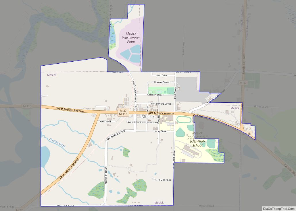
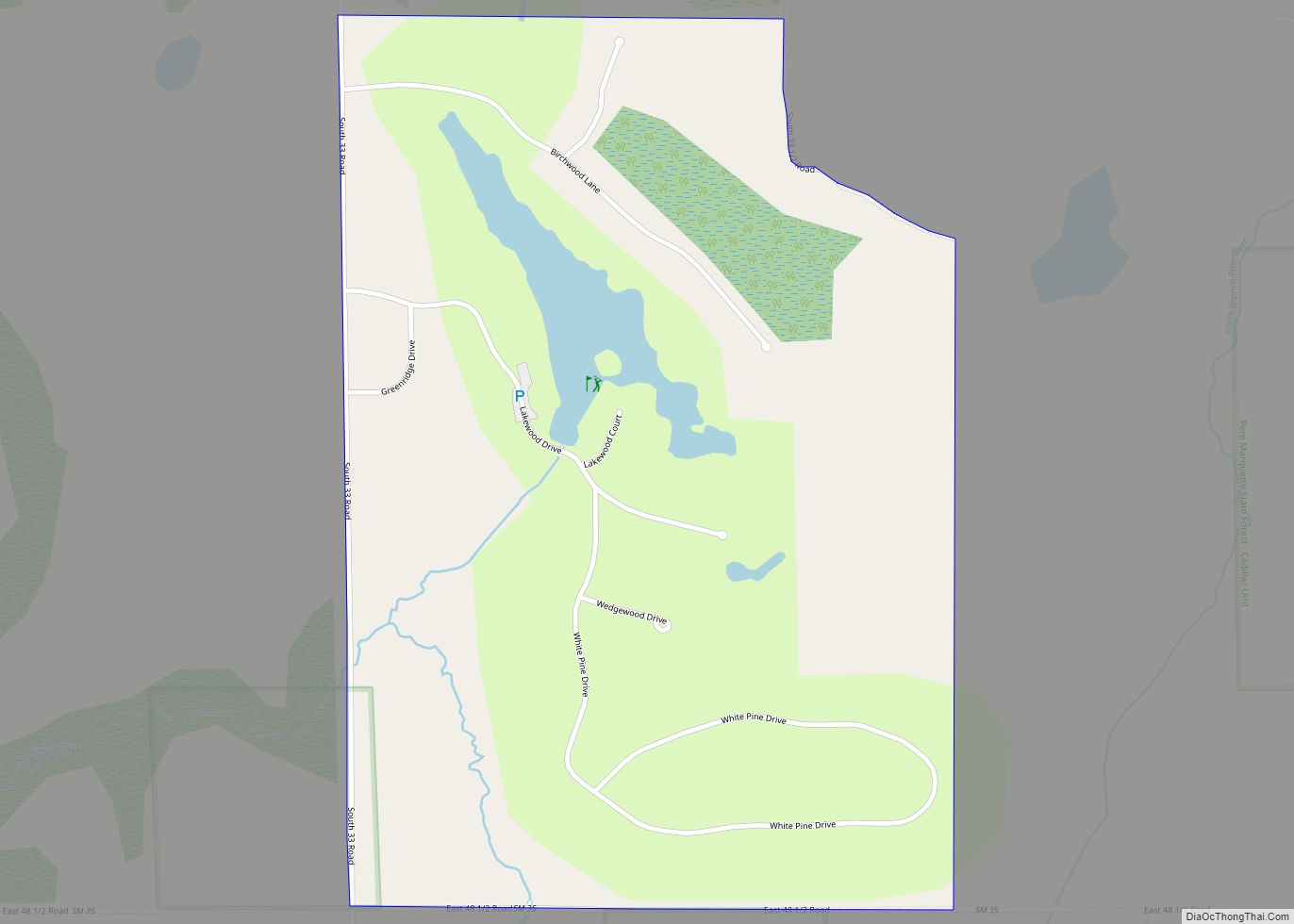
Online Interactive Map
Click on ![]() to view map in "full screen" mode.
to view map in "full screen" mode.
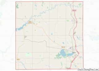
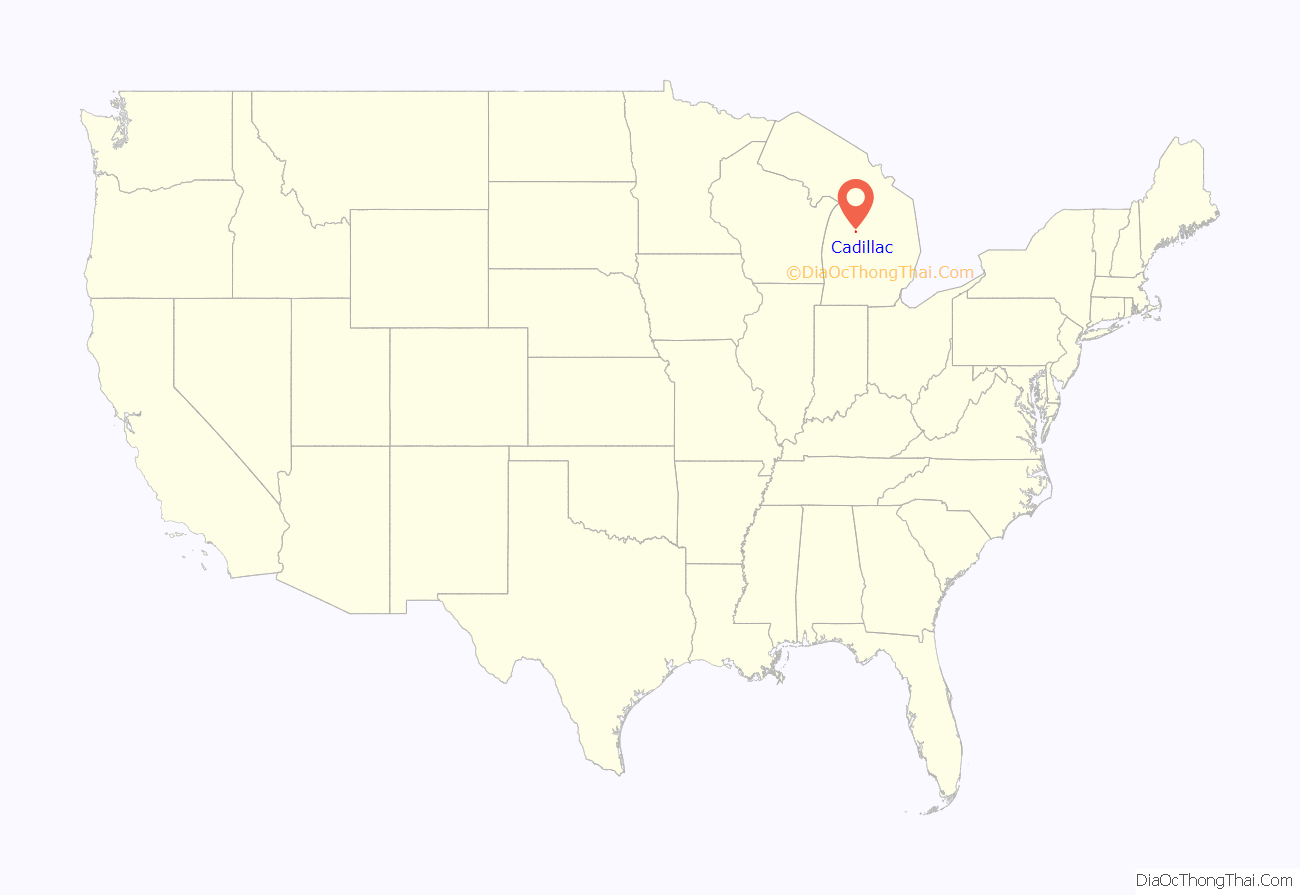
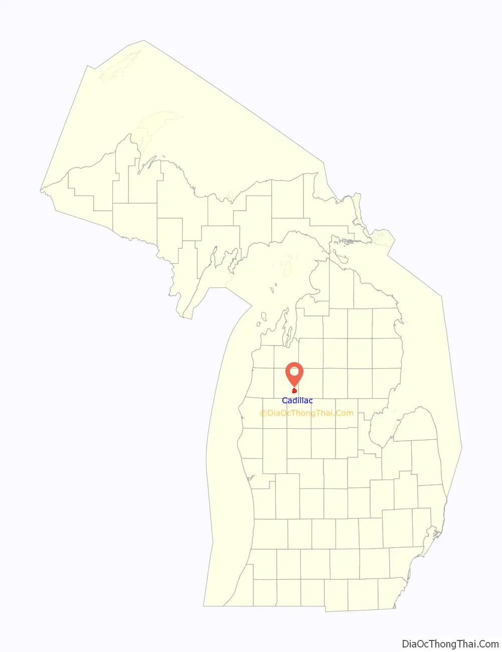
Cadillac location map. Where is Cadillac city?
History
Village of Clam Lake
European explorers and fur traders visited this area from the 18th century, most of them initially French and French-Canadians who traded with regional Native Americans. More permanent communities were not established until the late 19th century. Initial settlements developed from logging camps and the logging industry.
In 1871, the first sawmill began operations at Clam Lake. Originally called the Pioneer Mill, it was built by John R. Yale. That same year, George A. Mitchell, a prominent local banker and railroad entrepreneur, and Adam Gallinger, a local carpenter, formed the Clam Lake Canal Improvement and Construction Company. Two years later, the Clam Lake Canal was constructed between Big and Little Clam lakes, known as present-day Lakes Mitchell and Lake Cadillac. Sawmill owners used the canal to transport timber from Big Clam Lake to the mills and railroad sites on Little Clam Lake. The Grand Rapids and Indiana Railroad (G.R. & I. Railroad) had reached the area in 1872.
The settlement of Clam Lake was incorporated as a village in 1874. George Mitchell was elected as the first mayor. The village was incorporated as a city in 1877 and renamed Cadillac, after Antoine Laumet de La Mothe, sieur de Cadillac, a French colonist who started the first permanent settlement at Detroit in 1701.
Battle of Manton
The Wexford County seat of government, originally located in Sherman, was moved to Manton in 1881, as the result of a compromise between the feuding residents of Cadillac and Sherman. Cadillac partisans, however, won the county seat by a county-wide vote in April 1882. The day following the election, a sheriff’s posse left the city for Manton by special train to seize the county records. After they arrived and collected a portion of the materials, however, an angry crowd confronted the Cadillac men and drove them out of town.
When the sheriff returned to Cadillac, he encountered a force consisting of several hundred armed men; this group reportedly included a brass band. The Sheriff’s force, some of whom may have been intoxicated, traveled back to Manton to seize the remaining records. Although Manton residents confronted the Cadillac men and barricaded the courthouse, the posse successfully seized the documents. They returned to Cadillac in dubious glory.
City of Cadillac
In 1878, Ephraim Shay perfected his Shay locomotive, which was particularly effective in its ability to climb steep grades, maneuver sharp turns, and accommodate imperfections in railroad tracks. Cadillac was home to the Michigan Iron Works Company, which manufactured the Shay locomotive for a short time in the early 1880s. The lumber industry continued to dominate the city, attracting a large immigrant labor force, most of whom were Swedish. (Later Cadillac made sister city arrangements with Mölnlycke, Sweden, and Rovaniemi, Finland).
In 1899, the Cadillac Club formed, the forerunner of the Cadillac Area Chamber of Commerce. Gradually, various manufacturing firms found success in Cadillac.
By the early 20th century, with the lumber depleted, the timber industry was in decline. Industrial development soon dominated the local economy, and it continues to do so today. Cadillac’s range of industries includes the manufacture of pleasure boats, automotive parts, water-well components, vacuum cleaners, and rubber products.
In 1936, the U.S. Forest Service and the Civilian Conservation Corps developed the Caberfae Ski Area during the Great Depression as an investment in future economic development. This resulted in promotion of this area as a tourist center. Caberfae remains in operation today, as the oldest ski resort in the midwest. Tourism and outdoor recreation have since become an important sector of Cadillac’s economy.
In the summer, tourists travel to the city and region for boating, fishing, hiking, mountain biking, and camping. During the fall, hunting and color tours are popular. The winter is possibly the busiest season; the area can be found packed with downhill skiers, cross-country skiers, ice-fishers, snow-shoers and–most of all-snowmobilers. The North American Snowmobile Festival (NASF) is held on frozen Lake Cadillac every winter.
Thirsty’s, a gas station on M-55 west of Cadillac, was the home of Samantha or “Sam The Bear” from the 1970s through the late 1990s, when Sam died of old age. Sam was the only brown bear in captivity in the US at the time to hibernate naturally. Sam lived in a large cage in front of the gas station and was fed ice cream cones by tourists every summer.
In October 1975 the rock group Kiss visited Cadillac and performed at the Cadillac High School gymnasium. They played the concert to honor the Cadillac High School football team. In previous years, the team had compiled a record of sixteen consecutive victories, but the 1974 squad opened the season with two losses. The assistant coach, Jim Neff, an English teacher and rock’n’roll fan, thought to inspire the team by playing Kiss music in the locker room. He also connected the team’s game plan, K-I-S-S or “Keep It Simple Stupid”, with the band. The team went on to win seven straight games and their conference co-championship. After learning of their association with the team’s success, the band decided to visit the school and play for the homecoming game.
Historic landmarks
Cadillac maintains a number of state historic landmarks. Most are marked with a green “Michigan Historical Marker” sign, which includes a description of the landmark. Six sites with the city are marked: Cadillac Carnegie Library, Charles T. Mitchell House, Clam Lake Canal, Cobbs & Mitchell Building, Cobbs & Mitchell No. 1, and the Shay Locomotive (pictured at the right). Two more are in the near Cadillac area: Caberfae Ski Resort and Greenwood Disciples of Christ Church; and another two are in surrounding Wexford County, marking Battle of Manton and the First Wexford County Court House.
Cadillac Road Map
Cadillac city Satellite Map
Geography
Topography
According to the U.S. Census Bureau, the city has a total area of 9.02 square miles (23.36 km), of which 7.16 square miles (18.54 km) is land and 1.86 square miles (4.82 km) is water.
The 1,150-acre (5 km) Lake Cadillac is entirely within the city limits. The larger, 2,580-acre (10 km) Lake Mitchell is nearby on the west side of the city, with 1,760 feet (540 m) of shoreline within the city’s municipal boundary. The lakes were connected by a stream which was replaced in 1873 by the Clam Lake Canal. The canal was featured on Ripley’s Believe It or Not in the 1970s due to the phenomenon that in winter the canal freezes before the lakes and then after the lakes freeze, the canal thaws and remains unfrozen for the rest of the winter.
Cadillac is located at the eastern edge of what is now managed as the Manistee National Forest. The surrounding area is heavily wooded, with mixed hardwood and conifer forests. Christmas tree farming has been important to the area agricultural industry. Cadillac was chosen in 1988 to donate the holiday tree installed at the lawn of the U.S. Capitol building in Washington, D.C.
The area surrounding Cadillac is primarily rural, and is considered to be part of Northern Michigan. Given the small size of nearby communities, the city is a major commercial and industrial hub of the region.
Cityscape
The commercial center of the city is located on the eastern edge of Lake Cadillac. Most downtown buildings range from two to five stories in height. Many face Mitchell Street, the city’s tree-lined main street and traditional corridor of travel through town. The downtown contains a movie theater, gift shops, restaurants, a bookstore, specialty food stores, jewelers, clothing retailers, and various other businesses.
The Courthouse Hill Historic District, recognized in April 2005, lies adjacent to the city’s commercial center. The District contains a number of large Victorian-style residences built by the lumber barons and businessmen who helped develop the city in the 1870s. Population and building density is highest in this area.
On the western bank of Lake Cadillac, where M-55 intersects M-115, is what is locally referred to as Cadillac West. This is a small commercial district, bordering Mitchell State Park and the two lakes; it caters mostly to tourists. It contains a number of motels and restaurants.
Along the northern and southern stretches of the lake are the main residential areas of the city. They are generally of low to moderate density, characterized primarily by single-family structures.
Climate
Cadillac experiences a typical northern Michigan climate, undergoing temperate seasonal changes, influenced by the presence of Lake Michigan and the inevitable lake effect. Winters are generally cold with large amounts of snowfall. Summers are warm. The average high temperature in July is 80 °F (27 °C) and the average low in January is 12 °F (−11 °C). Summer temperatures can exceed 90 °F (32 °C), and winter temperatures can drop below 0 °F (−18 °C). Average annual rainfall is 30 inches (76 cm), and average annual snowfall is 81 inches (210 cm) . Snowfall typically occurs between the months of November and March. According to the Köppen climate classification system, Cadillac has a humid continental climate, abbreviated “Dfb” on climate maps.
Superfund sites
Cadillac has two superfund sites, according to the U.S. Environmental Protection Agency. One is located at 1100 Wright Street, the former site of Kysor Industrial Corp, which operations resulted in toxic wastes. The other is located at 1002 6th Street, the former site of Northernaire Plating. Its operations also produced hazardous wastes, which produced contamination.
See also
Map of Michigan State and its subdivision:- Alcona
- Alger
- Allegan
- Alpena
- Antrim
- Arenac
- Baraga
- Barry
- Bay
- Benzie
- Berrien
- Branch
- Calhoun
- Cass
- Charlevoix
- Cheboygan
- Chippewa
- Clare
- Clinton
- Crawford
- Delta
- Dickinson
- Eaton
- Emmet
- Genesee
- Gladwin
- Gogebic
- Grand Traverse
- Gratiot
- Hillsdale
- Houghton
- Huron
- Ingham
- Ionia
- Iosco
- Iron
- Isabella
- Jackson
- Kalamazoo
- Kalkaska
- Kent
- Keweenaw
- Lake
- Lake Hurron
- Lake Michigan
- Lake St. Clair
- Lake Superior
- Lapeer
- Leelanau
- Lenawee
- Livingston
- Luce
- Mackinac
- Macomb
- Manistee
- Marquette
- Mason
- Mecosta
- Menominee
- Midland
- Missaukee
- Monroe
- Montcalm
- Montmorency
- Muskegon
- Newaygo
- Oakland
- Oceana
- Ogemaw
- Ontonagon
- Osceola
- Oscoda
- Otsego
- Ottawa
- Presque Isle
- Roscommon
- Saginaw
- Saint Clair
- Saint Joseph
- Sanilac
- Schoolcraft
- Shiawassee
- Tuscola
- Van Buren
- Washtenaw
- Wayne
- Wexford
- Alabama
- Alaska
- Arizona
- Arkansas
- California
- Colorado
- Connecticut
- Delaware
- District of Columbia
- Florida
- Georgia
- Hawaii
- Idaho
- Illinois
- Indiana
- Iowa
- Kansas
- Kentucky
- Louisiana
- Maine
- Maryland
- Massachusetts
- Michigan
- Minnesota
- Mississippi
- Missouri
- Montana
- Nebraska
- Nevada
- New Hampshire
- New Jersey
- New Mexico
- New York
- North Carolina
- North Dakota
- Ohio
- Oklahoma
- Oregon
- Pennsylvania
- Rhode Island
- South Carolina
- South Dakota
- Tennessee
- Texas
- Utah
- Vermont
- Virginia
- Washington
- West Virginia
- Wisconsin
- Wyoming