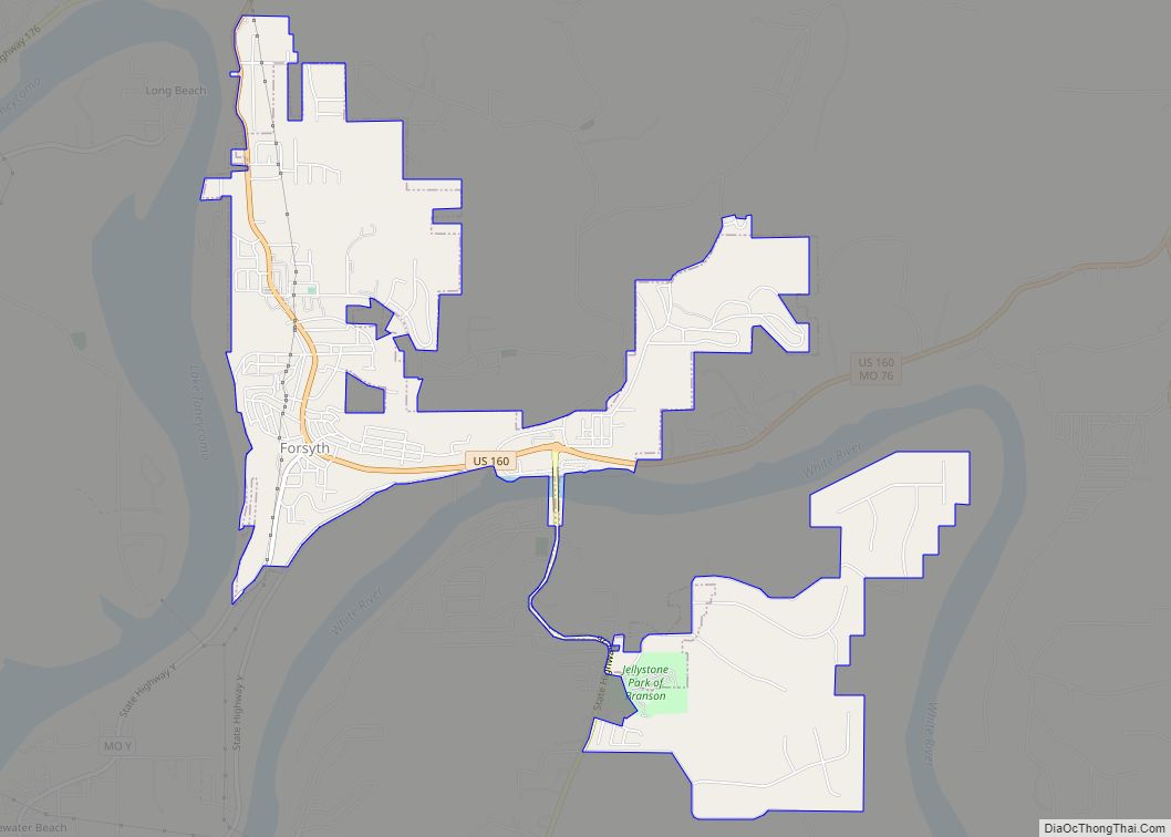
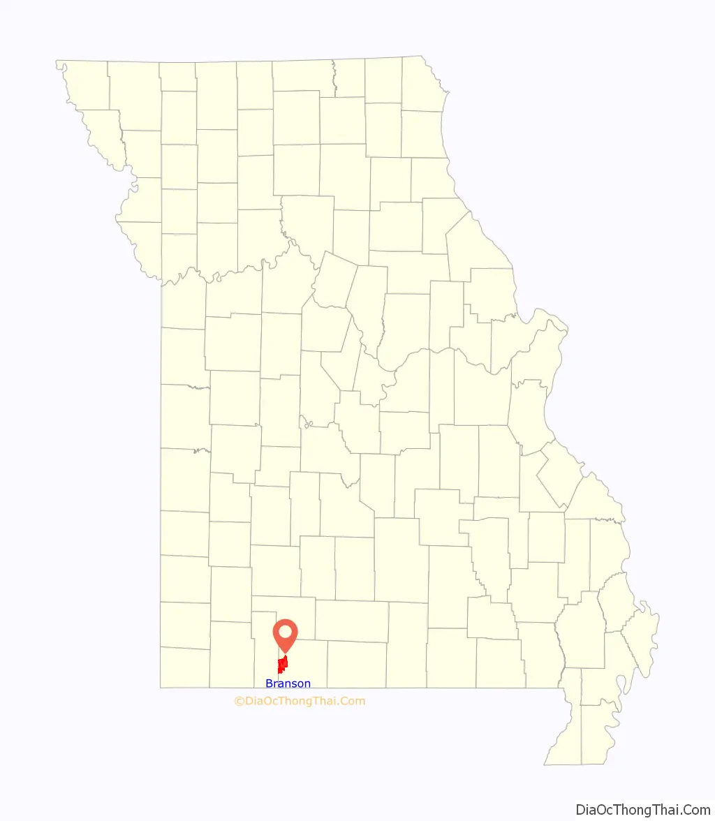
Branson is a city in the U.S. state of Missouri. Most of the city is situated in Taney County, with a small portion in the west extending into Stone County. Branson is in the Ozark Mountains. The community was named after Reuben Branson, postmaster and operator of a general store in the area in the 1880s. The population was 12,638 at the 2020 census.
Branson has long been a popular destination for vacationers from Missouri and around the country. The collection of entertainment theaters along 76 Country Boulevard (and to a lesser extent along Shepherd of the Hills Expressway), including Dolly Parton’s Stampede, has increased Branson’s popularity as a tourist destination.
| Name: | Branson city |
|---|---|
| LSAD Code: | 25 |
| LSAD Description: | city (suffix) |
| State: | Missouri |
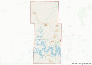
| County: | Stone County, Taney County |
| Founded: | 1882 |
| Incorporated: | April 1, 1912 |
| Elevation: | 774 ft (236 m) |
| Land Area: | 21.35 sq mi (55.29 km²) |
| Water Area: | 0.15 sq mi (0.40 km²) |
| Population Density: | 592.05/sq mi (228.59/km²) |
| ZIP code: | 65615-65616 |
| Area code: | 417 |
| FIPS code: | 2907966 |
| GNISfeature ID: | 0739970 |
| Website: | cityofbranson.gov |
Explore the Branson map collection and discover what this city has to offer. From sightseeing, to fishing, to shopping, to shows, to golf, to theme parks and more, you’re sure to find something to do.
Check out the interactive map provided by Google Maps to find your way around the tourist hub of Missouri. Here you can explore the city in a more detailed way and plan your trip accordingly.
Discover the beauty of Branson and all it has to offer with the Branson map collection. From sightseeing to fishing, shopping to shows, golf to theme parks and more, you’re sure to find something to do. Plus, the interactive map provided by Google Maps lets you explore the city in a more detailed way and plan your trip accordingly.
Online Interactive Map
Click on ![]() to view map in "full screen" mode.
to view map in "full screen" mode.
Branson is a city in the U.S. state of Missouri that is known for its world-class attractions, variety of festivals, and live entertainment. It’s also known for its thriving arts community, with over 40 theaters and 80 shows. Branson offers something for everyone, from thrilling roller coasters to relaxing spas. So whether you’re looking for a family vacation or planning a romantic getaway, use this interactive map of Branson to explore the popular tourist destination.
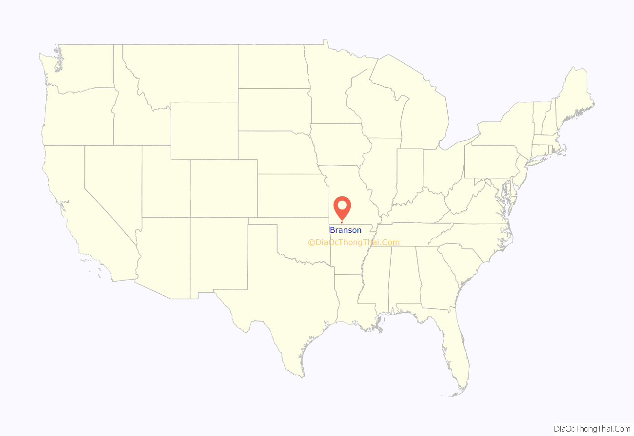
Branson location map. Where is Branson city?
History
In 1882, Reuben Branson opened a general store and post office in the area. Branson was formally incorporated on April 1, 1912, and construction of the Powersite Dam nearby on the White River which would form Lake Taneycomo was completed.
In 1894, William Henry Lynch bought Marble Cave (renamed “Marvel Cave”) and began charging visitors to tour it. Hugo and Mary Herschend leased the cave for 99 years in 1950 and began hosting square dances in it. The Herschend Family modernized the cave with electricity and concrete staircases, and in 1960 the Herschends opened Silver Dollar City, a re-creation of a frontier town that featured five shops, a church, and a log cabin, with actors that played out the feud between the Hatfields and the McCoys.
Harold Bell Wright published his novel about the Ozarks, The Shepherd of the Hills, in 1907. The novel became an international best seller, making Wright the first millionaire author and established Branson and Southwest Missouri as a tourist destination. The Old Mill Theater began its first outdoor production based on the novel in 1960. The show, known as The Shepherd of the Hills Outdoor Drama, continued in its 61st season for 2021. The historic farm is also the home of Inspiration Tower, the #1 rated Shepherd of the Hills Adventure Park as well as numerous other shows and attractions.
The Harold Bell Wright Museum is located within The World’s Largest Toy Museum complex. Mayor of Branson for 12 years and entrepreneur Jim Owen built the first theater in 1934 on Commercial Street, originally called “The Hillbilly Theater”, which began to attract people from far and wide to tour the area. 1959 saw the completion of Table Rock Dam on the White River, which created Table Rock Lake. In 1959, the Mabe Brothers started a band that, in 1961, would become the first music show in Branson. Taking their name from the parts they played in the Shepherd of the Hills Outdoor Drama, they became known as the Baldknobber Hillbilly Jamboree.
In 1962, Paul Henning, inspired by a Boy Scout camping trip to the Ozarks, created The Beverly Hillbillies, which ran on first-run television until 1971. Henning later donated 1,534 acres (6.21 km) for the Ruth and Paul Henning Conservation Area near Branson. He also donated the modified 1921 Oldsmobile truck used as the vehicle in the series to the College of the Ozarks, where it is on display in the Ralph Foster Museum.
The Presley family became the first to move their show (Presleys’ Country Jubilee) to Highway 76 in 1967, followed a year later by the Baldknobbers. Eventually Branson would have more than 50 theaters, most of them located on Highway 76.
Also in 1983, the 7,500-seat Swiss Villa Amphitheatre opened in Lampe, southwest of Branson. The outdoor amphitheater brought in acts like Def Leppard, Lynyrd Skynyrd, REO Speedwagon, Steppenwolf, and Ozzy Osbourne. Closing in the early 2000s, it reopened in 2010 as the Black Oak Mountain Amphitheater. Closing suddenly in 2013, it went unused until relaunching live music events in 2021.
In 1987, Boxcar Willie became the first internationally known entertainer to purchase a theater in Branson and have a permanent performance schedule there.
In 1989, Shoji Tabuchi opened his first theater in Branson (converting the Ozarks Auto Museum on West 76 Highway into a theater). He then built a new theater on Shepherd of the Hills Expressway in 1990, while Mel Tillis moved into Shoji’s old theater. In 1990-1991 several nationally known stars such as Jim Stafford, Ray Stevens, Mickey Gilley, and Moe Bandy opened their own theaters. Along with these national stars, many home-grown shows also had theaters. The Lowe Family featured their show and hosted nationally known stars like Conway Twitty, Loretta Lynn, Vern Gosdin, Waylon Jennings, and others. 76 Music Hall (now known as the Grand Country Music Hall) became the first theater to have three different shows a day performing in different time slots. In 1991, local producer and entertainer Bob Nichols opened the first morning show and the following year, Buck Trent became the first nationally known star to star in a morning show.
The increasing number of theaters and other attractions opening in Branson drew the attention of 60 Minutes, which aired an episode about Branson on December 8, 1991, and called it the “live music capital of the entire universe”.
Andy Williams built his theater in Branson, opening on May 1, 1992, calling it the Moon River Theatre. The Glen Campbell Goodtime Theatre opened in 1994, starring Glen along with his “Goodtime Band”, daughter Debbie Campbell, the Matthew Dickens Dancers, and comedian ventriloquist Jim Barber. Also headlining their own theaters were Tony Orlando (Yellow Ribbon Theater) and Bobby Vinton (Blue Velvet Theater). In 1998, the Acrobats of China arrived in Branson, making them one of the first international shows to call Branson home. They opened their theatre, the New Shanghai Theatre, in 2005. In 2006, Dick Clark’s American Bandstand Theatre opened and is the most recent new theater to be built on Route 76. Branson has continued to add theaters (the most recent being the Sight & Sound Theatres) and shows; it refers to itself as “the live music show capital of the world”.
Use of social media is now an important factor in putting the spotlight on Branson. For example, the Petersens, a family bluegrass band, forced by COVID-19 to quit touring or performing live at Branson’s Little Opry Theatre for much of 2020, found that YouTube was an alternative, with their videos generating more than 70 million views. In addition, 65% of their nearly 600,000 subscribers live outside the United States. (Figures as of October 2021 are as found on YouTube or cited by the Petersens). Thus this “American roots” band is generating a wide range of interest in Branson as a tourist destination.
2012 tornado
Just after 1 a.m. on February 29, 2012, the city of Branson sustained damage from an EF-2 tornado in the 2012 Leap Day tornado outbreak. At least 37 injuries were reported, most being cuts and bruises, with the most serious injury being an 80-year-old woman with a head injury. Most of the tourist attractions and businesses were undamaged and remained open after the storm, although at least 11 buildings suffered more than $3 million in total damage. As of November 2012, most of the damage was repaired. Mary Jane Rice, a spokeswoman for Branson Area Chamber of Commerce, told the AP that February is generally a slow time for business and most of the damage would be cleaned up in the next few days. The tornado followed a 22-mile-long (35 km) path from Kimberling City, Missouri, across Table Rock Lake and along the entertainment strip Missouri Route 76 (now 76 country boulevard) before hitting the downtown area where it blew out or cracked windows in 219 of the hotel rooms in the 12-story/295 room Hilton Branson Convention Center. The tornado extensively damaged three of Branson’s 50-plus theatres — (Americana Theater, Branson Variety Theater and Dick Clark’s American Bandstand Theater) and there was damage to portions of Branson Landing on Lake Taneycomo and the Veterans Memorial Museum. Vehicles at the Ride the Ducks water/land attraction were flipped over, but officials said they were not damaged enough to be put out of service.
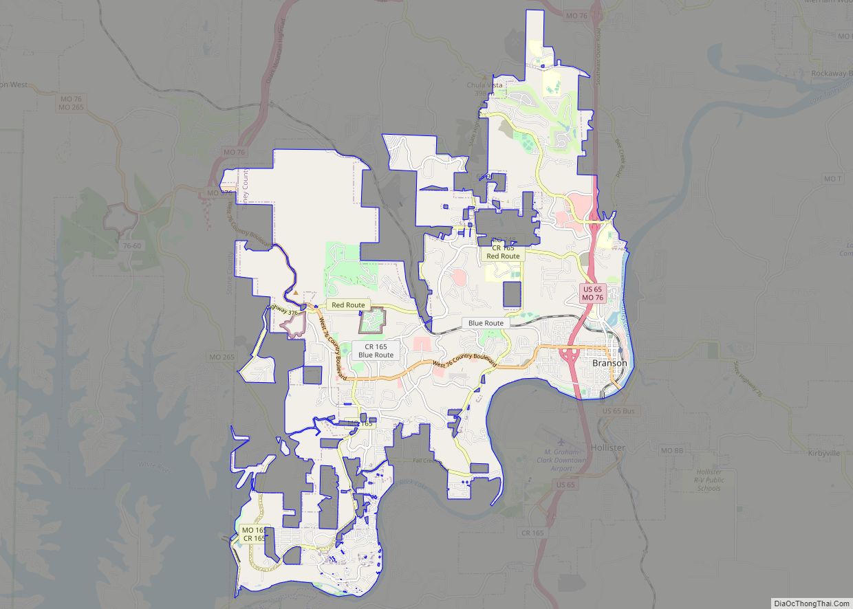
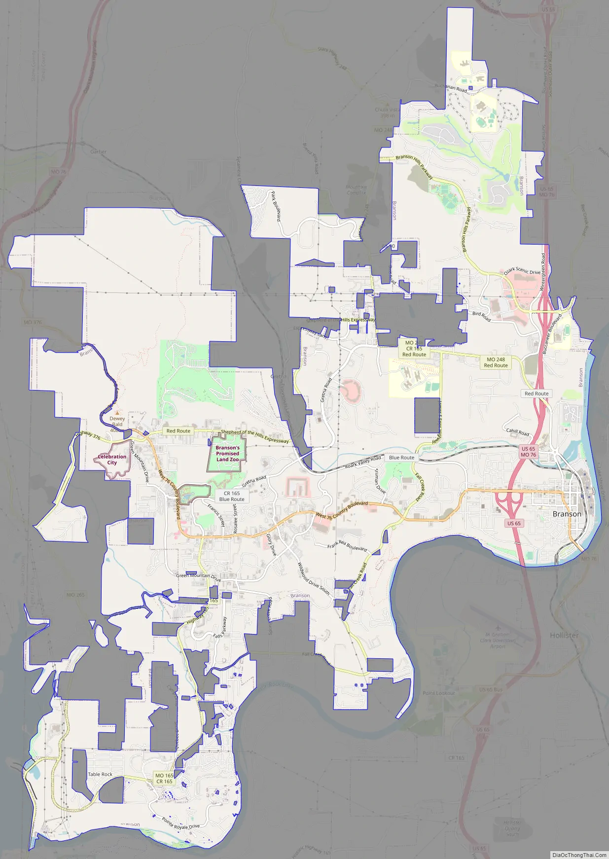
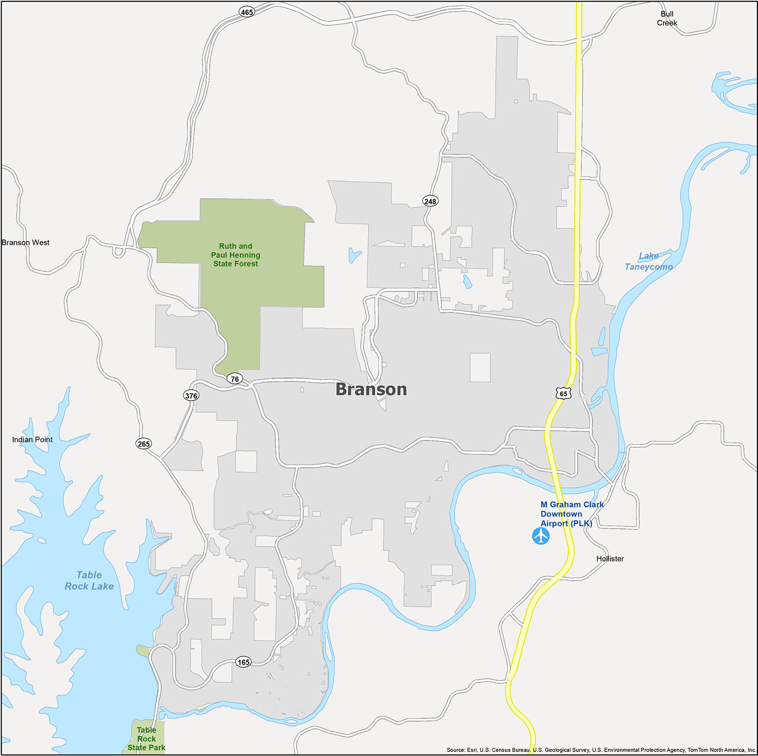
Branson Road Map
When planning a trip to Branson, it’s essential to know the locations of major landmarks in the area. To help you get around the city with ease, we’ve put together a handy guide to the major highways, roads, parkways and expressways. The main highways in the area are 65, 76, 165, 248, 265 and 376. Other major roads include Country Blvd, Main St and Veterans Blvd. Parkways and expressways include Shepherd of the Hills Expy and Branson Hills Pky. Additionally, there are roads such as 5th St, Bee Creek Rd, Branson Landing Blvd, Cliff Dr, Long St, Roark Valley Dr, Stanley Blvd and Veterans Blvd. For trips outside of Branson, make sure to print the road map of Missouri to ensure you get where you want to go.
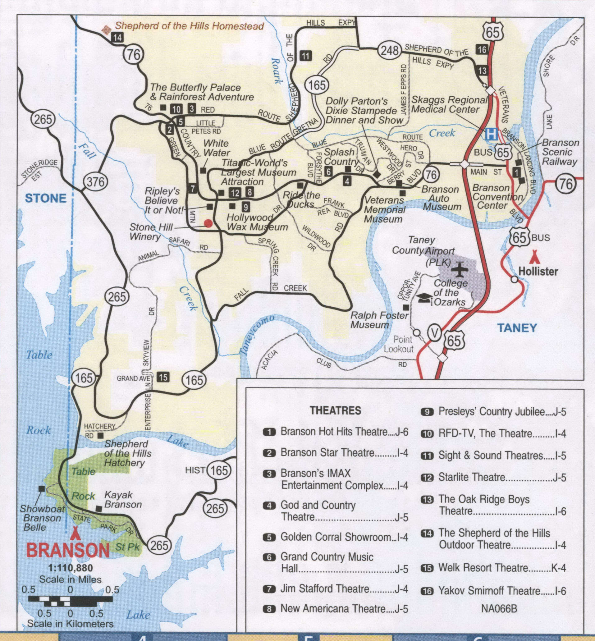
Highways: US 65, US 160, Business 65, Missouri 465
Visiting Branson is like stepping into a world of natural beauty and entertainment. With its perfect blend of attractions, this small city is one of the most popular tourist destinations in the country. To help you get around, here is a general map of Branson and the surrounding area.
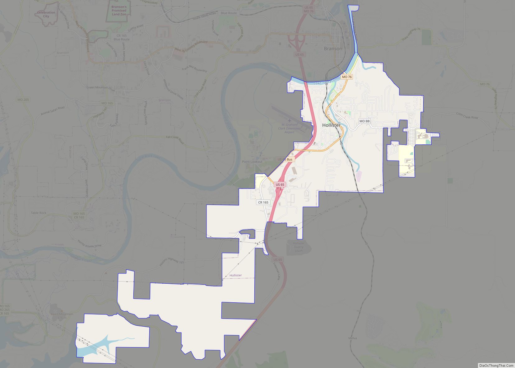
The M. Graham Clark Downtown Airport (PLK) is the main airport servicing Branson, and the cities of Branson, Branson West, and Hollister are all located nearby. There are also two villages, Bull Creek and Indian Point, as well as two reservoirs, Table Rock Lake and Lake Taneycomo. The main highways in the area are US 65, US 160, Business 65, and Missouri 465.
No matter where you’re from, you’ll find something to love in Branson. With its stunning natural beauty, top-notch entertainment, and convenient transportation, it’s easy to see why this small city is such a popular tourist destination. Use the above map to help you explore the area and make the most of your visit to Branson.
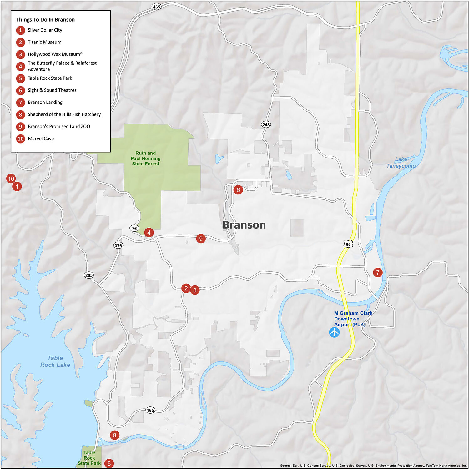
10 things to do in Branson city
Branson, Missouri is a bustling city filled with entertainment and activities for everyone. From live theatre performances, to museums, to outdoor activities, there is something for everyone to enjoy. A few of the most popular attractions in Branson are Silver Dollar City, Titanic Museum, Hollywood Wax Museum®, The Butterfly Palace & Rainforest Adventure, Table Rock State Park, Sight & Sound Theatres, Branson Landing, Shepherd of the Hills Fish Hatchery, Branson’s Promised Land Zoo, and Marvel Cave. With so much to do, you’ll never be bored in Branson!
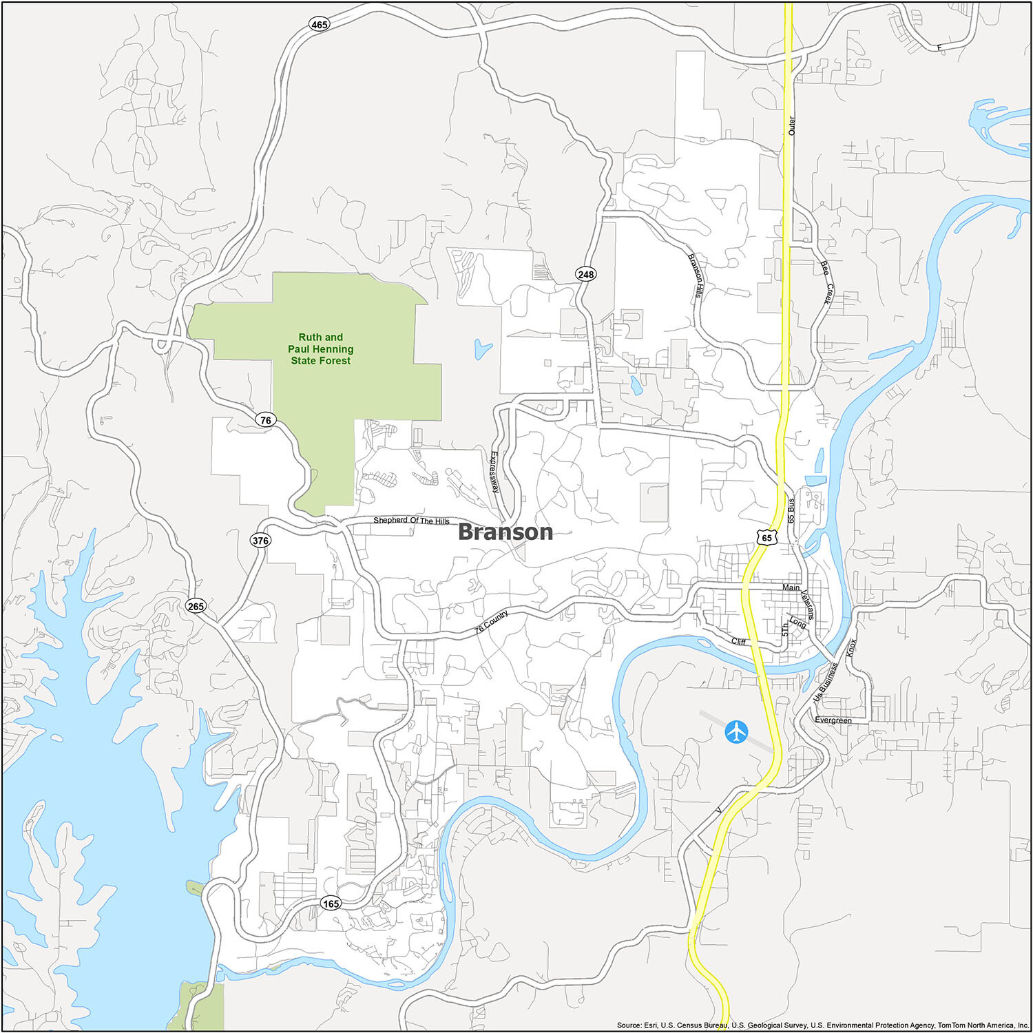
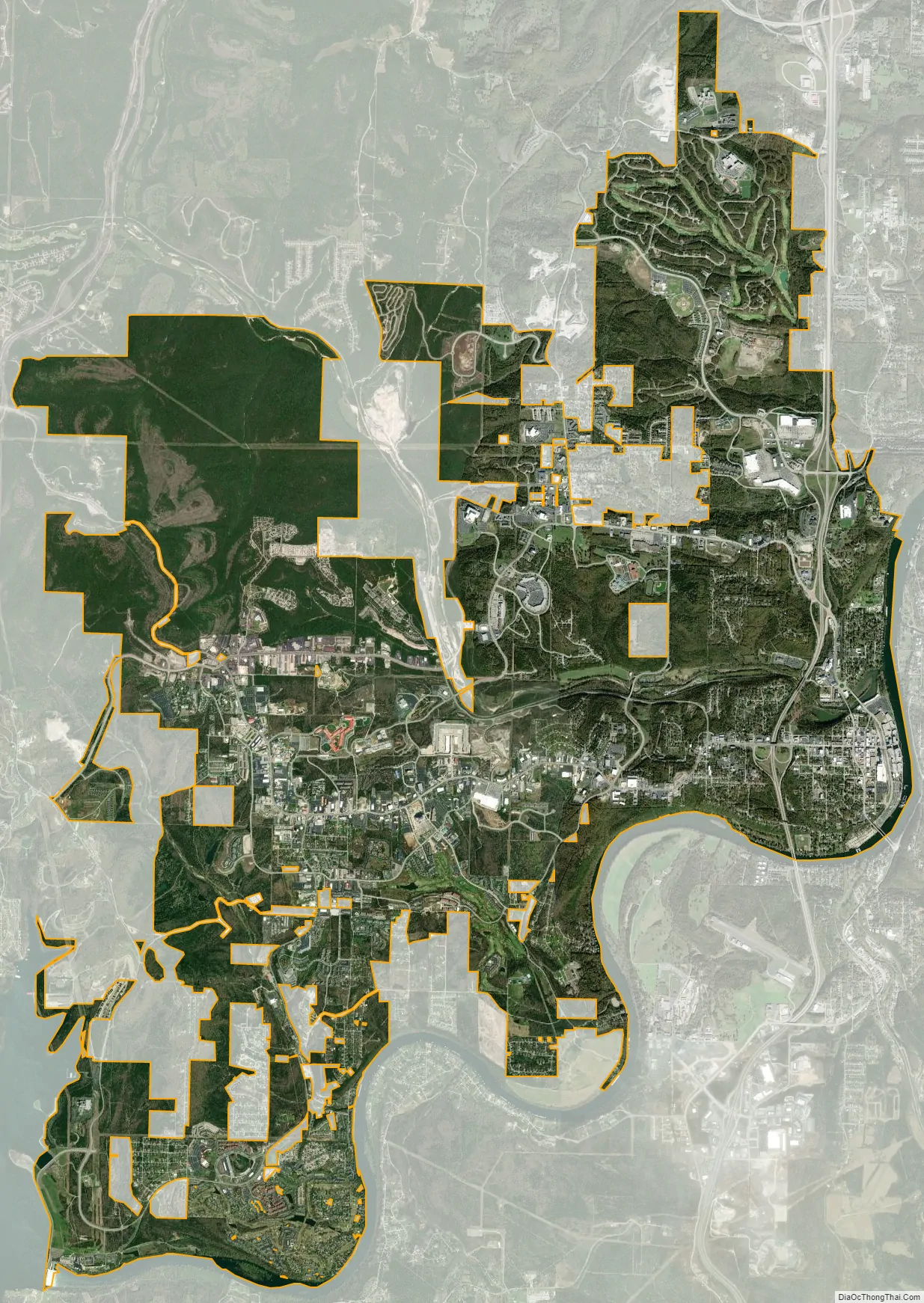
Branson city Satellite Map
Geography
Branson is located at 36°38′16″N 93°15′18″W / 36.63778°N 93.25500°W / 36.63778; -93.25500 (36.637706, -93.254965). The White River/Lake Taneycomo forms a bend on the east and southern side of the city.
According to the United States Census Bureau, the city has a total area of 20.80 square miles (53.87 km), of which 20.63 square miles (53.43 km) is land and 0.17 square miles (0.44 km) is water.
Climate
Branson has a humid subtropical climate (Cfa) with characteristics of a continental climate. The hardiness zone is 6b. [1]
See also
Map of Missouri State and its subdivision:- Adair
- Andrew
- Atchison
- Audrain
- Barry
- Barton
- Bates
- Benton
- Bollinger
- Boone
- Buchanan
- Butler
- Caldwell
- Callaway
- Camden
- Cape Girardeau
- Carroll
- Carter
- Cass
- Cedar
- Chariton
- Christian
- Clark
- Clay
- Clinton
- Cole
- Cooper
- Crawford
- Dade
- Dallas
- Daviess
- De Kalb
- Dent
- Douglas
- Dunklin
- Franklin
- Gasconade
- Gentry
- Greene
- Grundy
- Harrison
- Henry
- Hickory
- Holt
- Howard
- Howell
- Iron
- Jackson
- Jasper
- Jefferson
- Johnson
- Knox
- Laclede
- Lafayette
- Lawrence
- Lewis
- Lincoln
- Linn
- Livingston
- Macon
- Madison
- Maries
- Marion
- McDonald
- Mercer
- Miller
- Mississippi
- Moniteau
- Monroe
- Montgomery
- Morgan
- New Madrid
- Newton
- Nodaway
- Oregon
- Osage
- Ozark
- Pemiscot
- Perry
- Pettis
- Phelps
- Pike
- Platte
- Polk
- Pulaski
- Putnam
- Ralls
- Randolph
- Ray
- Reynolds
- Ripley
- Saint Charles
- Saint Clair
- Saint Francois
- Saint Louis
- Sainte Genevieve
- Saline
- Schuyler
- Scotland
- Scott
- Shannon
- Shelby
- Stoddard
- Stone
- Sullivan
- Taney
- Texas
- Vernon
- Warren
- Washington
- Wayne
- Webster
- Worth
- Wright
- Alabama
- Alaska
- Arizona
- Arkansas
- California
- Colorado
- Connecticut
- Delaware
- District of Columbia
- Florida
- Georgia
- Hawaii
- Idaho
- Illinois
- Indiana
- Iowa
- Kansas
- Kentucky
- Louisiana
- Maine
- Maryland
- Massachusetts
- Michigan
- Minnesota
- Mississippi
- Missouri
- Montana
- Nebraska
- Nevada
- New Hampshire
- New Jersey
- New Mexico
- New York
- North Carolina
- North Dakota
- Ohio
- Oklahoma
- Oregon
- Pennsylvania
- Rhode Island
- South Carolina
- South Dakota
- Tennessee
- Texas
- Utah
- Vermont
- Virginia
- Washington
- West Virginia
- Wisconsin
- Wyoming