Independence is the fifth-largest city in Missouri and the county seat of Jackson County. Independence is a satellite city of Kansas City, Missouri, and is the largest suburb on the Missouri side of the Kansas City metropolitan area. In 2020, it had a total population of 123,011.
Independence is known as the “Queen City of the Trails” because it was a point of departure for the California, Oregon, and Santa Fe Trails. It is the hometown of U.S. President Harry S. Truman, with the Truman Presidential Library and Museum, and the gravesites of Truman and First Lady Bess Truman. The city is sacred to the Latter Day Saint movement, as the home of Joseph Smith’s 1831 Temple Lot, and the headquarters of several Mormon denominations.
| Name: | Independence city |
|---|---|
| LSAD Code: | 25 |
| LSAD Description: | city (suffix) |
| State: | Missouri |
| County: | Clay County, Jackson County |
| Founded: | March 29, 1827 |
| Elevation: | 863 ft (263 m) |
| Total Area: | 78.42 sq mi (203.10 km²) |
| Land Area: | 77.97 sq mi (201.93 km²) |
| Water Area: | 0.45 sq mi (1.17 km²) |
| Total Population: | 123,011 |
| Population Density: | 1,577.75/sq mi (609.17/km²) |
| ZIP code: | 64050-64057 |
| Area code: | 816 |
| FIPS code: | 2935000 |
| GNISfeature ID: | 2395422 |
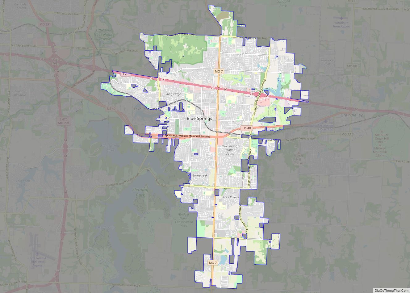
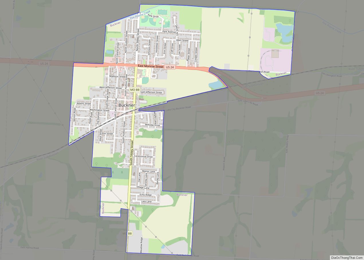
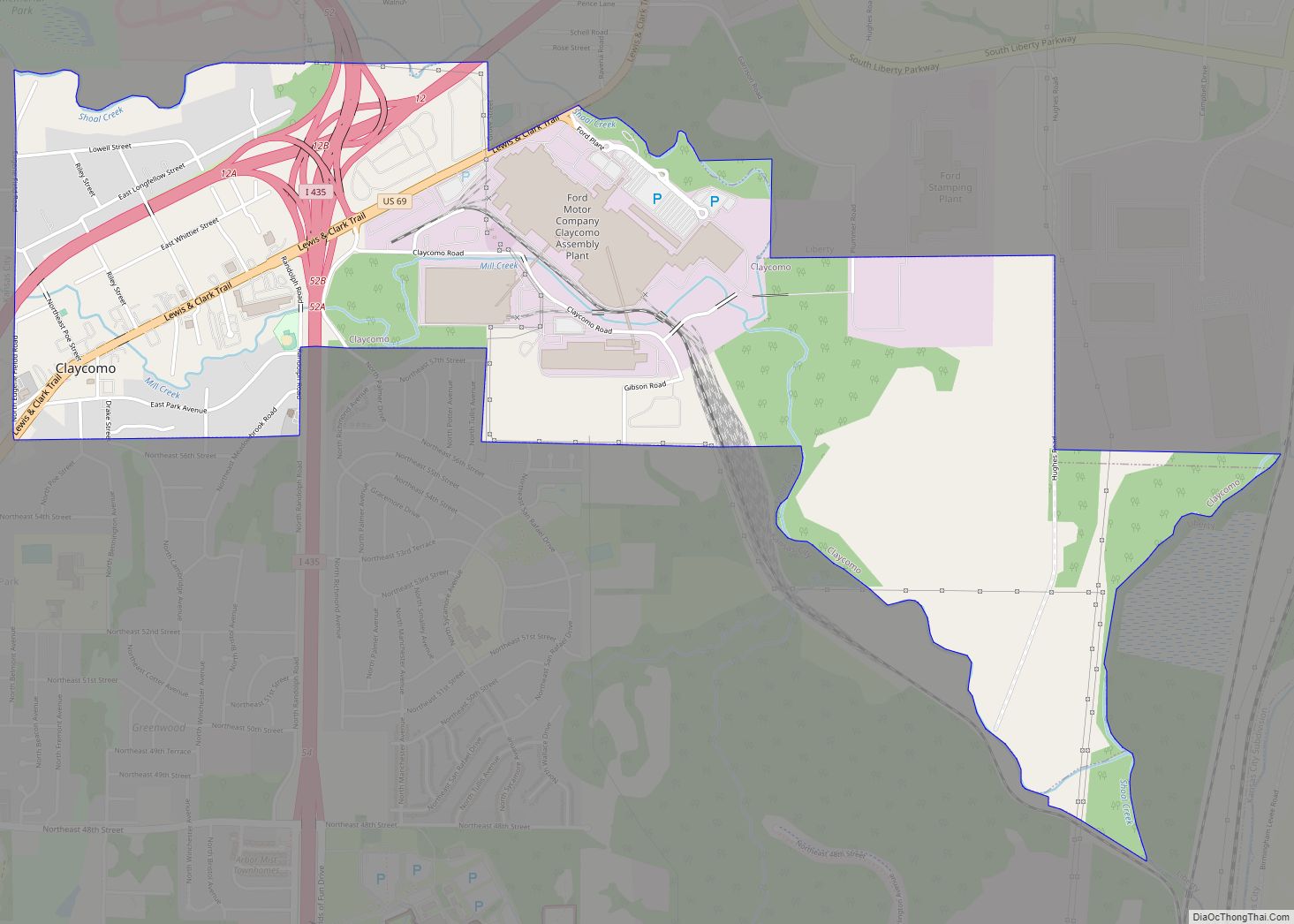
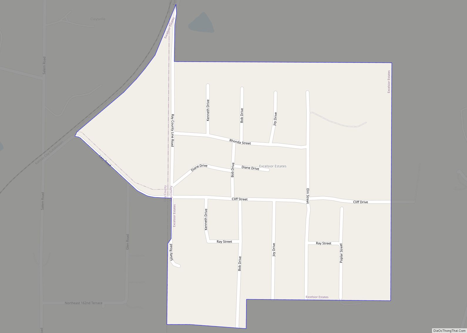
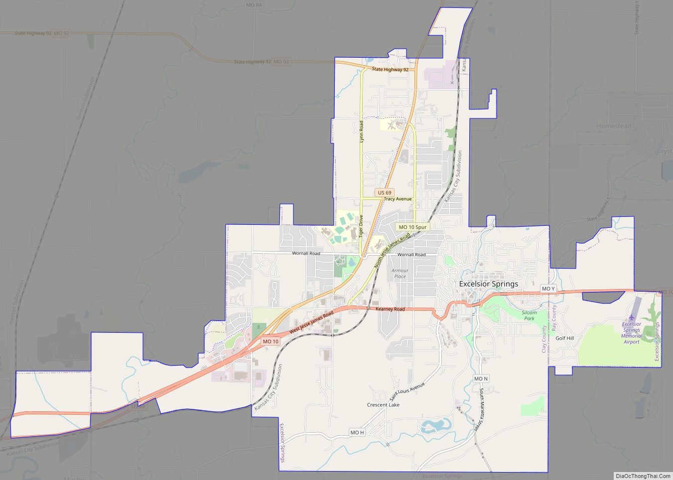
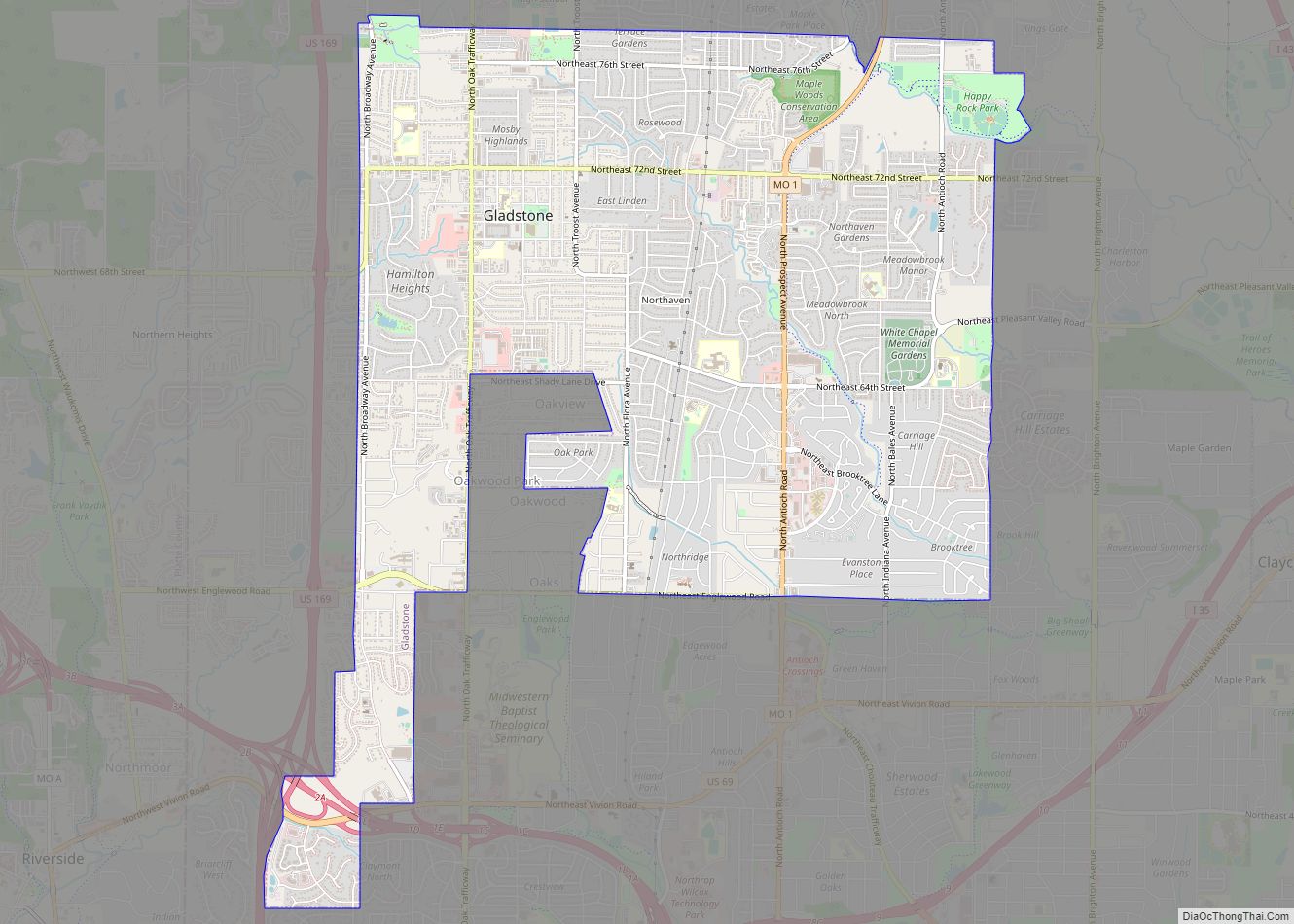
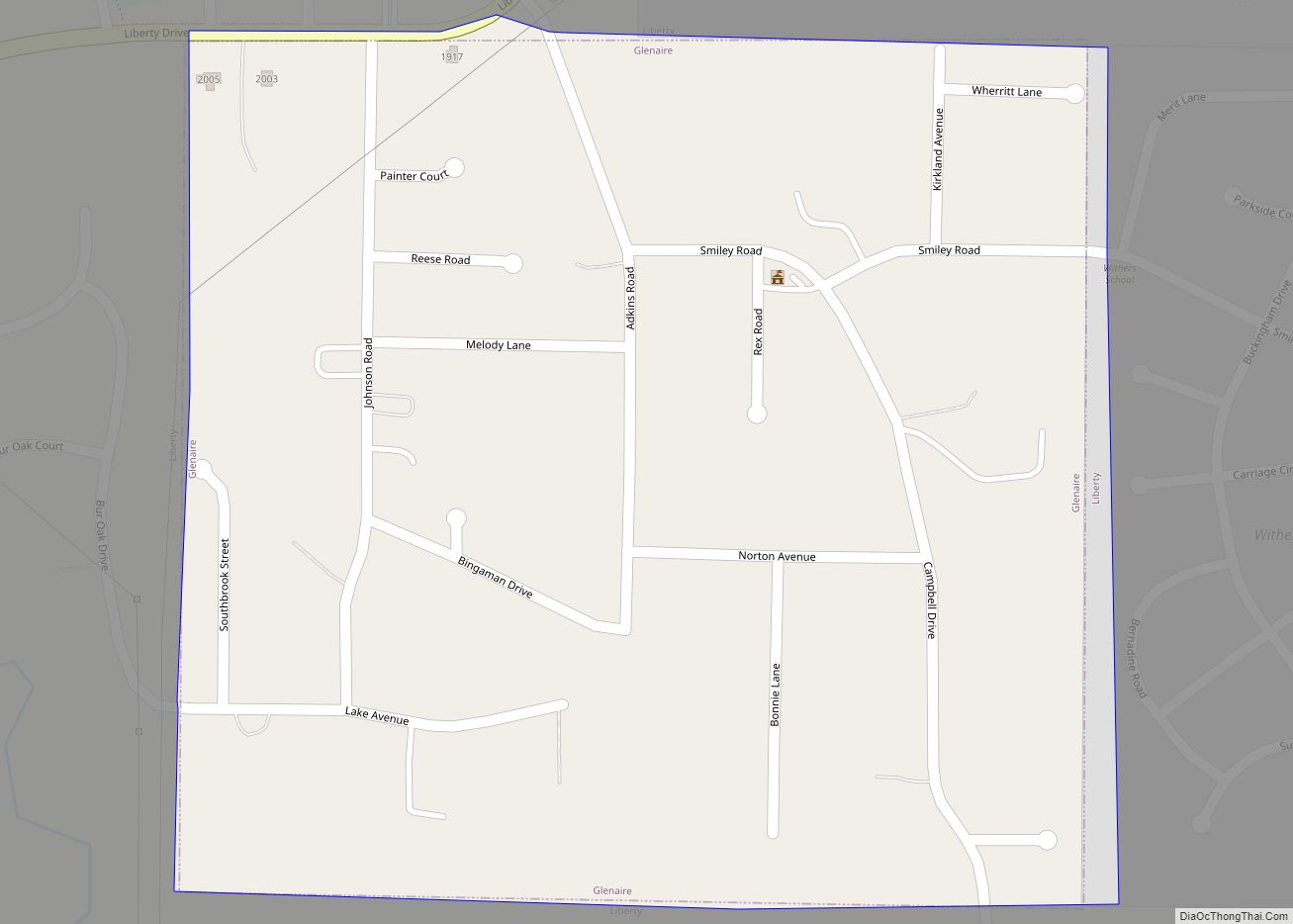
Online Interactive Map
Click on ![]() to view map in "full screen" mode.
to view map in "full screen" mode.
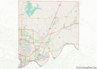
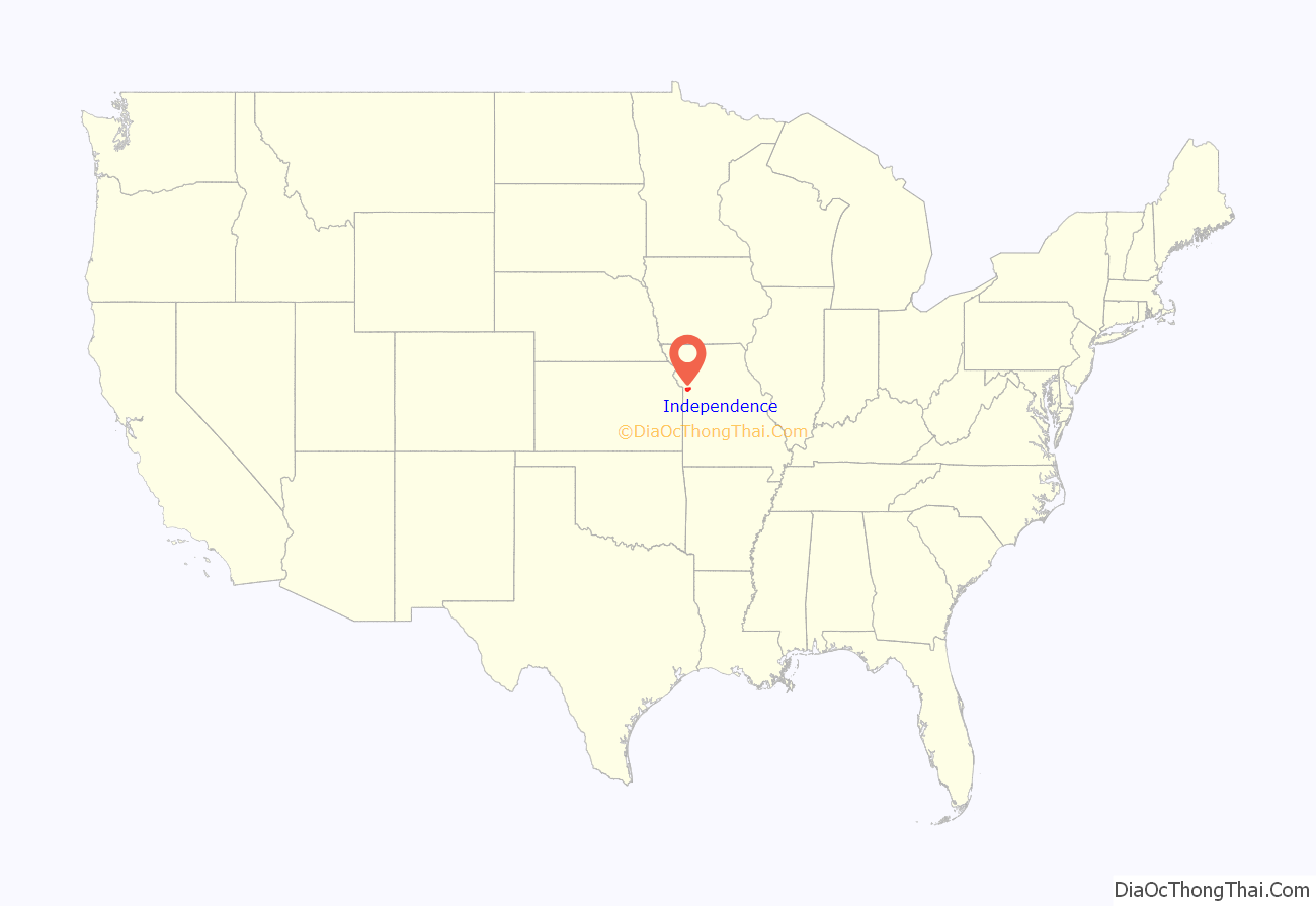
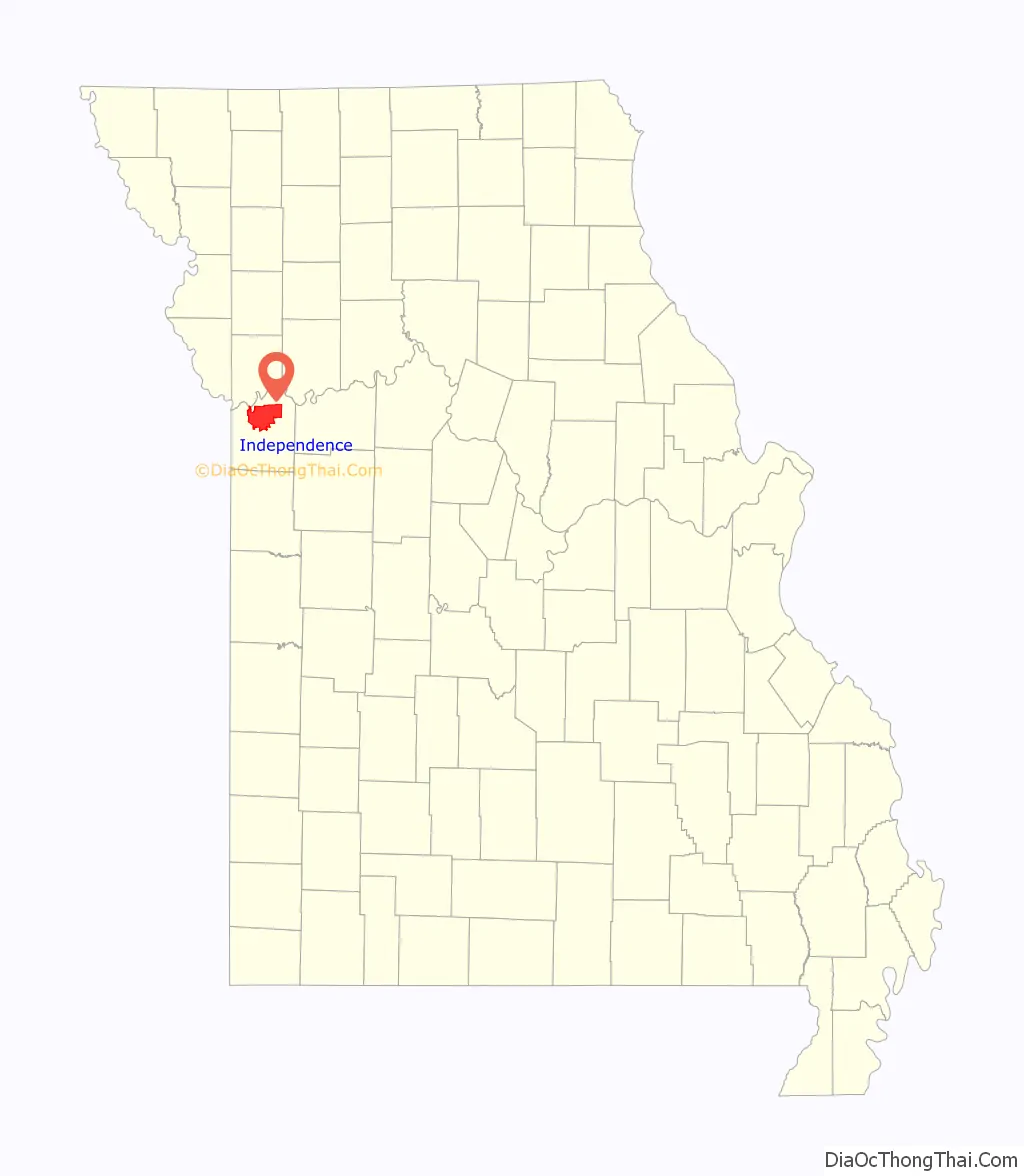
Independence location map. Where is Independence city?
History
Independence was originally inhabited by Missouri and Osage Native Americans, followed by the Spanish and a brief French tenure. It became part of the United States with the Louisiana Purchase in 1803. Lewis and Clark recorded in their journals that they stopped in 1804 to pick plums, raspberries, and wild apples at a site that would later form part of the city. Independence was also a stopping point for the “Donner Party”, an ill fated group of 19th Century wagon train emigrants whose westward journey along the California Trail ended in disaster; spawning one of the most well known and taboo stories of pioneer era America.
Named after the Declaration of Independence, Independence was founded on March 29, 1827, and quickly became an important frontier town. Independence was the farthest point westward on the Missouri River where the steamboats or other cargo vessels could travel, due to the convergence of the Kansas River with the Missouri River approximately six miles west of town, near the current Kansas-Missouri border. Independence immediately became a jumping-off point for the emerging fur trade, accommodating merchants and adventurers beginning the long trek westward on the Santa Fe Trail.
In 1831, members of the Latter Day Saint movement began moving to the Jackson County, Missouri area. Shortly thereafter, founder Joseph Smith declared a spot west of the Courthouse Square to be the place for his prophesied temple of the New Jerusalem, in expectation of the Second Coming of Christ. Tension grew with local Missourians until the Latter Day Saints were driven from the area in 1833, the beginning of a conflict which culminated in the 1838 Mormon War. Several branches of this movement gradually returned to the city beginning in 1867, with many making their headquarters there. These include the Community of Christ (formerly the Reorganized Church of Jesus Christ of Latter Day Saints), the Church of Christ (Temple Lot), the Church of Jesus Christ (Cutlerite) and the Restoration Branches.
Independence saw great prosperity from the late 1830s through the mid-1840s, while the business of outfitting pioneers boomed. Between 1848 and 1868, it was a hub of the California Trail. On March 8, 1849, the Missouri General Assembly granted a home-rule charter to the town and on July 18, 1849, William McCoy was elected as its first mayor. In the mid-19th century an Act of the United States Congress defined Independence as the start of the Oregon Trail.
Two important Civil War battles occurred at Independence: the first on August 11, 1862, when Confederate soldiers took control of the town, and the second in October 1864, which resulted in a Union victory. The war took its toll on Independence and the town was never able to regain its previous prosperity, although a flurry of building activity took place soon after the war. The rise of nearby Kansas City also contributed to the town’s relegation to a place of secondary prominence in Jackson County, though Independence has retained its position as county seat to the present day.
United States President Harry S. Truman grew up in Independence, and in 1922 was elected judge of the county Court of Jackson County, Missouri (an administrative, not judicial, post). Although he was defeated for reelection in 1924, he won back the office in 1926 and was reelected in 1930. Truman performed his duties diligently, and won personal acclaim for several popular public works projects, including an extensive series of fine roads for the growing use of automobiles, the building of a new County Court building in Independence, and a series of 12 Madonna of the Trail monuments to pioneer women dedicated across the country in 1928 and 1929. He would later return to the city after two terms as president. His wife, First Lady Bess Truman, was born and raised in Independence, and both are buried there. The Harry S. Truman National Historic Site (Truman’s home) and the Harry S. Truman Presidential Library and Museum are both located in Independence, as is one of Truman’s boyhood residences.
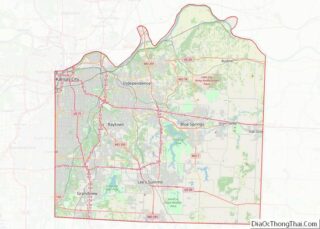
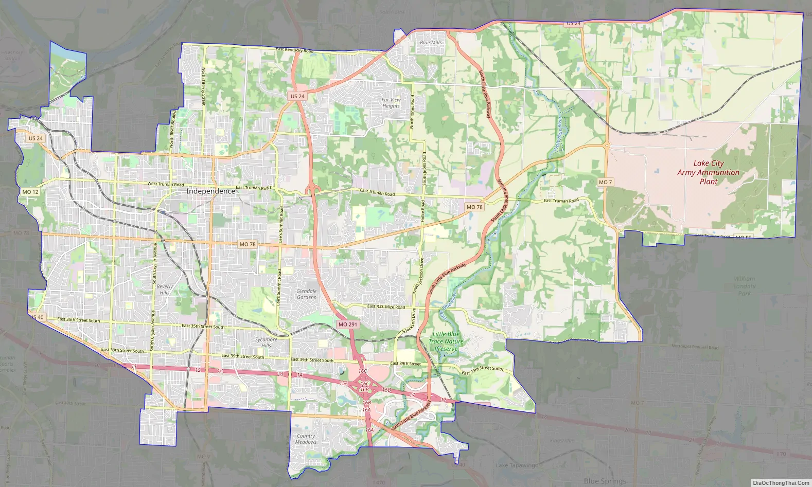
Independence Road Map
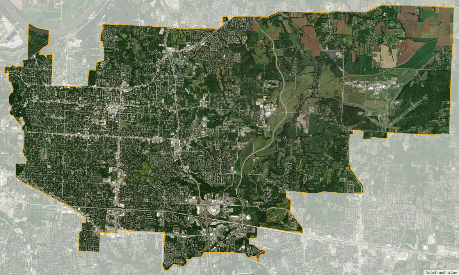
Independence city Satellite Map
Geography
Independence is located on the south bank of the Missouri River, near the western edge of the state. According to the United States Census Bureau, the city has a total area of 78.25 square miles (202.67 km), of which 77.57 square miles (200.91 km) is land and 0.68 square miles (1.76 km) is water.
See also
Map of Missouri State and its subdivision:- Adair
- Andrew
- Atchison
- Audrain
- Barry
- Barton
- Bates
- Benton
- Bollinger
- Boone
- Buchanan
- Butler
- Caldwell
- Callaway
- Camden
- Cape Girardeau
- Carroll
- Carter
- Cass
- Cedar
- Chariton
- Christian
- Clark
- Clay
- Clinton
- Cole
- Cooper
- Crawford
- Dade
- Dallas
- Daviess
- De Kalb
- Dent
- Douglas
- Dunklin
- Franklin
- Gasconade
- Gentry
- Greene
- Grundy
- Harrison
- Henry
- Hickory
- Holt
- Howard
- Howell
- Iron
- Jackson
- Jasper
- Jefferson
- Johnson
- Knox
- Laclede
- Lafayette
- Lawrence
- Lewis
- Lincoln
- Linn
- Livingston
- Macon
- Madison
- Maries
- Marion
- McDonald
- Mercer
- Miller
- Mississippi
- Moniteau
- Monroe
- Montgomery
- Morgan
- New Madrid
- Newton
- Nodaway
- Oregon
- Osage
- Ozark
- Pemiscot
- Perry
- Pettis
- Phelps
- Pike
- Platte
- Polk
- Pulaski
- Putnam
- Ralls
- Randolph
- Ray
- Reynolds
- Ripley
- Saint Charles
- Saint Clair
- Saint Francois
- Saint Louis
- Sainte Genevieve
- Saline
- Schuyler
- Scotland
- Scott
- Shannon
- Shelby
- Stoddard
- Stone
- Sullivan
- Taney
- Texas
- Vernon
- Warren
- Washington
- Wayne
- Webster
- Worth
- Wright
- Alabama
- Alaska
- Arizona
- Arkansas
- California
- Colorado
- Connecticut
- Delaware
- District of Columbia
- Florida
- Georgia
- Hawaii
- Idaho
- Illinois
- Indiana
- Iowa
- Kansas
- Kentucky
- Louisiana
- Maine
- Maryland
- Massachusetts
- Michigan
- Minnesota
- Mississippi
- Missouri
- Montana
- Nebraska
- Nevada
- New Hampshire
- New Jersey
- New Mexico
- New York
- North Carolina
- North Dakota
- Ohio
- Oklahoma
- Oregon
- Pennsylvania
- Rhode Island
- South Carolina
- South Dakota
- Tennessee
- Texas
- Utah
- Vermont
- Virginia
- Washington
- West Virginia
- Wisconsin
- Wyoming